Scarce and important map
Albania by Johannes Laurenberg, published by Joannes Janssonius. 1650


The Janssonius Family
Joannes Janssonius (Arnhem, 1588-1664), son of the Arnhem publisher Jan Janssen, married Elisabeth Hondius, daughter of Jodocus Hondius, in Amsterdam in 1612. After his marriage, he settled down in this town as a bookseller and publisher of cartographic material. In 1618, he established himself in Amsterdam next door to Blaeu’s bookshop. He entered into serious competition with Willem Jansz. Blaeu when copying Blaeu’s Licht der Zeevaert after the expiration of the privilege in 1620. His activities concerned the publication of atlases, books, single maps, and an extensive book trade with branches in Frankfurt, Danzig, Stockholm, Copenhagen, Berlin, Koningsbergen, Geneva, and Lyon. In 1631, he began publishing atlases together with Henricus Hondius.
In the early 1640s, Henricus Hondius left the atlas publishing business to Janssonius. Competition with Joan Blaeu, Willem’s son and successor, in atlas production, prompted Janssonius to enlarge his Atlas Novus finally into a work of six volumes, into which a sea atlas and an atlas of the Old World were inserted. Other atlases published by Janssonius are Mercator’s Atlas Minor, Hornius’s historical atlas (1652), the townbooks in eight volumes (1657), Cellarius’s Atlas Coelestis and several sea atlases and pilot guides.
After the death of Joannes Janssonius, the shop and publishing firm were continued by the heirs under the direction of Johannes van Waesbergen (c. 1616-1681), son-in-law of Joannes Janssonius. Van Waesbergen added Janssonius's name to his own.
In 1676, Joannes Janssonius’s heirs sold by auction “all the remaining Atlases in Latin, French, High and Low German, as well as the Stedeboecken in Latin, in 8 volumes, bound and unbound, maps, plates belonging to the Atlas and Stedeboecken.” The copperplates from Janssonius’s atlases were afterwards sold to Schenk and Valck.
Johannes Laurenberg (1590-1658)
The German professor Johannes Laurenberg was a mathematician and cartographer from Rostock. He was particularly interested in historical geography, and all of his maps concern Greek topography except for one, a map of the Duchy of Mecklenburg. The source of all the maps published under Laurenberg's name is the eight maps of Greek regions published in volume five of Janssonius's Novus Atlas in 1650.
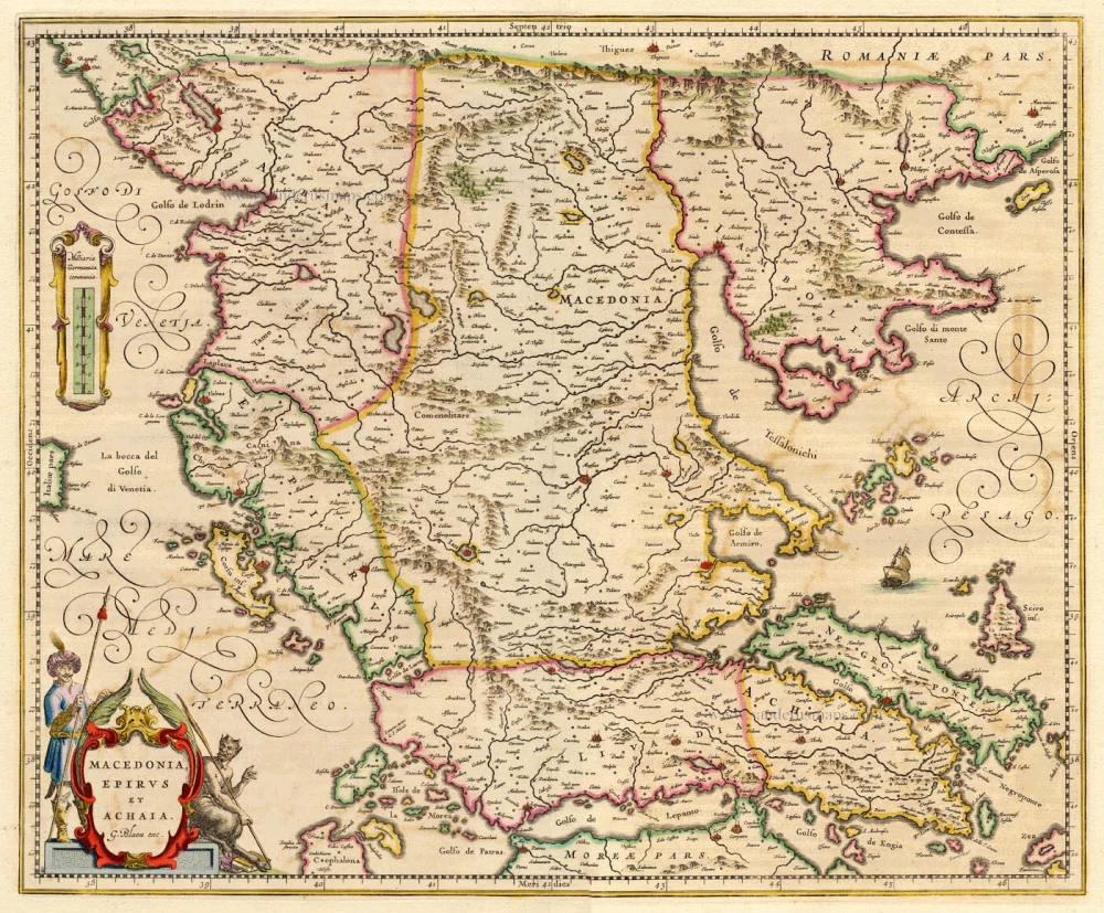
Epirus hodie vulgo Albania.
Item Number: 32620 Authenticity Guarantee
Category: Antique maps > Europe > Greece & Greek Islands
Albania by Johannes Laurenberg, published by Joannes Janssonius.
Title: Epirus hodie vulgo Albania.
Authore I. Laurenbergio.
Cartographer: Johannes Laurenberg.
Date of the first edition: 1650.
Date of this map: 1650.
Copper engraving, printed on paper.
Image size: 390 x 500mm (15¼ x 19¾ inches).
Sheet size: 495 x 590mm (19½ x 23¼ inches).
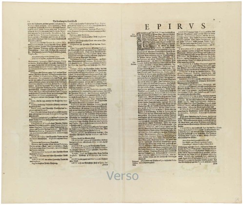
Verso: German text.
Condition: Original coloured, excellent.
Condition Rating: A+.
From: Novus Atlas, Das ist, Welt-beschreibun mit schönen newen außführlichen Taffeln inhaltende die Köngreiche und Länder des gantzen Erdreichs. Amsterdam, 1650. (van der Krogt 1:426)
The Janssonius Family
Joannes Janssonius (Arnhem, 1588-1664), son of the Arnhem publisher Jan Janssen, married Elisabeth Hondius, daughter of Jodocus Hondius, in Amsterdam in 1612. After his marriage, he settled down in this town as a bookseller and publisher of cartographic material. In 1618, he established himself in Amsterdam next door to Blaeu’s bookshop. He entered into serious competition with Willem Jansz. Blaeu when copying Blaeu’s Licht der Zeevaert after the expiration of the privilege in 1620. His activities concerned the publication of atlases, books, single maps, and an extensive book trade with branches in Frankfurt, Danzig, Stockholm, Copenhagen, Berlin, Koningsbergen, Geneva, and Lyon. In 1631, he began publishing atlases together with Henricus Hondius.
In the early 1640s, Henricus Hondius left the atlas publishing business to Janssonius. Competition with Joan Blaeu, Willem’s son and successor, in atlas production, prompted Janssonius to enlarge his Atlas Novus finally into a work of six volumes, into which a sea atlas and an atlas of the Old World were inserted. Other atlases published by Janssonius are Mercator’s Atlas Minor, Hornius’s historical atlas (1652), the townbooks in eight volumes (1657), Cellarius’s Atlas Coelestis and several sea atlases and pilot guides.
After the death of Joannes Janssonius, the shop and publishing firm were continued by the heirs under the direction of Johannes van Waesbergen (c. 1616-1681), son-in-law of Joannes Janssonius. Van Waesbergen added Janssonius's name to his own.
In 1676, Joannes Janssonius’s heirs sold by auction “all the remaining Atlases in Latin, French, High and Low German, as well as the Stedeboecken in Latin, in 8 volumes, bound and unbound, maps, plates belonging to the Atlas and Stedeboecken.” The copperplates from Janssonius’s atlases were afterwards sold to Schenk and Valck.
Johannes Laurenberg (1590-1658)
The German professor Johannes Laurenberg was a mathematician and cartographer from Rostock. He was particularly interested in historical geography, and all of his maps concern Greek topography except for one, a map of the Duchy of Mecklenburg. The source of all the maps published under Laurenberg's name is the eight maps of Greek regions published in volume five of Janssonius's Novus Atlas in 1650.