
Rome (Roma) by Christoph Weigel. 1718
Christoph Weigel the Elder (1654 -1725)
Christoph Weigel the Elder was a German engraver and publisher who learned the art of copperplate engraving in Augsburg. After various positions, including in Vienna and Frankfurt am Main, he acquired Nuremberg citizenship in 1698.
In Nuremberg, he worked very closely with the imperial geographer and cartographer Johann Baptist Homann to create his maps. He published 70 books and some series of engravings during his lifetime, including in 1718, the Atlas Scholasticus, followed in 1720 by Descriptio Orbis Antiquus; he also published a Reise Atlas in 1724 and an Atlas Manualis in the same year.
His younger brother Johann Christoph Weigel ran an art dealership in Nuremberg around the same time and was also very successful.
His widow continued Weigel's publishing house after 1725, who still published some of her deceased husband's works.
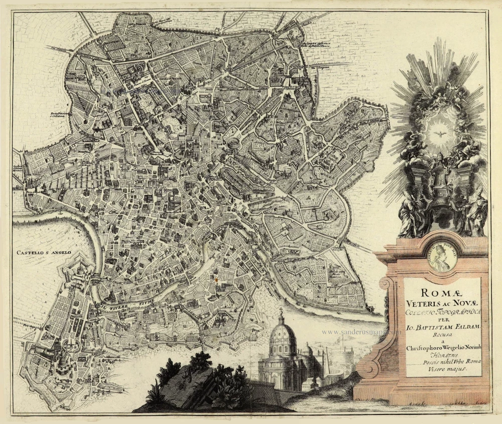
Romae Veteris ac Novae.
Item Number: 28213 Authenticity Guarantee
Category: Antique maps > Europe > Italy - Cities
Old, antique bird’s-eye view plan of , by Christoph Weigel.
Title: Romae Veteris ac Novae.
Collatio Topographica per Io. Baptistam Faldam.
Recusa a ChristophoroWeigelio Norimb
Horatius
Possis nihil Urbe Roma Visere majus.
Cartographer: J.B. Faldam.
Date of the first edition: 1718.
Date of this map: 1718.
Copper engraving, printed on paper.
Size (not including margins): 345 x 505mm (13.58 x 19.88 inches).
Verso: Blank.
Condition: Excellent.
Condition Rating: A+.
References: Shirley (Brit.Lib.), T.WEIG-1a (28); Fauser, #11946
From: Weigel Christoph. Atlas Scholasticus et Itinerarius. Nürnberg, J.E. Adelbulnern, 1718.
Second title: Johann David Köhlers ... Bequemer Schül-und Reisen-Atlas Aller Zu Erlernung der Alten, Mittlern und Neuen Geographie dienlichen Universal-und Particular-Charten ... ausgefertiger von Christoph Weigeln Kunsthändlern in Nürnberg ... Gedruckt bey Johann Ernst Adelbulnern. 1718.
Christoph Weigel the Elder (1654 -1725)
Christoph Weigel the Elder was a German engraver and publisher who learned the art of copperplate engraving in Augsburg. After various positions, including in Vienna and Frankfurt am Main, he acquired Nuremberg citizenship in 1698.
In Nuremberg, he worked very closely with the imperial geographer and cartographer Johann Baptist Homann to create his maps. He published 70 books and some series of engravings during his lifetime, including in 1718, the Atlas Scholasticus, followed in 1720 by Descriptio Orbis Antiquus; he also published a Reise Atlas in 1724 and an Atlas Manualis in the same year.
His younger brother Johann Christoph Weigel ran an art dealership in Nuremberg around the same time and was also very successful.
His widow continued Weigel's publishing house after 1725, who still published some of her deceased husband's works.
Related items
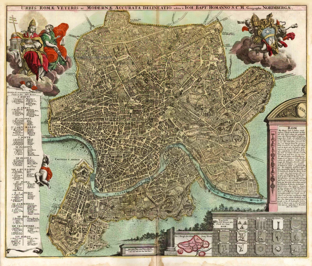
Urbis Romae Veteris ac Modernae Accurata Delineatio ... 1716-37
Rome (Roma), by J.B. Homann.
[Item number: 1856]
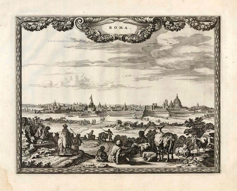
Roma. 1658/60
Rome (Roma), by P.H. Schut.
[Item number: 26626]
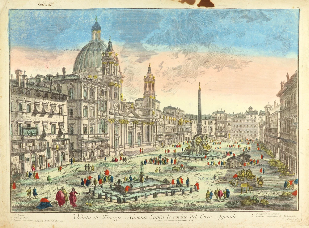
Veduta di Piazza Navona Sopra le rovine del Circo Agonale. c. 1780
Rome (Roma), Piazza Navona after Piranesi, published in Paris by the Jean family.
[Item number: 28893]
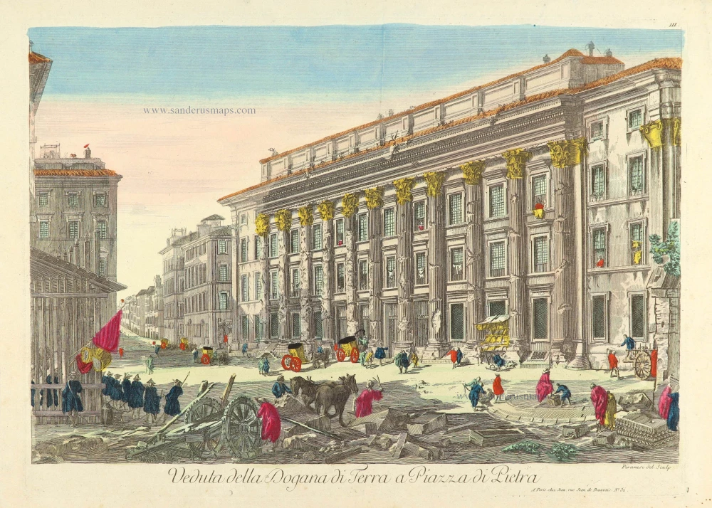
Veduta della Dogana di Terra a Piazza di Pietra. c. 1780
Rome (Roma), Piazza di Pietra, after Piranesi, published in Paris by the Jean family.
[Item number: 28903]

Larii Lacus vulgo Comensis descriptio - Territorii Romani descrip. - Fori Iulii, vulgo Friuli Typus. 1601
Como - Rome - Friuli by Abraham Ortelius
[Item number: 28930]