
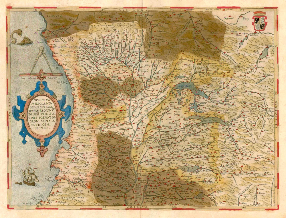
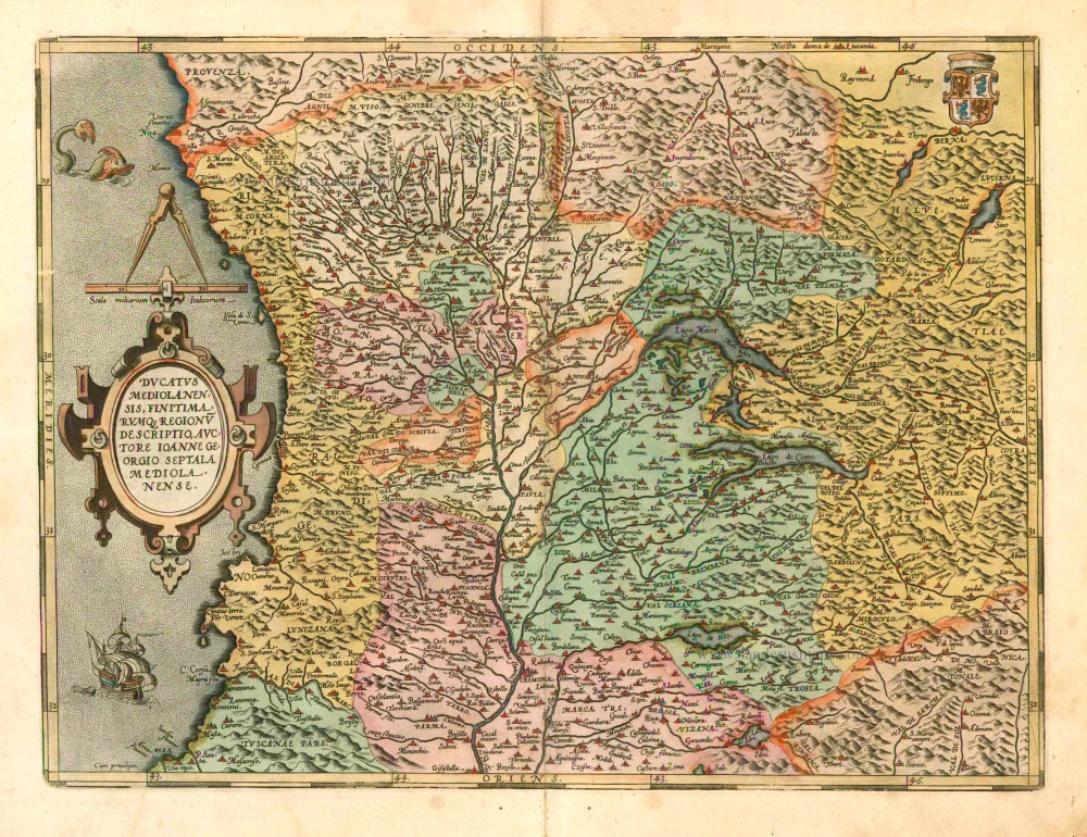
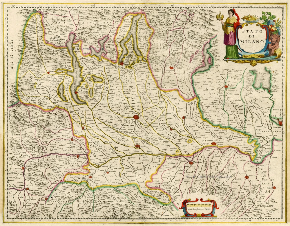
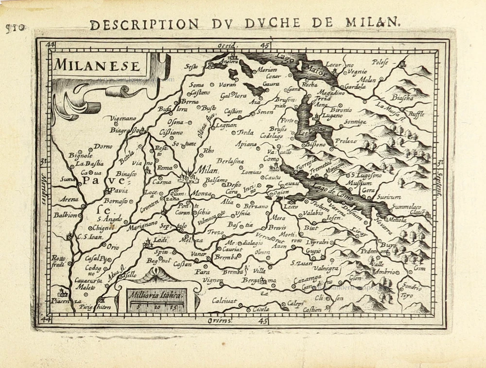
Milano by Abraham Ortelius. 1579

Abraham Ortelius (1527-1598)
The maker of the 'first atlas', the Theatrum Orbis Terrarum (1570), was born on 4 April 1527 into an old Antwerp family. He learned Latin and studied Greek and mathematics.
Abraham and his sisters Anne and Elizabeth took up map colouring. Ortelius was admitted to the Guild of St. Luke as an "illuminator of maps." In addition to colouring maps, Ortelius was a dealer in antiques, coins, maps, and books, and the book and map trade gradually became his primary occupation.
Business went well because his means permitted him to start an extensive collection of medals, coins, antiques, and a library of many volumes. In addition, he travelled a lot, visited Italy and France, made contacts everywhere with scholars and editors, and maintained extensive correspondence with them.
In 1564, he published his first map, a large and ambitious world wall map. The inspiration for this map may well have been Gastaldi's large world map. In 1565, he published a map of Egypt and a map of the Holy Land; a large map of Asia followed.
In 1568, the production of individual maps for his atlas Theatrum Orbis Terrarum was already in full swing. He completed the atlas in 1569, and in May 1570, it was available for sale. It was one of the most expensive books ever published.
This first edition contained seventy maps on fifty-three sheets. Franciscus Hogenberg engraved the maps.
Later editions included Additamenta (additions), resulting in Ortelius' historical atlas, the Parergon, which is mainly bound together with the atlas. The Parergon can be considered a truly original work by Ortelius, who drew the maps based on his research.
The importance of the Theatrum Orbis Terrarum for geographical knowledge in the last quarter of the sixteenth century is difficult to overemphasize. Nothing was like it until Mercator's atlas appeared twenty-five years later. Demand for the Theatrum was remarkable. Some 24 editions appeared during Ortelius's lifetime and another 10 after he died in 1598. Editions were published in Dutch, German, French, Spanish, English, and Italian. The number of map sheets grew from 53 in 1570 to 167 in 1612 in the last edition.
In 1577, engraver Philip Galle and poet-translator Pieter Heyns published the first pocket-sized edition of the Theatrum, the Epitome. The work was trendy. Over thirty editions of this Epitome were published in different languages.
Ducatus Mediolanensis, finitimarumq, Regionu descriptio, auctore Ioanne Georgio Septala Mediolanense.
Item Number: 23348 Authenticity Guarantee
Category: Antique maps > Europe > Italy
Old, antique map of Milano by Abraham Ortelius.
Title: Ducatus Mediolanensis, finitimarumq, Regionu descriptio, auctore Ioanne Georgio Septala Mediolanense.
Oriented to the west.
Cartographer: Giorgio Settala.
Date of the first edition: 1570.
Date of this map: 1579.
Copper engraving, printed on paper.
Size (not including margins): 359 x 480mm (14.13 x 18.9 inches).
Verso: Latin text.
Condition: Original coloured, verdigris (green colour) turned brown.
Condition Rating: A.
From: Theatrum Orbis Terrarum. Antwerp, Chr. Plantin, 1579. (Van der Krogt 3, 31:021A (First printing of two)) First Plantin edition.
Abraham Ortelius (1527-1598)
The maker of the 'first atlas', the Theatrum Orbis Terrarum (1570), was born on 4 April 1527 into an old Antwerp family. He learned Latin and studied Greek and mathematics.
Abraham and his sisters Anne and Elizabeth took up map colouring. Ortelius was admitted to the Guild of St. Luke as an "illuminator of maps." In addition to colouring maps, Ortelius was a dealer in antiques, coins, maps, and books, and the book and map trade gradually became his primary occupation.
Business went well because his means permitted him to start an extensive collection of medals, coins, antiques, and a library of many volumes. In addition, he travelled a lot, visited Italy and France, made contacts everywhere with scholars and editors, and maintained extensive correspondence with them.
In 1564, he published his first map, a large and ambitious world wall map. The inspiration for this map may well have been Gastaldi's large world map. In 1565, he published a map of Egypt and a map of the Holy Land; a large map of Asia followed.
In 1568, the production of individual maps for his atlas Theatrum Orbis Terrarum was already in full swing. He completed the atlas in 1569, and in May 1570, it was available for sale. It was one of the most expensive books ever published.
This first edition contained seventy maps on fifty-three sheets. Franciscus Hogenberg engraved the maps.
Later editions included Additamenta (additions), resulting in Ortelius' historical atlas, the Parergon, which is mainly bound together with the atlas. The Parergon can be considered a truly original work by Ortelius, who drew the maps based on his research.
The importance of the Theatrum Orbis Terrarum for geographical knowledge in the last quarter of the sixteenth century is difficult to overemphasize. Nothing was like it until Mercator's atlas appeared twenty-five years later. Demand for the Theatrum was remarkable. Some 24 editions appeared during Ortelius's lifetime and another 10 after he died in 1598. Editions were published in Dutch, German, French, Spanish, English, and Italian. The number of map sheets grew from 53 in 1570 to 167 in 1612 in the last edition.
In 1577, engraver Philip Galle and poet-translator Pieter Heyns published the first pocket-sized edition of the Theatrum, the Epitome. The work was trendy. Over thirty editions of this Epitome were published in different languages.
Related items
Ducatus Mediolanensis, finitimarumq, Regionu descriptio, auctore Ioanne Georgio Septala Mediolanense. 1601
Milano by A. Ortelius.
[Item number: 8062]
Stato di Milano. 1656-80
Milano by Johannes Janssonius.
[Item number: 15712]
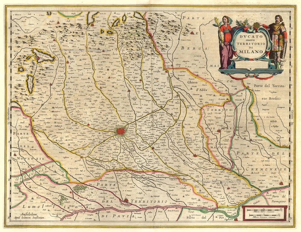
Ducato ouero Territorio di Milano. 1644-58
Milano, by Janssonius J. - Hondius H.
[Item number: 19231]
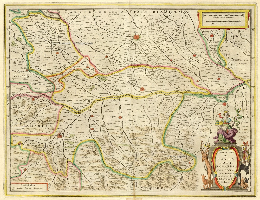
Territorio di Pavia, Lodi, Noavarra, Tortona, Allessandria et altri vicini dello Stato di Milano. 1644-58
Milano (South), by Janssonius J. - Hondius H.
[Item number: 19238]
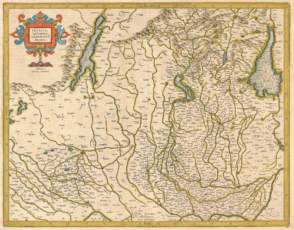
Brescia Episcopanus Mediolanu Ducatus. 1613
Brescia - Milano, by Gerard Mercator.
[Item number: 24513]
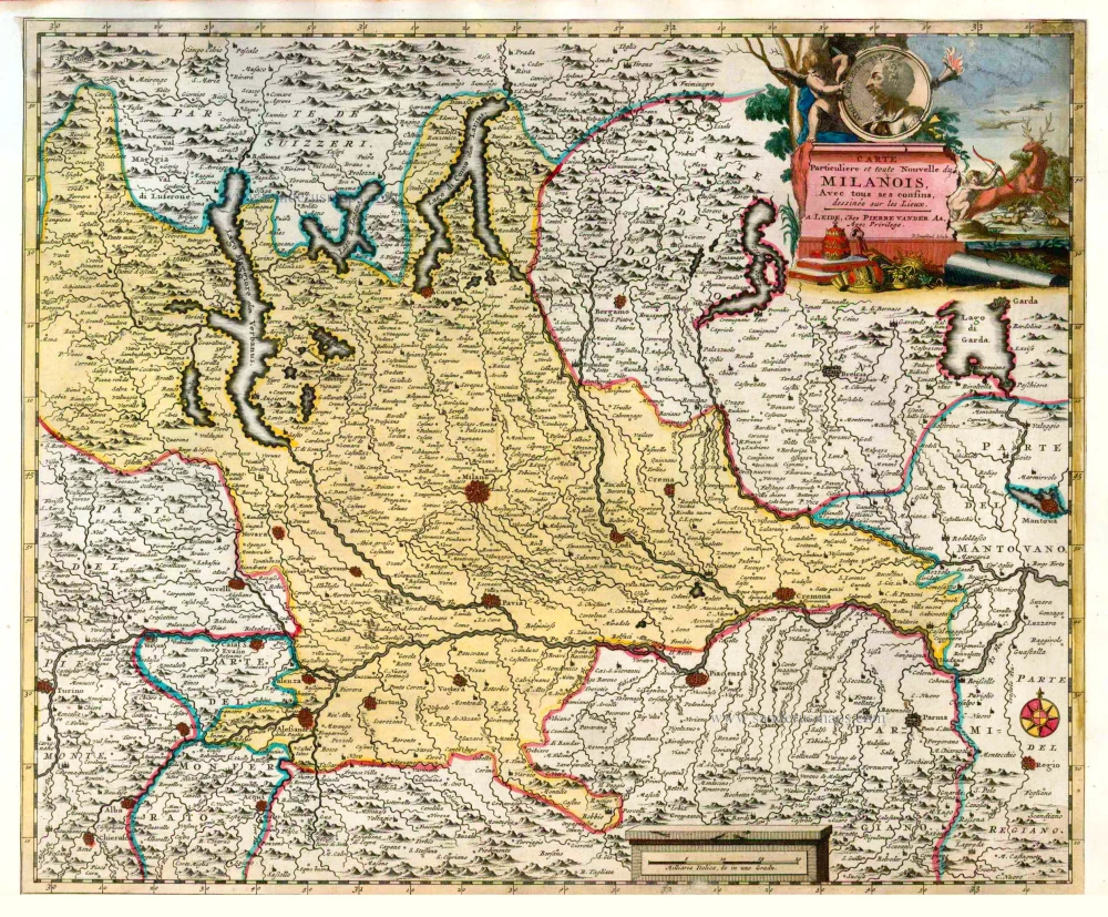
Carte Particuliere et toute Nouvelle du Milanois. Avec tous ses confins. 1713
Milano, by P. Van der Aa.
[Item number: 26084]

Carte Nouvelle et exacte de la Gaule Cisalpine et sur tout de la Ligurie, de l'Insubrie et des Pays voisins, suivant l'Ancienne Geographie. 1713
Northern Italy, by Pieter Van der Aa.
[Item number: 26089]
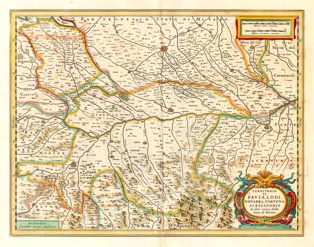
Territorio di Pavia, Lodi, Noavarra, Tortona, Allessandria et altri vicini dello Stato di Milano. 1641
Milan (South), by Johannes Janssonius.
[Item number: 26380]
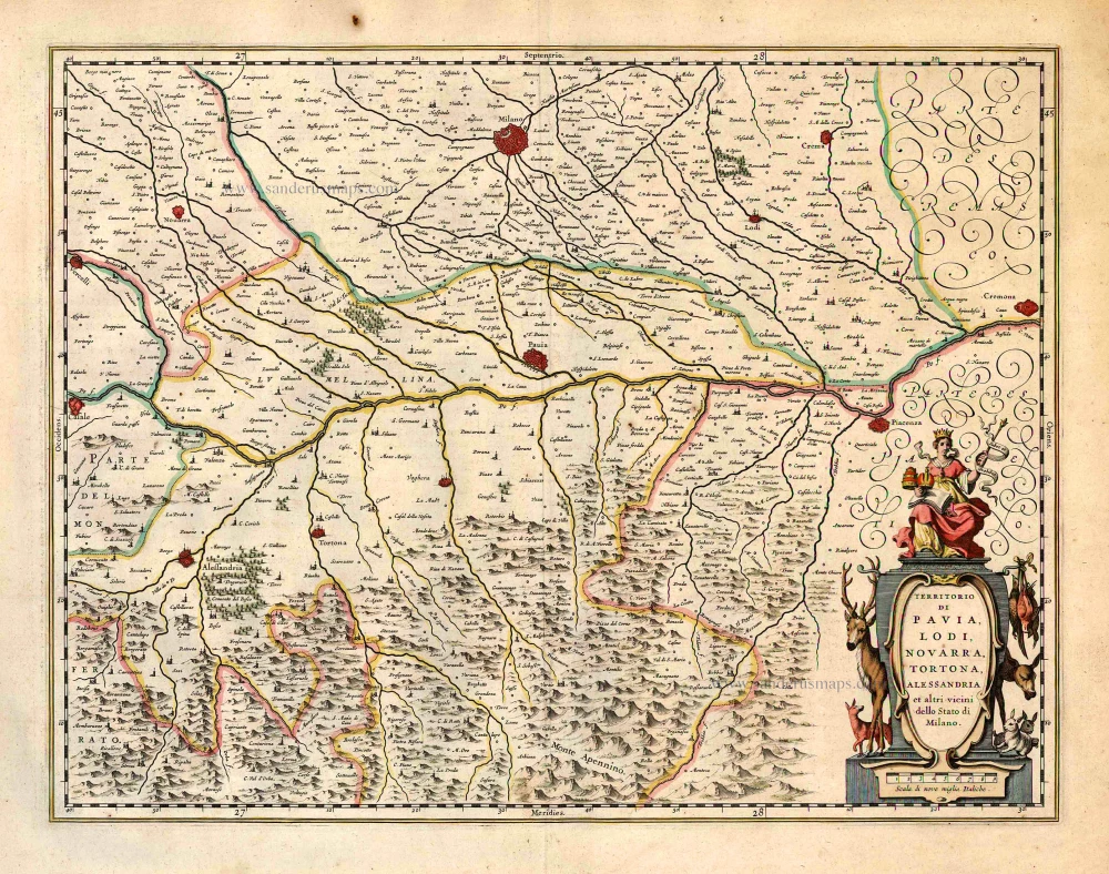
Territorio di Pavia, Lodi, Noavarra, Tortona, Allessandria et altri vicini dello Stato di Milano. 1640
Milan (South), by Willem & Joan Blaeu
[Item number: 27211]
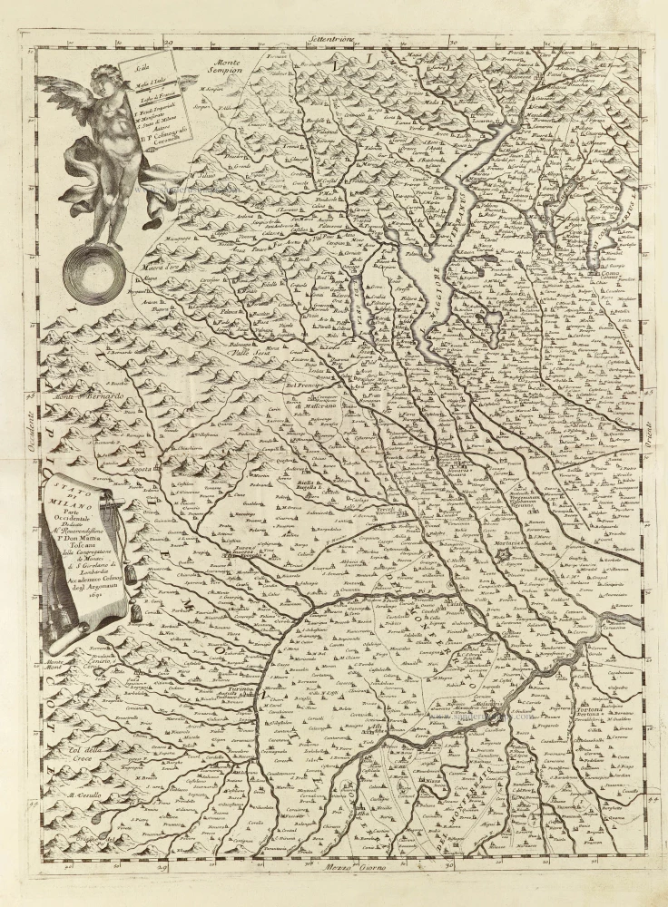
Stato di Milano Parte Occidentale. 1696
Western part of the State of Milan with a plan of Como on verso, by Vincenzo Coronelli.
[Item number: 28734]
Spectacular wall map of North Italy. Heightened in gold.
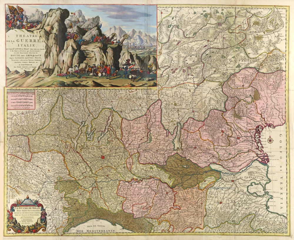
Théatre de la Guerre en Italie Qui comprend le Duché de Milan, dans toute son Estendue & les Estats et Frontières qui l'environnent 1703
Duchy of Milan by Pierre Mortier.
[Item number: 29507]
Milanese. 1618
Milano by Petrus Bertius, published by Jodocus Hondius II.
[Item number: 31638]
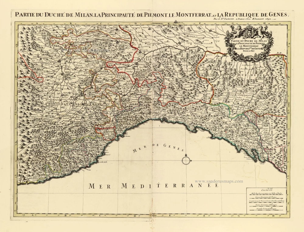
Partie du Duché de Milan, la principauté de Piémont, le Montferrat et la republique de Genes. 1692
Milan by N. Sanson, so-called published by Hubert Jaillot. (Pirated edition by Pierre Mortier).
[Item number: 31718]

Le Duché de Milan dans toute son Estendue divisé en ses Principales Parties: Avec les Etats et Frontieres qui l'environnent. c. 1700
Milan (Milano), by Covens & Mortier.
[Item number: 32617]
new