
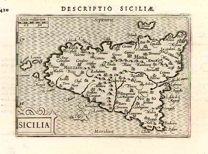
Sicily (Sicilia), by Langenes, published by P. Bertius. 1602
Petrus Bertius (1565-1629)
Petrus Bertius, born at Beveren, Flanders, in 1565, was related to Pieter van den Keere (Kaerius) and Jodocus Hondius. Both famous cartographers were brothers-in-law of Petrus Bertius. As a refugee, he settled in Amsterdam, and after finishing his studies, he became a professor of mathematics and librarian at the University of Leiden. In 1618, he became a cosmographer and historiographer for Louis XIII of France. He lived in Paris, where he died in 1629.
Petrus Bertius's remarkable work ethic is evident in the numerous geographical and theological works he produced. His contributions to the works of Clüver and Herrera further solidified his reputation in geography.
His fame among geographers was established by his text in the pocket atlas Tabularum Geographicarum and by his edition of Ptolemy’s Geographia.
The origin of the Tabularum Geographicum lies in the well-known miniature atlas Caert thresoor, published by Barent Langenes in 1598 in Middelburg. Bertius engraved 169 maps for this small but attractive atlas, sold for the first time in 1599 by Cornelis Claesz in Amsterdam. In 1600, Claesz published the pocket atlas with a Latin text composed by Petrus Bertius. From then on, new editions, often enlarged with new maps, regularly appeared, subsequently published by Cornelis Claesz, Jodocus Hondius, Johannes Janssonius and ultimately, in 1649, by Claes Jansz. Visscher.
Koeman divides this series of pocketbooks into two atlases: The Caert-thresoor, published by Langenes and Claesz., with five editions between 1598 and 1609, and the Tabularum Geographicarum Contractarum by Petrus Bertius with ten editions between 1600 and 1650.
Barent Langenes ans his Caert-Thresoor
Barent Langenes, a Dutch bookseller and publisher of Middelburg (Zeeland), about whom little is known, was the first printer of the Caert-Thresoor (1598), a small-size atlas with an exciting history. This atlas had many editions in Dutch, Latin, French, and German, later brought out by Cornelis Claesz and Jodocus Hondius. Langenes was involved in the first two Dutch editions.
The Caert-Thresoor, is a collection of maps to which the text was adapted and not the reverse, as in the case with many geographical studies. The most exciting maps are those of the English and the Dutch in arctic waters, searching for the route to China (Northwest Passage). It records the departure of the Dutch third fleet in the spring of 1596 but not the return of survivors of this tragic voyage in August 1597. This atlas sets a new standard for minor atlases. Moreover, it was affordable to the citizens of the lowest income.
The text was rewritten, first by Petrus Bertius and reissued in 1600, and then again by Jacobus Viverius in 1609. The edition with the original basic text continued to be published until 1609, the year of Cornelis Claesz’s death.
Sicilia.
Item Number: 26539 Authenticity Guarantee
Category: Antique maps > Europe > Italy
Old, antique map of Sicily (Sicilia), by Langenes, published by P. Bertius.
Date of the first edition: 1596
Date of this map: 1602
Copper engraving, printed on paper.
Size (not including margins): 8.5 x 12.5cm (3.3 x 4.9 inches)
Verso text: Latin
Condition: Excellent.
Condition Rating: A+
References: Van der Krogt 3, 7510:341; Dufour-La Gumina, p.103 & 294.
From: BERTIUS P. Tabulae Geographicae contractae, ... Amsterdam, C. Claesz., 1602/03.
Petrus Bertius (1565-1629)
Petrus Bertius, born at Beveren, Flanders, in 1565, was related to Pieter van den Keere (Kaerius) and Jodocus Hondius. Both famous cartographers were brothers-in-law of Petrus Bertius. As a refugee, he settled in Amsterdam, and after finishing his studies, he became a professor of mathematics and librarian at the University of Leiden. In 1618, he became a cosmographer and historiographer for Louis XIII of France. He lived in Paris, where he died in 1629.
Petrus Bertius's remarkable work ethic is evident in the numerous geographical and theological works he produced. His contributions to the works of Clüver and Herrera further solidified his reputation in geography.
His fame among geographers was established by his text in the pocket atlas Tabularum Geographicarum and by his edition of Ptolemy’s Geographia.
The origin of the Tabularum Geographicum lies in the well-known miniature atlas Caert thresoor, published by Barent Langenes in 1598 in Middelburg. Bertius engraved 169 maps for this small but attractive atlas, sold for the first time in 1599 by Cornelis Claesz in Amsterdam. In 1600, Claesz published the pocket atlas with a Latin text composed by Petrus Bertius. From then on, new editions, often enlarged with new maps, regularly appeared, subsequently published by Cornelis Claesz, Jodocus Hondius, Johannes Janssonius and ultimately, in 1649, by Claes Jansz. Visscher.
Koeman divides this series of pocketbooks into two atlases: The Caert-thresoor, published by Langenes and Claesz., with five editions between 1598 and 1609, and the Tabularum Geographicarum Contractarum by Petrus Bertius with ten editions between 1600 and 1650.
Barent Langenes ans his Caert-Thresoor
Barent Langenes, a Dutch bookseller and publisher of Middelburg (Zeeland), about whom little is known, was the first printer of the Caert-Thresoor (1598), a small-size atlas with an exciting history. This atlas had many editions in Dutch, Latin, French, and German, later brought out by Cornelis Claesz and Jodocus Hondius. Langenes was involved in the first two Dutch editions.
The Caert-Thresoor, is a collection of maps to which the text was adapted and not the reverse, as in the case with many geographical studies. The most exciting maps are those of the English and the Dutch in arctic waters, searching for the route to China (Northwest Passage). It records the departure of the Dutch third fleet in the spring of 1596 but not the return of survivors of this tragic voyage in August 1597. This atlas sets a new standard for minor atlases. Moreover, it was affordable to the citizens of the lowest income.
The text was rewritten, first by Petrus Bertius and reissued in 1600, and then again by Jacobus Viverius in 1609. The edition with the original basic text continued to be published until 1609, the year of Cornelis Claesz’s death.
Related items

Insularum Aliquot Maris Mediterranei Descriptio. 1592
Sicily, Sardinia, Corfu, Zerbi, Elba, Malta by Abraham Ortelius.
[Item number: 23053]
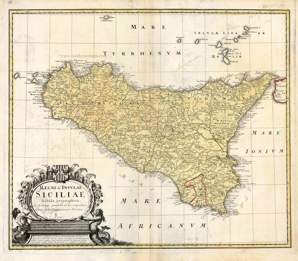
Regni & Insulae Siciliae Tabula Geographica ... c. 1720-65
Sicily, by Homann Heirs.
[Item number: 25478]

Isle et Royaume de Sicile. 1665
Sicily, by N. & G. Sanson.
[Item number: 25896]

In rare original colour.
L'Ile de Sicile. 1713
Sicily, by Pieter Van der Aa.
[Item number: 26077]

La Sicile, Avec les anciens noms de presque toutes ses Places, Rivieres, Chasteaux, &c. 1679
Sicily, by P. Duval.
[Item number: 26485]
Sicilia Insula. After 1575
Sicily (Sicilia) by Giovanni Francesco Camocio
[Item number: 27566]

Carte de L'Isle et Royaume de Sicile. 1776-79
Sicily & Malta, by Paolo Santini.
[Item number: 27732]
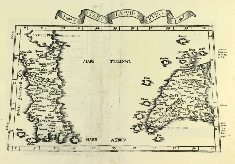
Tabula . VII . Euro. 1525
Sardinia & Sicily by Lorenz Fries.
[Item number: 28385]

Sicilia Regnum. 1650
Sicily (Sicilia), by Willem & Joan Blaeu.
[Item number: 28774]
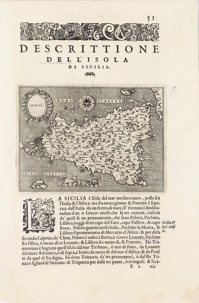
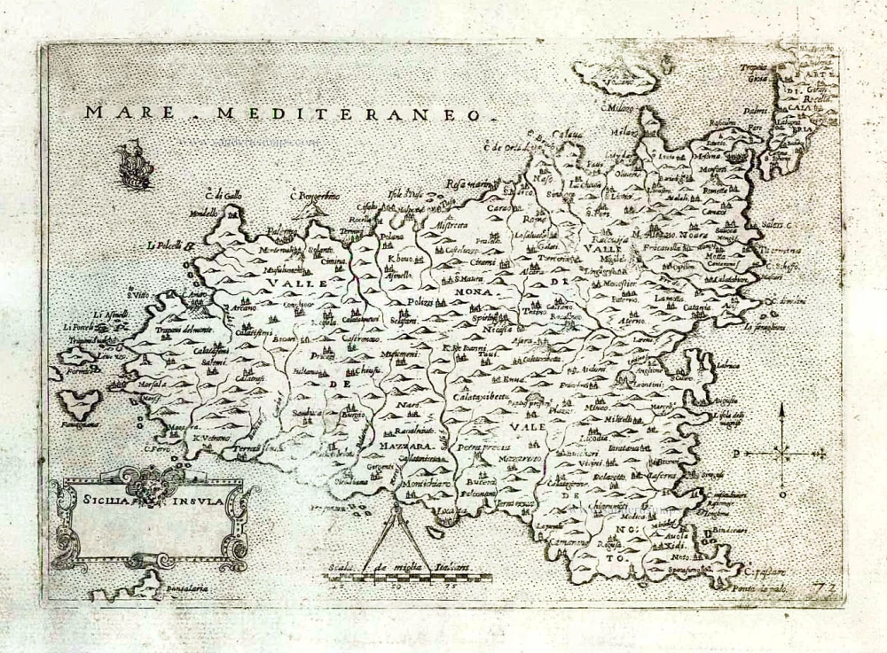
Sicilia - [Above map :] Descrittione dell'Isola di Sicilia. 1590
Sicily (Sicilia) by Thomaso Porcacchi.
[Item number: 29766]

Tabula . VII . Euro. 1525
Ptolemy map of Sardinia & Sicily by Lorenz Fries, after Martin Waldseemüller
[Item number: 30534]

Sicilia. 1618
Sicily (Sicilia) by Petrus Bertius, published by Jodocus Hondius II.
[Item number: 31860]
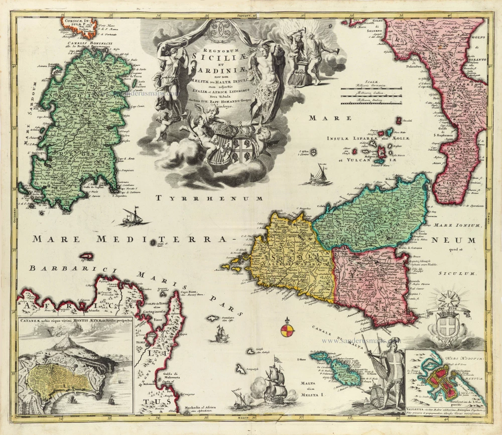
Regnorum Siciliae et Sardiniae nec non Melitae seu Maltae insuli cum adjectis Italiae et Africae Litoribus Nova Tabula. c. 1720
Sicily - Sardinia, by J.B. Homann.
[Item number: 32164]

Tabula Moderna Italie. 1525
Corsica, Sardinia, and Sicilia (Sicily), by Lorenz Fries.
[Item number: 32732]
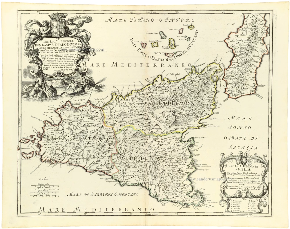
Isola e Regno di Sicilia 1684
Sicilia, by Giacomo Cantelli da Vignola, published by Giovanni de Rossi.
[Item number: 32915]

Parergon map
Siciliae Veteris Typus. 1592
Ancient Sicily, by Abraham Ortelius.
[Item number: 33064]
new

Insula sive Regnum Siciliae Urbibus praecipuis exornatum 1682-88
Sicily by Frederick de Wit.
[Item number: 33168]
new