
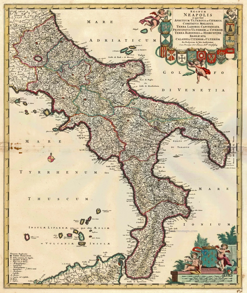
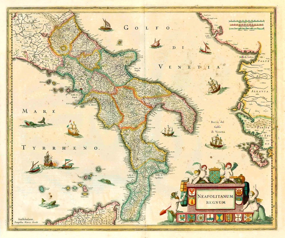
Napoli (Kingdom) by Frederik de Wit. c. 1680
Frederick de Wit (1630-1706)
The engraver and map-seller, Frederick de Wit, was born in Gouda (Netherlands) in 1630 as a son of Hendrick Fredericksz de Wit. Through his marriage with Maria van der Waag of Amsterdam in 1661, he obtained citizenship of the city where he had been working since 1648 and where he became one of the most famous engravers of maps of the second half of the 17th century. Although De Wit was a Catholic, which meant that he was not favoured at the time by the city council, he was awarded the honour of being listed as one of the "excellent citizens" on the roll of the city council in the years 1694-1704. However, his name was not written in the Guild of St. Luke book before 1664. At that time, he lived on the Kalverstraat "in de Witte Pascaert", where he stayed until his death in 1706. His earliest dates on maps engraved are 1659 (Regni Daniae) and 1660 (World map).
Frederick de Wit published several world atlases, a sea atlas, and an atlas of the Netherlands.
The dating of the maps is difficult. However, as a privilege was granted in 1689, the annotation 'cum privilegio' marks an edition after 1688.
Around 1700, Frederick de Wit entered the market with a town atlas. He produced two volumes with a total of 260 plans and views. Most were printed from plates used for Janssonius and Blaeu town atlases.
After he died in 1706, his widow continued the shop until 1709. The plates and stock of De Wit's atlas were sold to Covens & Mortier in 1710, who sold the atlas for an extended period.
Regnum Neapolis in quo sunt Aprutium Ulterius et Citerius, Comitatus Molisius, Terra Laboris, Capitaniata Orincipatus Ulterior et Citerior Terra Bariensis et Hidruntina Basilicata Calabria Citerior et Ulterior.
Item Number: 14832 Authenticity Guarantee
Category: Antique maps > Europe > Italy
Old, antique map of the Kingdom of Napoli by Frederik De Wit.
Title: Regnum Neapolis in quo sunt Aprutium Ulterius et Citerius, Comitatus Molisius, Terra Laboris, Capitaniata Orincipatus Ulterior et Citerior Terra Bariensis et Hidruntina Basilicata Calabria Citerior et Ulterior.
Per Fredericum de Witt Amstelodami.
Cum Privilegio DD Ordinum Holl. Westfrisiq.
Copper engraving, printed on paper.
Size (not including margins): 580 x 490mm (22.83 x 19.29 inches).
Verso: Blank.
Condition: Old coloured, a few small stains at left, else good.
Condition Rating: A
References: Koeman - III, p. 215 [94*]
From: Composite Atlas by F. De Wit, c. 1680.
Frederick de Wit (1630-1706)
The engraver and map-seller, Frederick de Wit, was born in Gouda (Netherlands) in 1630 as a son of Hendrick Fredericksz de Wit. Through his marriage with Maria van der Waag of Amsterdam in 1661, he obtained citizenship of the city where he had been working since 1648 and where he became one of the most famous engravers of maps of the second half of the 17th century. Although De Wit was a Catholic, which meant that he was not favoured at the time by the city council, he was awarded the honour of being listed as one of the "excellent citizens" on the roll of the city council in the years 1694-1704. However, his name was not written in the Guild of St. Luke book before 1664. At that time, he lived on the Kalverstraat "in de Witte Pascaert", where he stayed until his death in 1706. His earliest dates on maps engraved are 1659 (Regni Daniae) and 1660 (World map).
Frederick de Wit published several world atlases, a sea atlas, and an atlas of the Netherlands.
The dating of the maps is difficult. However, as a privilege was granted in 1689, the annotation 'cum privilegio' marks an edition after 1688.
Around 1700, Frederick de Wit entered the market with a town atlas. He produced two volumes with a total of 260 plans and views. Most were printed from plates used for Janssonius and Blaeu town atlases.
After he died in 1706, his widow continued the shop until 1709. The plates and stock of De Wit's atlas were sold to Covens & Mortier in 1710, who sold the atlas for an extended period.
Related items
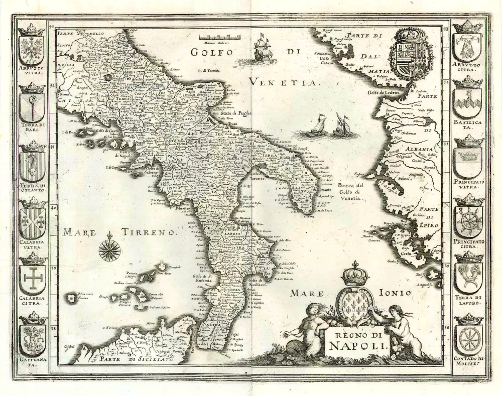
Regno di Napoli. 1638
Southern Italy, by M. Merian.
[Item number: 25925]
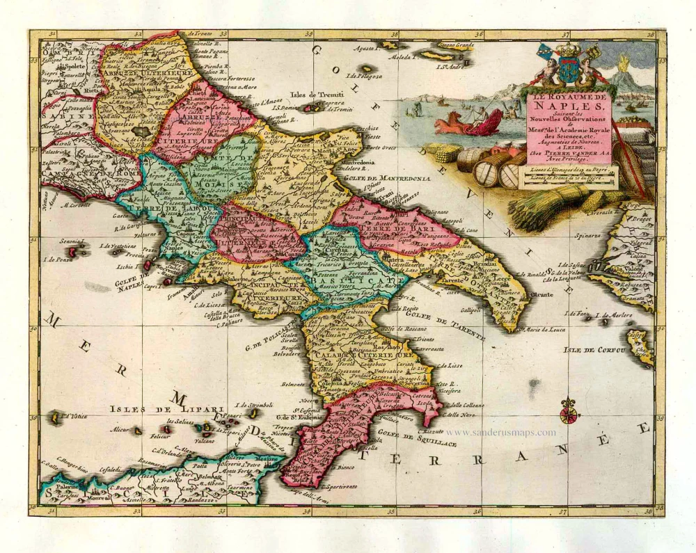
Le Royaume de Naples. 1713
Naples, by P. Van der Aa.,
[Item number: 26078]
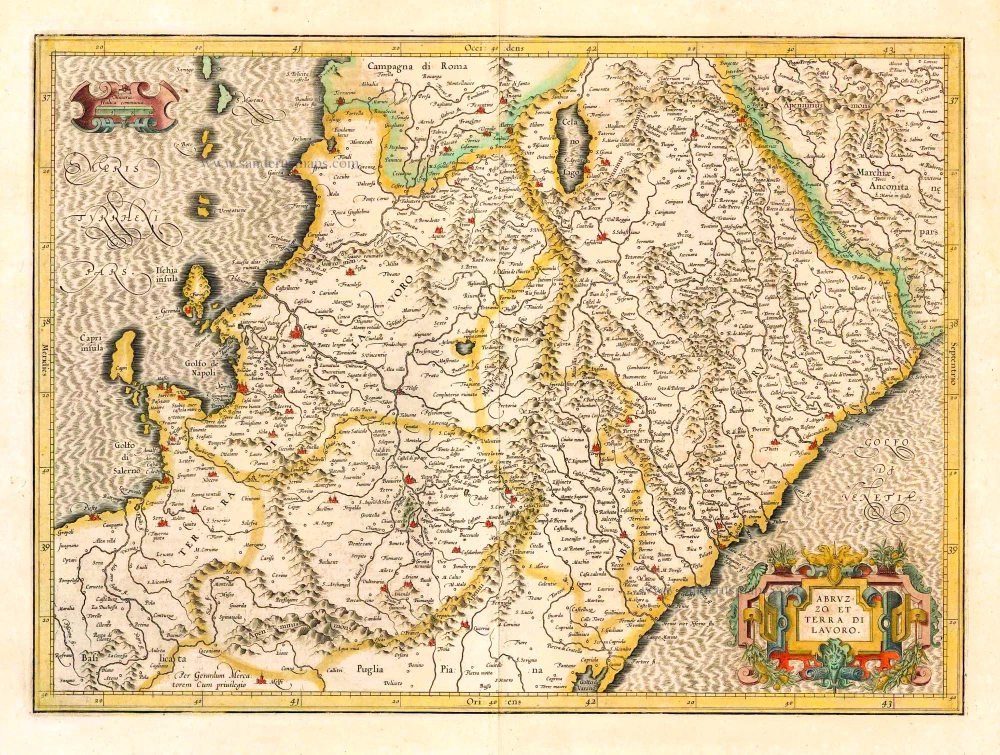
Abruzzo et Terra di Lavoro. 1619
Napoli (North) by Gerard Mercator.
[Item number: 26116]
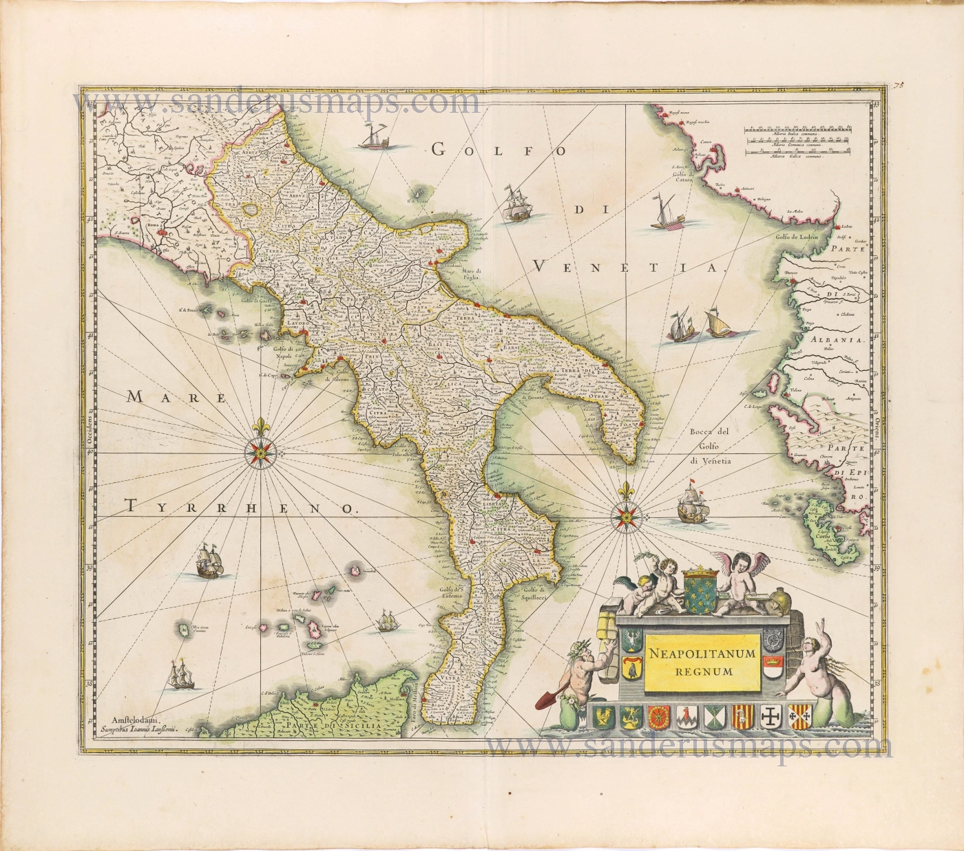
Neapolitanum Regnum. 1641
The Kingdom of Napoli, by Henricus Hondius.
[Item number: 26406]
Neapolitanum Regnum. 1656-80
The Kingdom of Napoli by Joannes Janssonius.
[Item number: 28599]

Rare!
Regno di Napoli. ca. 1585
Napels by Pietro di Nobili.
[Item number: 28924]
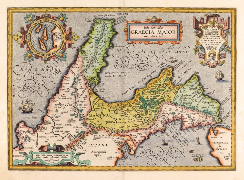
Parergon map
Itala nam tellus Graecia Maior. 1595
Ancient Southern Italy by Ortelius A.
[Item number: 30656]

Regnum Neapolitanu[m]. 1618
Napoli (Kingdom) by Petrus Bertius, published by Jodocus Hondius II.
[Item number: 31866]