
Verona, by Paolo Santini. 1776-79

Francesco and Paolo Santini (c.1729-1793)
Francesco Santini, a Venetian publisher, acquired the printing plates of Vaugondy’s Atlas Universel …, a commercial and cartographic success, with widespread influence on mapmakers throughout Europe. Together with his brother Paolo, he commissioned a new set of plates and reissued the atlas in 1776. The following year, Paolo Santini assigned all his publication rights to M. Remondini, who in 1777 reissued the same atlas but with his name.
Le Territoire de Verone.
Item Number: 27715 Authenticity Guarantee
Category: Antique maps > Europe > Italy
Old, antique map of Verona, by Paolo Santini.
Title: Le Territoire de Verone.
Date of the first edition: 1777.
Date of this map: 1776-79.
Copper engraving, printed on paper.
Size (not including margins): 475 x 455mm (18.7 x 17.91 inches).
Verso: Blank.
Condition: Original coloured in outline, excellent.
Condition Rating: A+.
From: Atlas Universel dressé sur les meilleures cartes modernes. Venice, Remondini, 1776-79.
Francesco and Paolo Santini (c.1729-1793)
Francesco Santini, a Venetian publisher, acquired the printing plates of Vaugondy’s Atlas Universel …, a commercial and cartographic success, with widespread influence on mapmakers throughout Europe. Together with his brother Paolo, he commissioned a new set of plates and reissued the atlas in 1776. The following year, Paolo Santini assigned all his publication rights to M. Remondini, who in 1777 reissued the same atlas but with his name.
Related items

Carte Nouvelle du Territoire de Verone 1721-41
Verona and Garda lake, by Covens & Mortier.
[Item number: 23554]

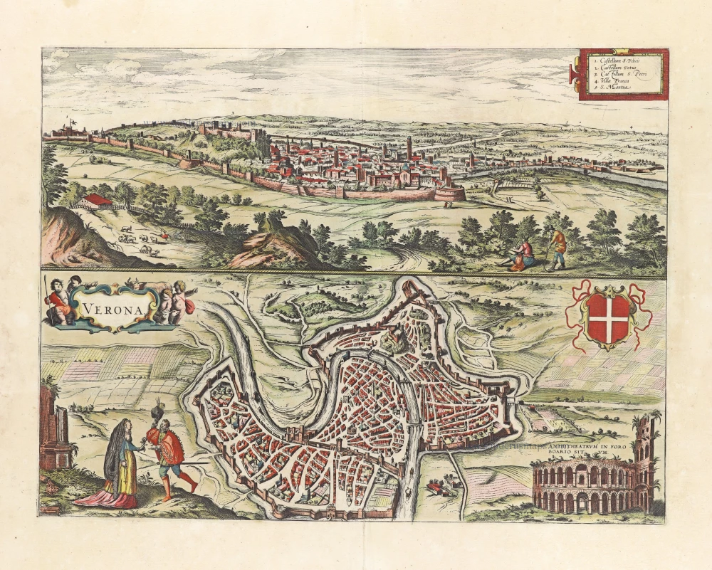
Magnifica Illa Civitas Verona [on sheet with] Colonia Augusta Verona Nova Galieniana Verona, Celeberrima, Amplissimaque Cenomanorum Urbs, Ptolemaeo 1599
Verona, by Braun and Hogenberg.
[Item number: 24064]

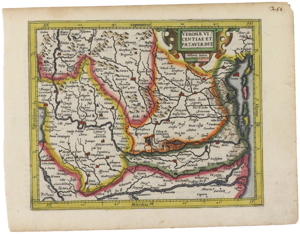
Veronae Vicentiae et Patavii Ditiones. 1623
Verona - Vicenza - Padua, by Gerard Mercator.
[Item number: 27937]
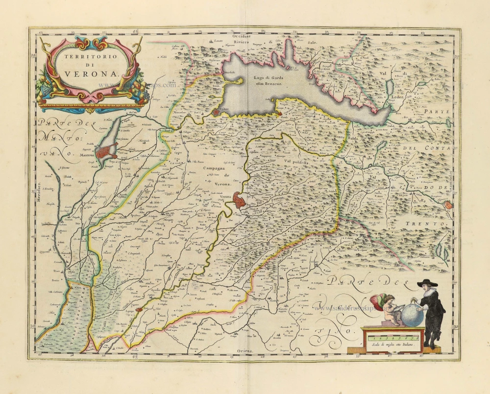
Territorio di Verona. 1650
Verona by Joan Blaeu.
[Item number: 28513]
Verona. 1657
Verona by J. Janssonius after Braun & Hogenberg.
[Item number: 31020]

Veronensis Ager. 1618
Verona by Petrus Bertius, published by Jodocus Hondius II.
[Item number: 31641]

Magnifica Illa Civitas Verona [on sheet with] Colonia Augusta Verona Nova Galieniana Verona, Celeberrima, Amplissimaque Cenomanorum Urbs, Ptolemaeo. 1582
Verona by Georg Braun & Frans Hogenberg
[Item number: 32004]
Veronae Vicentiae et Pataviae dit. 1607
Verona, Vincenza, and Padova by Gerard Mercator, published by Jodocus Hondius.
[Item number: 33178]
new