
Extremely rare and important plan
's Hertogenbosch by J.B. Vrientius. c. 1603
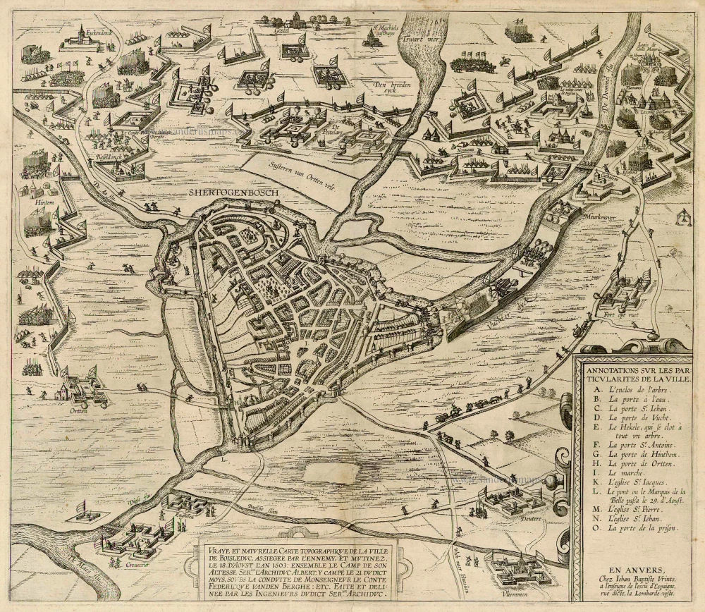
Vraye et naturelle Carte topographique de la ville de Boisleduc, assiegeé par l'ennemy, et mutinez, le 18. d'Aoust l'an 1603: Ensemble le Camp de son Altesse ser.me l'Archiduc Albert, y campe le 21 dudict moys, soubs la conduite de Monseigneur ...
Item Number: 22488 Authenticity Guarantee
Category: Antique maps > Europe > The Netherlands - Cities
An apparently unrecorded bird's-eye view plan of the siege of 's-Hertogenbosch in 1603, published by J.B. Vrientius.
There are two cartouches: one at the bottom centre with the title and one at the bottom right with a key to 14 locations + the address: "En Anvers, Chez Iehan Baptiste Vrints, a l'enseigne de l'escu d'Espaigne, rue dicte, la Lombarde-veste".
Not in Muller F.
Title: Vraye et naturelle Carte topographique de la ville de Boisleduc, assiegeé par l'ennemy, et mutinez, le 18. d'Aoust l'an 1603: Ensemble le Camp de son Altesse ser.me l'Archiduc Albert, y campe le 21 dudict moys, soubs la conduite de Monseigneur ...
Date: c. 1603.
Copper engraving, printed on paper.
Size (not including margins): 405 x 465mm (15.94 x 18.31 inches).
Verso: Blank.
Condition: Some small repairs at folds.
Condition Rating: B.
Separate publication.
Related items
First edition
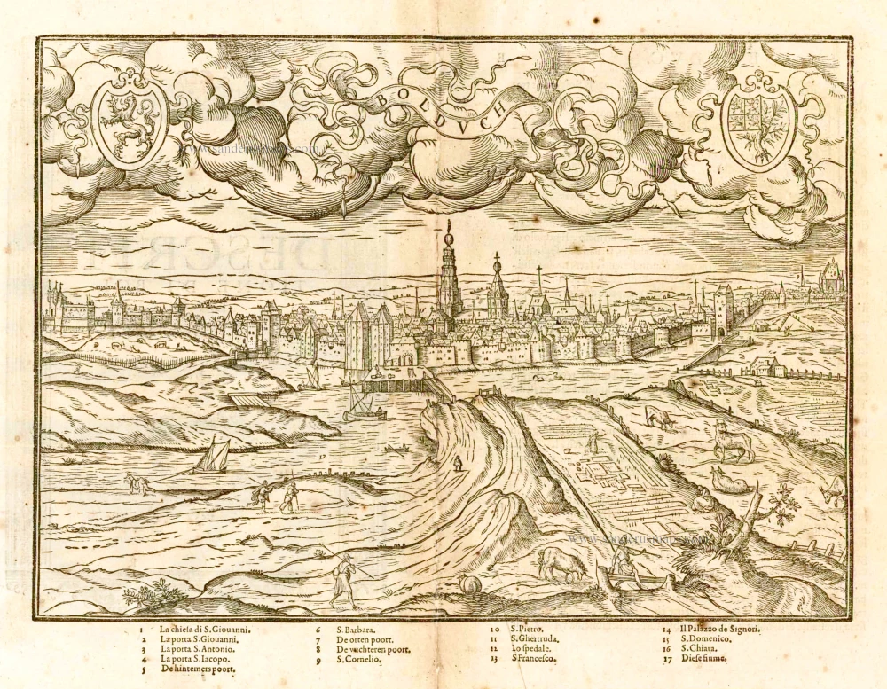
Bolduch. 1567
's-Hertogenbosch by L. Guicciardini
[Item number: 25198]

s' Hertogenbosch. 1656
's-Hertogenbosch by Visscher N. - Schut P.H.
[Item number: 25370]

A print of the 'Geschichtsblätter'
Hertzogen Busch - Eigentliche abcontrafactur der weitberumbten stat Hertzogen Bosch in Brabant gelegen, 1601-1612
Siege of s' Hertogenbosch by Maurice of Orange, published by Frans Hogenberg (Atelier)..
[Item number: 29947]

First edition
Bolduch. 1567
's-Hertogenbosch by L. Guicciardini
[Item number: 30815]
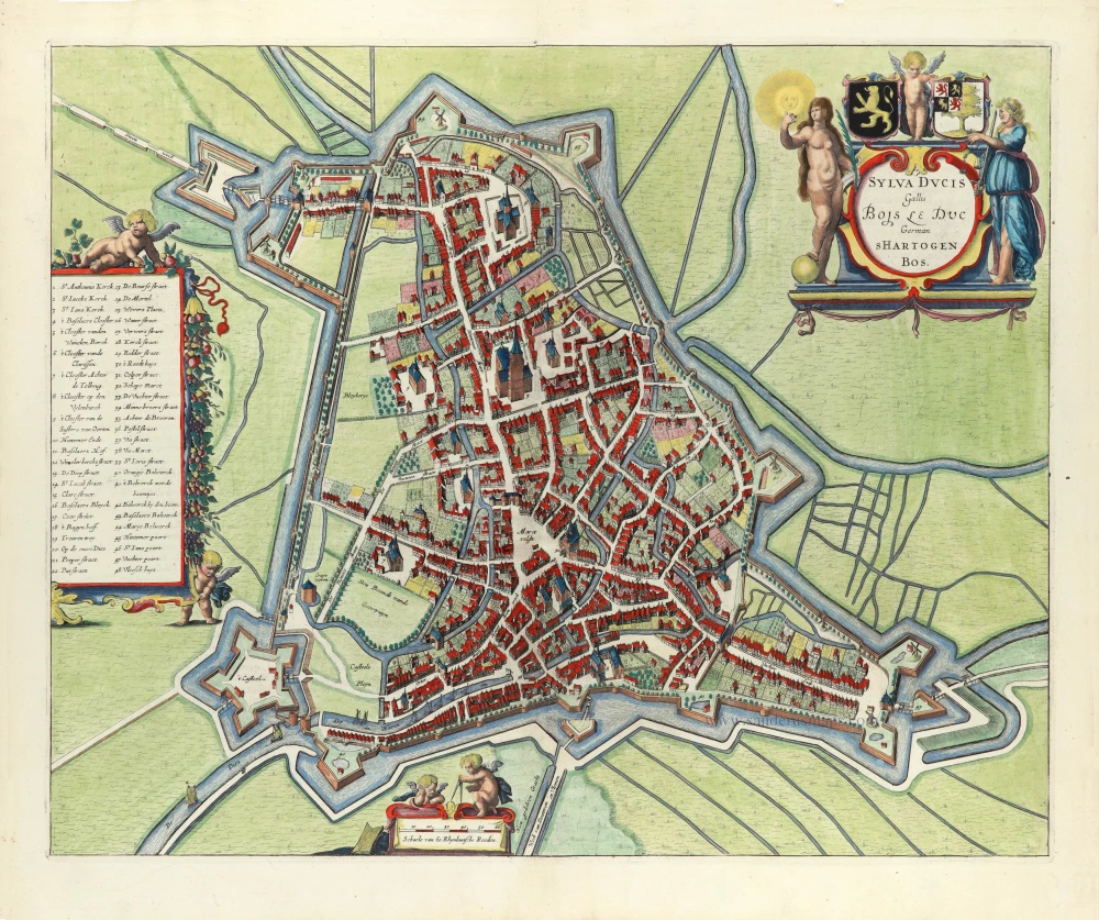
Sylva Ducis, Gallis vulgo Bois Le Duc, Vernacule 's Hartogen Bossche. 1657
's Hertogenbosch by J. Janssonius.
[Item number: 32430]

Tshertogenbosch - Buscumducis oppidum ludo literario, et pugnaci populo nobile Horum arma superiorib. annis haud semel Geldrij sensere, ... 1609
's-Hertogenbosch by Lodovico Guicciardini
[Item number: 32854]