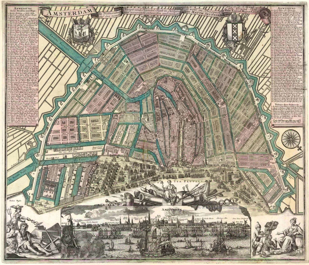
Old antique plan and view of Amsterdam by M. Seutter. 1740
Matthäus Seutter (Augsburg, 1678 - 1757)
Matthäus Seutter was an engraver, globe maker and map publisher in Augsburg. He apprenticed as an engraver to publisher J.B. Homann in Nuremberg in 1697. He returned to Augsburg c. 1707 and set up his own map publishing house, which became a primary competitor of the Homann company. As a result, most of Seutter's maps were based upon, if not copies, earlier work done by the Homann and Delisle firms.
Karl VI awarded him the title of Imperial Geographer in 1731.
Amsterdam die Weltberuhmte Haupt- und Handel Statt in Holland ...
Item Number: 25481 Authenticity Guarantee
Category: Antique maps > Europe > The Netherlands - Cities
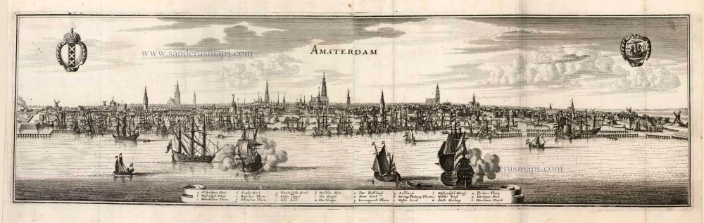
Old antique plan of Amsterdam with a panoramic view below, by M. Seutter.
Date of this map: c. 1740
Copper engraving
Size (not including margins): 48 x 56cm (18.7 x 21.8 inches)
Verso: Blank
Condition: Original coloured (view uncoloured), new margins, centrefold restored.
Condition Rating: B
References: Fauser, 402: D'Ailly, 243.
From: Atlas Novus. Augsburg, c. 1740.
Matthäus Seutter (Augsburg, 1678 - 1757)
Matthäus Seutter was an engraver, globe maker and map publisher in Augsburg. He apprenticed as an engraver to publisher J.B. Homann in Nuremberg in 1697. He returned to Augsburg c. 1707 and set up his own map publishing house, which became a primary competitor of the Homann company. As a result, most of Seutter's maps were based upon, if not copies, earlier work done by the Homann and Delisle firms.
Karl VI awarded him the title of Imperial Geographer in 1731.