
Utrecht by Georg Braun & Frans Hogenberg. 1582


TRANSLATION OF CARTOUCHE TEXT: Utrecht is also an important bishopric, whose bishop is of considerable influence in church affairs. Utrecht was [...] called Traiectum in Latin, since there was a possibility of crossing the old Rhine here. [...] The city is generously equipped with moats, bulwarks and blockhouses and a castle, and has many magnificent churches and colleges of canons, of which the noblest is Sint-Maartens. Hadrianus Barlandus writes that the bishop of the college of Utrecht is so rich and powerful that if necessary he can raise 40,000 men in a short time.
COMMENTARY BY BRAUN; "Some believe that Utrecht was founded by Antonio, a Roman councillor who fled from the raging tyrant Nero. Many Roman coins and other objects have been found here, from which the city can be judged to have a certain age. In Utrecht, there is a royal council that hears litigious cases from the surrounding towns. A magnificent and secure castle, by the name of Vredenburg, was also built here on the orders of Emperor Charles V."
The episcopal city of Utrecht, located on the confluence of several small rivers in the middle of the Netherlands, is here presented in a bird's-eye view. Particularly striking are the virtually rectangular town plan and the large number of churches, of which the most important is the Gothic cathedral of Sint-Maarten in the city centre. Numerous Romanesque churches also survive (Sint-Pieter, Sint-Jan, Sint-Nicolaas). Utrecht is one of the oldest cities in the Netherlands and goes back to a Roman settlement that was probably called Traiectum ("river crossing"). In the 7th century Willibrord, the bishop of Frisia, began his mission here. By the 12th century, the fortified town was already an important religious and economic centre. In 1559 Utrecht became the seat of an archbishopric. In 1576 revolt broke out against the Spanish forces. Three years later the seven northern provinces of the Netherlands united against the Spanish in the Union of Utrecht. Lastly, the signing of the Treaty of Utrecht at the start of the 18th century brought an end to the War of the Spanish Succession. (Taschen)
Braun G. & Hogenberg F. and the Civitates Orbis Terrarum.
The Civitates Orbis Terrarum, also known as the 'Braun & Hogenberg', is a six-volume town atlas and the most excellent book of town views and plans ever published: 363 engravings, sometimes beautifully coloured. It was one of the best-selling works in the last quarter of the 16th century. Georg Braun, a skilled writer, wrote the text accompanying the plans and views on the verso. Many plates were engraved after the original drawings of a professional artist, Joris Hoefnagel (1542-1600). The first volume was published in Latin in 1572 and the sixth in 1617. Frans Hogenberg, a talented engraver, created the tables for volumes I through IV, and Simon van den Neuwel made those for volumes V and VI. Other contributors were cartographers Daniel Freese and Heinrich Rantzau, who provided valuable geographical information. Works by Jacob van Deventer, Sebastian Münster, and Johannes Stumpf were also used as references. Translations appeared in German and French, making the atlas accessible to a broader audience.
Since its original publication of volume 1 in 1572, the Civitates Orbis Terrarum has left an indelible mark on the history of cartography. Seven more editions followed the first volume in 1575, 1577, 1582, 1588, 1593, 1599, and 1612. Vol.2, initially released in 1575, saw subsequent editions in 1597 and 1612. The subsequent volumes, each a treasure trove of historical insights, graced the world in 1581, 1588, 1593, 1599, and 1606. The German translation of the first volume, a testament to its widespread appeal, debuted in 1574, followed by the French edition in 1575.
Several printers were involved: Theodor Graminaeus, Heinrich von Aich, Gottfried von Kempen, Johannis Sinniger, Bertram Buchholtz, and Peter von Brachel, all of whom worked in Cologne.
Georg Braun (1541-1622)
Georg Braun, the author of the text accompanying the plans and views in the Civitates Orbis Terrarum, was born in Cologne in 1541. After his studies in Cologne, he entered the Jesuit Order as a novice, indicating his commitment to learning and intellectual pursuits. In 1561, he obtained his bachelor's degree; in 1562, he received his Magister Artium, further demonstrating his academic achievements. Although he left the Jesuit Order, he continued his studies in theology, gaining a licentiate in theology. His theological background likely influenced the content and tone of the text in the Civitates Orbis Terrarum, adding a unique perspective to the work.
Frans Hogenberg (1535-1590)
Frans Hogenberg was a Flemish and German painter, engraver, and mapmaker. He was born in Mechelen as the son of Nicolaas Hogenberg.
By the end of the 1560s, Frans Hogenberg was employed upon Abraham Ortelius's Theatrum Orbis Terrarum, published in 1570; he is named an engraver of numerous maps. In 1568, he was banned from Antwerp by the Duke of Alva and travelled to London, where he stayed a few years before emigrating to Cologne. He immediately embarked on his two most important works, the Civitates, published in 1572 and the Geschichtsblätter, which appeared in several series from 1569 until about 1587.
Thanks to large-scale projects like the Geschichtsblätter and the Civitates, Hogenberg's social circumstances improved with each passing year. He died as a wealthy man in Cologne in 1590.
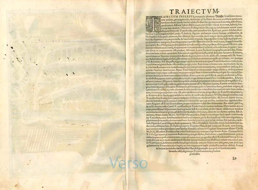
Traiectum clara et vetus est Episcopalis Civitas, ...
Item Number: 25316 Authenticity Guarantee
Category: Antique maps > Europe > The Netherlands - Cities
Old, antique bird’s-eye view plan of Utrecht, by Georg Braun & Frans Hogenberg.
Title: Traiectum clara et vetus est Episcopalis Civitas, ...
Date of the first edition: 1575.
Date of this map: 1582.
Copper engraving, printed on paper.
Map size: 330 x 475mm (12.99 x 18.7 inches).
Sheet size: 380 x 520mm (14.96 x 20.47 inches).
Verso: Latin text.
Condition: Original coloured, excellent.
Condition Rating: A+.
References: Van der Krogt 4 - #4539 State 1; Fauser - #14516; Taschen, Br. Hog. - p. 78; Donkersloot-de Vrij (Utrecht) - #3
From: Civitates Orbis Terrarum, Liber Primus. Köln, Gottfried von Kempen, 1582. (Van der Krogt 4, 41:1.1(1582))
TRANSLATION OF CARTOUCHE TEXT: Utrecht is also an important bishopric, whose bishop is of considerable influence in church affairs. Utrecht was [...] called Traiectum in Latin, since there was a possibility of crossing the old Rhine here. [...] The city is generously equipped with moats, bulwarks and blockhouses and a castle, and has many magnificent churches and colleges of canons, of which the noblest is Sint-Maartens. Hadrianus Barlandus writes that the bishop of the college of Utrecht is so rich and powerful that if necessary he can raise 40,000 men in a short time.
COMMENTARY BY BRAUN; "Some believe that Utrecht was founded by Antonio, a Roman councillor who fled from the raging tyrant Nero. Many Roman coins and other objects have been found here, from which the city can be judged to have a certain age. In Utrecht, there is a royal council that hears litigious cases from the surrounding towns. A magnificent and secure castle, by the name of Vredenburg, was also built here on the orders of Emperor Charles V."
The episcopal city of Utrecht, located on the confluence of several small rivers in the middle of the Netherlands, is here presented in a bird's-eye view. Particularly striking are the virtually rectangular town plan and the large number of churches, of which the most important is the Gothic cathedral of Sint-Maarten in the city centre. Numerous Romanesque churches also survive (Sint-Pieter, Sint-Jan, Sint-Nicolaas). Utrecht is one of the oldest cities in the Netherlands and goes back to a Roman settlement that was probably called Traiectum ("river crossing"). In the 7th century Willibrord, the bishop of Frisia, began his mission here. By the 12th century, the fortified town was already an important religious and economic centre. In 1559 Utrecht became the seat of an archbishopric. In 1576 revolt broke out against the Spanish forces. Three years later the seven northern provinces of the Netherlands united against the Spanish in the Union of Utrecht. Lastly, the signing of the Treaty of Utrecht at the start of the 18th century brought an end to the War of the Spanish Succession. (Taschen)
Braun G. & Hogenberg F. and the Civitates Orbis Terrarum.
The Civitates Orbis Terrarum, also known as the 'Braun & Hogenberg', is a six-volume town atlas and the most excellent book of town views and plans ever published: 363 engravings, sometimes beautifully coloured. It was one of the best-selling works in the last quarter of the 16th century. Georg Braun, a skilled writer, wrote the text accompanying the plans and views on the verso. Many plates were engraved after the original drawings of a professional artist, Joris Hoefnagel (1542-1600). The first volume was published in Latin in 1572 and the sixth in 1617. Frans Hogenberg, a talented engraver, created the tables for volumes I through IV, and Simon van den Neuwel made those for volumes V and VI. Other contributors were cartographers Daniel Freese and Heinrich Rantzau, who provided valuable geographical information. Works by Jacob van Deventer, Sebastian Münster, and Johannes Stumpf were also used as references. Translations appeared in German and French, making the atlas accessible to a broader audience.
Since its original publication of volume 1 in 1572, the Civitates Orbis Terrarum has left an indelible mark on the history of cartography. Seven more editions followed the first volume in 1575, 1577, 1582, 1588, 1593, 1599, and 1612. Vol.2, initially released in 1575, saw subsequent editions in 1597 and 1612. The subsequent volumes, each a treasure trove of historical insights, graced the world in 1581, 1588, 1593, 1599, and 1606. The German translation of the first volume, a testament to its widespread appeal, debuted in 1574, followed by the French edition in 1575.
Several printers were involved: Theodor Graminaeus, Heinrich von Aich, Gottfried von Kempen, Johannis Sinniger, Bertram Buchholtz, and Peter von Brachel, all of whom worked in Cologne.
Georg Braun (1541-1622)
Georg Braun, the author of the text accompanying the plans and views in the Civitates Orbis Terrarum, was born in Cologne in 1541. After his studies in Cologne, he entered the Jesuit Order as a novice, indicating his commitment to learning and intellectual pursuits. In 1561, he obtained his bachelor's degree; in 1562, he received his Magister Artium, further demonstrating his academic achievements. Although he left the Jesuit Order, he continued his studies in theology, gaining a licentiate in theology. His theological background likely influenced the content and tone of the text in the Civitates Orbis Terrarum, adding a unique perspective to the work.
Frans Hogenberg (1535-1590)
Frans Hogenberg was a Flemish and German painter, engraver, and mapmaker. He was born in Mechelen as the son of Nicolaas Hogenberg.
By the end of the 1560s, Frans Hogenberg was employed upon Abraham Ortelius's Theatrum Orbis Terrarum, published in 1570; he is named an engraver of numerous maps. In 1568, he was banned from Antwerp by the Duke of Alva and travelled to London, where he stayed a few years before emigrating to Cologne. He immediately embarked on his two most important works, the Civitates, published in 1572 and the Geschichtsblätter, which appeared in several series from 1569 until about 1587.
Thanks to large-scale projects like the Geschichtsblätter and the Civitates, Hogenberg's social circumstances improved with each passing year. He died as a wealthy man in Cologne in 1590.
Related items

Episcop. Ultraiectinus c. 1610-1650
Utrecht, by Henricus Hondius.
[Item number: 31224]

La Seigneurie d'Utrecht. 1692
Utrecht by N. Sanson, so-called published by Hubert Jaillot. (Pirated edition by Pierre Mortier).
[Item number: 31374]
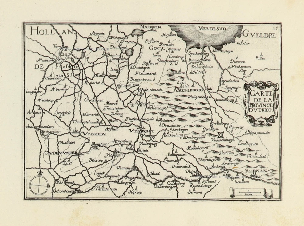
Carte de la Province d'Utrect. 1633
Utrecht by C. Tassin.
[Item number: 31763]

Trajectum 1612
Utrecht by Guicciardini Lodovico
[Item number: 32989]

Traiectum Wttrecht. 1649
Utrecht, by Joan Blaeu.
[Item number: 33200]
new