
Antique map of Gulf of Riga - Island of Saaremaa by Waghenaer L.J. 1600
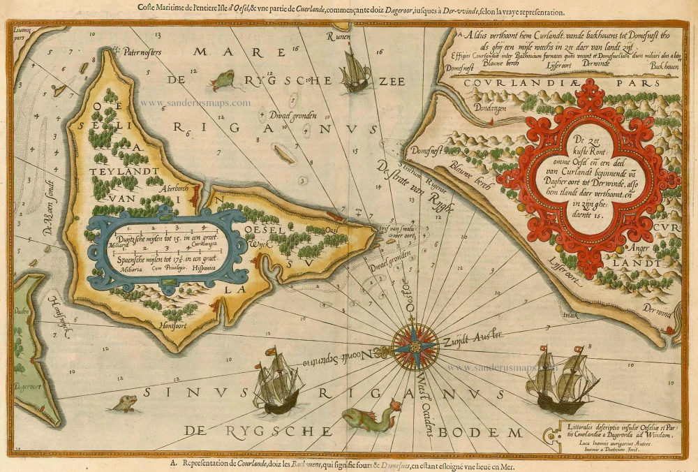


De Zee Kuste Rontomme Oesel en een Deel van Curlandt beginnende va Dagher Oort tot Derwinde, also hem tlandt daer verthoont, en in zijn ghedaente is.
Item Number: 4941 Authenticity Guarantee
Category: Antique maps > Europe > Northern Europe
Copper engraving, engraved by B. & J. van Doetecum.
Size: 34 x 52cm (13 x 20 inches)
Verso text: French
Condition: Old coloured, two worm traces in lower margin.
From: Le nouveau mirroir des voyages et navigations. Antwerp, Jean Bellère, 1600. (Koeman, Wag11A).
"Thanks to the unparalleled skill of the engravers, Baptist and Johannes van Deutecom, the original ms. charts by Waghenaer were transformed into the most beautiful maps of the period. The composition and the adornment have greatly contributed to the splendour of what originally were simple sketch-charts." (Koeman, Atlantes Neerlandici)