
Antique map of Norway by Waghenaer L.J. 1600

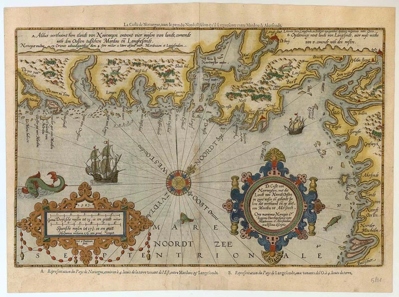


De Custe van Noorweghen, met dat Landt van Noordt Oosten in zijne wesen en gedaente soe hem dat verhoont en op doet van Mardou tot Akersondt
Item Number: 5201 Authenticity Guarantee
Category: Antique maps > Europe > Northern Europe
Copper engraving, engraved by B. & J. van Doetecum.
Size: 34 x 52cm (13 x 20 inches)
Verso text: French
Condition: Old coloured.
From: Le nouveau mirroir des voyages et navigations. Antwerp, Jean Bellère, 1600. (Koeman, Wag11A).
"Thanks to the unparalleled skill of the engravers, Baptist and Johannes van Deutecom, the original ms. charts by Waghenaer were transformed into the most beautiful maps of the period. The composition and the adornment have greatly contributed to the splendour of what originally were simple sketch-charts." (Koeman, Atlantes Neerlandici)