
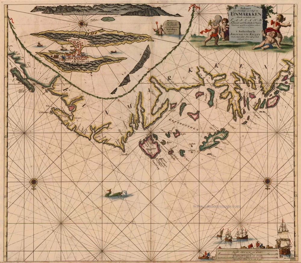
Antique map of Norway - Finnmark by Van Keulen Johannes 1697-1709
back
References: Koeman - Keu (59)
Paskaart van 't Noordelykste van de Kust van Finmarkken Alsmede een Gedeelte van Lapland Beginnende van C. Tromsondt tot Tiepena.
SOLD
Item Number: 2804 Authenticity Guarantee
Category: Antique maps > Europe > Northern Europe
Sea chart of the coast of Norway - Finnmark, oriented to the South.
With inset map of the island Wardhuys.
Copper engraving
Size: 50 x 58cm (19.5 x 22.6 inches)
Verso: Blank
Condition: Old coloured, age-toned, some spotting.
Condition Rating: B
References: Koeman, Keu (59).
From: De Nieuwe Groote Lichtende Zee-Fakkel, ... Amsterdam, J. van Keulen, 1697-1709.