
Antique map of Scandinavia by Blaeu W. & J. 1644-45
The item displayed on this page has been sold. However, we have a similar map in stock:
Scandinavia by Joan Blaeu. 1643
Suecia, Dania et Norvegia, Regna Europae ...
[Item number: 29998]

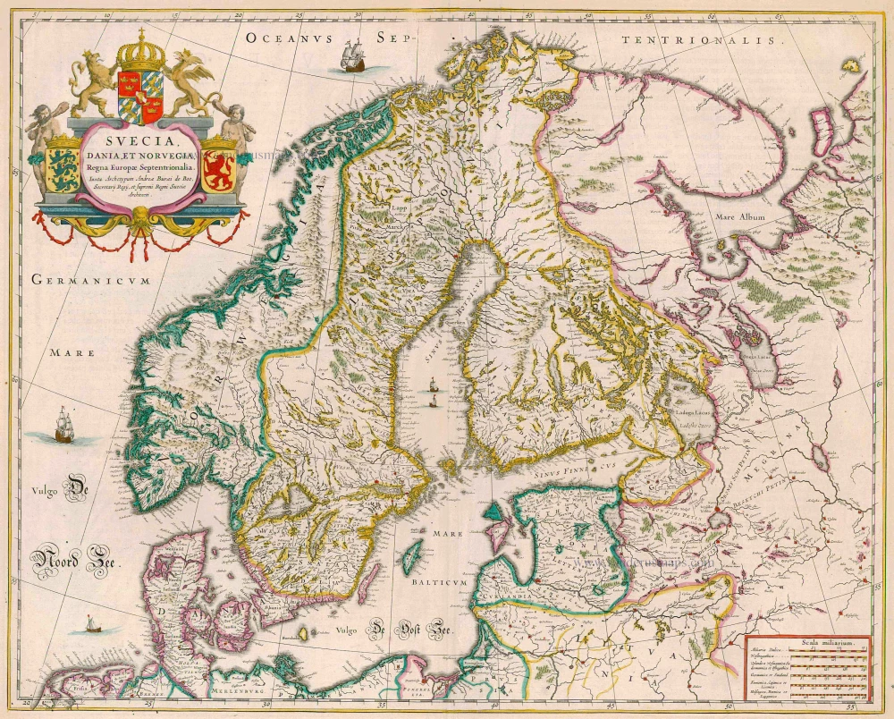
Suecia, Dania et Norvegia, Regna Europae Septentrionalia. Iuxta Archetypum Andreae Buraei de Boo, ...
Item Number: 13150 Authenticity Guarantee
Category: Antique maps > Europe > Northern Europe
Antique map of Scandinavia by Blaeu W. & J., oriented to the North
The map of Scandinavia shows the three kingdoms of Sweden, Denmark and Norway, the arms of which are arranged around the cartouche. The kingdom of Sweden was much larger in Blaeu's time than it is now, encompassing not only present-day Sweden but also Finland, Estonia, Latvia and Ingermanland.
Date of the first edition: 1634
Date of this map: 1644-45
Copper engraving
Size: 42.5 x 53.5cm (16.6 x 20.8 inches)
Verso text: Latin
Condition: Old coloured, excellent.
Condition Rating: A
References: Van der Krogt 2, 1210:2.
From: Theatrum Orbis Terrarum.. J. Blaeu, 1644-45. (Van der Krogt 2, 2:202)