
The Island of Hven (Denmark), by Georg Braun & Frans Hogenberg. c. 1593


It shows the Island of Hven, where Tycho Brahe's observatory, Uraniborg, is oriented to the west.
Two insets show the elevation and ground plan of the Uraniborg (left) and a bird's-eye view of the whole complex.
TRANSLATION OF CAPTION TOP LEFT: The castle of Urania, equipped with a significant number and variety of accurately made astronomical instruments, was built in honour and for the renewal of that noble science by Tycho Brahe, the famous Dane, lord of Knudsdrup, around 1580.
CARTOUCHE BOTTOM LEFT: Topography of the Island of Hven in the famous strait in the kingdom of Denmark, which in the vernacular is called Øresund. Drawn in Cologne in 1586.
COMMENTARY BY BRAUN: "This is the description of the Island of Hven, situated in the famous strait in the Kingdom of Denmark, called the Øresund. There is a castle called Uraniborg, which contains many ingenious astronomical instruments. It was built by Tycho Brahe, a Danish nobleman, to honour and renew the above-mentioned noble art of astronomy. ... Despite its small size, no part is useless or unfruitful, for it produces grain, has a surplus of cattle, chamois, hares, wrens and partridges in great numbers. Above all, it is in a perfect situation for catching fish."
The observer of the map of Denmark and the view of the Øresund has, as it were, approached the Earth from space and has now reached his goal: the Island of Hven, from where the astronomer Tycho Brahe explored the broad expanse of the universe and made pioneering discoveries. The plate shows Uraniborg, the most famous astronomical observatory of its time. It was built by Tycho Brahe, to whom the island was given as a fief by the Danish king in 1576, and who added a second observatory with underground observation rooms in 1584. Among other things, we can see Uraniborg itself (B), the workshop and house of the craftsmen who made the astronomical instruments (C) and the position of the underground observatory (D). When royal support was withdrawn, Brahe left Hven in 1597 with all his tools and moved to the estate of his friend Heinrich Rantzau. Brahe had not been liked by the farmers on the island, who resented him so much that they destroyed the castle of Uraniborg after his departure. Today, the Brahe Museum stands here. The observatory has been excavated and restored. (Taschen)
Braun G. & Hogenberg F. and the Civitates Orbis Terrarum.
The Civitates Orbis Terrarum, also known as the 'Braun & Hogenberg', is a six-volume town atlas and the most excellent book of town views and plans ever published: 363 engravings, sometimes beautifully coloured. It was one of the best-selling works in the last quarter of the 16th century. Georg Braun, a skilled writer, wrote the text accompanying the plans and views on the verso. Many plates were engraved after the original drawings of a professional artist, Joris Hoefnagel (1542-1600). The first volume was published in Latin in 1572 and the sixth in 1617. Frans Hogenberg, a talented engraver, created the tables for volumes I through IV, and Simon van den Neuwel made those for volumes V and VI. Other contributors were cartographers Daniel Freese and Heinrich Rantzau, who provided valuable geographical information. Works by Jacob van Deventer, Sebastian Münster, and Johannes Stumpf were also used as references. Translations appeared in German and French, making the atlas accessible to a wider audience.
Since its original publication of volume 1 in 1572, the Civitates Orbis Terrarum has left an indelible mark on the history of cartography. The first volume was followed by seven more editions in 1575, 1577, 1582, 1588, 1593, 1599, and 1612. Vol.2, initially released in 1575, saw subsequent editions in 1597 and 1612. The subsequent volumes, each a treasure trove of historical insights, graced the world in 1581, 1588, 1593, 1599, and 1606. The German translation of the first volume, a testament to its widespread appeal, debuted in 1574, followed by the French edition in 1575.
Several printers were involved: Theodor Graminaeus, Heinrich von Aich, Gottfried von Kempen, Johannis Sinniger, Bertram Buchholtz, and Peter von Brachel, all of whom worked in Cologne.
Georg Braun (1541-1622)
Georg Braun, the author of the text accompanying the plans and views in the Civitates Orbis Terrarum, was born in Cologne in 1541. After his studies in Cologne, he entered the Jesuit Order as a novice, indicating his commitment to learning and intellectual pursuits. In 1561, he obtained his bachelor's degree; in 1562, he received his Magister Artium, further demonstrating his academic achievements. Although he left the Jesuit Order, he continued his studies in theology, gaining a licentiate in theology. His theological background likely influenced the content and tone of the text in the Civitates Orbis Terrarum, adding a unique perspective to the work.
Frans Hogenberg (1535-1590)
Frans Hogenberg was a Flemish and German painter, engraver, and mapmaker. He was born in Mechelen as the son of Nicolaas Hogenberg.
By the end of the 1560s, Frans Hogenberg was employed upon Abraham Ortelius's Theatrum Orbis Terrarum, published in 1570; he is named an engraver of numerous maps. In 1568, he was banned from Antwerp by the Duke of Alva and travelled to London, where he stayed a few years before emigrating to Cologne. He immediately embarked on his two most important works, the Civitates, published in 1572 and the Geschichtsblätter, which appeared in several series from 1569 until about 1587.
Thanks to large-scale projects like the Geschichtsblätter and the Civitates, Hogenberg's social circumstances improved with each passing year. He died as a wealthy man in Cologne in 1590.
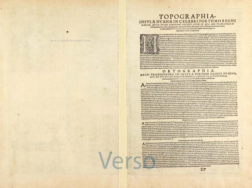
Topographia Insulae Huenae in Celebri Porthmo Regni Daniae, quem vulgo Oersunt uocant. Effigiata Coloniae 1586.
Item Number: 28962 Authenticity Guarantee
Category: Antique maps > Europe > Northern Europe
Antique map of the Island of Hven (Denmark) by Georg Braun & Frans Hogenberg.
Title: Topographia Insulae Huenae in Celebri Porthmo Regni Daniae, quem vulgo Oersunt uocant. Effigiata Coloniae 1586.
Oriented to the west.
Date of the first edition: 1588.
Date of this map: c. 1593.
Copper engraving, printed on paper.
Map size: 340 x 480mm (13.39 x 18.9 inches).
Sheet size: 395 x 520mm (15.55 x 20.47 inches).
Verso: French text.
Condition: Excellent, original coloured.
Condition Rating: A+.
From: Liber Quartus - Théatre des Principales Villes de tout L'Univers. Cologne, c. 1593. (Van der Krogt 4, 41:3.4)
It shows the Island of Hven, where Tycho Brahe's observatory, Uraniborg, is oriented to the west.
Two insets show the elevation and ground plan of the Uraniborg (left) and a bird's-eye view of the whole complex.
TRANSLATION OF CAPTION TOP LEFT: The castle of Urania, equipped with a significant number and variety of accurately made astronomical instruments, was built in honour and for the renewal of that noble science by Tycho Brahe, the famous Dane, lord of Knudsdrup, around 1580.
CARTOUCHE BOTTOM LEFT: Topography of the Island of Hven in the famous strait in the kingdom of Denmark, which in the vernacular is called Øresund. Drawn in Cologne in 1586.
COMMENTARY BY BRAUN: "This is the description of the Island of Hven, situated in the famous strait in the Kingdom of Denmark, called the Øresund. There is a castle called Uraniborg, which contains many ingenious astronomical instruments. It was built by Tycho Brahe, a Danish nobleman, to honour and renew the above-mentioned noble art of astronomy. ... Despite its small size, no part is useless or unfruitful, for it produces grain, has a surplus of cattle, chamois, hares, wrens and partridges in great numbers. Above all, it is in a perfect situation for catching fish."
The observer of the map of Denmark and the view of the Øresund has, as it were, approached the Earth from space and has now reached his goal: the Island of Hven, from where the astronomer Tycho Brahe explored the broad expanse of the universe and made pioneering discoveries. The plate shows Uraniborg, the most famous astronomical observatory of its time. It was built by Tycho Brahe, to whom the island was given as a fief by the Danish king in 1576, and who added a second observatory with underground observation rooms in 1584. Among other things, we can see Uraniborg itself (B), the workshop and house of the craftsmen who made the astronomical instruments (C) and the position of the underground observatory (D). When royal support was withdrawn, Brahe left Hven in 1597 with all his tools and moved to the estate of his friend Heinrich Rantzau. Brahe had not been liked by the farmers on the island, who resented him so much that they destroyed the castle of Uraniborg after his departure. Today, the Brahe Museum stands here. The observatory has been excavated and restored. (Taschen)
Braun G. & Hogenberg F. and the Civitates Orbis Terrarum.
The Civitates Orbis Terrarum, also known as the 'Braun & Hogenberg', is a six-volume town atlas and the most excellent book of town views and plans ever published: 363 engravings, sometimes beautifully coloured. It was one of the best-selling works in the last quarter of the 16th century. Georg Braun, a skilled writer, wrote the text accompanying the plans and views on the verso. Many plates were engraved after the original drawings of a professional artist, Joris Hoefnagel (1542-1600). The first volume was published in Latin in 1572 and the sixth in 1617. Frans Hogenberg, a talented engraver, created the tables for volumes I through IV, and Simon van den Neuwel made those for volumes V and VI. Other contributors were cartographers Daniel Freese and Heinrich Rantzau, who provided valuable geographical information. Works by Jacob van Deventer, Sebastian Münster, and Johannes Stumpf were also used as references. Translations appeared in German and French, making the atlas accessible to a wider audience.
Since its original publication of volume 1 in 1572, the Civitates Orbis Terrarum has left an indelible mark on the history of cartography. The first volume was followed by seven more editions in 1575, 1577, 1582, 1588, 1593, 1599, and 1612. Vol.2, initially released in 1575, saw subsequent editions in 1597 and 1612. The subsequent volumes, each a treasure trove of historical insights, graced the world in 1581, 1588, 1593, 1599, and 1606. The German translation of the first volume, a testament to its widespread appeal, debuted in 1574, followed by the French edition in 1575.
Several printers were involved: Theodor Graminaeus, Heinrich von Aich, Gottfried von Kempen, Johannis Sinniger, Bertram Buchholtz, and Peter von Brachel, all of whom worked in Cologne.
Georg Braun (1541-1622)
Georg Braun, the author of the text accompanying the plans and views in the Civitates Orbis Terrarum, was born in Cologne in 1541. After his studies in Cologne, he entered the Jesuit Order as a novice, indicating his commitment to learning and intellectual pursuits. In 1561, he obtained his bachelor's degree; in 1562, he received his Magister Artium, further demonstrating his academic achievements. Although he left the Jesuit Order, he continued his studies in theology, gaining a licentiate in theology. His theological background likely influenced the content and tone of the text in the Civitates Orbis Terrarum, adding a unique perspective to the work.
Frans Hogenberg (1535-1590)
Frans Hogenberg was a Flemish and German painter, engraver, and mapmaker. He was born in Mechelen as the son of Nicolaas Hogenberg.
By the end of the 1560s, Frans Hogenberg was employed upon Abraham Ortelius's Theatrum Orbis Terrarum, published in 1570; he is named an engraver of numerous maps. In 1568, he was banned from Antwerp by the Duke of Alva and travelled to London, where he stayed a few years before emigrating to Cologne. He immediately embarked on his two most important works, the Civitates, published in 1572 and the Geschichtsblätter, which appeared in several series from 1569 until about 1587.
Thanks to large-scale projects like the Geschichtsblätter and the Civitates, Hogenberg's social circumstances improved with each passing year. He died as a wealthy man in Cologne in 1590.