
Antique sea chart of the North Atlantic Ocean 1697-1709
The item displayed on this page has been sold. However, we have a similar map in stock:
North Atlantic Ocean by J. Van Keulen. 1706
Nieuwe Paskaart vande Geheele Oosterzé en Noortzé...
[Item number: 31737]
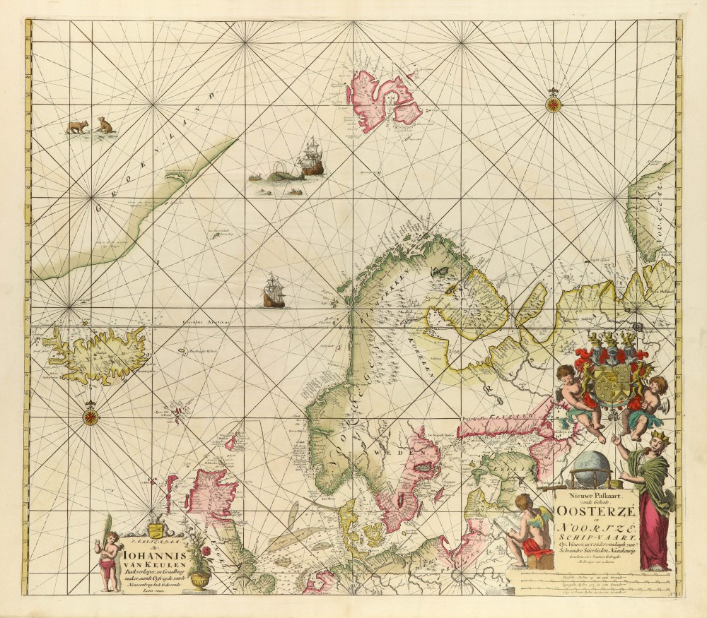
Nieuwe Paskaart, vande Geheele Oosterze en Noortze Schip-Vaart ...
Item Number: 61 Authenticity Guarantee
Category: Antique maps > Europe > Northern Europe
Sea chart of the North Atlantic Ocean.
Early edition, without the later added engraved number 1.
Copper engraving
Size: 51 x 58cm (19.9 x 22.6 inches)
Verso: Blank
Condition: Old coloured (refreshed), a few small repairs at lower edge.
Condition Rating: B
References: Koeman, Keu (31).
From: De Nieuwe Groote Lichtende Zee-Fakkel, ... Amsterdam, J. van Keulen, 1697-1709.