
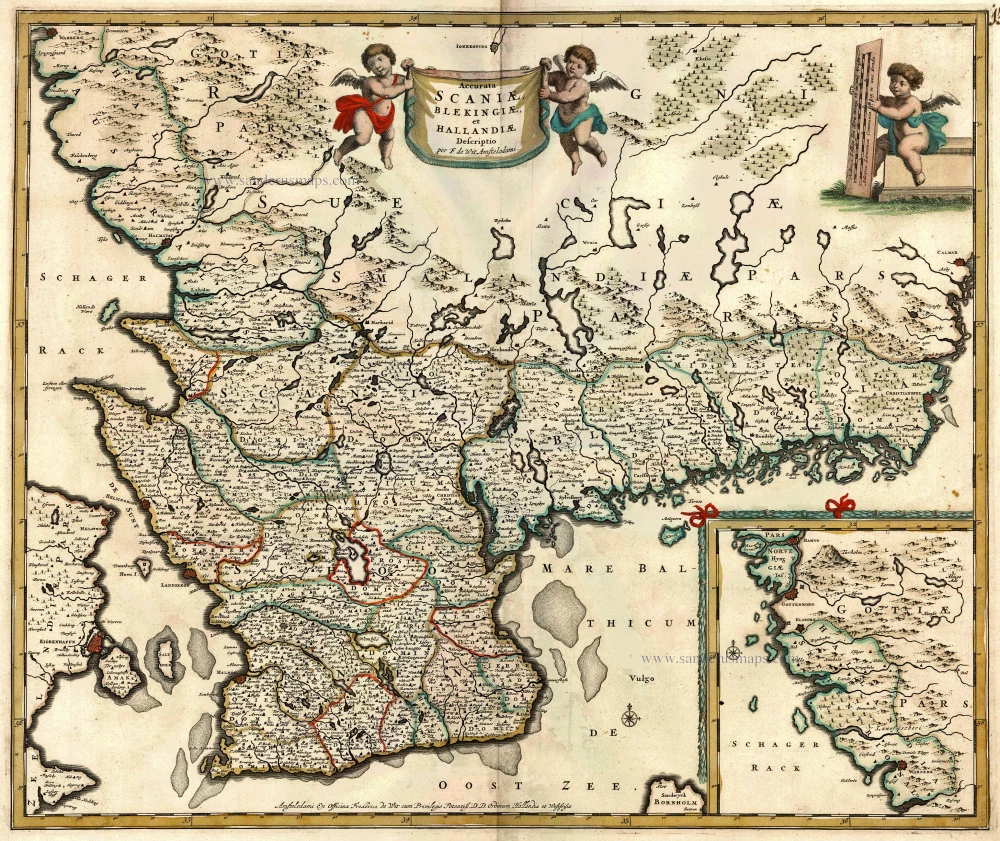
Old, antique map of Southern Sweden by F. De Wi c. 1680
back
References: Carhart de Wit (2016) - p. 320-321 #86
Accurata Scaniae, Blekingiae, et Hallandiae Descriptio
SOLD
Item Number: 10592 Authenticity Guarantee
Category: Antique maps > Europe > Northern Europe
Map of Southern Sweden by F. De Wit, oriented to the North
Inset: Extension of coast from Varberg to Goteborg.
Copper engraving
Size: 49.5 x 59cm (19.3 x 23 inches)
Verso: Blank
Condition: Old coloured, excellent.
Condition Rating: A
From: Composite Atlas by F. De Wit, c. 1680.