
Swedish Lapland, by Zacharias Châtelain. 1714


The Châtelain Family
Zacharias Châtelain (1684-1743) was a bookseller and publisher of Amsterdam. He was succeeded by his sons Zacharias jr and Henry Abraham. The Châtelain family was best known for the historical atlas Atlas Historique, ou nouvelle introduction à l’histoire…, a major work of its time. It was an encyclopaedia in seven volumes, including geography as one of its main subjects. The atlas was published in Amsterdam in seven volumes in various editions with different imprints from 1705 to 1739. An anonym person (Mr. C***) compiled the work with compositions of text, maps, plates and chronological and genealogical tables by Gueudeville, except volume 7, where H.P. Limiers took over this task. The maps were made mainly after the work of Guillaume de l'Isle.
The 1705 edition was published with the imprint “L’Honoré & Châtelain”. Later editions had the imprint: “les Frères Châtelain Libraires” or “L’Honoré & Châtelain Libraires”.
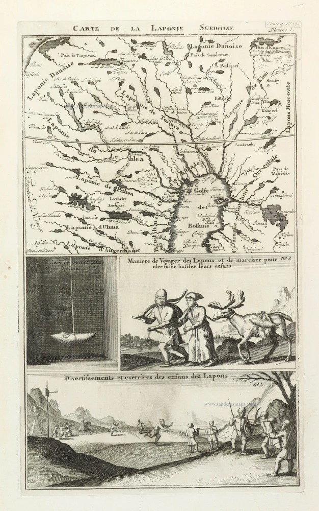
Carte de la Laponie Suedoise.
Item Number: 29414 Authenticity Guarantee
Category: Antique maps > Europe > Northern Europe
Old, antique map of Swedish Lapland, by Zacharias Châtelain.
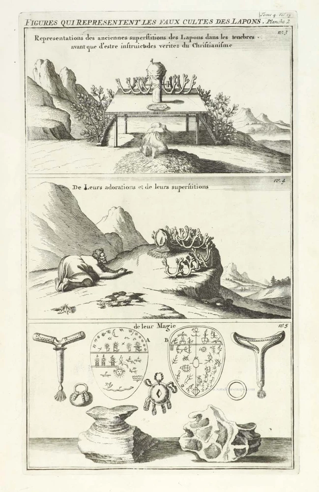
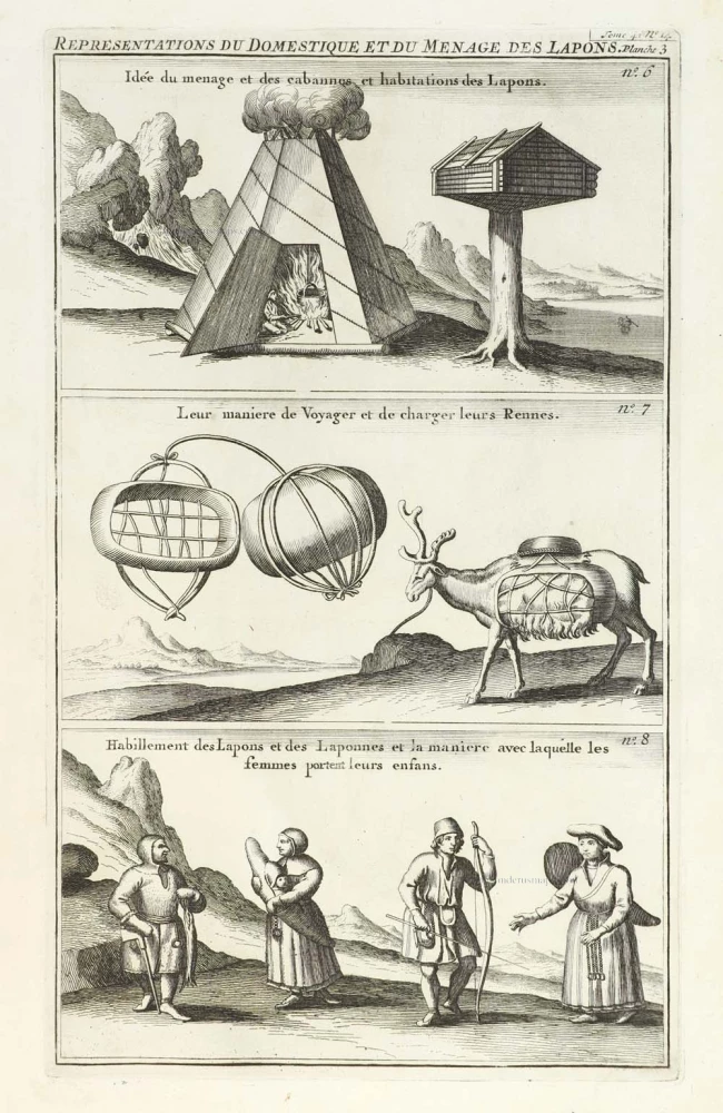
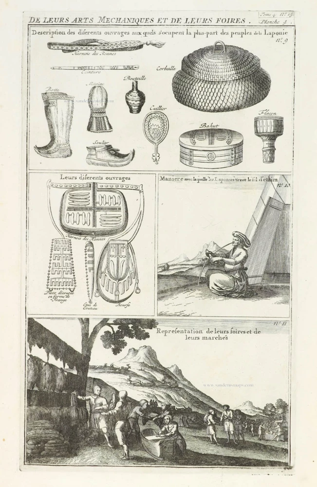
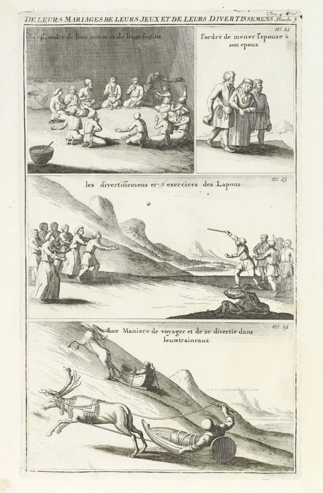
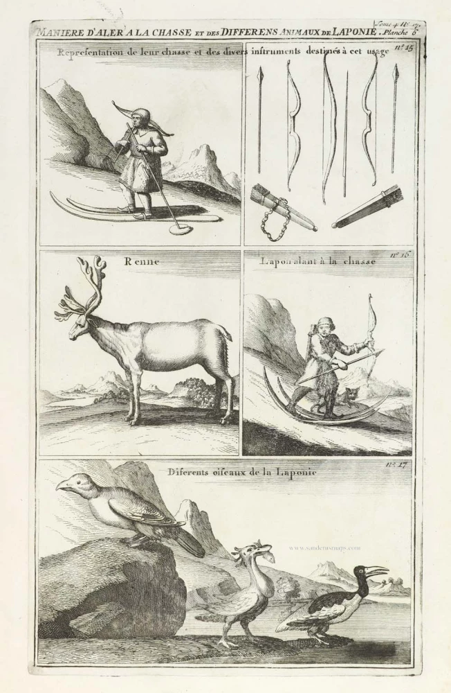
With two vignettes below the map and five other plates showing scenes of the customs of the Lapps.
Set of six sheets with 17 numbered vignettes.
Title: Carte de la Laponie Suedoise.
Tome 4. N° 12 Planche 1 to 17.
Date of the first edition: 1714.
Date of this map: 1714.
Copper engravings, printed on paper.
Plate size of first sheet: 350 x 205mm (13.78 x 8.07 inches).
Sheet size: 440 x 270mm (17.32 x 10.63 inches).
Verso: Blank.
Condition: Excellent.
Condition Rating: A+.
From: Châtelain Z. Atlas Historique, ou Nouvelle Introduction A l'Histoire, à la Chronologie & à la Geographie Ancienne & Moderne; ... Tome IV. Qui comprend le Danemarck, la Suède, la Pologne, la Moscovie, la Turquie, etc. A Amsterdam, Chez les Frères Châtelain Libraires, M.DCC.XIV. (1714). (Koeman II, p. 36, Cha5)
The Châtelain Family
Zacharias Châtelain (1684-1743) was a bookseller and publisher of Amsterdam. He was succeeded by his sons Zacharias jr and Henry Abraham. The Châtelain family was best known for the historical atlas Atlas Historique, ou nouvelle introduction à l’histoire…, a major work of its time. It was an encyclopaedia in seven volumes, including geography as one of its main subjects. The atlas was published in Amsterdam in seven volumes in various editions with different imprints from 1705 to 1739. An anonym person (Mr. C***) compiled the work with compositions of text, maps, plates and chronological and genealogical tables by Gueudeville, except volume 7, where H.P. Limiers took over this task. The maps were made mainly after the work of Guillaume de l'Isle.
The 1705 edition was published with the imprint “L’Honoré & Châtelain”. Later editions had the imprint: “les Frères Châtelain Libraires” or “L’Honoré & Châtelain Libraires”.
