
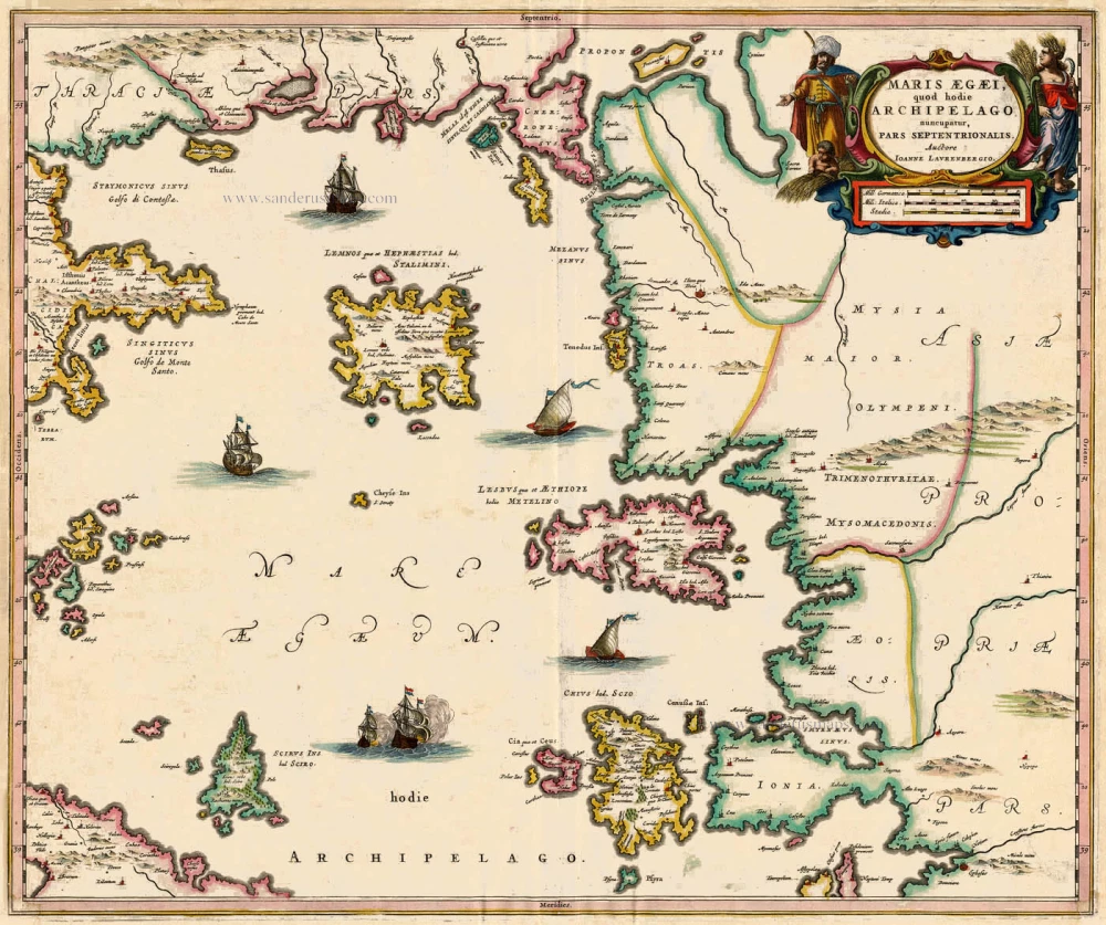
Antique map of Aegean Islands (North) by J. Blaeu 1664
back
References: Van der Krogt 2 - 7911:2
Maris Aegaei, quod hodie Archipelago nuncupatur, Pars Septentrionalis.
SOLD
Item Number: 6928 Authenticity Guarantee
Category: Antique maps > Europe > Southeastern Europe
Copper engraving
Size: 48 x 58cm (19 x 23 inches)
Verso text: Dutch
Condition: Old coloured, light infilled worming in lower corners.
References: Van der Krogt 2, 7911:2.
From: Toonneel des Aerdriicx, Ofte Nieuwe Atlas, Dat is Beschryving van alle Landen. Amsterdam, 1642. (Van der Krogt 2, 221)