
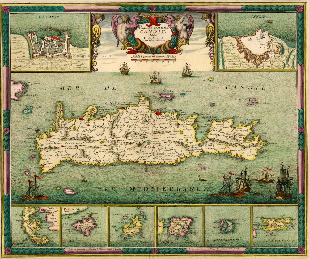
Antique map of Crete + Greek Islands by de Beaulieu Ca. 1694.
Sr. Sébastien de Beaulieu (1612 - 1674)
Sébastien de Pontault, Sieur de Beaulieu was born around 1612. He entered the service of the king at the age of 15. Despite his young age, he obtained the post of commissioner of artillery in 1628. He had a successful career in the military but was severely wounded several times. In 1642, he received a royal privilege for creating and publishing battle plans. At the request of the king, he had numerous sieges engraved.
de Beaulieu left us fourteen small oblong atlases of plans and profiles of the cities of France, commonly called “Les Petits Beaulieu”, and a large folio atlas of the battles of Louis XIII and Louis XIV, known as “le Grand Beaulieu”. These works are the culmination of a long career as a military engineer.
Beaulieu died in 1674 before having completed his collection of battle plans. His niece, Reine-Michèle de Beaulieu, completed the atlas in 1694.
Plan de L'Isle de Candie Iadis Crete et des Isles voisines.
Item Number: 5937 Authenticity Guarantee
Category: Antique maps > Europe > Southeastern Europe
Old, antique map of Crete, by Sr Sebastien de Beaulieu
Copper engraving, printed on paper.
Size (not including margins): 45 x 54cm (17.6 x 21.1 inches)
Verso: Blank
Condition: Original coloured.
References: Pastoureau, Beaulieu XV - II (65) - Rare!.
Sr. Sébastien de Beaulieu (1612 - 1674)
Sébastien de Pontault, Sieur de Beaulieu was born around 1612. He entered the service of the king at the age of 15. Despite his young age, he obtained the post of commissioner of artillery in 1628. He had a successful career in the military but was severely wounded several times. In 1642, he received a royal privilege for creating and publishing battle plans. At the request of the king, he had numerous sieges engraved.
de Beaulieu left us fourteen small oblong atlases of plans and profiles of the cities of France, commonly called “Les Petits Beaulieu”, and a large folio atlas of the battles of Louis XIII and Louis XIV, known as “le Grand Beaulieu”. These works are the culmination of a long career as a military engineer.
Beaulieu died in 1674 before having completed his collection of battle plans. His niece, Reine-Michèle de Beaulieu, completed the atlas in 1694.