
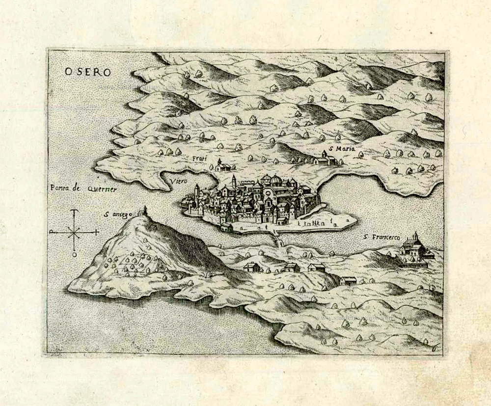
Croatia - Osor by Giovanni Francesco Camocio After 1575
Giovanni Francesco Camocio (active in Venice between 1552 and 1575)
Giovanni Francesco Camocio, Venetian publisher and engraver was born in the first half of the 16th century, probably in Asolo (Treviso). He then moved to Venice, where his publishing activity has been registered since 1552. He was the owner of the bookshop Al segno della Piramide (At the Sign of the Pyramid) in San Lio in Merceria, where his main activity was the sale of prints and engravings, engraved reproductions of works of art and geographical maps. Camocio was one of the most significant publishers of the time. The presence of his name on many papers and prints and his numerous requests for privilege testify to his intense activity. It included subjects derived from great artists such as Titian and Michelangelo, views of cities, fortresses, and geographic maps. To realise these maps, he collaborated with famous engravers and cartographers, including Domenico Zenoi, Paolo Forlani, Giacomo Gastaldi and others. Many small-format papers were published between 1566 and 1574, forming the volume known as Isole famose (famous islands). The drawing of a pyramid on four spheres, resting on a pedestal with the inscription Prudentia perpetuat and a snake's head represents the typographic mark he used. It is assumed that the publisher died around 1575 because there is no more news of his activity after this date, which corresponds with the spread of a severe plague in Venice.
Osero.
Item Number: 27089 Authenticity Guarantee
Category: Antique maps > Europe > Southeastern Europe
Croatia - Osor by Giovanni Francesco Camocio.
Title: Osero.
Oriented to the east.
Date of the first edition: c. 1570.
Date of this map: After 1575.
Copper engraving, printed on paper.
Image size: 130 x 170mm (5.12 x 6.69 inches).
Sheet size: 200 x 250mm (7.87 x 9.84 inches).
Verso: Blank.
Condition: Excellent.
Condition Rating: A+.
From: Isole Famose, Porti, Fortezze, e Terre Maritime. Venice, Libraria des segno di S. Marco (i.e. D. Bertelli), After 1575. (Phillips 3975; Bifolco-Ronca, p.140ff)
Giovanni Francesco Camocio (active in Venice between 1552 and 1575)
Giovanni Francesco Camocio, Venetian publisher and engraver was born in the first half of the 16th century, probably in Asolo (Treviso). He then moved to Venice, where his publishing activity has been registered since 1552. He was the owner of the bookshop Al segno della Piramide (At the Sign of the Pyramid) in San Lio in Merceria, where his main activity was the sale of prints and engravings, engraved reproductions of works of art and geographical maps. Camocio was one of the most significant publishers of the time. The presence of his name on many papers and prints and his numerous requests for privilege testify to his intense activity. It included subjects derived from great artists such as Titian and Michelangelo, views of cities, fortresses, and geographic maps. To realise these maps, he collaborated with famous engravers and cartographers, including Domenico Zenoi, Paolo Forlani, Giacomo Gastaldi and others. Many small-format papers were published between 1566 and 1574, forming the volume known as Isole famose (famous islands). The drawing of a pyramid on four spheres, resting on a pedestal with the inscription Prudentia perpetuat and a snake's head represents the typographic mark he used. It is assumed that the publisher died around 1575 because there is no more news of his activity after this date, which corresponds with the spread of a severe plague in Venice.