
Black Sea and surroundings, by Francesco Santini. 1776-79


Francesco and Paolo Santini (c.1729-1793)
Francesco Santini, a Venetian publisher, acquired the printing plates of Vaugondy’s Atlas Universel …, a commercial and cartographic success, with widespread influence on mapmakers throughout Europe. Together with his brother Paolo, he commissioned a new set of plates and reissued the atlas in 1776. The following year, Paolo Santini assigned all his publication rights to M. Remondini, who in 1777 reissued the same atlas but with his name.
Carte de la Partie Septentrionale de l'Empire Otoman Contenant la Crimée, la Moldavie, la Valakie, la Bulgarie, avec la Nouvelle Russie, les Gouvernement d'Astracan, et de Voronez, les Tatares Cosaques &.
Item Number: 26973 Authenticity Guarantee
Category: Antique maps > Europe > Southeastern Europe
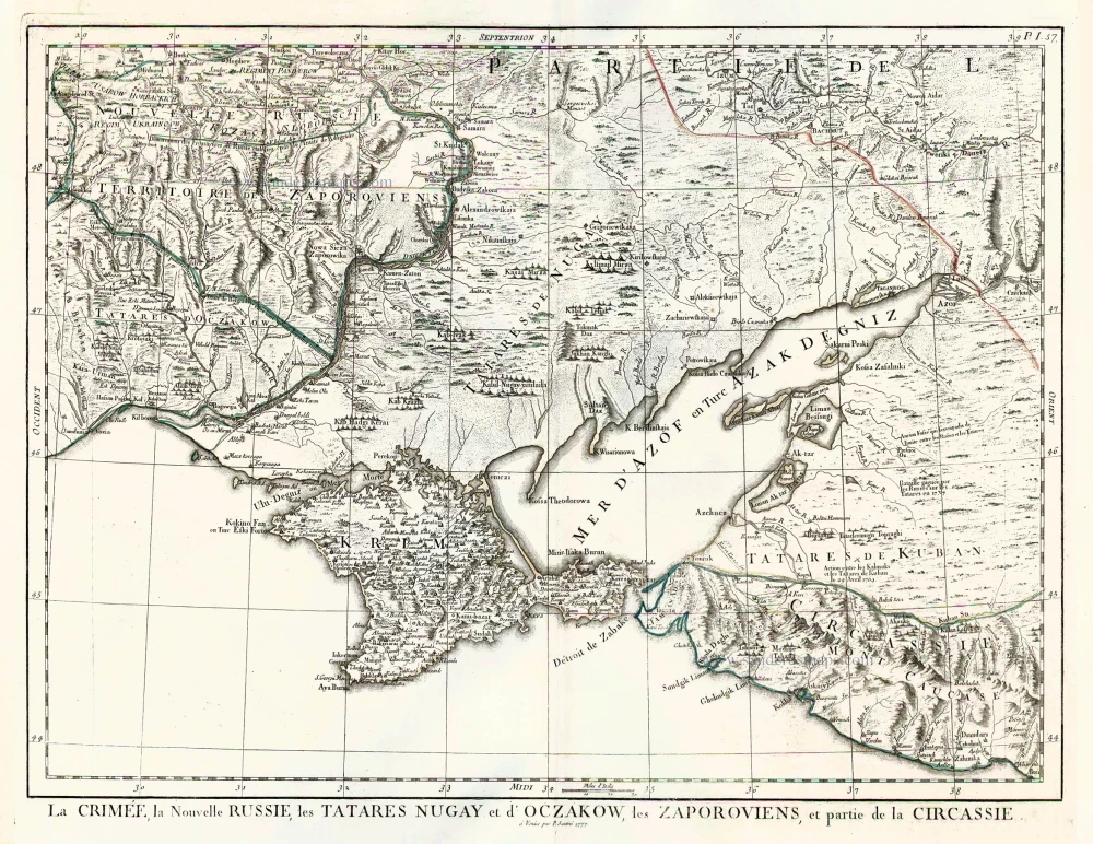
Antique 6-sheet wall map of the Black Sea and surroundings, by Francesco Santini, after Giovanni Rizzi-Zannoni (Sieur).
Shows parts of Poland, Romania, Hungary, Bulgaria, Ukraine, the Krim and Constantinople.
Based on Rizzi-Zannoni's 3-sheet map of 1774.
First state with the imprint of Remondini: with engraved page numbers in the top right corner: "P.I.55".
Date of the first edition: 1776
Date of this map: 1776
Copper engraving, printed on six sheets of paper, not joined..
Size of each sheet: (not including margins): 42.5 x 56cm (16.6 x 21.8 inches)
Size when joined: 82.5 x 161.5cm (32.2 x 63 inches)
Verso: Blank
Condition: Original coloured in outline, excellent.
Condition Rating: A+
From: Atlas Universel dressé sur les meilleures cartes modernes. Venice, Remondini, 1776.
Francesco and Paolo Santini (c.1729-1793)
Francesco Santini, a Venetian publisher, acquired the printing plates of Vaugondy’s Atlas Universel …, a commercial and cartographic success, with widespread influence on mapmakers throughout Europe. Together with his brother Paolo, he commissioned a new set of plates and reissued the atlas in 1776. The following year, Paolo Santini assigned all his publication rights to M. Remondini, who in 1777 reissued the same atlas but with his name.