
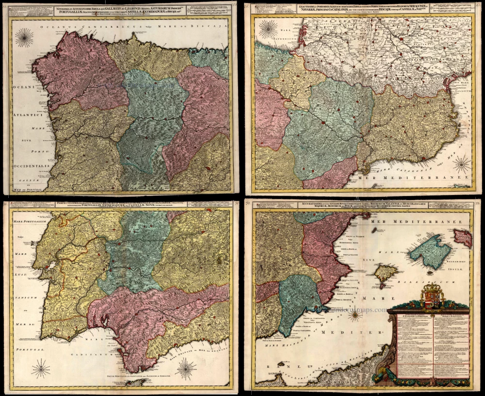
Antique map of Iberian Peninsula by Ottens R. & J. 1756


The Ottens Family
Joachim Ottens (1663-1719), was a copper-engraver and the founder of the print- and mapsellers’ firm in Amsterdam. In 1710 he became a member of the art- and printsellers guild. After he died in 1719, his widow and the sons continued the business under the name “In de Wereldcaert” (In the world map). On the whole, the Ottens’s financial position was rather weak, and the stock was not very large.
In a notary contract dated 20 October 1726, the partnership between the two brothers, Reinier and Josua, was stipulated. Despite separate shops, the brothers’ partnership continued until the death of Renier in 1750.
After Joshua died in 1765, his widow continued the firm, together with her son, Renier II, until c. 1780.
The firm flourished mainly between 1719 and c. 1750. In that period, they advertised at various times the publication of new maps.
Ottens’s greatest fame comes from the voluminous atlases assembled to order. A small number of these so-called ‘Atlas factice’, splendid copies with gorgeous illumination, have survived. These collector’s copies are known to exist in 2, 6, 8, 11, and even 15 volumes. Ottens also published atlases in one volume, with a varying number of maps, pocket atlases, collections of military plans, and Renard’s atlas de la navigation.
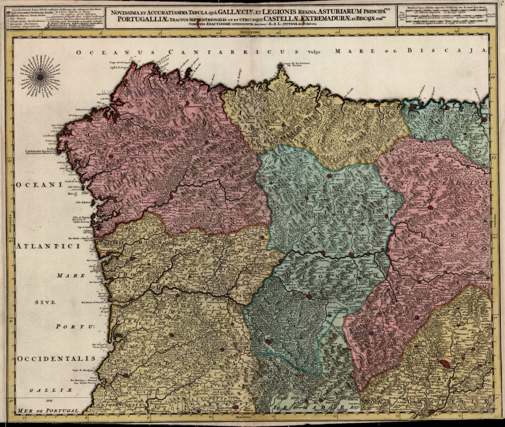
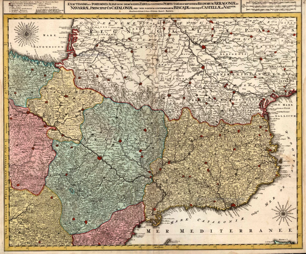
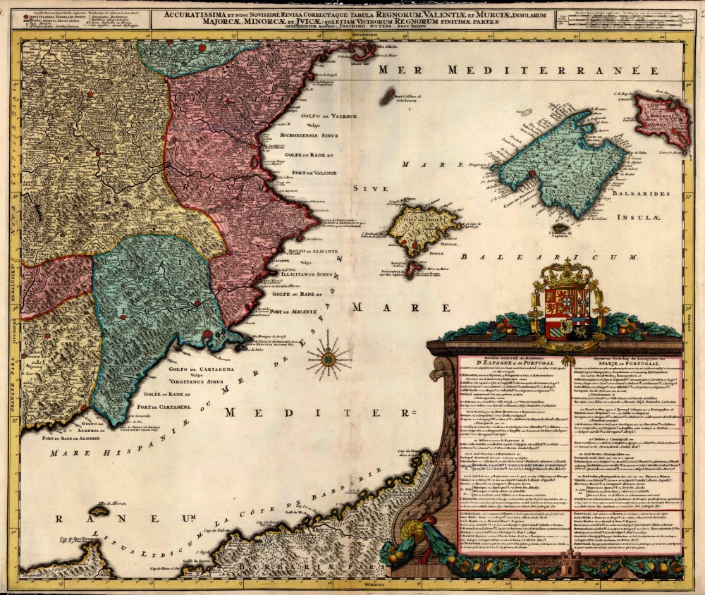
Novissima et Accuratissima Tabula qua Gallaeciae et Legionis Regna, Asturiarum / ... Regnorum Arragoniae et Navarrae, Principatus Cataloniae ... / Regnorum Vandalitiae, Granatae, et Algarbiae; ... Portugalliae, Extramadurae ... / Regnorum Valentiae ...
Item Number: 23504 Authenticity Guarantee
Category: Antique maps > Europe > Spain and Portugal
Map of the Iberian Peninsula, printed on four sheets, unjoined. Each map has his own title which was cut off when assembled for mounting.
Copper engraving
Size of each sheet: 51 x 60cm (19.9 x 23.4 inches)
Verso: Blank
Condition: Old coloured, lower neatline of first map partly trimmed, third map title partly trimmed.
Condition Rating: B+
From: Atlas minor sive geographia compendiosa in qua orbid terrarum paucis attamen novissimis tablulis ostenditur - Atlas nouveau contenant toutes les parties du monde où sont exactement remarquées les empires, monarchies, royaumes,états, républiques, &c. Amsterdam, R. & J. Ottens (1756). (Koeman, Ott3)
The Ottens Family
Joachim Ottens (1663-1719), was a copper-engraver and the founder of the print- and mapsellers’ firm in Amsterdam. In 1710 he became a member of the art- and printsellers guild. After he died in 1719, his widow and the sons continued the business under the name “In de Wereldcaert” (In the world map). On the whole, the Ottens’s financial position was rather weak, and the stock was not very large.
In a notary contract dated 20 October 1726, the partnership between the two brothers, Reinier and Josua, was stipulated. Despite separate shops, the brothers’ partnership continued until the death of Renier in 1750.
After Joshua died in 1765, his widow continued the firm, together with her son, Renier II, until c. 1780.
The firm flourished mainly between 1719 and c. 1750. In that period, they advertised at various times the publication of new maps.
Ottens’s greatest fame comes from the voluminous atlases assembled to order. A small number of these so-called ‘Atlas factice’, splendid copies with gorgeous illumination, have survived. These collector’s copies are known to exist in 2, 6, 8, 11, and even 15 volumes. Ottens also published atlases in one volume, with a varying number of maps, pocket atlases, collections of military plans, and Renard’s atlas de la navigation.