
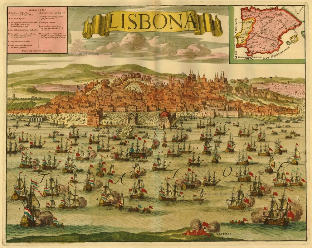
Antique map of Lisbon by Husson P. c. 1709
Pierre Husson (1678-1733)
Pierre (Pieter), a publisher in Den Haag, was a neighbour of Mrs Anna Beek, with whom he shared his interest in publishing plans of battlefields and fortifications during the War of Succession (1702-1713).
A collection of maps and plans by various authors was brought together in an atlas, to which was added the title page of Nicolas Visscher's Variae tabulae geographicae in quibus loca in orbe bello, now with the address of Pierre Husson.
Lisbona
Item Number: 20700 Authenticity Guarantee
Category: Antique maps > Europe > Spain and Portugal
Copper engraving
Size: 42 x 52cm (16 x 20 inches)
Verso: Blank
Condition: Old coloured, excellent.
References: Koeman, Hus 1 (9).
From: Variae tabulae geographicae un quibus loca in orbe bello flagrantia conspiciuntur ut in Flandria, Brabantia, Leodiensi Tractu, Germania, Hungaria, . . .
Diverses cartes de geographie, où l'in peut voir le theatre de la guerre dans tout le monde. Comme dans les pais de Flandres, de Brabant, de Liège, d'Allemagne, de Hongrie, . . .
View of Lisbon, showing English and Dutch combined forces 2 Mar 1704, with key and inset map of Spain and Portugal.
Pierre Husson (1678-1733)
Pierre (Pieter), a publisher in Den Haag, was a neighbour of Mrs Anna Beek, with whom he shared his interest in publishing plans of battlefields and fortifications during the War of Succession (1702-1713).
A collection of maps and plans by various authors was brought together in an atlas, to which was added the title page of Nicolas Visscher's Variae tabulae geographicae in quibus loca in orbe bello, now with the address of Pierre Husson.