
Old, antique wall map of Switzerland by J. J. Scheuchzer. 1721-41
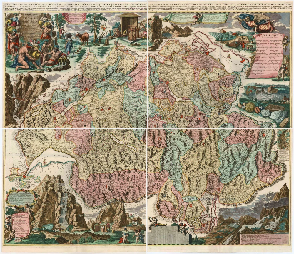
Nouvelle Carte de la Suisse. Divisées en ses Treize Cantons ses Alliez et ses Sujets
Item Number: 25080 Authenticity Guarantee
Category: Antique maps > Europe > Switzerland
Old, antique wall map of Switzerland, with an elaborate title cartouche with allegorical figures representing the Swiss rivers, richly decorated surrounds with key,
Cartographer: J. J. Scheuchzer (1672-1733), physician and geographer of Zürich.
Copper engraving, printed on four sheets, unjoined, cut at inner sides (ready to be joined).
Size of each sheet: 52 x 59.5cm (20.3 x 23.2 inches)
Verso: Blank
Condition: Old body colour.
Condition Rating: A
From: Composite Atlas. Amsterdam, Covens & Mortier, 1721-41.
"Scheuchzer's splendid four-sheet map was published in 1712; [...] Its borders make it probably the most handsome map ever produced of Switzerland; yet the carefully labelled tableaux were intended as scientific illustrations, not just decoration ..." (Campbell)