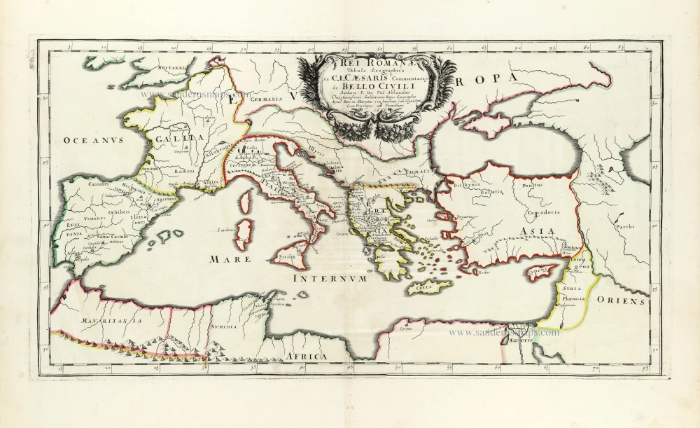
Roman Empire by Pierre Duval. 1666
Pierre Duval (Abbeville, 1618 - 1683)
French geographer, nephew and pupil of Nicolas Sanson. He was encouraged by Louis XIV to move to Paris. In 1650 he became Géographe Ordinaire du Roy.
Pierre Mariette (1602-1658)
Bookseller, printseller, printer, and publisher, located in the Rue Saint-Jacques in Paris. On February 12, 1644, Pierre Mariette acquired most of Melchior Tavernier's fund. In 1646, he had a series of maps by Blaeu copied and asked Abraham Peyrounin to engrave them. In the meantime, he published the works of Nicolas Sanson. In 1650, he published the atlas Théâtre Géographique de France. A second edition followed in 1653. He later contributed to Sanson's atlas, the Cartes générales de toutes les parties du monde. Many maps of Mariette's Théatre appeared in later editions of Sanson's Cartes générales.
Rei Romanae Tabula Geographica ex C.I. Caesaris Commentariis de Bello Civili.
Item Number: 30017 Authenticity Guarantee
Category: Antique maps > Mediterranean Sea
Old, antique map of the Roman Empire by Pierre Duval.
Title: Rei Romanae Tabula Geographica ex C.I. Caesaris Commentariis de Bello Civili.
Authore P. Du Val Abbavillaeo Christianissimi Galliarum Regis Geographo.
Apud Petrum Mariette via Iacobaea sub Insion Spei - Cum Privilegio ad Vicennium 1666.
Cartographer: Pierre Duval.
Date: 1666.
Date on map: 1666.
Copper engraving, printed on paper.
Image size: 305 x 560mm (12.01 x 22.05 inches).
Sheet size: 485 x 640mm (19.09 x 25.2 inches).
Verso: Blank.
Condition: Original coloured in outline, excellent.
Condition Rating: A+.
Separate publication.
Pierre Duval (Abbeville, 1618 - 1683)
French geographer, nephew and pupil of Nicolas Sanson. He was encouraged by Louis XIV to move to Paris. In 1650 he became Géographe Ordinaire du Roy.
Pierre Mariette (1602-1658)
Bookseller, printseller, printer, and publisher, located in the Rue Saint-Jacques in Paris. On February 12, 1644, Pierre Mariette acquired most of Melchior Tavernier's fund. In 1646, he had a series of maps by Blaeu copied and asked Abraham Peyrounin to engrave them. In the meantime, he published the works of Nicolas Sanson. In 1650, he published the atlas Théâtre Géographique de France. A second edition followed in 1653. He later contributed to Sanson's atlas, the Cartes générales de toutes les parties du monde. Many maps of Mariette's Théatre appeared in later editions of Sanson's Cartes générales.

