
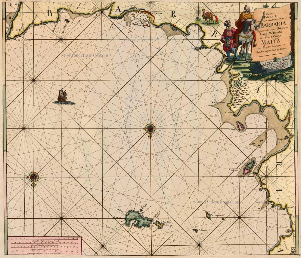
Sea chart of Malta, Tunesia and Libya by J. Van Keulen. 1697-1709
The House of Van Keulen
For more than two centuries, the chart makers firm of Van Keulen was established in the house with the name of “De Gekroonde Lootsman” (The Crowned Pilot). In 1678, the founder of the firm, Johannes I Van Keulen (1634-1689), registered with the Amsterdam booksellers’ guild. He had enlisted the aid of the well-known Mathematical Practitioner Claas Janz Vooght in the preparation of his nautical publications. In 1680 he published the first edition of the Zee-Atlas with 40 charts, all issued for the first time. In the short period of four years, they produced the five volumes of the Nieuwe Groote Ligtende Zee-Fakkel (1681-85). His acquisition of the stock of the bookseller Hendrik Doncker was an essential factor in the development of the firm.
In 1678 a son, Gerard Van Keulen (1678-1726), was born out of Johannes’s first marriage. This son was endowed with talent. He was a skilful engraver and proficient in mathematics and navigational science. Gerard was responsible for establishing the scientific basis of the firm of Van Keulen. In 1714 he was appointed to the office of hydrographer to the Dutch East India Company. The Van Keulens remained chart makers to the East India Company until the Company’s liquidation.
With the introductions to the Zee-Fakkel and Zee-Atlas, Gerard van Keulen gave a new impetus to the firm. Unfortunately, he did not live long, dying when he was 49. The business was carried on by his widow Ludwina Konst. Shortly before Gerard’s death, his son Johannes II had entered the bookseller’s guild, and in 1726 he assumed the management of the firm, though his mother retained her financial interests in the business.
Johannes II Van Keulen (1704-1755) is known in particular for his publication in 1753 of a sixth volume of the Zee-Fakkel, the volume containing the charts of the route to the East Indies.
Johannes II had two sons; they joined the firm as partners in 1757. A considerable number of books appeared in the period 1778-1801. New issues of the Zee-Fakkel again saw the light. The firm flourished under different names until 1885.
Nieuwe pascaart Voor een gedeelte van Barbaria Beginnende van Susa tot Caap Mesurata Als Mede t' Eylandt Malta
Item Number: 13680 Authenticity Guarantee
Category: Antique maps > Mediterranean Sea
Sea chart of the central Mediterranean with Malta, the east coast of Tunesia and a part of the Libyan coast, by J. Van Keulen.
Oriented to the South
Cartographer: C.J. Vooght
Copper engraving
Size: 51 x 58cm (19.9 x 22.6 inches)
Verso: Blank
Condition: Old coloured, a few spots, else excellent.
Condition Rating: A
References: Koeman, Keu (175); Ganado, p.139.
From: De Nieuwe Groote Lichtende Zee-Fakkel, ... Amsterdam, J. van Keulen, 1697-1709.
The House of Van Keulen
For more than two centuries, the chart makers firm of Van Keulen was established in the house with the name of “De Gekroonde Lootsman” (The Crowned Pilot). In 1678, the founder of the firm, Johannes I Van Keulen (1634-1689), registered with the Amsterdam booksellers’ guild. He had enlisted the aid of the well-known Mathematical Practitioner Claas Janz Vooght in the preparation of his nautical publications. In 1680 he published the first edition of the Zee-Atlas with 40 charts, all issued for the first time. In the short period of four years, they produced the five volumes of the Nieuwe Groote Ligtende Zee-Fakkel (1681-85). His acquisition of the stock of the bookseller Hendrik Doncker was an essential factor in the development of the firm.
In 1678 a son, Gerard Van Keulen (1678-1726), was born out of Johannes’s first marriage. This son was endowed with talent. He was a skilful engraver and proficient in mathematics and navigational science. Gerard was responsible for establishing the scientific basis of the firm of Van Keulen. In 1714 he was appointed to the office of hydrographer to the Dutch East India Company. The Van Keulens remained chart makers to the East India Company until the Company’s liquidation.
With the introductions to the Zee-Fakkel and Zee-Atlas, Gerard van Keulen gave a new impetus to the firm. Unfortunately, he did not live long, dying when he was 49. The business was carried on by his widow Ludwina Konst. Shortly before Gerard’s death, his son Johannes II had entered the bookseller’s guild, and in 1726 he assumed the management of the firm, though his mother retained her financial interests in the business.
Johannes II Van Keulen (1704-1755) is known in particular for his publication in 1753 of a sixth volume of the Zee-Fakkel, the volume containing the charts of the route to the East Indies.
Johannes II had two sons; they joined the firm as partners in 1757. A considerable number of books appeared in the period 1778-1801. New issues of the Zee-Fakkel again saw the light. The firm flourished under different names until 1885.
Related items
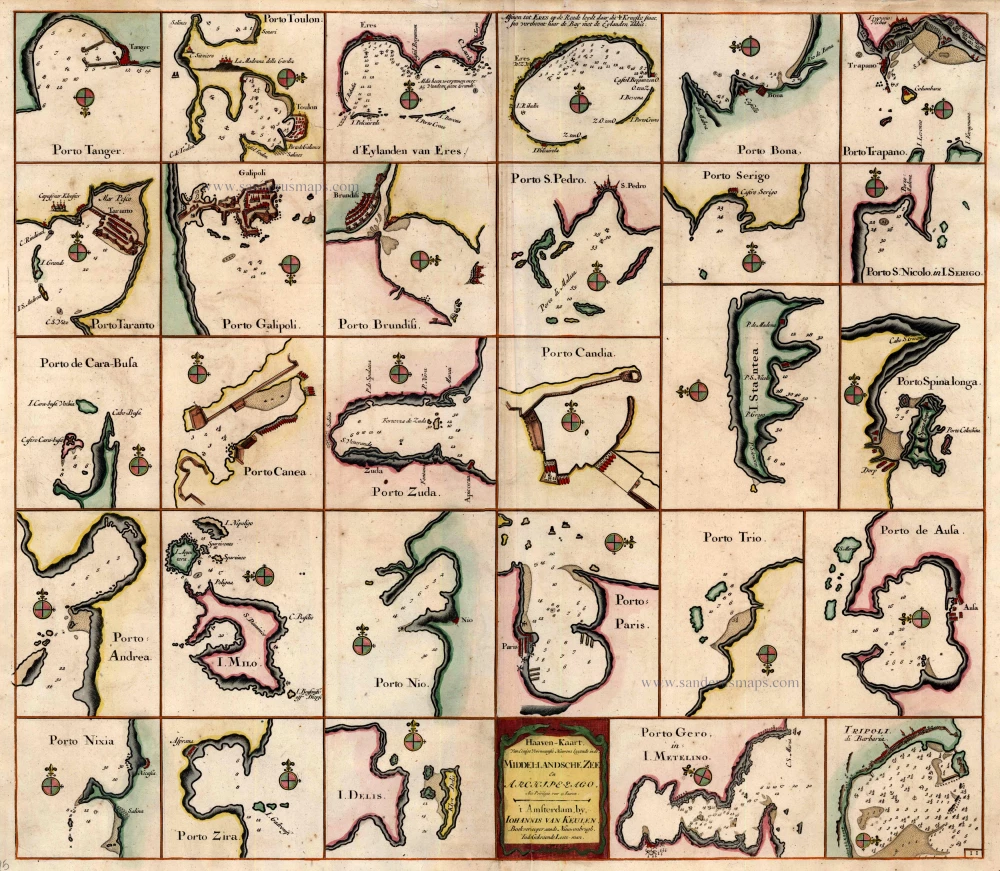
Haaven-Kaart van Eenige Voornaamste Haavens Leggende in de Middel-Landsche Zee en Archipelago 1697-1709
Mediterranean Sea Ports by Johannes Van Keulen.
[Item number: 4125]
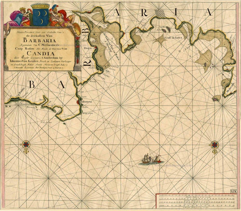
Nieuwe Pascaart voor een Gedeelte van de Zeekusten van Barbaria Beginnende van C. Mesurata tot Caap Rusato Als mede de West-kust van Candia. 1697-1709
Sea chart of the coasts of Morocco, by Johannes Van Keulen.
[Item number: 6506]
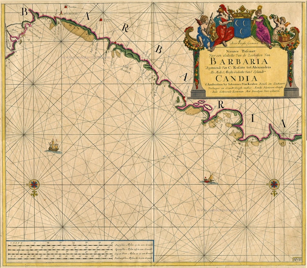
Nieuwe Pascaart Voor een Gedeelte van de Zeekusten van Barbaria ... 1697-1709
Sea chart of the coasts of Morocco, by Johannes Van Keulen.
[Item number: 9775]
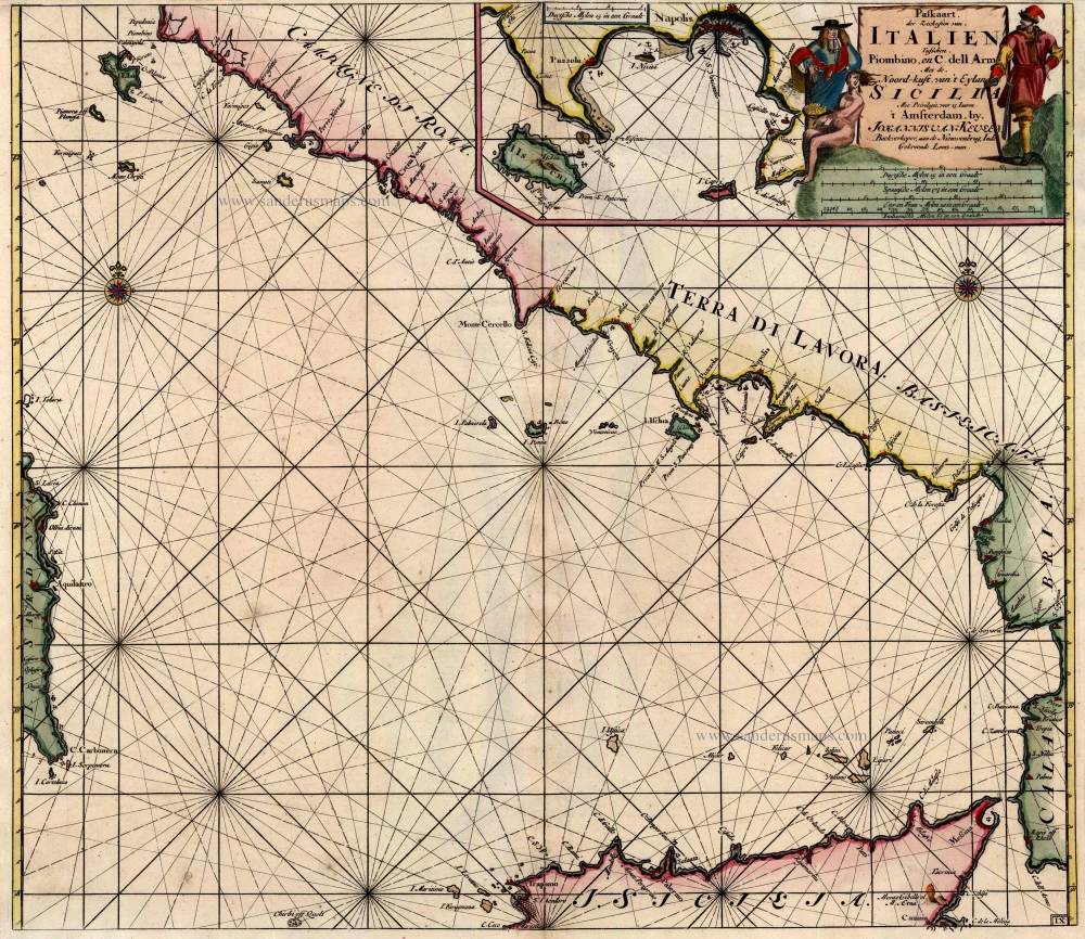
Paskaart der Zeekusten van Italien tusschen Piombino en C. dell Arme met de Noord-Kust van 't Eylandt Sicilia ... 1697-1709
Tyrrhenian Sea, by Van Keulen Johannes.
[Item number: 12955]
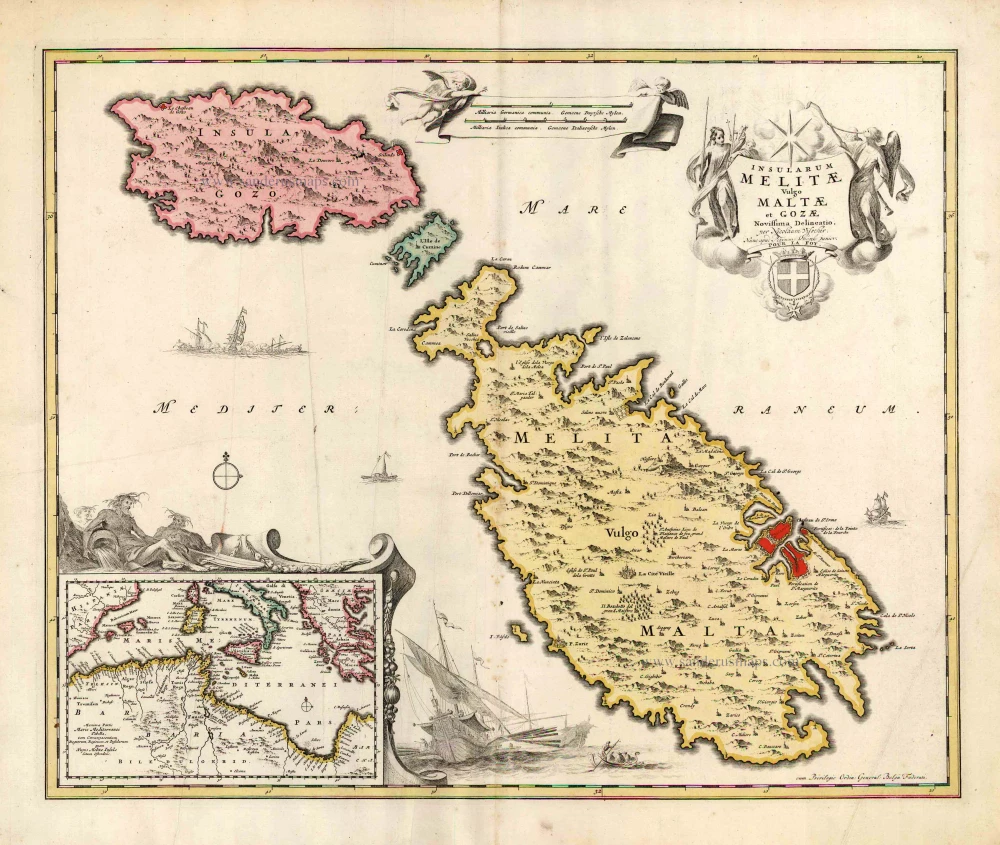
Insularum Melitae vulgo Maltae et Gozae Novissima Delineatio. c. 1700
Malta & Gozo, by N. Visscher, published by P. Schenk.
[Item number: 25697]
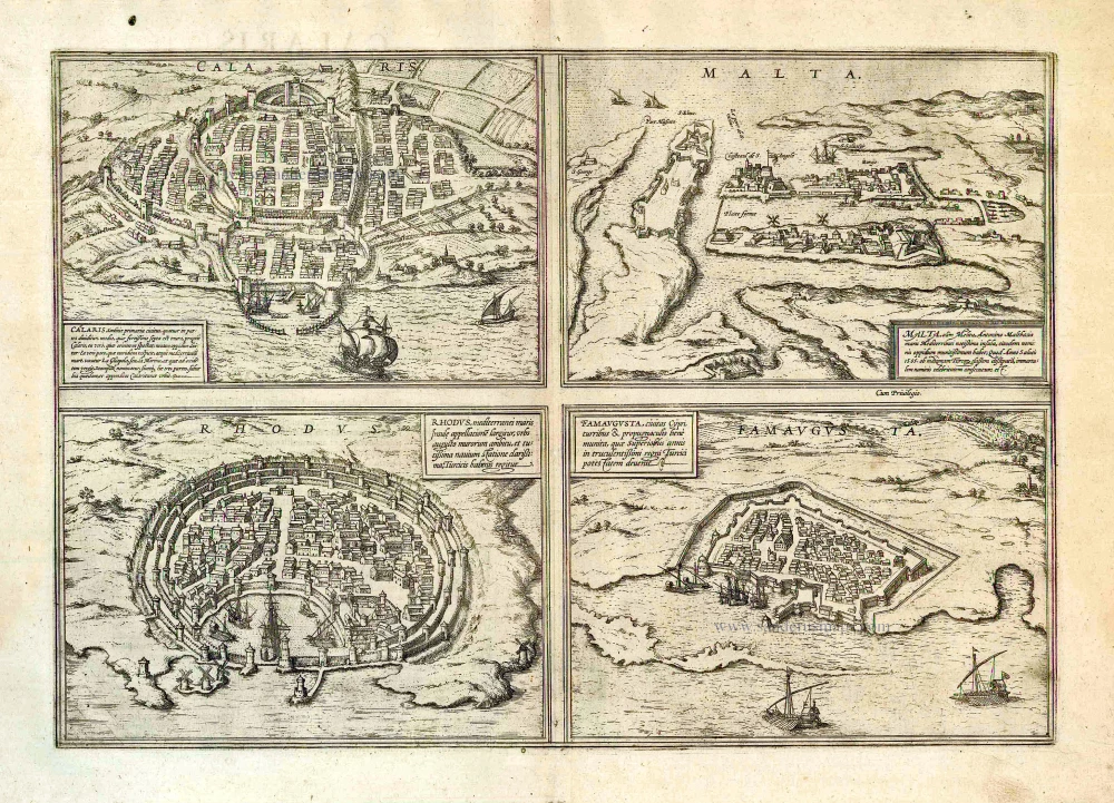
Calaris [on sheet with] Malta [and] Rhodus [and] Famagusta. 1612
Cagliari - Malta - Rhodos - Famagusta, by Georg Braun & Frans Hogenberg.
[Item number: 26910]
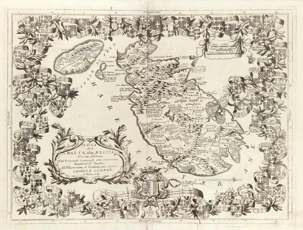
Isola di Malta olim Melita. 1696
Malta by Vincenzo Coronelli.
[Item number: 28817]
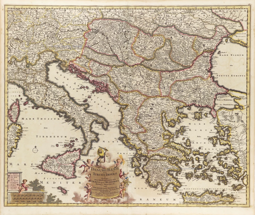
Danubii Fluvii Sive Turcici Imperii in Europa. c. 1705
Danube and European Ottoman Empire, by Frederick de Wit.
[Item number: 29279]