
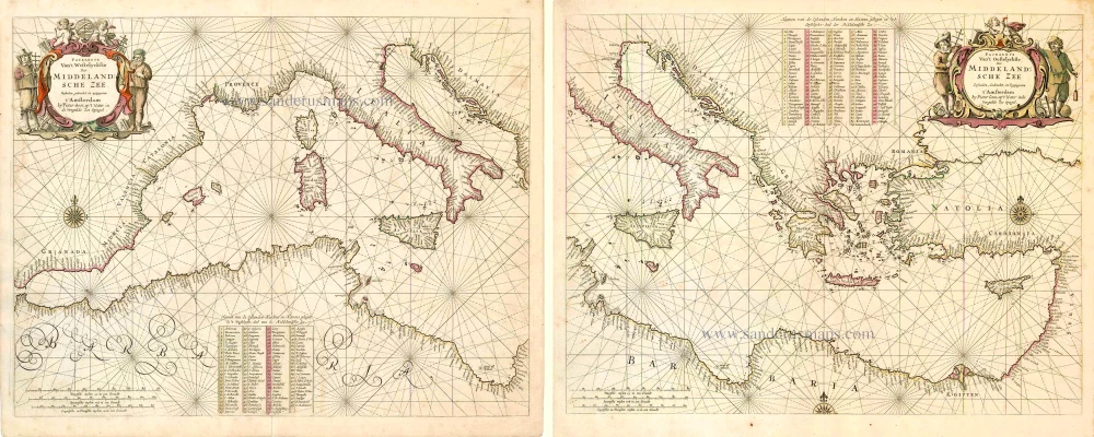
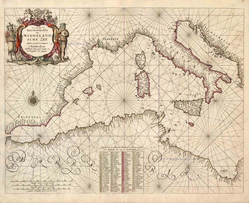
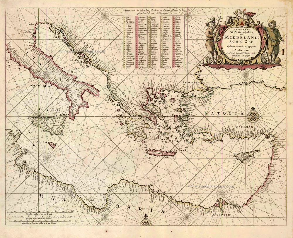
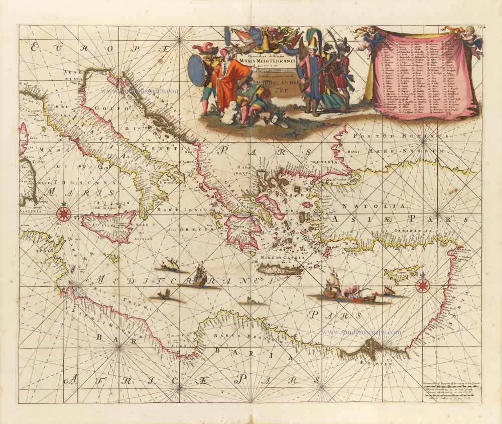
The Western & Eastern Mediterranean Sea, by Pieter Goos. 1666


Pieter Goos (1615-1675)
Pieter Goos, son of the engraver Abraham Goos, was one of the best known maritime booksellers of Amsterdam. He was not only a bookseller but also a copper-engraver and even a book printer.
His first pilot book, the Lichtende Columne ofte Zee-Spiegel appeared in 1650. The well-made pilot guides and the beautiful sea-atlas reflect a high professional standard. The many editions published over 28 years is an indication of the customers’ appreciation. The Zeespiegel was printed in Dutch, French (1662), and English (1658). Goos printed all the time from the same 60 plates. For his Straetsboeck, being the third part of the Zeespiegel, Pieter Goos copied the text from Lootsman’s Straetboeck and copied also the plates. This atlas of the Mediterranean appeared in 1662.
Pieter Goos also published a fourth and fifth part of his Zeespiegel. For the fourth part, he used the second part of Het Brandende Veen by Arent Roggeveen, which dealt with the coasts of West-Africa (No copy with Goos’s imprint is known). For the fifth part, he used the first part of Het Brandende Veen, which appeared in 1675. It contains the charts and sailing directions for the West Indies.
The first edition of his sea-atlas, the Zee-Atlas ofte Water-Wereld, came out in 1666. For the design of the charts, Goos copied nearly all the charts from Hendrik Doncker’s sea-atlas. All the years through, till 1675 (the year of his death), the number of 40 or 41 maps remained the same.
When Pieter Goos died in March 1675, his widow continued the shop. She brought out a few new editions of the Zee-Atlas with 44 charts. Part of the atlases was sold then by the famous Amsterdam bookbinder Albert Magnus. These copies are renowned for their outstanding colouring. She died in 1677; their son, Hendrik Goos, born in 1641, took over and sold his father’s pilot books until 1680.
Paskaerte van't Westelyckste der Middelandsche Zee. [in set with:] Paskaerte van't Oosttelyckste der Middelandsche Zee.
Item Number: 25836 Authenticity Guarantee
Category: Antique maps > Mediterranean Sea
Two old, antique charts of the Western & Eastern Mediterranean Sea, by P. Goos
Date of the first edition: 1666
Date of this map: 1666
Copper engravings, printed on paper.
Size (not including margins): 40 x 51.5cm (15.6 x 20.1 inches)
Verso: Blank
Condition: Original coloured, excellent.
Condition Rating: A+
References: Koeman, Goos1B (18 & 19); Bifolco, Mare Nostrum, Tav. 48
From: De Zee-Atlas, Ofte Water-Weereld, Waer in vertoont werden alle de Zee-Kusten Van het bekende des Aerd-Bodems. P. Goos, 1666. (Koeman, Goos1B)
Pieter Goos (1615-1675)
Pieter Goos, son of the engraver Abraham Goos, was one of the best known maritime booksellers of Amsterdam. He was not only a bookseller but also a copper-engraver and even a book printer.
His first pilot book, the Lichtende Columne ofte Zee-Spiegel appeared in 1650. The well-made pilot guides and the beautiful sea-atlas reflect a high professional standard. The many editions published over 28 years is an indication of the customers’ appreciation. The Zeespiegel was printed in Dutch, French (1662), and English (1658). Goos printed all the time from the same 60 plates. For his Straetsboeck, being the third part of the Zeespiegel, Pieter Goos copied the text from Lootsman’s Straetboeck and copied also the plates. This atlas of the Mediterranean appeared in 1662.
Pieter Goos also published a fourth and fifth part of his Zeespiegel. For the fourth part, he used the second part of Het Brandende Veen by Arent Roggeveen, which dealt with the coasts of West-Africa (No copy with Goos’s imprint is known). For the fifth part, he used the first part of Het Brandende Veen, which appeared in 1675. It contains the charts and sailing directions for the West Indies.
The first edition of his sea-atlas, the Zee-Atlas ofte Water-Wereld, came out in 1666. For the design of the charts, Goos copied nearly all the charts from Hendrik Doncker’s sea-atlas. All the years through, till 1675 (the year of his death), the number of 40 or 41 maps remained the same.
When Pieter Goos died in March 1675, his widow continued the shop. She brought out a few new editions of the Zee-Atlas with 44 charts. Part of the atlases was sold then by the famous Amsterdam bookbinder Albert Magnus. These copies are renowned for their outstanding colouring. She died in 1677; their son, Hendrik Goos, born in 1641, took over and sold his father’s pilot books until 1680.
Related items

Creta Iovis magni, medio iacet insula ponto. Ex conatibus geographicis Abrahami Ortelij. [On sheet with:] Corsica [and:] Insulae Maris Ionii [and:] Sardinia 1624
Crete, Corsica and Sardinia by Ortelius A.
[Item number: 2052]
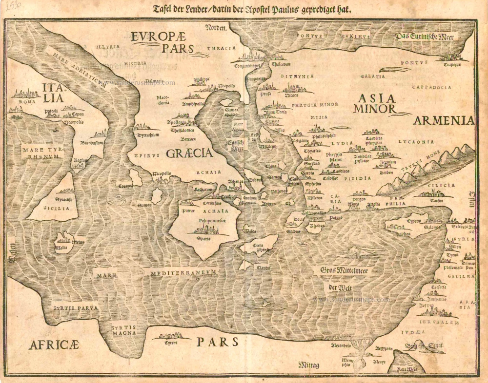
Tafel der Lender darin der Apostel Paulus geprediget hat. 1581
Eastern part of the Mediterranean Sea, by Heinrich Bünting.
[Item number: 2530]
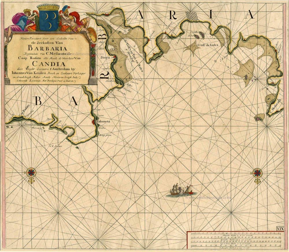
Nieuwe Pascaart voor een Gedeelte van de Zeekusten van Barbaria Beginnende van C. Mesurata tot Caap Rusato Als mede de West-kust van Candia. 1697-1709
Sea chart of the coasts of Morocco, by Johannes Van Keulen.
[Item number: 6506]
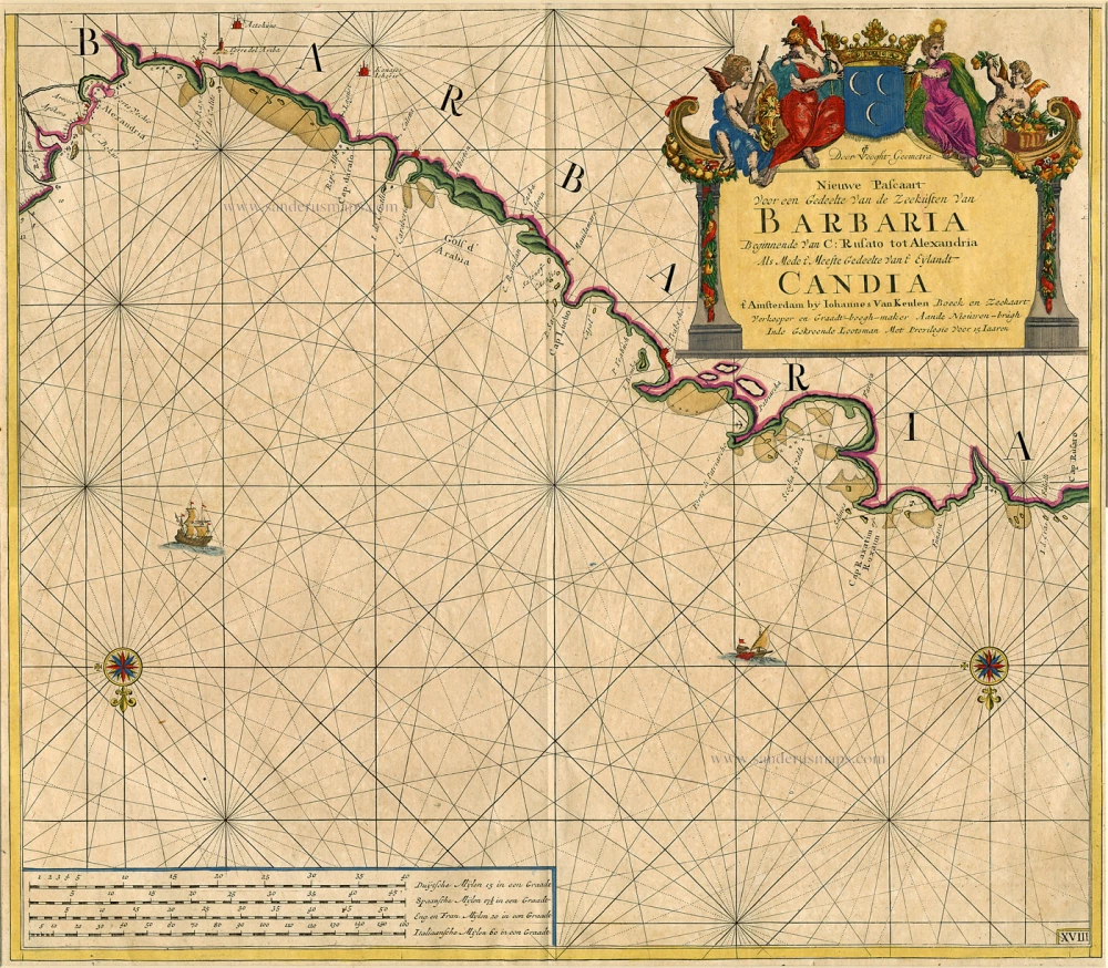
Nieuwe Pascaart Voor een Gedeelte van de Zeekusten van Barbaria ... 1697-1709
Sea chart of the coasts of Morocco, by Johannes Van Keulen.
[Item number: 9775]
Parergon map
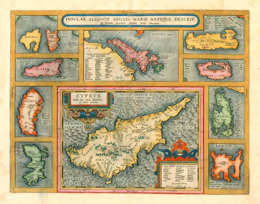
Insular. aliquot Aegaei Maris Antiqua Descrip. 1601
Cyprus & other Greek Islands by Abraham Ortelius.
[Item number: 12452]
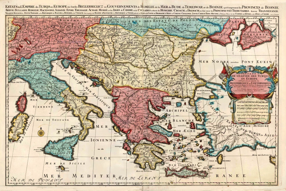
Estats de l'Empire des Turqs en Europe. c. 1705
European Ottoman Empire by Nicolas Sanson, published by Pieter Mortier.
[Item number: 27770]
Parergon map
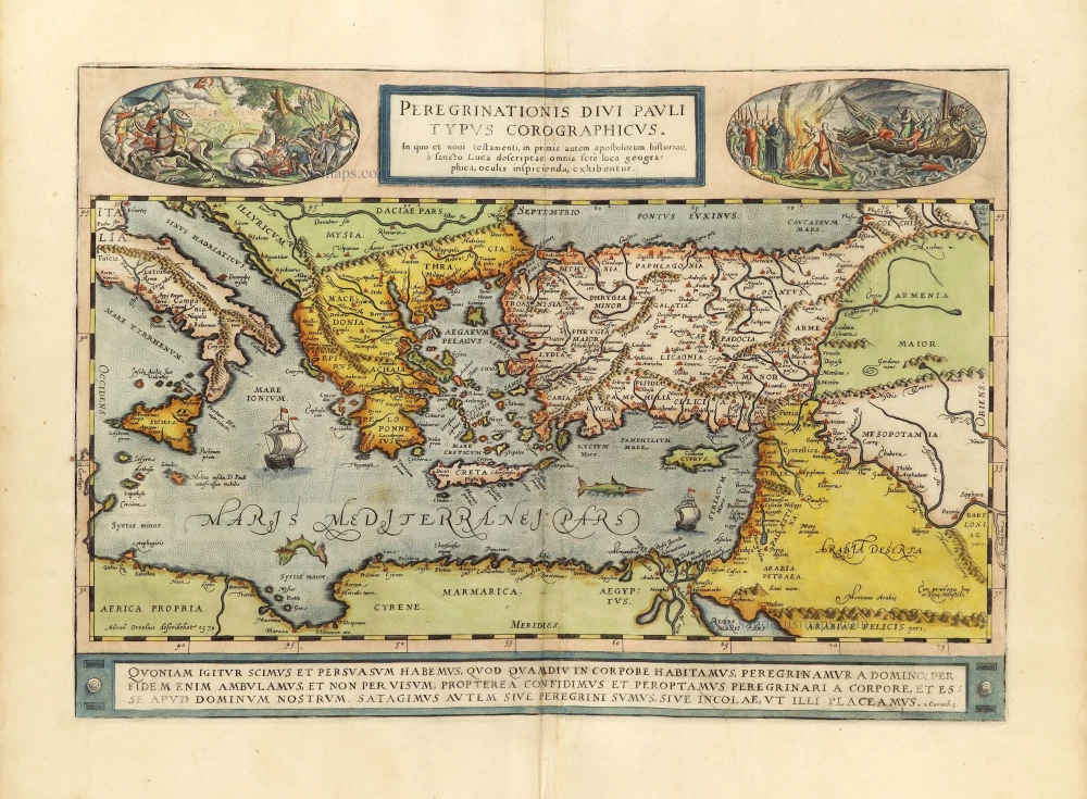
Peregrinationis Divi Pauli Typus Chorographicus. 1598
Paulus's Travels by Abraham Ortelius.
[Item number: 28920]
Orientalior districtus Maris Mediterranei. = t' Ooster gedeelte van de Middelandse Zee. c. 1689-90
Western Mediterranean Sea, by Frederick de Wit.
[Item number: 29247]
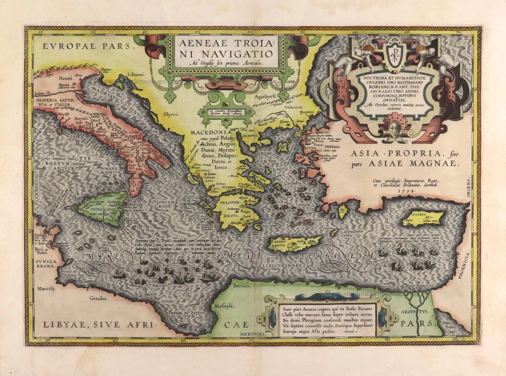
Aeneae Troiani Navigatio Ad Vergilij sex priores Aeneidos. 1595
Aenea's travels by Abraham Ortelius.
[Item number: 29470]