
Antique map of Atlantic Ocean by De Wit F. c. 1680
The item displayed on this page has been sold. However, we have a similar map in stock:
The Western Atlantic Ocean, by Frederick de Wit. c. 1680
Terra Nova ac Maris Tractus circa Novam Franciam, ...
[Item number: 29175]

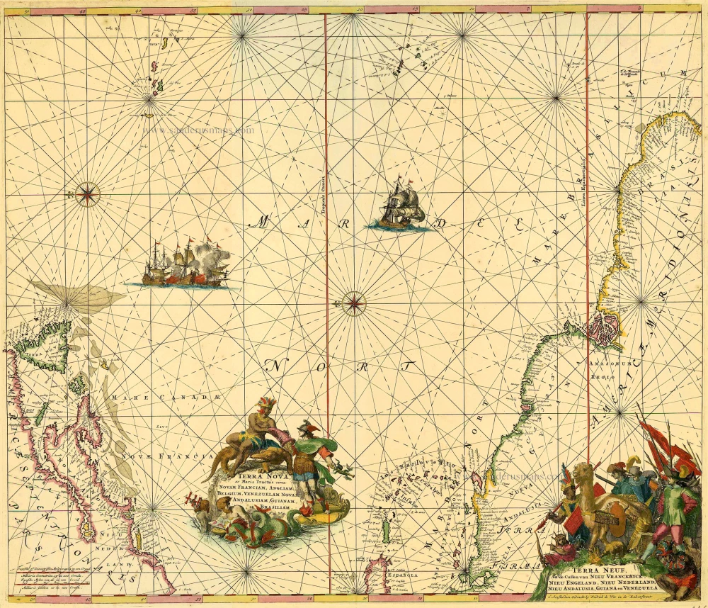
Terra Nova ac Maris Tractus circa Novam Franciam, Angliam, Belgium, Venezuelam Novam, Andalusiam, Guianam, et Brasiliam. - Terra Neuf, en de Custen van Nieu Vranckryck, Nieu Engeland, Nieu Nederland, Nieu Andalusia, Guiana en Venezuela.
Item Number: 11667 Authenticity Guarantee
Category: Antique maps > Oceans
Antique map of Atlantic Ocean by De Wit F.
Title: Terra Nova ac Maris Tractus circa Novam Franciam, Angliam, Belgium, Venezuelam Novam, Andalusiam, Guianam, et Brasiliam. - Terra Neuf, en de Custen van Nieu Vranckryck, Nieu Engeland, Nieu Nederland, Nieu Andalusia, Guiana en Venezuela.
Apud F. de Wit.
t' Amsterdam Gedruckt by Frederick de Wit in de Kalverstraat.
Oriented to the east.
Date of the first edition: ca. 1671-76.
Date of this map: c. 1680.
Copper engraving, printed on paper.
Size (not including margins): 480 x 560mm (18.9 x 22.05 inches).
Verso: Blank.
Condition: Original coloured, excellent.
Condition Rating: A+.