
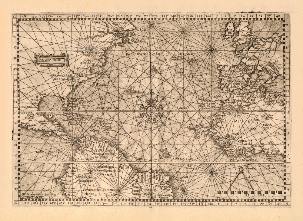
Antique map of Atlantic Ocean by Nicolas de Nicolai 1553 [54]
back
References: Burden - 19
Nouveau Monde
SOLD
Item Number: 22716 Authenticity Guarantee
Category: Antique maps > Oceans
Map of the Atlantic Ocean with the east coast of the Americas and Western Europe and Africa.
Nicolas de Nicolai travelled extensively in the service of the French King, usually as a spy. He was well rewarded for his work, and a number of his observations and surveys were published. The first issue of this work is dated 1553, but was actually published in 1554.
Copper engraving
Size: 25 x 36cm (9.8 x 14 inches)
Verso: Blank
Condition: Browned and spotted.
Condition Rating: A
References: Burden, 19.
From: L'art de Naviguer. Lyon, 1553 [54].