
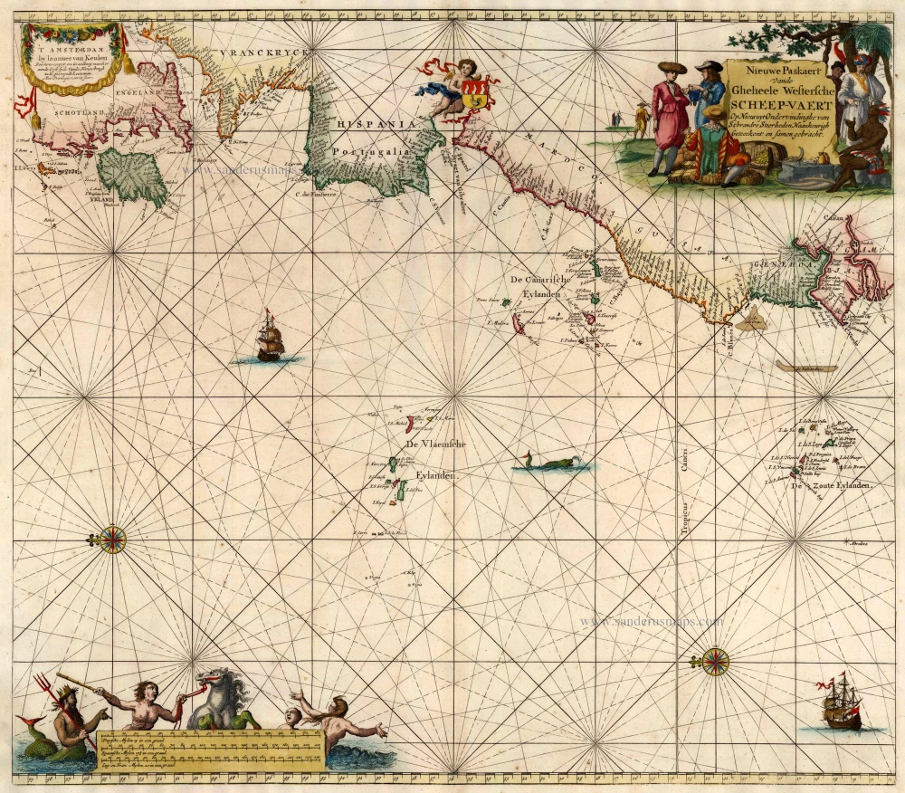
Antique map of Atlantic Ocean by Van Keulen Johannes 1697-1709
back
References: Koeman - Keu (64)
Nieuwe Paskaert vande Gheheele Westersche Scheep-Vaert, op Nieus uyt Ondervindinghe van Schrandre Stierlieden Naaukeurigh Geteeckent en Samen Gebracht.
SOLD
Item Number: 10773 Authenticity Guarantee
Category: Antique maps > Oceans
Sea chart of the Atlantic Ocean with the coasts of Europe and Africa, oriented to the North.
First state, without the later added engraved number 1.
Copper engraving
Size: 50.5 x 57.5cm (19.7 x 22.4 inches)
Verso: Blank
Condition: Old coloured, excellent.
Condition Rating: A
References: Koeman, Keu (64).
From: De Nieuwe Groote Lichtende Zee-Fakkel, ... Amsterdam, J. van Keulen, 1697-1709.