
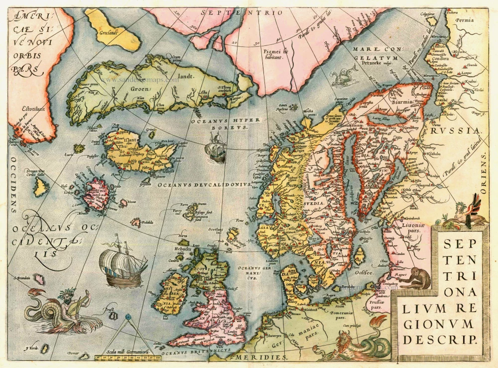
Antique map of the North Atlantic Ocean by A. Ortelius 1592
back
References: Van der Krogt 3 - 1200:31; Van den Broecke - 160; Ginsberg (Scandinavia) - 24 State 7
Septentrionalium Regionum Descrip.
SOLD
Item Number: 13164 Authenticity Guarantee
Category: Antique maps > Oceans
Map of the North Atlantic Ocean, oriented to the North
Copper engraving
Size: 36.5 x 49.5cm (14.1 x 19.3 inches)
Verso text: Latin
Condition: Old coloured, excellent.
Condition Rating: A
References: Van der Krogt 3, 1200:31; van den Broecke, 160; Ginsberg (Scandinavia), 24 State 7; Burden 40.
From: Theatrum Orbis Terrarum Antwerpen, Plantin Press, 1592. (Van der Krogt 3, 1:041)