
Old, antique map of the Western Hemisphere with the Americas, by Châtelain 1713-1719
The item displayed on this page has been sold. However, we have a similar map in stock:
Pacific by Zacharias Châtelain after Nicolas de Fer. 1719
Carte tres Curieuse de la Mer du Sud, Contenant ...
[Item number: 29466]
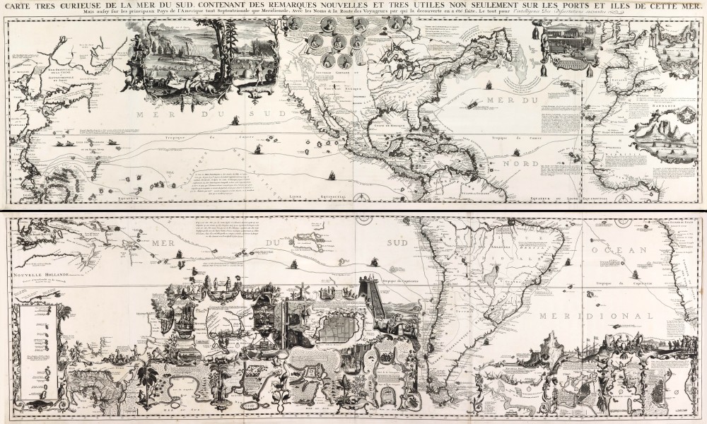
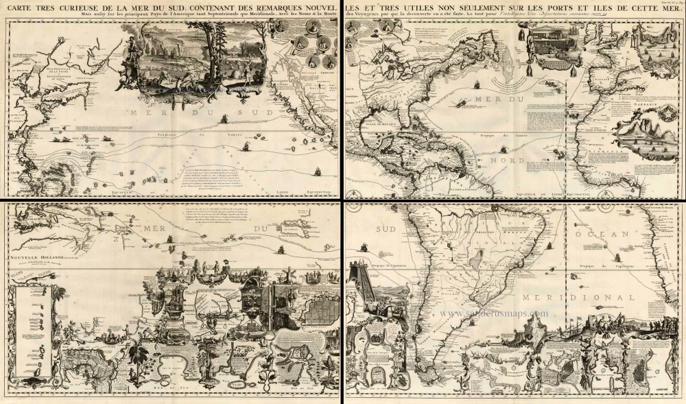
Carte tres Curieuse de la Mer du Sud, Contenant des Remarques Nouvelles et tres Utiles non Seulement sur les Ports et Iles de cette Mer, ...
Item Number: 4196 Authenticity Guarantee
Category: Antique maps > Oceans
Old, antique map of the Western Hemisphere showing the Pacific, the Americas and the Atlantic Ocean, by Châtelain, with opposite the continental regions..
One of the most elaborately engraved maps ever published that includes Southeast Asia with the north coast of Australia, America occupying a central position with California prominent as an island, to the west coast of Europe and Africa. The many inset plans, views, portraits, and scenes make this a visual encyclopaedia of the discovery and exploration of the Americas.
Large vignette of Niagara Falls; others show hunting and drying of cod. Many historical notes and explorer's tracks.
Copper engraving on four unjoined sheets
Size when joined: 81 x 140cm (31.6 x 54.6 inches)
Verso: Blank
Condition: Uncoloured, nice copy.
Condition Rating: A
References: Schwartz-Ehrenberg, p.142, pl.85.
From: Atlas Historique. Amsterdam, Châtelain, 1713-1719.
Old, antique map of Pacific - America - Atlantic Ocean by Châtelain
Related items
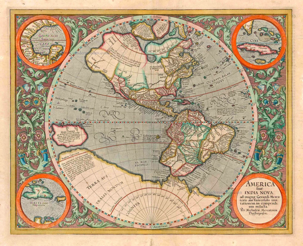
America sive India Nova ad magnae Gerardi Mercatoris avi Universalis imitationem in compendium redacta. 1623
America, by Gerard Mercator
[Item number: 131]
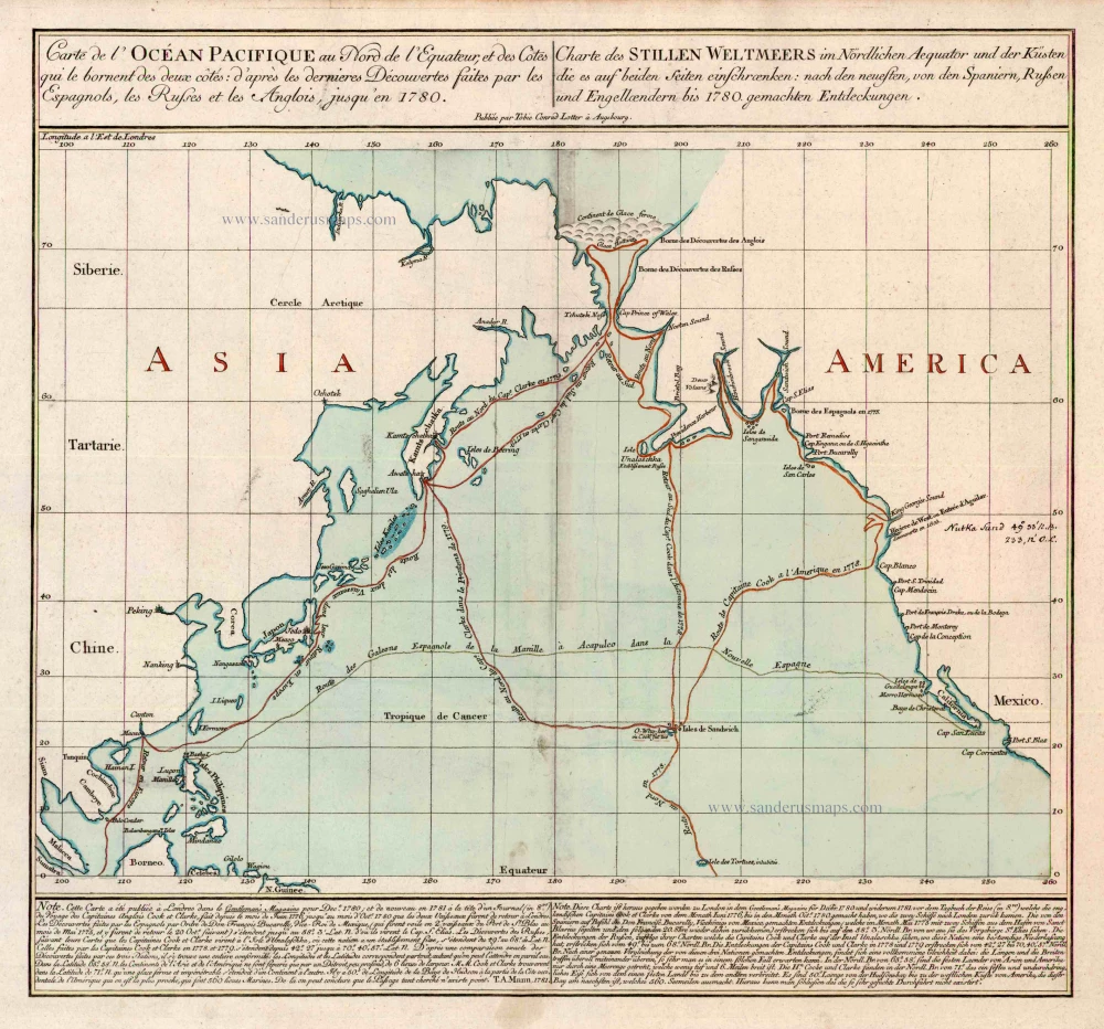
Carte de l'Ocean Pacifique au Nord de l'Equateur, et des Cotes qui le Bornent des Deux Cotes: D'Apres les Dernieres Decouvertes Faites par les Espagnols, les Russes et les Anglois, jusqu'en 1780. 1780
The Northern Pacific Ocean, by T.C. Lotter.
[Item number: 11984]