
Old, antique map - sea chart of the Pacific Ocean by F. De Wit c. 1680
The item displayed on this page has been sold. However, we have a similar map in stock:
Pacific Ocean, by Frederick de Wit. c. 1680
Magnum Mare del Zur cum Insula California = De...
[Item number: 29241]

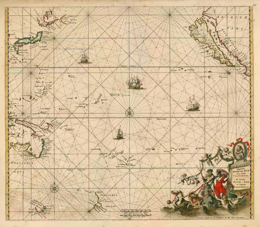


Magnum Mare del Zur cum Insula California
Item Number: 4397 Authenticity Guarantee
Category: Antique maps > Oceans
Old, antique map - sea chart of the Pacific Ocean by F. De Wit, with California as an island and Oceana: Australia, Van Diemens Land and New Zealand
The map shows also information from Tasman's two voyages in 1642-3 and 1644 and the discoveries by the Dutch on the northern coast of Australia and New Guinea reflecting the prevailing opinion that the two were connected.
Date of the first edition: c. 1675
Date of this map: c. 1680
Copper engraving
Size: 50 x 57.5cm (19.5 x 22.4 inches)
Verso: Blank
Condition: Contemporary old coloured, some offsetting, small reinforcement of verdigris area at bottom right.
Condition Rating: B
References: Burden, 469, State 2.
From: Orbis Maritimus ofte Zee Atlas. Amsterdam, c. 1680.