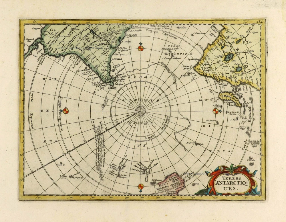
Southern Hemisphere by J.N. Bellin, published by Bernard. 1780
James Cook (1728 – 1779)
Captain James Cook, a British explorer, cartographer, and captain in the British Royal Navy, was born of poor parentage in 1728. Yet, he became the most excellent navigator of his day. More than any other man, Cook contributed to the mapping of Australia and the Pacific. He was famous for his three voyages between 1768 and 1779. In these voyages, Cook sailed thousands of miles across largely uncharted areas of the globe. He mapped lands from New Zealand to Hawaii in the Pacific Ocean in greater detail and on a scale not previously charted by Western explorers. He surveyed and named features and recorded islands and coastlines on European maps for the first time.
In his first voyage 1768-71 in the Endeavour, he charted the whole of New Zealand and the east coast of Australia.
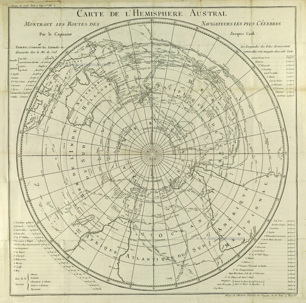
In his second voyage, 1772-75, in the Resolution and Adventure, he dispelled the myth of an immense southern landmass and reduced the Antarctic to its proper proportions.
In his third voyage, 1776-79 in the Resolution and Discovery, he completed the charting of the coasts between America and Asia. Unfortunately, in 1779 he was attacked and killed by natives on the island of Hawaii.
Jean-François de La Harpe (1739 - 1803)
French author, published: Abrégé de l'Histoire générale des voyages. Paris, 1780. 32 vol.
This work is a compilation of travel reports, based on the great History of Abbé Prévost's voyages, published from 1747 to 1775. La Harpe only worked on the first twenty-one volumes of the work; the following, including the supplement (volumes 24 to 32) and the continuation (volumes 33 to 44), are by Father Delpuech de Comeiras.
The author has brought together the essential facts of the most famous journeys from the first discoveries to those of the end of the 18th century, dividing his work into five parts: the voyages of Africa, those of Asia, those of America, those to the poles and trips around the world, then added modern expeditions - including those of Captain Cook, Dampier, Carteret, Kaempfer, Bernier, Bruce, Norden, Anson, Bougainville, etc. - bringing together a multitude of information on the history, manners and customs of the inhabitants of the continents explored.
Carte De L'Hemisphere Austral Montrant Les Routes Des Navigateurs Les Plus Célebres par le Captaine Jacques Cook.
Item Number: 28296 Authenticity Guarantee
Category: Antique maps > Oceans
Old, antique sea chart of Southern Hemisphere, by James Cook - J.-F. La Harpe J.-F.
Title: Carte De L'Hemisphere Austral Montrant Les Routes Des Navigateurs Les Plus Célebres par le Captaine Jacques Cook.
Voyages de Cook. Tome 1 Page 1ere Pl.2.
Bernard Direxit.
Abregé de l'Histoire Générale des Voyages. in Tome 19. Page 1ere.
Cartographer: James Cook.
Copper engraving, printed on paper.
Size (not including margins): 540 x 535mm (21.26 x 21.06 inches).
Verso: Blank.
Condition: Folds as issued, excellent.
Condition Rating: A.
References: MCC, 2 #76; MCC, 64 #335; Tooley (Australia), p. 47 #335
From: La Harpe Jean-François, Abrégé de l'Histoire Generale des Voyages. Paris, 1780.
James Cook (1728 – 1779)
Captain James Cook, a British explorer, cartographer, and captain in the British Royal Navy, was born of poor parentage in 1728. Yet, he became the most excellent navigator of his day. More than any other man, Cook contributed to the mapping of Australia and the Pacific. He was famous for his three voyages between 1768 and 1779. In these voyages, Cook sailed thousands of miles across largely uncharted areas of the globe. He mapped lands from New Zealand to Hawaii in the Pacific Ocean in greater detail and on a scale not previously charted by Western explorers. He surveyed and named features and recorded islands and coastlines on European maps for the first time.
In his first voyage 1768-71 in the Endeavour, he charted the whole of New Zealand and the east coast of Australia.
In his second voyage, 1772-75, in the Resolution and Adventure, he dispelled the myth of an immense southern landmass and reduced the Antarctic to its proper proportions.
In his third voyage, 1776-79 in the Resolution and Discovery, he completed the charting of the coasts between America and Asia. Unfortunately, in 1779 he was attacked and killed by natives on the island of Hawaii.
Jean-François de La Harpe (1739 - 1803)
French author, published: Abrégé de l'Histoire générale des voyages. Paris, 1780. 32 vol.
This work is a compilation of travel reports, based on the great History of Abbé Prévost's voyages, published from 1747 to 1775. La Harpe only worked on the first twenty-one volumes of the work; the following, including the supplement (volumes 24 to 32) and the continuation (volumes 33 to 44), are by Father Delpuech de Comeiras.
The author has brought together the essential facts of the most famous journeys from the first discoveries to those of the end of the 18th century, dividing his work into five parts: the voyages of Africa, those of Asia, those of America, those to the poles and trips around the world, then added modern expeditions - including those of Captain Cook, Dampier, Carteret, Kaempfer, Bernier, Bruce, Norden, Anson, Bougainville, etc. - bringing together a multitude of information on the history, manners and customs of the inhabitants of the continents explored.