
Atlas frontipsice + title page, by J.B. Homann. 1712

Standing atop a great globe of the world Atlas, and his temporary assistant, Hercules, support the heavens, including the starry Milky Way. Various birds fly across the night sky, from the moon on the right towards the setting sun to the west on the left. In front of the globe stand or sit various stately gods and goddesses with powers over the earth and its waters. To the left, Neptune is prominent with his trident, while opposite him are Mercury, with winged helmet and caduceus, and the goddess Cybele with her turreted crown. Cybele was the patroness of towns, cities and the countryside, and she holds a sickle and a sheaf of corn. Behind her are Aeolus, the god of winds, and his assistants.
The Homann Family: Masters of German Cartography and Publishing
The Homann family stands as one of the most significant names in the history of German cartography and publishing. Their maps, atlases, and geographic works not only shaped contemporary understanding of the world during the 18th century but also left an enduring legacy in the fields of geography, engraving, and scholarly publishing.
The family's prominence began with Johann Baptist Homann (1664–1724), a native of Oberkammlach in Bavaria. Initially trained in law and theology, Johann Baptist later turned to engraving and cartography — a field that was flourishing amid the Age of Discovery and the growing demand for precise geographic knowledge.
In 1702, he founded his own publishing house in Nürnberg, a city then renowned for its vibrant intellectual, artistic, and scientific community. Nuremberg’s rich tradition of printmaking and map production provided fertile ground for Homann's enterprise.
Johann Baptist Homann quickly rose to prominence as one of Germany’s leading cartographers and publishers. His works combined technical accuracy, artistic merit, and rich ornamentation, often embellished with elaborate cartouches, mythological scenes, and heraldic symbols.
In 1715, Homann was appointed Imperial Geographer to the Holy Roman Emperor Charles VI. He obtained the "Imperial Privilege" (Privilegium Imperialis). This prestigious title solidified his status and bestowed upon his publishing house both credibility and influence. His most famous works include:
- Atlas Novus Terrarum Orbis (1707) — an early and ambitious atlas project.
- Grosser Atlas über die ganze Welt (1716) — one of the most crucial German world atlases of the early 18th century.
Homann’s maps covered both European and global territories, including the Americas, Asia, and Africa, reflecting contemporary geographical knowledge and political boundaries.
The Homann Heirs (Homannische Erben)
After Johann Baptist Homann died in 1724, his son Johann Christoph Homann (1703–1730) briefly took over the business. However, Johann Christoph died at a young age, and the enterprise was then continued under the name Homännische Erben ("Homann Heirs"), a partnership of family members and associates.
Despite the loss of its founder, the firm remained highly productive and influential for several decades. The Homann Heirs continued to publish atlases, wall maps, city views, and geographical treatises well into the late 18th century. Their catalogue included works by noted cartographers such as Johann Matthias Hase, Leonhard Euler, and Tobias Conrad Lotter.
The Homann publishing house played a crucial role in disseminating geographic and scientific knowledge during the Enlightenment. Their maps combined artistry with empirical detail and were sought after by scholars, navigators, governments, and collectors.
Several of their works are now prized as valuable historical artefacts, housed in museums, libraries, and private collections around the world. The Homann Heirs' firm gradually declined by the end of the 18th century, overtaken by newer publishing houses and changing technologies, but their contribution to the cartographic tradition remains significant.
The Homann family’s name is indelibly linked to the golden age of German cartography. Through meticulous craftsmanship and a keen sense of visual storytelling, they charted the known world of their time, leaving a remarkable record of early modern geography. Today, their maps not only inform historians of cartography but also captivate collectors and enthusiasts for their aesthetic beauty and historical value.
Atlas Novus Terrarum Orbis Imperia, Regna et Status exactis Tabulis Geographice demonstrans + Neuer Atlas bestehend in einig curieusen Astromischen Mappen und vielen auserlesenen allerneuesten Land-Charten über die Ganße Welt.
Item Number: 33270 new Authenticity Guarantee
Category: Antique maps > Title Pages
Atlas frontipsice + title page, by J.B. Homann.
Title: Atlas Novus Terrarum Orbis Imperia, Regna et Status exactis Tabulis Geographice demonstrans + Neuer Atlas bestehend in einig curieusen Astronomischen Mappen und vielen auserlesenen allerneuesten Land-Charten über die Ganße Welt.
... Von Johann Baptista Homann.
Nuerenberg In Verlegung des Auctoris. MDCCXII. [1712]
Engraver: Casper Luyken.
Date: 1712.
Copper engraving + typographic title, printed on paper.
Image size: 485 x 280mm (19 x 11 inches).
Sheet size each: 520 x 310mm (20½ x 12¼ inches).
Verso: Blank.
Condition: Original coloured, tear reinforced at the bottom right of the frontispiece.
Condition Rating: A.
Standing atop a great globe of the world Atlas, and his temporary assistant, Hercules, support the heavens, including the starry Milky Way. Various birds fly across the night sky, from the moon on the right towards the setting sun to the west on the left. In front of the globe stand or sit various stately gods and goddesses with powers over the earth and its waters. To the left, Neptune is prominent with his trident, while opposite him are Mercury, with winged helmet and caduceus, and the goddess Cybele with her turreted crown. Cybele was the patroness of towns, cities and the countryside, and she holds a sickle and a sheaf of corn. Behind her are Aeolus, the god of winds, and his assistants.
The Homann Family: Masters of German Cartography and Publishing
The Homann family stands as one of the most significant names in the history of German cartography and publishing. Their maps, atlases, and geographic works not only shaped contemporary understanding of the world during the 18th century but also left an enduring legacy in the fields of geography, engraving, and scholarly publishing.
The family's prominence began with Johann Baptist Homann (1664–1724), a native of Oberkammlach in Bavaria. Initially trained in law and theology, Johann Baptist later turned to engraving and cartography — a field that was flourishing amid the Age of Discovery and the growing demand for precise geographic knowledge.
In 1702, he founded his own publishing house in Nürnberg, a city then renowned for its vibrant intellectual, artistic, and scientific community. Nuremberg’s rich tradition of printmaking and map production provided fertile ground for Homann's enterprise.
Johann Baptist Homann quickly rose to prominence as one of Germany’s leading cartographers and publishers. His works combined technical accuracy, artistic merit, and rich ornamentation, often embellished with elaborate cartouches, mythological scenes, and heraldic symbols.
In 1715, Homann was appointed Imperial Geographer to the Holy Roman Emperor Charles VI. He obtained the "Imperial Privilege" (Privilegium Imperialis). This prestigious title solidified his status and bestowed upon his publishing house both credibility and influence. His most famous works include:
- Atlas Novus Terrarum Orbis (1707) — an early and ambitious atlas project.
- Grosser Atlas über die ganze Welt (1716) — one of the most crucial German world atlases of the early 18th century.
Homann’s maps covered both European and global territories, including the Americas, Asia, and Africa, reflecting contemporary geographical knowledge and political boundaries.
The Homann Heirs (Homannische Erben)
After Johann Baptist Homann died in 1724, his son Johann Christoph Homann (1703–1730) briefly took over the business. However, Johann Christoph died at a young age, and the enterprise was then continued under the name Homännische Erben ("Homann Heirs"), a partnership of family members and associates.
Despite the loss of its founder, the firm remained highly productive and influential for several decades. The Homann Heirs continued to publish atlases, wall maps, city views, and geographical treatises well into the late 18th century. Their catalogue included works by noted cartographers such as Johann Matthias Hase, Leonhard Euler, and Tobias Conrad Lotter.
The Homann publishing house played a crucial role in disseminating geographic and scientific knowledge during the Enlightenment. Their maps combined artistry with empirical detail and were sought after by scholars, navigators, governments, and collectors.
Several of their works are now prized as valuable historical artefacts, housed in museums, libraries, and private collections around the world. The Homann Heirs' firm gradually declined by the end of the 18th century, overtaken by newer publishing houses and changing technologies, but their contribution to the cartographic tradition remains significant.
The Homann family’s name is indelibly linked to the golden age of German cartography. Through meticulous craftsmanship and a keen sense of visual storytelling, they charted the known world of their time, leaving a remarkable record of early modern geography. Today, their maps not only inform historians of cartography but also captivate collectors and enthusiasts for their aesthetic beauty and historical value.
Related items

Atlas Novus - Atlas-Nouveau Contenant toutes les parties du Monde &c. 1733
Atlas frontispiece, by Covens & Mortier.
[Item number: 12544]

Toonneel des Aerdrycx, oft Nieuwe Atlas, uytgegeven door Wilhelm en Joan Blaeu. Vierde Deel. 1642-43
Atlas frontispiece for the Blaeu Atlas of England
[Item number: 16772]

Sevende Stuck der Aerdrycks-Beschryving, welck vervat Italien en Griecken. 1664-65
Atlas frontispiece by J. Blaeu
[Item number: 21621]

Heightened in gold
De Groote Nieuwe Vermeerderde Zee-Atlas ofte Water-Werelt. Vertoonende in sigh alle de Zee-Kusten des Aardtryks, ... 1693
Atlas frontispiece, by J. Van Keulen.
[Item number: 26447]
Rare Atlas Major title.
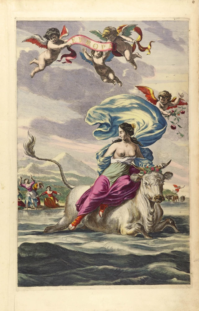
Europa. 1662
Atlas frontispiece by Joan Blaeu.
[Item number: 29731]
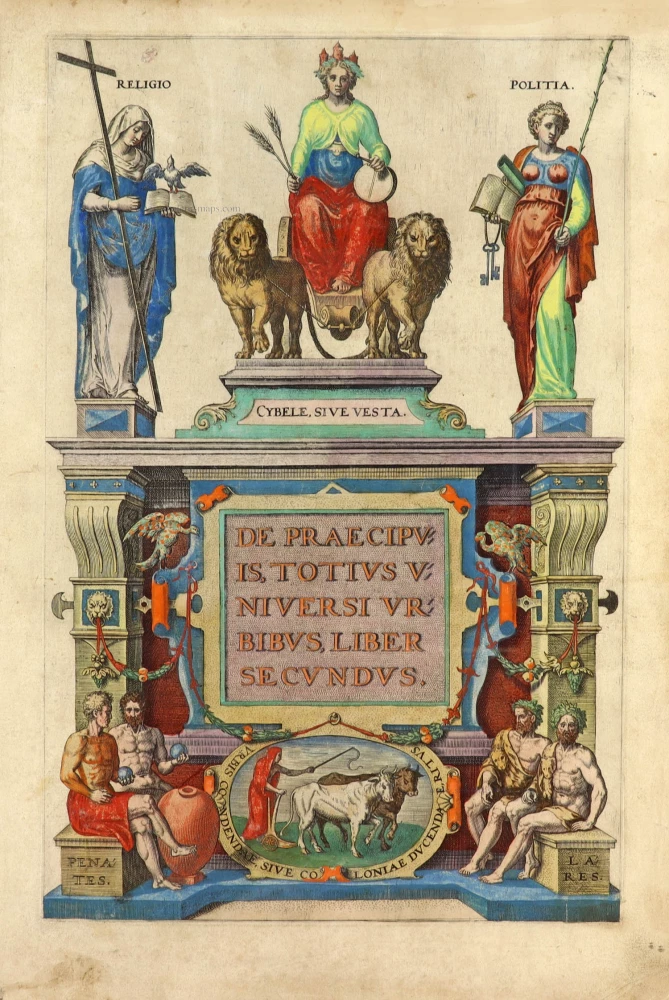
De Praecipuis, Totius Universi Urbibus Liber Secundus. 1575-1612
Georg Braun & Frans Hogenberg, allegorical atlas title page of the second part.
[Item number: 30096]

Nouveau Theatre du Monde ou Nouvel Atlas comprenant Les Tables et Descriptions de toutes les Regions de la Terre. 1641
Frontispiece by Hondius Henricus
[Item number: 30116]

N: Visscheri Germania Inferior Sive XVII Provinciarum Geographicae Generales ut et Particulares Tabulae. - Kaert-Boeck van de XVII Nederlandtsche Provincien, Nieuwlycx uytgegeven door Nicolaes Visscher. After 1677 (privilege)
Atlas frontispiece by Nicolas Visscher II.
[Item number: 30417]

Le Nouveau & Grand Illuminant Flambeau de la Mer. 1684
Atlas frontispiece published by Johannes Van Keulen
[Item number: 32472]

Superb colouring
Theatrum Orbis Terrarum. 1579
Atlas frontispiece by Abraham Ortelius.
[Item number: 32516]

Beautiful original coloured
Parergon, cioe fuor d'Opera, et Giunta, overo alcune tavole dell'antica Geografia. 1612.
Engraved atlas title page of the Parergon, by Abraham Ortelius.
[Item number: 32517]

Famous frontispiece by Romeyn de Hooghe
Atlas Maritime 1693
Title page of Pierre Mortier's Atlas Maritime
[Item number: 32627]

Atlas. c. 1680
Atlas Title Page by Frederick de Wit.
[Item number: 33152]