
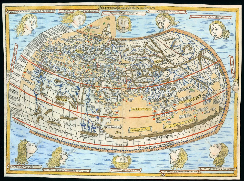
Antique map of Ptolemaic World by Ptolemy 1486
[No title]
Item Number: 13161 Authenticity Guarantee
Category: Antique maps > World and Polar
The first edition of this map was printed by Leinhart Holle in Ulm in 1482.
This world map is of particular interest as it is the first to be signed, according to the inscription "Engraved by Johann, woodcutter from Armszheim". The map also ventures to represent some features which update the Ptolemaic world picture and which were very probably based on a manuscript of Donnus Nicolaus Germanus of the 1470s.
Shortly after publication of the first edition Leinhart Holle went bankrupt. His stock was taken over by Johann Reger who, four years later in 1486, put out a second edition with a pinting of about 1000 copies.
Woodcut
Size: 40 x 55cm (15.6 x 21.5 inches)
Verso: Blank
Condition: Good and dark impression, old coloured. Professional repairs to lower and upper margins and to lower corners, small portions of the hair of the bottom corner windheads reinstated. Overall, good condition.
Condition Rating: C
References: Shirley (World), 10; Karrow, 32/M.1; Shirley (Brit.Lib.), T.Ptol-4f.
From: [Colophon] Ptolemei Viri Alexandrini Cosmographie . . . Explicit. Opus Donni Nicolai Germani Secundum Ptolomeum Finit. [separate colophon] Impressum Ulme Opera . . . Johannem Reger. Anno MCCCLXXXVI [1486]. (Shirley (Brit.Lib.) T.PTOL-4f)