
Antique world map by H. Moll c. 1726
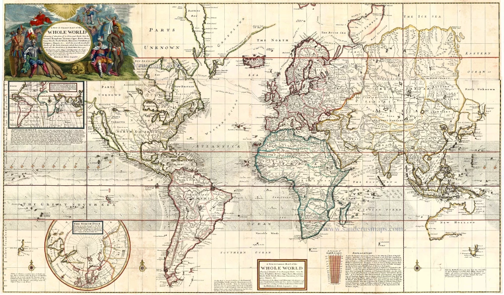
A New & Correct Map of the Whole World Shewing ye Situation of its Principal Parts ... with the Most Remarkable Tracks of the Bold Attempts which have been Made to Find Out the Northeast and Northwest Passages ...
Item Number: 13727 Authenticity Guarantee
Category: Antique maps > World and Polar
Worldmap in Mercator's projection showing the magnetic variation.
Inset: North Polar chart.
Copper engraving, printed from four plates, joined.
Size: 71 x 121cm (27.7 x 47.2 inches)
Verso: Blank
Condition: Old coloured with later additions.
Condition Rating: A
References: Wagner, 512; Phillips (Maps), p.1089.
From: Moll Herman, The World Described, or a New and Correct Sett of Maps . . . London, J. & T. Bowles, c. 1726. (Phillips (Atlases), 554)