
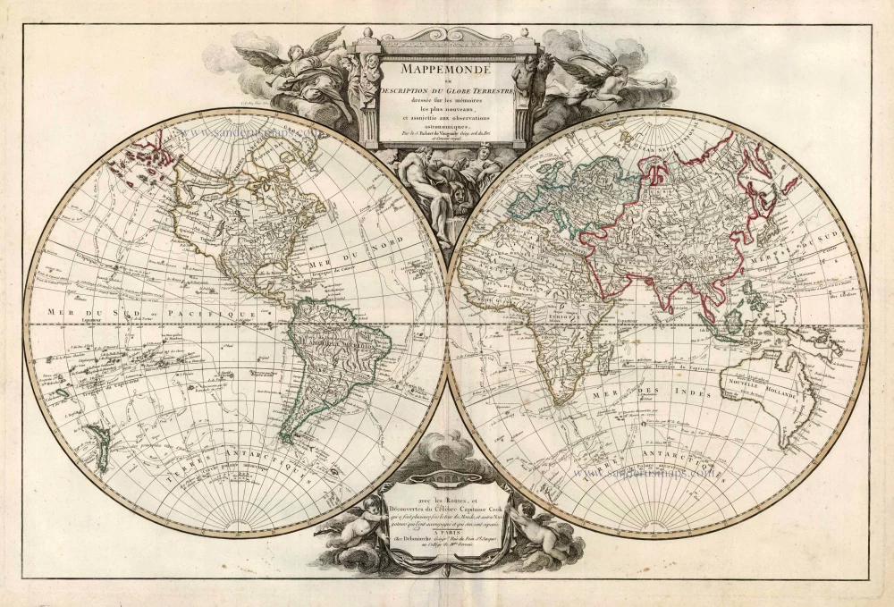
Old, antique map of the World - double hemispheres by Robert de Vaugondy. c. 1757
Gilles and Didier Robert de Vaugondy
Gilles Robert de Vaugondy (1688-1766) and his son Didier Robert de Vaugondy (1723-1786) were leading cartographers in France during the 18th century. They served both as geographer to the king of France. The father, Gilles is also known as ‘Le Sieur’ or ‘Monsieur Robert’. He descended from the Nicolas Sanson family through Sanson's grandson Pierre Moulard-Sanson, from whom he inherited Sanson's cartographic material. After Hubert Jaillot died in 1712, the de Vaugondy's acquired numerous copies of his maps and plates, which formed the basis of their beautiful Atlas Universel (1757).
Their business flourished from 1731 to 1778. They made a substantial contribution to the world of cartography.
Mappemonde ou Description du Globe Terrestre, Dressée sur les Memoires les Plus Nouveaux, et Assujettie aux Observations Astronomiques ...
Item Number: 4214 Authenticity Guarantee
Category: Antique maps > World and Polar
Old, antique map of the World - double hemispheres by Robert de Vaugondy.
Copper engraving
Size: 47 x 73cm (18.3 x 28.5 inches)
Verso: Blank
Condition: Original coloured in outline, excellent.
Condition Rating: A
References: Pedley, 6.
From: Atlas Universelle. Paris, c.1757.
Gilles and Didier Robert de Vaugondy
Gilles Robert de Vaugondy (1688-1766) and his son Didier Robert de Vaugondy (1723-1786) were leading cartographers in France during the 18th century. They served both as geographer to the king of France. The father, Gilles is also known as ‘Le Sieur’ or ‘Monsieur Robert’. He descended from the Nicolas Sanson family through Sanson's grandson Pierre Moulard-Sanson, from whom he inherited Sanson's cartographic material. After Hubert Jaillot died in 1712, the de Vaugondy's acquired numerous copies of his maps and plates, which formed the basis of their beautiful Atlas Universel (1757).
Their business flourished from 1731 to 1778. They made a substantial contribution to the world of cartography.
Related items

Orbis Vetus in utraque Continente juxta Mentem Sansonianam Distinctus, nec non Observationibus Astronomicis Redactus ... c. 1757
The world by Robert de Vaugondy.
[Item number: 5092]
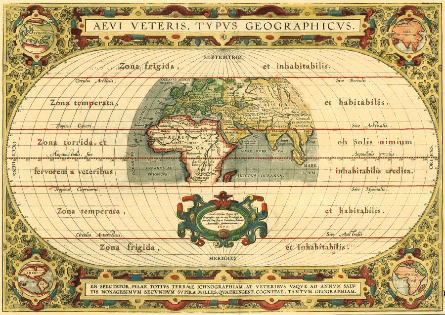
Aevi Veteris, Typus Geographicus 1595
Old, antique map of Ancient World by Ortelius A.
[Item number: 6684]