
Old, antique world map by J.B. Vrients 1596


"A close copy of Plancius' 1594 world map (Shirley 187) was prepared for the first edition of Linschoten's Itinerario published by Cornelis Claesz. in 1596. Linschoten, one-time secretary to the Archbishop of Goa and assiduous observer of practices in the East, wrote a detailed account of his travels in a work richly illustrated with regional engravings and maps.
Apart from the longer title, the 1596 map appears superficially the same as the earlier one of 1594. However there are differences affecting the northern seas, and the pictorial scenes forming the outer border have been regrouped with even greater stylistic effect. Below the double hemispheres Mexicana and Peruvana have been omitted in favour of full-panel Africa. The overall engraving by the brothers Arnold and Hendrik van Langren is even finer than that of the earlier map by their fellow-craftsman Jan van Doetecum.
As with Plancius' wall map of 1592, there seems to have been copublication between Vrients in Antwerp and the firm of Cornelis Claesz. in Amsterdam. ... Vrient's map is occasionally found in the 1599 edition of Linschoten, but more usually Plancius' 1594 world map is bound in this and in all later editions published on the continent." (Shirley)
Jan Huygen van Linschoten (1562-c.1611)
Jan Huygen van Linschoten was one of the pathfinders for the first Dutch voyages to the East. Born in Haarlem, his parents moved to Enkhuizen in or after 1572 for political and religious reasons. In 1579 he left for Spain, where his older brothers had already been living for several years. In 1583, Jan Huygen set sail with a fleet heading for Goa in India. There he entered the service of the new archbishop.
The years that Jan Huygen spent in Goa, the administrative centre of Portugal’s widespread colonial territory in the East, provided an excellent opportunity to collect a wealth of information. Ships from all directions came into port here, and he could inform himself on the patterns of trade and the economic opportunities to China and Japan. In the foreword to his Itinerario (1596), Jan Huygen refers to the fact that he could not help but take note of everything. For instance, during his six-year sojourn in Goa, he also drew a bird’s eye view of this city, which he included in the Itinerario. He also gave ample attention to the Portuguese sailing routes to, from, and within Asian waters.
In November 1588 he came back home with the pepper ship Santa Cruz. He interrupted this voyage after an eventful journey and spent two years on the island of Terceira. In 1592 he arrived back in Enkhuizen. With his writings, drawings, and tales, he captured the attention of the town, and people encouraged him to publish the report of his journey.
While preparations for the publication of the Itinerario were in full swing, Jan Huygen took part in the first two polar expeditions as a chief commercial officer on the ships fitted out by Enkhuizen.
After these voyages, Jan Huygen stayed on land. He married with Reynu Meinertsdr Semeyns, daughter of one of Enkhuizen’s regent families. Thanks to his in-laws, he subsequently occupied various positions in the city’s civil administration until he died in 1611.
Jan Huygen van Linschoten and his Itinerario (1595-96).
By the time Jan Huygen returned from India, commercial and scientific circles in the Northern Netherlands were strongly motivated to learn more about overseas territories. He came in contact with the Amsterdam publisher Cornelis Claesz, who had been the publisher of Waghenaer’s cartographic work since 1589. Claesz showed great interest in Van Linschoten’s plans. He realized that on the threshold of a new era, cartographic and maritime works would be in high demand in circles of navigators, merchants, and other interested parties. Van Linschoten’s work could also serve as a guide to unknown territories.
On 14 March 1594, shortly before leaving northbound, Van Linschoten and Claesz signed a contract to print a book on navigation to the East Indies. By the end of this year, the States General granted Jan Huygen a ten-year privilege on the publication of his Itinerario and Reysgeschrift.
The volume published under the title Itinerario would include Van Linschoten’s travel account, supplemented by further information on the peoples, flora, and fauna of the Asian territories. Cornelis Claesz expanded the work and gave some attention to the west coast of Africa and also to America, a territory completely unknown to Van Linschoten. Because Jan Huygen had never been in these areas himself, Bernardus Paludanus was called in to help out. With the aid of Portuguese and Spanish sources, Paludanus and Van Linschoten made a compendium entitled Beschryvinghe van de gantsche Custe van Guinea.
The result of all this was a set of four different and distinctly separate individuals works. Each work has its own title page, its own date of publication, and a dedication. These four parts are usually bound in a single volume, with the Itinerario coming first. Therefore, the contents of the whole work are generally referred to by that name.
The Van Doetecum brothers engraved Jan Huygens drawings. Joannes van Doetecum had already engraved the world map of Petrus Plancius in 1594. Cornelis Claesz included this map in some copies of the 1596-99 editions. Still, in some copies, it was replaced by a map by Joan Baptista Vrients, engraved by the Van Langren brothers. The five detail maps, all of which were engraved by Arnold Floris and Hendrik Floris van Langren, cover a large proportion of the non-European world known at the time.
Jan Huygen van Linschoten’s Itinerarium was one of the most impressive works to be published at the end of the sixteenth century. The report of his northern travels appeared a couple of years later.
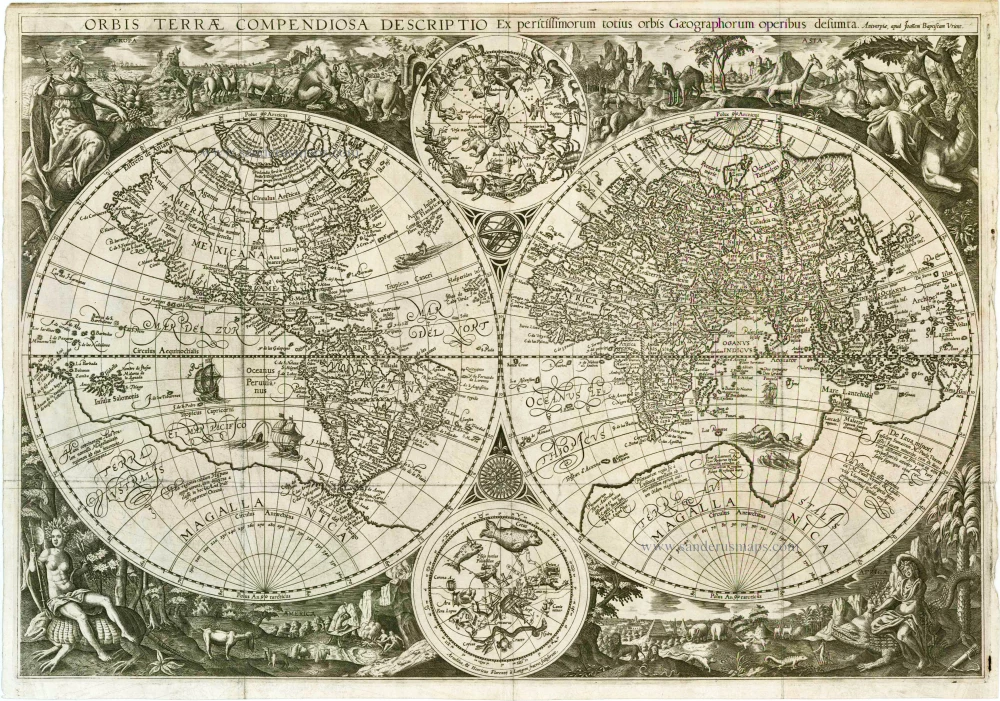
Orbis Terrae Compendiosa Descriptio Ex peritissimorum totius orbis Gaeographorum operibus desumta.
Item Number: 25803 Authenticity Guarantee
Category: Antique maps > World and Polar
Old, antique world map - double hemispheres by P. Plancius & J.B. Vrients.
Date of the first edition: 1596
Date of this map: 1596
Copper engraving, printed on paper.
Engraved by Arnold and Hendrik van Langren.
Size (not including margins): 39.5 x 57.5cm (15.4 x 22.4 inches)
Verso: Blank
Condition: Excellent. 3 vertical and 1 horizontal folds (as issued in Itinerario).
Condition Rating: A+
References: Shirley (World), 192 (Rarity "R"); Wagner, 184; Schilder 7, 10.27 (Facs. 19)
From: Jan Huygen van Linschoten, Itinerario, Voyage ofte Schipvaert naer Oost ofte Portugaels Indien.... Amsterdam: C. Claesz, 1595-96.
Linschoten, one-time secretary to the Archbishop of Goa and assiduous observer of practices in the East, wrote a detailed account of his travels in a work richly illustrated with regional engravings and maps.
"This map is a fairly accurate copy of Petrus Plancius's world map published in 1594 by Cornelis Claesz. Since 1596, Plancius's map was added to Van Linschoten's Itinerario and bound into the volume as one of its six maps. However, a few copies of the Itinerario (in the editions of 1596-99) contain a new world map that was engraved by the brothers Arnold Floris and Hendrik Floris van Langren. Their names appear in the hemisphere of the southern firmament: Arnoldus & Henricus Florentij à Langren fratres sculpserunt. Plancius is no longer mentioned as author in the title that runs along the upper edge across the full width of the map. In its place, the wording gives the address of the Antwerp publisher Joan Baptista Vrients, where the map can be purchased. Because the Itinerario carries the address of Cornelis Claesz in Amsterdam, we will have to consider the latter to be the primary and his colleague in Antwerp as co-publisher. This was not the first time Vrients had collaborated with Cornelis Claesz on the publication of a cartographic work. They might have wanted to be able to sell the Itinerario in Catholic countries as well. Instead of including a world map associated with the Reformation ideas of the theologian-geographer Plancius, who was known as a fanatic, they might well have preferred to use a map of the world bearing the neutral name and address of Vrients. Proof that the map was printed in Amsterdam, however, is provided by Cornelis Claesz's Const ende Caert- Register, where the map is listed for sale as 'Globe-Caert van Langren met zijn cieraet'.
The double hemispheres are framed by allegorical figures personifying the four continents. The space on top is occupied by Europe and Asia, while Africa and America are depicted below. In contrast to the representation on Plancius's 1594 map, the Van Langren brothers decided not to split America up into regions. The female figures are modifications of the allegorical renditions of the continents as they were represented in the series of prints by Adriaen Collaert after the designs of Maerten de Vos. The main personages are placed in a landscape typical of the continent in question, and they hold characteristic attributes in their hands: wearing a crown, Europe is seated on a globe with a sceptre and a cornucopia in her hands; Asia is seated on a camel and holds an incense burner in her right hand, while the left hand is resting on the sheath of a sword; a scantily clothed Africa is seated on a crocodile and holds a bow and a branch of spice in het hands; America, wearing only loincloth and a feather headdress, is seated on a giant armadillo and is armed with an arrow and a spear. The depicted clothing and attributes of the women denote the hierarchical structure of the four continents: the opulently dressed Europe and Asia are followed by the naked figures of Africa and America.
Not only in the representation of the decorations but also in the map content, this map deviates in a couple of ways from Plancius's 1594 world map. The most significant change is in the way the Arctic region is drawn. Although the four large polar islands are still shown, the island archipelago to the west of Novaya Zemlya has disappeared. Novaya Zemlya (Nova Zemla) now appears on the 1596 map as an elongated island, while there are no islands in the sea to the west of it (Petzorke morie). Further, the characteristic Cape Tabin, the most northerly projecting cape of continental Asia, is drawn even further to the north, to 74° (on the 1594 map, it was drawn to 71°). Thus, the only part of the so fervently desired northeast passage that remains is just a narrow sea strait." (Schilder).
"A close copy of Plancius' 1594 world map (Shirley 187) was prepared for the first edition of Linschoten's Itinerario published by Cornelis Claesz. in 1596. Linschoten, one-time secretary to the Archbishop of Goa and assiduous observer of practices in the East, wrote a detailed account of his travels in a work richly illustrated with regional engravings and maps.
Apart from the longer title, the 1596 map appears superficially the same as the earlier one of 1594. However there are differences affecting the northern seas, and the pictorial scenes forming the outer border have been regrouped with even greater stylistic effect. Below the double hemispheres Mexicana and Peruvana have been omitted in favour of full-panel Africa. The overall engraving by the brothers Arnold and Hendrik van Langren is even finer than that of the earlier map by their fellow-craftsman Jan van Doetecum.
As with Plancius' wall map of 1592, there seems to have been copublication between Vrients in Antwerp and the firm of Cornelis Claesz. in Amsterdam. ... Vrient's map is occasionally found in the 1599 edition of Linschoten, but more usually Plancius' 1594 world map is bound in this and in all later editions published on the continent." (Shirley)
Jan Huygen van Linschoten (1562-c.1611)
Jan Huygen van Linschoten was one of the pathfinders for the first Dutch voyages to the East. Born in Haarlem, his parents moved to Enkhuizen in or after 1572 for political and religious reasons. In 1579 he left for Spain, where his older brothers had already been living for several years. In 1583, Jan Huygen set sail with a fleet heading for Goa in India. There he entered the service of the new archbishop.
The years that Jan Huygen spent in Goa, the administrative centre of Portugal’s widespread colonial territory in the East, provided an excellent opportunity to collect a wealth of information. Ships from all directions came into port here, and he could inform himself on the patterns of trade and the economic opportunities to China and Japan. In the foreword to his Itinerario (1596), Jan Huygen refers to the fact that he could not help but take note of everything. For instance, during his six-year sojourn in Goa, he also drew a bird’s eye view of this city, which he included in the Itinerario. He also gave ample attention to the Portuguese sailing routes to, from, and within Asian waters.
In November 1588 he came back home with the pepper ship Santa Cruz. He interrupted this voyage after an eventful journey and spent two years on the island of Terceira. In 1592 he arrived back in Enkhuizen. With his writings, drawings, and tales, he captured the attention of the town, and people encouraged him to publish the report of his journey.
While preparations for the publication of the Itinerario were in full swing, Jan Huygen took part in the first two polar expeditions as a chief commercial officer on the ships fitted out by Enkhuizen.
After these voyages, Jan Huygen stayed on land. He married with Reynu Meinertsdr Semeyns, daughter of one of Enkhuizen’s regent families. Thanks to his in-laws, he subsequently occupied various positions in the city’s civil administration until he died in 1611.
Jan Huygen van Linschoten and his Itinerario (1595-96).
By the time Jan Huygen returned from India, commercial and scientific circles in the Northern Netherlands were strongly motivated to learn more about overseas territories. He came in contact with the Amsterdam publisher Cornelis Claesz, who had been the publisher of Waghenaer’s cartographic work since 1589. Claesz showed great interest in Van Linschoten’s plans. He realized that on the threshold of a new era, cartographic and maritime works would be in high demand in circles of navigators, merchants, and other interested parties. Van Linschoten’s work could also serve as a guide to unknown territories.
On 14 March 1594, shortly before leaving northbound, Van Linschoten and Claesz signed a contract to print a book on navigation to the East Indies. By the end of this year, the States General granted Jan Huygen a ten-year privilege on the publication of his Itinerario and Reysgeschrift.
The volume published under the title Itinerario would include Van Linschoten’s travel account, supplemented by further information on the peoples, flora, and fauna of the Asian territories. Cornelis Claesz expanded the work and gave some attention to the west coast of Africa and also to America, a territory completely unknown to Van Linschoten. Because Jan Huygen had never been in these areas himself, Bernardus Paludanus was called in to help out. With the aid of Portuguese and Spanish sources, Paludanus and Van Linschoten made a compendium entitled Beschryvinghe van de gantsche Custe van Guinea.
The result of all this was a set of four different and distinctly separate individuals works. Each work has its own title page, its own date of publication, and a dedication. These four parts are usually bound in a single volume, with the Itinerario coming first. Therefore, the contents of the whole work are generally referred to by that name.
The Van Doetecum brothers engraved Jan Huygens drawings. Joannes van Doetecum had already engraved the world map of Petrus Plancius in 1594. Cornelis Claesz included this map in some copies of the 1596-99 editions. Still, in some copies, it was replaced by a map by Joan Baptista Vrients, engraved by the Van Langren brothers. The five detail maps, all of which were engraved by Arnold Floris and Hendrik Floris van Langren, cover a large proportion of the non-European world known at the time.
Jan Huygen van Linschoten’s Itinerarium was one of the most impressive works to be published at the end of the sixteenth century. The report of his northern travels appeared a couple of years later.
Related items

Orbis Vetus in utraque Continente juxta Mentem Sansonianam Distinctus, nec non Observationibus Astronomicis Redactus ... c. 1757
The world by Robert de Vaugondy.
[Item number: 5092]
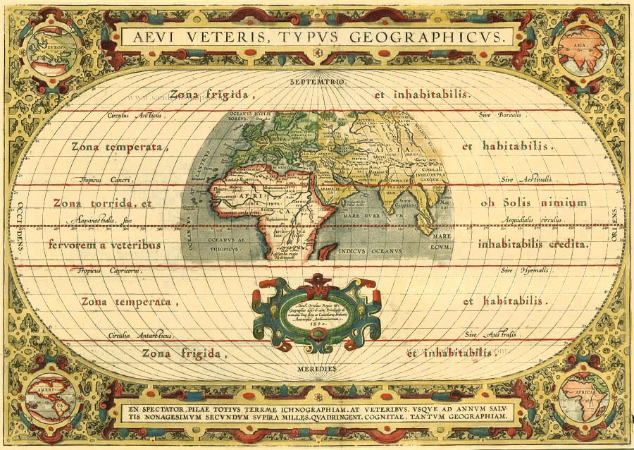
Aevi Veteris, Typus Geographicus 1595
Old, antique map of Ancient World by Ortelius A.
[Item number: 6684]
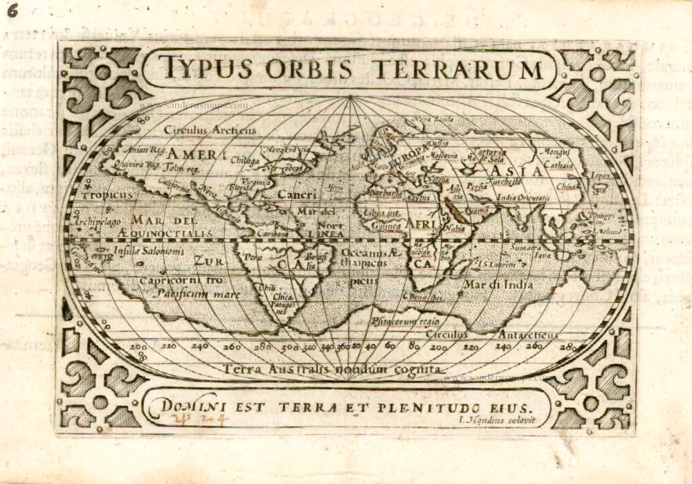
Typus Orbis Terrarum. 1602
World by Barent Langenes
[Item number: 12009]

Geographia Sacra 1601
Ancient world by A. Ortelius
[Item number: 24987]