
Ptolemaic World by Hartmann Schedel. 1493
The item displayed on this page has been sold. However, we have a similar map in stock:
World by Hartmann Schedel. 1493
Secunda Etas Mundi.
[Item number: 30669]

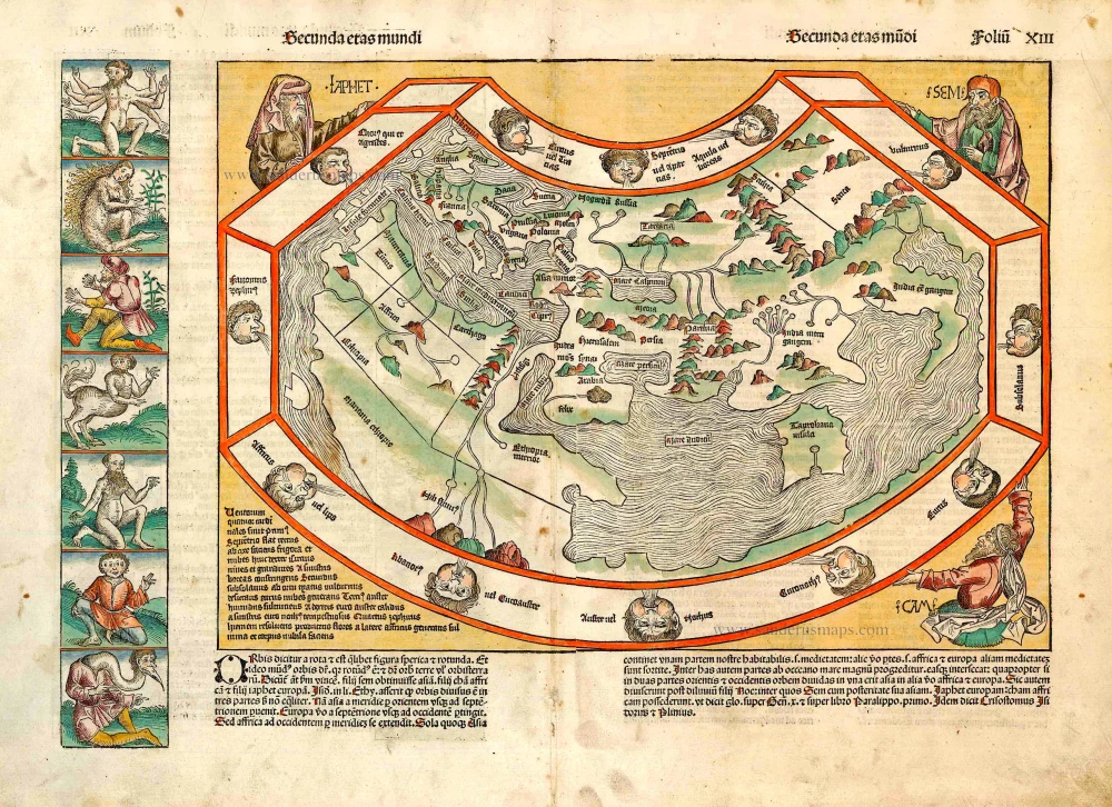
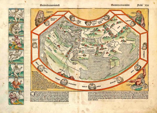

This world map is a robust woodcut taken from Ptolemy. The border contains twelve dour wind heads, while the map is supported in three corners by the solemn figures of Ham, Shem and Japhet taken from the Old Testament. What gives the map its present-day interest and attraction are the panels representing the outlandish creatures and beings that were thought to inhabit the furthermost parts of the earth. There are seven such scenes to the left of the map and a further fourteen on its reverse.
The map is a copy of a Venetian woodcut added to Pomponius Mela's Cosmographia eleven years previously. Like the Mela map, it references contemporary discoveries in its hint of the Gulf of Guinea, e reflection of Portuguese knowledge of about 1470. The unsigned Mela map was the first to show these developments in printed form. This Schedel derivative and the separately published world map of Francesco Rosselli were the only fifteenth-century printed maps to repeat these details. The current map adds one minor refinement, a curiously shaped, unidentified island off the west African coast.
Hartmann Schedel (Nuremberg, 1440-1514) and the Nuremberg Chronicle.
Hartmann Schedel grew up in Nuremberg and first studied liberal art in Leipzig. He earned a doctorate in medicine in Padua in 1466, then settled in Nuremberg to practice medicine and collect books. According to an inventory done in 1498, Schedel's library contained 370 manuscripts and 670 printed books.
Schedel is best known for his writing the text for the Nuremberg Chronicle, an illustrated biblical paraphrase and world history that follows the story of human history related in the Bible; it includes the histories of many important Western cities. The Nuremberg Chronicle was one of the most remarkable books of its time. It was commissioned by Sebald Schreyer (1446–1520) and Sebastian Kammermeister (1446–1503) and published in 1493 in Nuremberg. Maps in the Chronicle were the first-ever illustrations of many cities and countries. Wolgemut and Pleydenwurff, the painters, were commissioned to provide the illustrations and to take care of the layout. The large workshop of Michael Wolgemut, then Nuremberg's leading artist in various media, provided the 1,809 woodcut illustrations (duplications included).
Albrecht Dürer was an apprentice with Wolgemut from 1486 to 1489, so he may well have participated in designing some of the illustrations.
The Liber Chronicarum was first published in Latin on 12 July 1493 in the city of Nuremberg, printed by Anton Koberger, the most successful publisher in Germany. A German translation followed on 23 December 1493. An estimated 1400 to 1500 Latin and 700 to 1000 German copies were published.
Due to the great success and prestige of the Chronicle, pirate editions soon appeared on the market. Johann Schönsperger (c. 1455-1521), a printer working out of Augsburg, published smaller editions of the Chronicle in 1496, 1497, and 1500 in German, and Latin.
Claudius Ptolemy (c.100 – c.170 AD)
Claudius Ptolemaeus was a Greek astronomer, mathematician, and geographer who lived in Alexandria in the 2nd century. His ideas influenced much of medieval astronomy and geography. He was the first to use longitudinal and latitudinal coordinates. His idea of a global coordinate system was highly influential, and we use a similar system today.
Ptolemy wrote several scientific treatises. The first is the astronomical treatise, now known as the Almagest. The second is the Geography, which is a thorough discussion of the geographic knowledge of the Greco-Roman world. The third is the Apotelesmatika, an astrological treatise in which he attempted to adapt horoscopic astrology to the Aristotelian natural philosophy of his day.
The Geographia is a compilation of geographical coordinates of the part of the world known to the Roman Empire during his time. However, the maps in surviving manuscripts of Ptolemy's Geography only date from about 1300, after Maximus Planudes rediscovered the text. It seems likely that the topographical tables are cumulative texts that were altered and added to as new knowledge became available in the centuries after Ptolemy.
The earliest printed edition with engraved maps was produced in Bologna in 1477, followed quickly by a Roman edition in 1478. An edition printed at Ulm in 1482, including woodcut maps, was the first one published north of the Alps.
Secunda Etas Mundi.
Item Number: 27810 Authenticity Guarantee
Category: Antique maps > World and Polar
Old, antique map of the World (Ptolemaic), by Schedel H..
Title: Secunda Etas Mundi.
Cartographer: Claudius Ptolemy
Date of the first edition: 1493.
Date of this map: 1493.
Woodcut, printed on paper.
Size (not including margins): 31 x 44mm (1.22 x 1.73 inches).
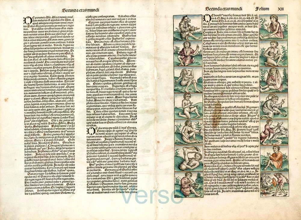
Verso: Latin text.
Condition: Original coloured, stitch holes along centrefold (as usual) - filled, margins a bit thumbed.
Condition Rating: A+
References: Shirley (World), #19; Clancy, p.63 Map.5.3
From: Liber Chronicarum. (= Nuremberg Chronicle). Nuremberg, Koberger, 1493.
This world map is a robust woodcut taken from Ptolemy. The border contains twelve dour wind heads, while the map is supported in three corners by the solemn figures of Ham, Shem and Japhet taken from the Old Testament. What gives the map its present-day interest and attraction are the panels representing the outlandish creatures and beings that were thought to inhabit the furthermost parts of the earth. There are seven such scenes to the left of the map and a further fourteen on its reverse.
The map is a copy of a Venetian woodcut added to Pomponius Mela's Cosmographia eleven years previously. Like the Mela map, it references contemporary discoveries in its hint of the Gulf of Guinea, e reflection of Portuguese knowledge of about 1470. The unsigned Mela map was the first to show these developments in printed form. This Schedel derivative and the separately published world map of Francesco Rosselli were the only fifteenth-century printed maps to repeat these details. The current map adds one minor refinement, a curiously shaped, unidentified island off the west African coast.
Hartmann Schedel (Nuremberg, 1440-1514) and the Nuremberg Chronicle.
Hartmann Schedel grew up in Nuremberg and first studied liberal art in Leipzig. He earned a doctorate in medicine in Padua in 1466, then settled in Nuremberg to practice medicine and collect books. According to an inventory done in 1498, Schedel's library contained 370 manuscripts and 670 printed books.
Schedel is best known for his writing the text for the Nuremberg Chronicle, an illustrated biblical paraphrase and world history that follows the story of human history related in the Bible; it includes the histories of many important Western cities. The Nuremberg Chronicle was one of the most remarkable books of its time. It was commissioned by Sebald Schreyer (1446–1520) and Sebastian Kammermeister (1446–1503) and published in 1493 in Nuremberg. Maps in the Chronicle were the first-ever illustrations of many cities and countries. Wolgemut and Pleydenwurff, the painters, were commissioned to provide the illustrations and to take care of the layout. The large workshop of Michael Wolgemut, then Nuremberg's leading artist in various media, provided the 1,809 woodcut illustrations (duplications included).
Albrecht Dürer was an apprentice with Wolgemut from 1486 to 1489, so he may well have participated in designing some of the illustrations.
The Liber Chronicarum was first published in Latin on 12 July 1493 in the city of Nuremberg, printed by Anton Koberger, the most successful publisher in Germany. A German translation followed on 23 December 1493. An estimated 1400 to 1500 Latin and 700 to 1000 German copies were published.
Due to the great success and prestige of the Chronicle, pirate editions soon appeared on the market. Johann Schönsperger (c. 1455-1521), a printer working out of Augsburg, published smaller editions of the Chronicle in 1496, 1497, and 1500 in German, and Latin.
Claudius Ptolemy (c.100 – c.170 AD)
Claudius Ptolemaeus was a Greek astronomer, mathematician, and geographer who lived in Alexandria in the 2nd century. His ideas influenced much of medieval astronomy and geography. He was the first to use longitudinal and latitudinal coordinates. His idea of a global coordinate system was highly influential, and we use a similar system today.
Ptolemy wrote several scientific treatises. The first is the astronomical treatise, now known as the Almagest. The second is the Geography, which is a thorough discussion of the geographic knowledge of the Greco-Roman world. The third is the Apotelesmatika, an astrological treatise in which he attempted to adapt horoscopic astrology to the Aristotelian natural philosophy of his day.
The Geographia is a compilation of geographical coordinates of the part of the world known to the Roman Empire during his time. However, the maps in surviving manuscripts of Ptolemy's Geography only date from about 1300, after Maximus Planudes rediscovered the text. It seems likely that the topographical tables are cumulative texts that were altered and added to as new knowledge became available in the centuries after Ptolemy.
The earliest printed edition with engraved maps was produced in Bologna in 1477, followed quickly by a Roman edition in 1478. An edition printed at Ulm in 1482, including woodcut maps, was the first one published north of the Alps.
Related items
Superb condition
Nova Totius Terrarum Orbis Geographica ac Hydrographica. 1643-50
Willem Blaeu, set of 5 maps: World & continents.
[Item number: 24287]

Universi Orbis Descriptio. 1597
World by Giovanni Magini
[Item number: 27837]
Rare 1525 edition of the second modern world map by Fries, in nice old colour.
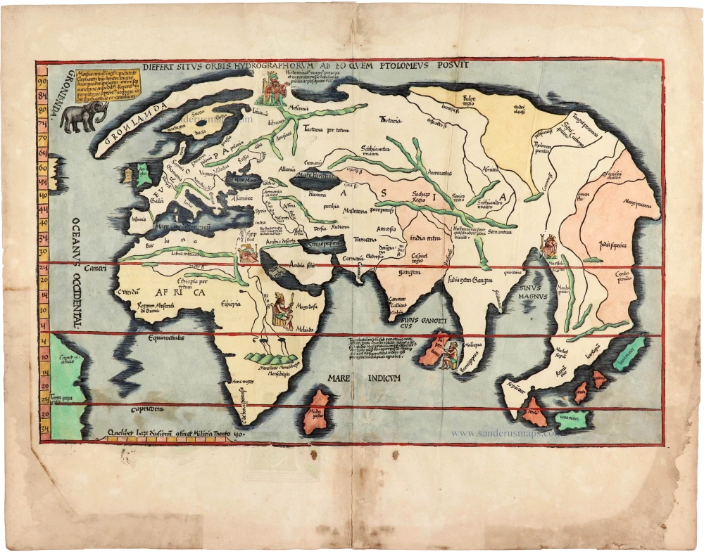
Diefert Situs Orbis Hydrographorum Ab Eo Quem Ptolomeus Posuit. 1525
Modern world map, by Lorenz Fries, after Martin Waldseemüller.
[Item number: 30661]