
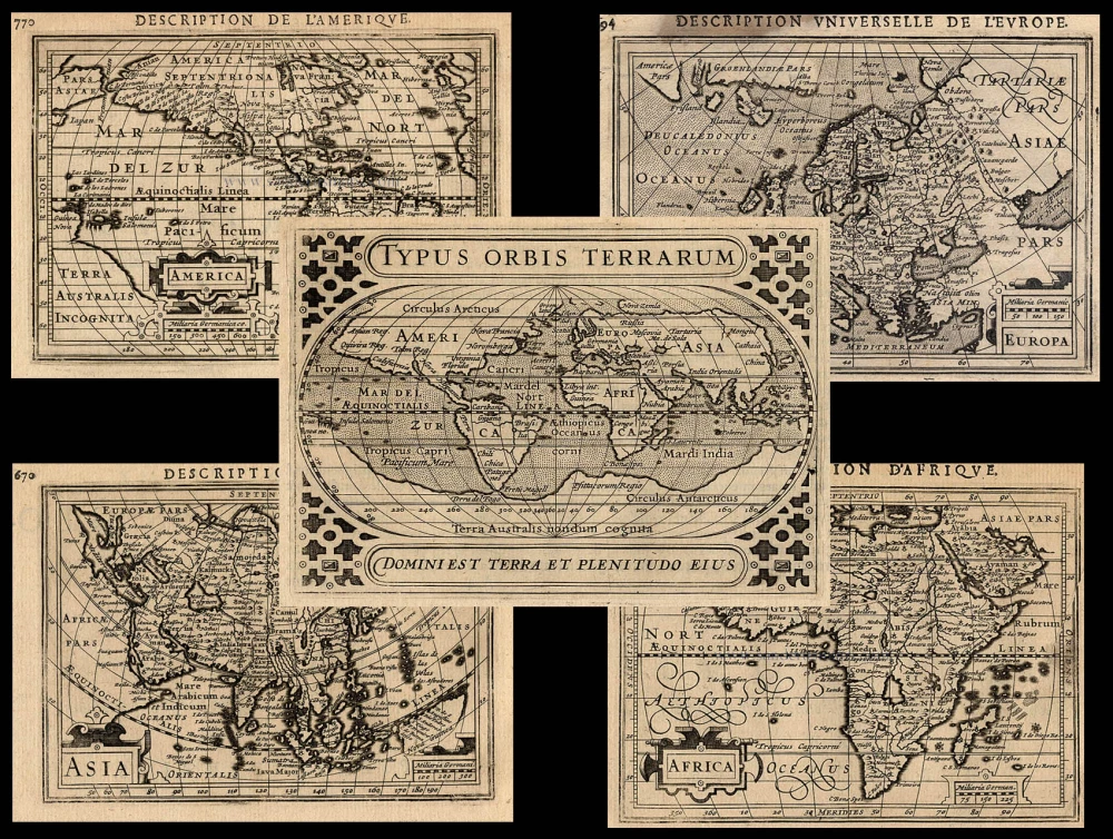
The world and the four continents by Gerard de Jode, 5 old, antique maps 1578

Heart-shaped world map, based on Ortelius' eight sheets world map of 1564, with in the lower corners a celestial and terrestrial globe. This map was first published in 1571 as a separate publication. The same map was used for the first edition of the Speculum in 1578 but with reworking of the border clouds and a new title.
There are three other states of this world map known: One with the titles of the oceans added and the words Tara Incognita across North America, one without the names of the Doetecum brothers which appears here in the left top corner and another one without the Cum privilegio in the title.
Map of EUROPE
Size: 33 x 44.5cm (12.9 x 17.4 inches)
Condition: Contemporary old coloured, some browning along centrefold.
Condition Rating: A
References: Van der Heijden (Europe), 33; Van der Krogt 3, 1000:32A; TNH Doet3, 561 II.
Map of ASIA, with a part of America (Alaska)
Size: 35 x 44.5cm (13.7 x 17.3 inches)
Condition: Contemporary old coloured, minor browning along centrefold.
Condition Rating: A
References: Van der Krogt 3, 8000:32A; TNH Doet3, 560.
Map of Central and South AMERICA, with two insets at the bottom: left a bird's eye view of the city of Cuzco and right a view of the city of Mexico
Cartographer: Diego Gutiérrez
Size: 37.5 x 46.5cm (14.5 x 18 inches)
Condition: Contemporary old coloured, excellent.
Condition Rating: A
References: Van der Krogt 3, 9800:32A; TNH Doet3, 558 II.
Map of AFRICA
First state of the first edition (without "cum privilegio").
Cartographer: Giacomo Gastaldi
Size: 34.5 x 48cm (13.3 x 18.6 inches)
Condition: Contemporary old coloured, excellent.
Condition Rating: A
References: Van der Krogt 3, 8600:32A; TNH Doet3, 559 I; Betz, 14.1.
Gerard and Cornelis de Jode
Gerard de Jode (Judaeus) (1508(?)-1591), a native of Nijmegen, began his career as a printer and engraver in Antwerp about 1550. He lived near the Bourse on the Catelijne Veste, or on "de Catte". He was in regular contact with Christoffel Plantin, to whom he sold many prints and maps. De Jode's business, which must have been a major one among Antwerp's many booksellers and printers, was represented at the Frankfurt fair, where de Jode bought maps that he later copied or re-sold. Most of the maps sold by De Jode have prototypes of Italian or German origin. Apart from his many separately published maps, Gerard de Jode is known for his atlas, Speculum Orbis Terrarum, published in 1578. Part of the engraving was done by himself, and part by brothers Jan and Lucas van Doetecum.
Gerard de Jode and Abraham Ortelius, who partly lived as map sellers, were competitors and only sometimes on good terms.
After the death of Gerard de Jode in 1591, the business was carried on by his widow, Pascale van Gelder and his son, Cornelis (1568-1600). More a publisher than an engraver, the latter reissued the Speculum in 1593, adding new maps and revising others.
Despite all its deficiencies, the Speculum must have had a good reputation. It is mentioned alongside Mercator's Atlas and Ortelius's Theatrum in Petrus Montanus's preface to the Germania Inferior of Pieter van den Keere.
Universi Orbis Seu Terreni Globi In Plano Effigies. [in set with] Europae Totius Orbis Partium Amoenissimae, Commoda Iam Recens Absolutaque Descriptio [and] Asiae Novissima Tabula [and] Americae Pruvi Aque Ita ut Postremum Detecta Traditur Recens Delineat
Item Number: 4030 Authenticity Guarantee
Category: Antique maps > World and Polar
Five antique maps: the world and the four continents by Gerard de Jode.
Copper engravings, engraved by Joannes and Lucas Van Doetecum.
Verso text: Latin
From: Speculum Orbis Terrae. Antwerp, G. De Jode, 1578. (Van der Krogt 3, 32:02)
WORLD map
Cartographer: A. Ortelius
Size: 33.5 x 52cm (13.1 x 20.3 inches)
Condition: Contemporary old coloured, some light spotting and age-toning.
Condition Rating: A
References: Shirley (World) 124; Van der Krogt 3, 0001:32A;TNH Doet3, 557 III.
Heart-shaped world map, based on Ortelius' eight sheets world map of 1564, with in the lower corners a celestial and terrestrial globe. This map was first published in 1571 as a separate publication. The same map was used for the first edition of the Speculum in 1578 but with reworking of the border clouds and a new title.
There are three other states of this world map known: One with the titles of the oceans added and the words Tara Incognita across North America, one without the names of the Doetecum brothers which appears here in the left top corner and another one without the Cum privilegio in the title.
Map of EUROPE
Size: 33 x 44.5cm (12.9 x 17.4 inches)
Condition: Contemporary old coloured, some browning along centrefold.
Condition Rating: A
References: Van der Heijden (Europe), 33; Van der Krogt 3, 1000:32A; TNH Doet3, 561 II.
Map of ASIA, with a part of America (Alaska)
Size: 35 x 44.5cm (13.7 x 17.3 inches)
Condition: Contemporary old coloured, minor browning along centrefold.
Condition Rating: A
References: Van der Krogt 3, 8000:32A; TNH Doet3, 560.
Map of Central and South AMERICA, with two insets at the bottom: left a bird's eye view of the city of Cuzco and right a view of the city of Mexico
Cartographer: Diego Gutiérrez
Size: 37.5 x 46.5cm (14.5 x 18 inches)
Condition: Contemporary old coloured, excellent.
Condition Rating: A
References: Van der Krogt 3, 9800:32A; TNH Doet3, 558 II.
Map of AFRICA
First state of the first edition (without "cum privilegio").
Cartographer: Giacomo Gastaldi
Size: 34.5 x 48cm (13.3 x 18.6 inches)
Condition: Contemporary old coloured, excellent.
Condition Rating: A
References: Van der Krogt 3, 8600:32A; TNH Doet3, 559 I; Betz, 14.1.
Gerard and Cornelis de Jode
Gerard de Jode (Judaeus) (1508(?)-1591), a native of Nijmegen, began his career as a printer and engraver in Antwerp about 1550. He lived near the Bourse on the Catelijne Veste, or on "de Catte". He was in regular contact with Christoffel Plantin, to whom he sold many prints and maps. De Jode's business, which must have been a major one among Antwerp's many booksellers and printers, was represented at the Frankfurt fair, where de Jode bought maps that he later copied or re-sold. Most of the maps sold by De Jode have prototypes of Italian or German origin. Apart from his many separately published maps, Gerard de Jode is known for his atlas, Speculum Orbis Terrarum, published in 1578. Part of the engraving was done by himself, and part by brothers Jan and Lucas van Doetecum.
Gerard de Jode and Abraham Ortelius, who partly lived as map sellers, were competitors and only sometimes on good terms.
After the death of Gerard de Jode in 1591, the business was carried on by his widow, Pascale van Gelder and his son, Cornelis (1568-1600). More a publisher than an engraver, the latter reissued the Speculum in 1593, adding new maps and revising others.
Despite all its deficiencies, the Speculum must have had a good reputation. It is mentioned alongside Mercator's Atlas and Ortelius's Theatrum in Petrus Montanus's preface to the Germania Inferior of Pieter van den Keere.
Related items
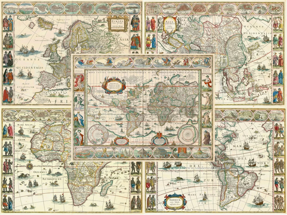
Typus Orbis Terrarum + Europa + Asia + Africa + America 1618
The World and Continents by Bertius P.
[Item number: 18172]
Superb condition
Nova Totius Terrarum Orbis Geographica ac Hydrographica. 1643-50
Willem Blaeu, set of 5 maps: World & continents.
[Item number: 24287]