
Châtelain Z. Atlas historique. 1708-1720. 1708-1720


The Châtelain Family
Zacharias Châtelain (1684-1743) was a bookseller and publisher of Amsterdam. He was succeeded by his sons Zacharias jr and Henry Abraham. The Châtelain family was best known for the historical atlas Atlas Historique, ou nouvelle introduction à l’histoire…, a major work of its time. It was an encyclopaedia in seven volumes, including geography as one of its main subjects. The atlas was published in Amsterdam in seven volumes in various editions with different imprints from 1705 to 1739. An anonym person (Mr. C***) compiled the work with compositions of text, maps, plates and chronological and genealogical tables by Gueudeville, except volume 7 where this task was taken over by H.P. Limiers.
The 1705 edition was published with the imprint “L’Honoré & Châtelain”. Later editions had the imprint : “les Frères Châtelain Libraires”, or “L’Honoré & Châtelain Libraires”.
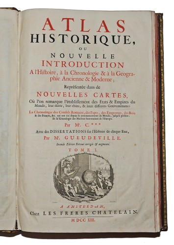
Atlas historique ou Nouvelle introduction à l'histoire, à la chronologie & à la Geographie ancienne & moderne; ...
Item Number: 24533 Authenticity Guarantee
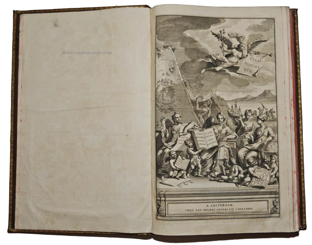
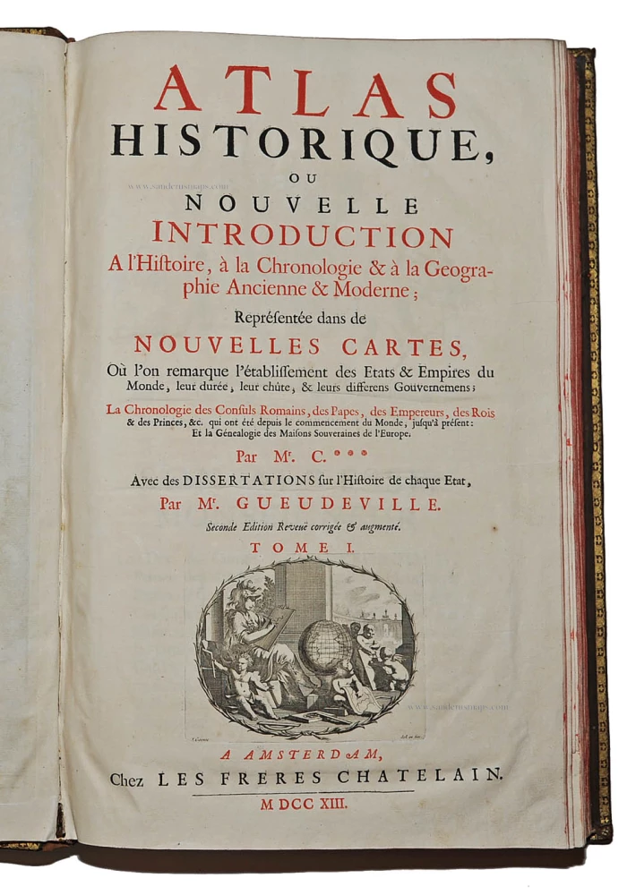
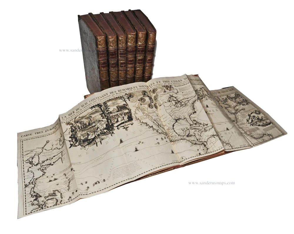
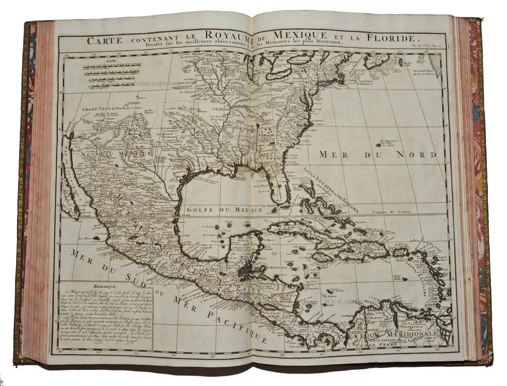
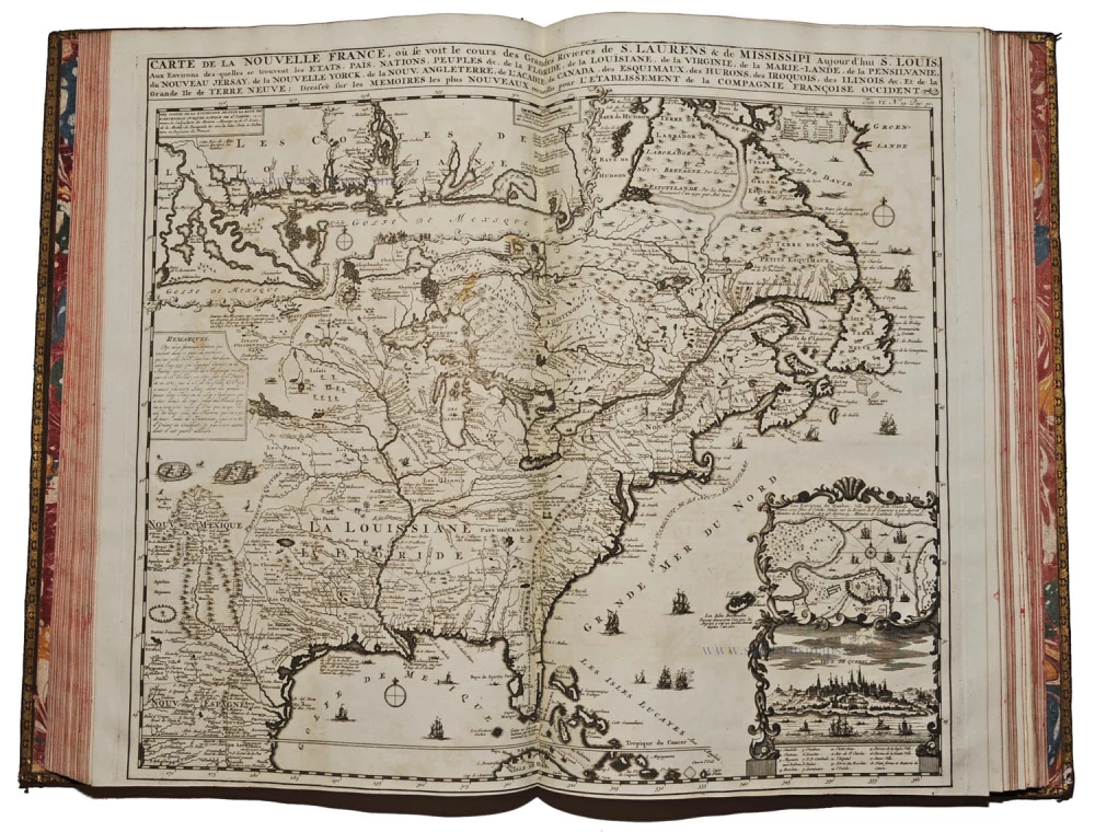
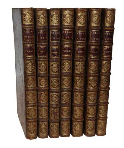
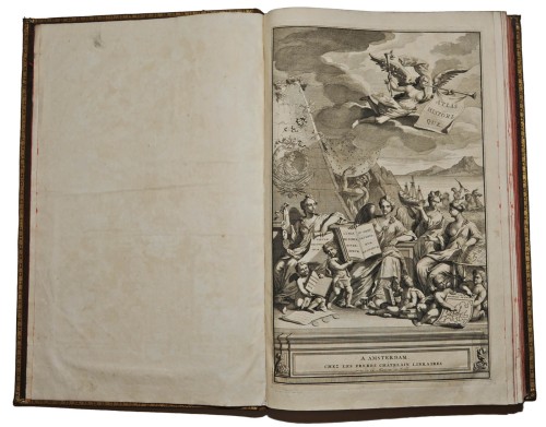
Châtelain Zacharias Atlas historique ou Nouvelle introduction à l'histoire, à la chronologie & à la Geographie ancienne & moderne; Representée dans de nouvelles cartes, où l'on remarque l'établissement des Etats & Empires du monde, leur durée, leur chûte, & leurs differens gouvernements. Amsterdam, Les Frères Châtelain, puis l'Honoré & Châtelain, 1708-1720. 7 volumes folio (440x280mm), contemporary calf, spines gilt, red edges. Nice condition. Volume 1 second edition, volumes 2-7 first edition. Printed titles in red and black with engraved vignettes, and 283 plates (many large folding) including 100 maps, also views, natural history subjects, elaborate genealogical tables, 4 printed tables in volume 7.
Sabin (America), 29141; Koeman II, pp. 33-38
A nice example of this encyclopaedic historical atlas. This atlas was intended for the general public, fascinated in the early eighteenth century by the recently conquered colonies and the new discoveries. Distant countries, such as the Americas, Africa, the Middle East, Mongolia, China, Japan, Indonesia, etc., take an important place in this work. Other sections deal with the history of the european countries, genealogy and heraldry. Volume 6 relates mostly to the Americas and contains a fine dark copy (bound in two large sheets, joined) of the Carte très curieuse de la Mer du Sud, depicting the history of discovery in the western hemisphere from the time of Columbus to the French explorations in North America in the late seventeenth century. In addition to the maps, many of which are based on Guillaume de l'Isle, the plates are after the best travel accounts of the period, such as those of Dapper, Chardin, de Bruyn, Le Hay and other.
The atlas was published by L'Honoré & Châtelain in seven volumes in various editions from 1705 to 1739. It was compiled by Mr. C*** (anon.) with 'Dissertations', i.e. compositions of text, maps, plates and chronological and genealogical tables by Mr. Gueudeville, except volume VII where this task was taken over by H.P. Limiers.
In each volume, the maps, plates and tables are numbered consecutively.
In this set, the volumes are dated 1: 1713; 2 & 3: 1708; 4: 1714; 5 & 6: 1719; 7: 1720.
The Châtelain Family
Zacharias Châtelain (1684-1743) was a bookseller and publisher of Amsterdam. He was succeeded by his sons Zacharias jr and Henry Abraham. The Châtelain family was best known for the historical atlas Atlas Historique, ou nouvelle introduction à l’histoire…, a major work of its time. It was an encyclopaedia in seven volumes, including geography as one of its main subjects. The atlas was published in Amsterdam in seven volumes in various editions with different imprints from 1705 to 1739. An anonym person (Mr. C***) compiled the work with compositions of text, maps, plates and chronological and genealogical tables by Gueudeville, except volume 7 where this task was taken over by H.P. Limiers.
The 1705 edition was published with the imprint “L’Honoré & Châtelain”. Later editions had the imprint : “les Frères Châtelain Libraires”, or “L’Honoré & Châtelain Libraires”.