
Atlas Russicus [Atlas Rossiiskoi.] by Joseph-Nicolas De L'Isle. The first atlas devoted solely to Russia.
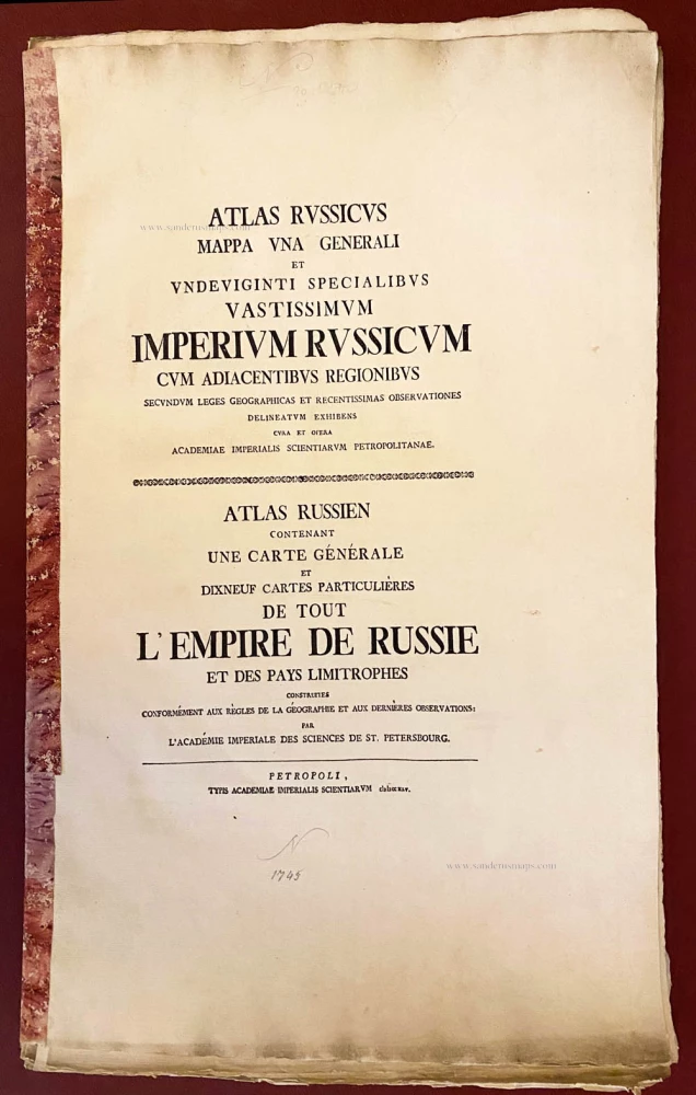

'This atlas marks the summit of Russian cartography at the end of the first half of the 18th century' (Svodnyi Katalog). 'As the most complete representation of Russia to date, the atlas gave the European public a knowledge of the vastness and complexity of the Russian Empire' (Whittaker). In 1729, four years after accepting Peter the Great's invitation to come to St. Petersburg, De L’ Isle suggested an atlas of the entire Russian empire (on a single scale) on 16 sheets. In 1735 the Academy gave its backing, and measurements from a number of expeditions were coordinated to produce the present work. The text was issued in Russian, German, Latin and French.
Joseph Nicolas De L'Isle (1688-1768)
J. N. De L'Isle, the younger brother of Guillaume, studied with Cassini as an astronomer and cartographer. He was invited by Peter the Great to survey the vast empire of Imperial Russia. Initially accompanied by his step-brother Louis, in 1726, the two Frenchmen journeyed to Russia ( now under the reign of Empress Catherine I) to start their surveys.
The first atlas of the Russian empire with 27 maps was assembled in 1734 (not complete yet) by Ivan Kirilov, the Russian director of the Cartographic Office, before the French party had fully completed their surveys. Kirilov died in 1737, and in 1745 the De L'Isle's Atlas Russicus (or Atlas Russiiskoi) was published by a special geographical department within the Academy of Sciences at St. Petersburg.
Atlas Russicus, Mappa una Generali et Undeviginti Specialibus Vastissimum Imperium Russicum ... - contenant une carte générale et dixneuf cartes particulières de tout l'empire de Russie et des Pays Limitrophes. [Atlas Rossiiskoi.]
Item Number: 29938 Authenticity Guarantee
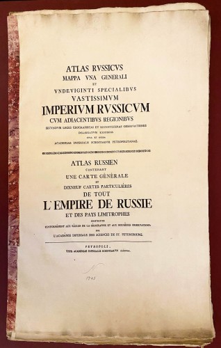
Joseph-Nicolas De L'Isle. Atlas Russicus, Mappa una Generali et Undeviginti Specialibus Vastissimum Imperium Russicum cum Adiacentibus Regionibus ... - Atlas Russien contenant une carte générale et dixneuf cartes particulières de tout l'Empire de Russie et des Pays Limitrophes. ... [Atlas Rossiiskoi.] St. Peterburg: Imperial Academy of Sciences, 1745. folio (565 x 245 mm).
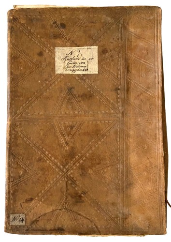
Title and text in parallel Latin and French. Engraved key, general map on two sheets as issued and 19 double-page regional maps. The gathering of text stitched and with a marbled paper spine, with the uncut and unbound sheets of maps together in an 18th-century goatskin portfolio, sides tooled in blind with a large diamond pattern and flower tools, upper side with paper labels, in German manuscript (some wear, one tie lacking, another with loss).
The maps are uncut, and unbound in bright state and with wide margins.
'This atlas marks the summit of Russian cartography at the end of the first half of the 18th century' (Svodnyi Katalog). 'As the most complete representation of Russia to date, the atlas gave the European public a knowledge of the vastness and complexity of the Russian Empire' (Whittaker). In 1729, four years after accepting Peter the Great's invitation to come to St. Petersburg, De L’ Isle suggested an atlas of the entire Russian empire (on a single scale) on 16 sheets. In 1735 the Academy gave its backing, and measurements from a number of expeditions were coordinated to produce the present work. The text was issued in Russian, German, Latin and French.
Joseph Nicolas De L'Isle (1688-1768)
J. N. De L'Isle, the younger brother of Guillaume, studied with Cassini as an astronomer and cartographer. He was invited by Peter the Great to survey the vast empire of Imperial Russia. Initially accompanied by his step-brother Louis, in 1726, the two Frenchmen journeyed to Russia ( now under the reign of Empress Catherine I) to start their surveys.
The first atlas of the Russian empire with 27 maps was assembled in 1734 (not complete yet) by Ivan Kirilov, the Russian director of the Cartographic Office, before the French party had fully completed their surveys. Kirilov died in 1737, and in 1745 the De L'Isle's Atlas Russicus (or Atlas Russiiskoi) was published by a special geographical department within the Academy of Sciences at St. Petersburg.
Related items
Carte Nouvelle de Moscovie Represente la partie Septentrionale. [In set with:] Partie Meridionale de Moscovie. 1792
Russia by G. Delisle, published by J.B. Elwe.
[Item number: 30173]

La Russie Blanche ou Moscovie Divisee Suivant l'Estendue des Royaumes, Duchés, Principautes, Provinces et Peuples qui sont Presentement sous la Domination du Czar de la Russe Cognu sous le Nom de Grand Duc de Moscovie. 1692
Russia by N. Sanson, so-called published by Hubert Jaillot. (Pirated edition by Pierre Mortier).
[Item number: 31176]
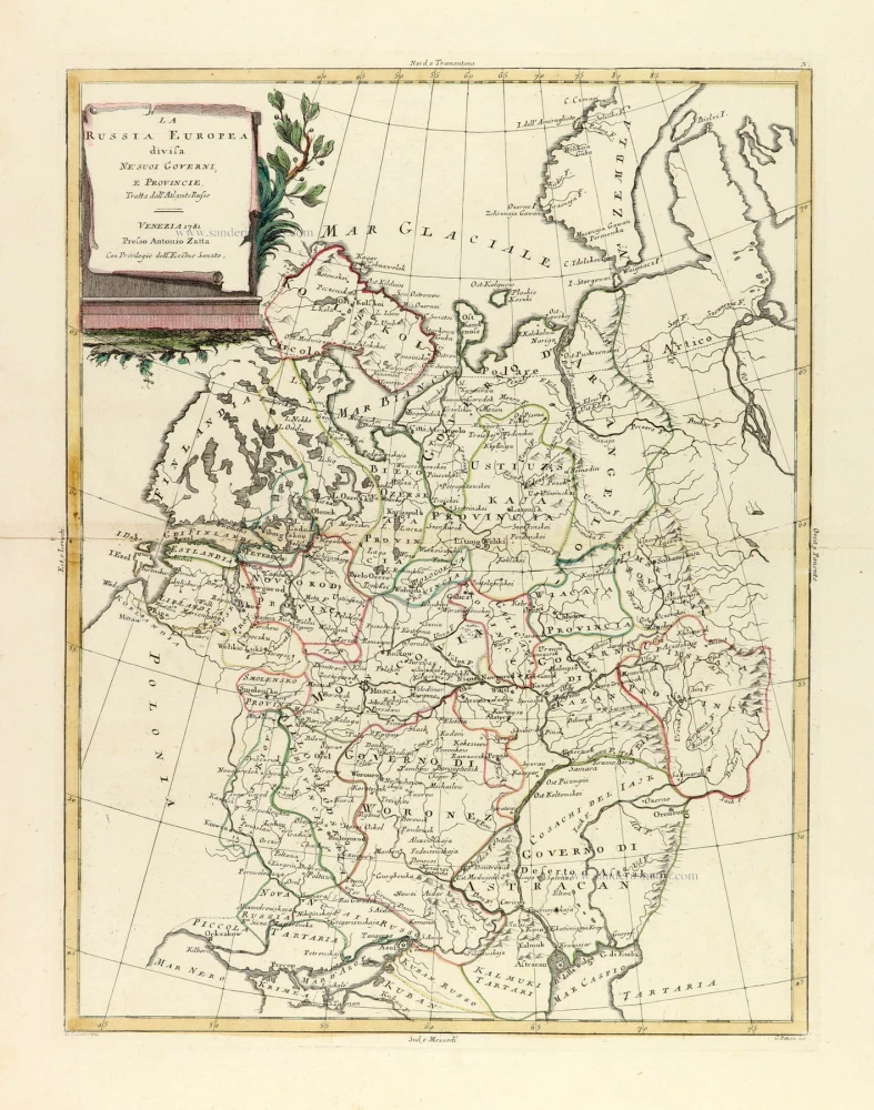
La Russia Europea divisa ne' suoi Governi, e Provincie. 1779-1785
Russia (European), by Antonio Zatta.
[Item number: 32136]

Generalis totius Imperii Moscovitici Novissima Tabula Magnam Orbis terrarum pertem à Polo Articousq ad mare Iaponicum, et Chinae Septentrionalis confinia exhibens cum via Czaricae nuper legationis ex urbe Moscua per universam Tartariam ad magnu[m] Chinae Imperatorem. c. 1720
Russia, by J.B. Homann.
[Item number: 32194]

Tabula Russiae ex autographo, quod delineandum curavit Foedor filius Tzaris Boris desumta; . . . 1643
Russia by Willem & Joan Blaeu.
[Item number: 32266]

Russia Bianca o Moscovia 1687
Russia, by Giacomo Cantelli da Vignola, published by Giovanni de Rossi.
[Item number: 32918]
new