
Superbly coloured and gold heightened example of Ortelius' THEATRUM, signed by the colourist. 1592


This is the first edition of the Theatrum with a clear division into three parts: (1) the atlas itself, (2) the Parergon, and (3) the Nomenclator. The Parergon had, for the first time, its own title page.
Printing started in July 1590 but lasted longer than expected because of a paper shortage. The Nomenclator was printed between February and May 1591 (the title page was dated 1591). The rest of the Theatrum was printed in the summer of 1591
The first copies were delivered on 6 August 1591. The colophon, however, has the date 1592.
The Plantin Press printed 525 copies of this edition.
Abraham Ortelius (1527-1598)
The maker of the 'first atlas', the Theatrum Orbis Terrarum (1570), was born on 4 April 1527 into an old Antwerp family. He learned Latin and studied Greek and mathematics.
Abraham and his sisters, Anne and Elizabeth, took up map colouring. Ortelius was admitted to the Guild of St. Luke as an "illuminator of maps." In addition to colouring maps, Ortelius was a dealer in antiques, coins, maps, and books, and the book and map trade gradually became his primary occupation.
Business went well because his means allowed him to amass an extensive collection of medals, coins, and antiques, as well as a library of many volumes. In addition, he travelled extensively, visited Italy and France, made contacts with scholars and editors everywhere, and maintained extensive correspondence with them.
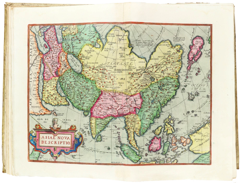
In 1564, he published his first map, a large and ambitious world wall map. The inspiration for this map may well have been Gastaldi's large world map. In 1565, he published a map of Egypt and a map of the Holy Land; a large map of Asia followed.
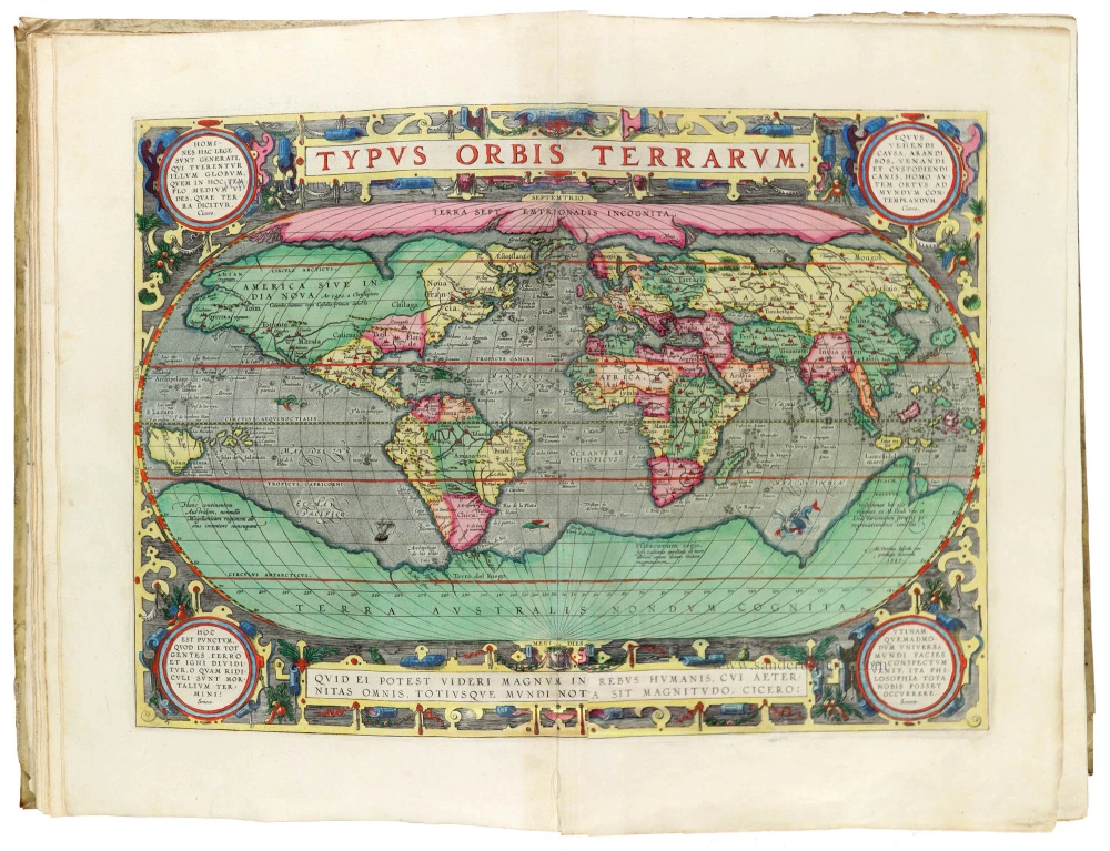
In 1568, the production of individual maps for his atlas Theatrum Orbis Terrarum was already in full swing. He completed the atlas in 1569, and in May 1570, it was available for sale. It was one of the most expensive books ever published.
This first edition contained seventy maps on fifty-three sheets. Franciscus Hogenberg engraved the maps.
Later editions included Additamenta (additions), resulting in Ortelius' historical atlas, the Parergon, which is mainly bound together with the atlas. The Parergon can be considered a truly original work by Ortelius, who drew the maps based on his research.
The importance of the Theatrum Orbis Terrarum for geographical knowledge in the last quarter of the sixteenth century is difficult to overemphasise. Nothing was like it until Mercator's atlas appeared twenty-five years later. Demand for the Theatrum was remarkable. Some 24 editions appeared during Ortelius's lifetime, and another 10 after he died in 1598. Editions were published in Dutch, German, French, Spanish, English, and Italian. The number of map sheets grew from 53 in 1570 to 167 in the last edition in 1612.
In 1577, engraver Philip Galle and poet-translator Pieter Heyns published the first pocket-sized edition of the Theatrum, the Epitome. The work was trendy. Over thirty editions of this Epitome were published in different languages.
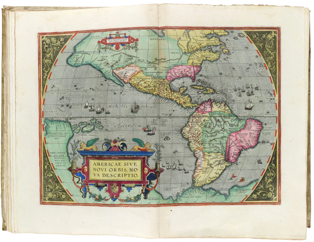
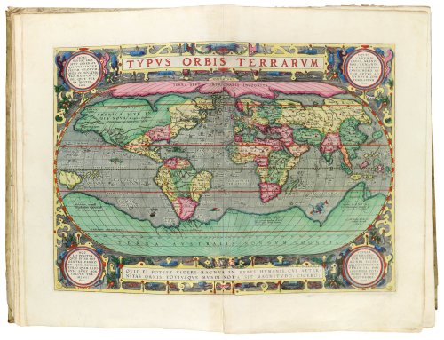
Ortelius is also remembered for an early idea resembling continental drift: he suggested that the Americas, Europe, and Africa may once have been joined together before separating over time. His work helped shape the development of modern geography and mapmaking.
Theatrum Orbis Terrarum. 1592.
Item Number: 29300 Authenticity Guarantee
Ortelius A. Theatrum Orbis Terrarum. Opus nunc ab ipso Auctore recognitum multisque locis castigatum, & quamplurimis novis Tabulis atque Commentarijs auctum. Antwerp, Chr. Plantin, 1592. Three parts in one vol.
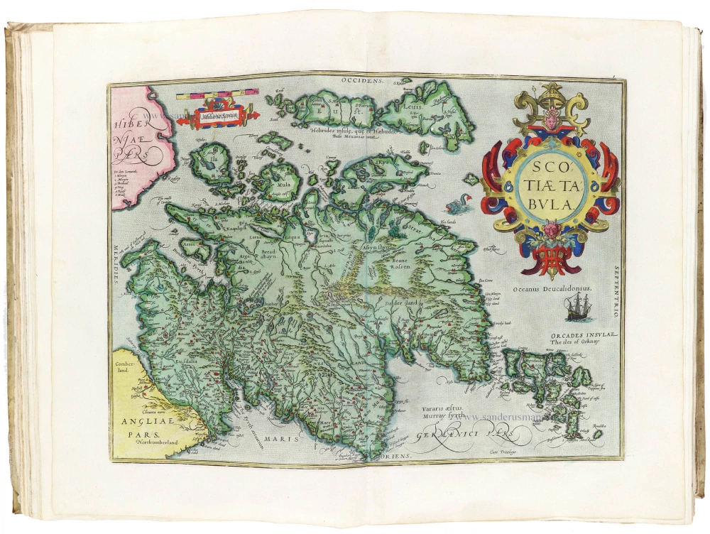
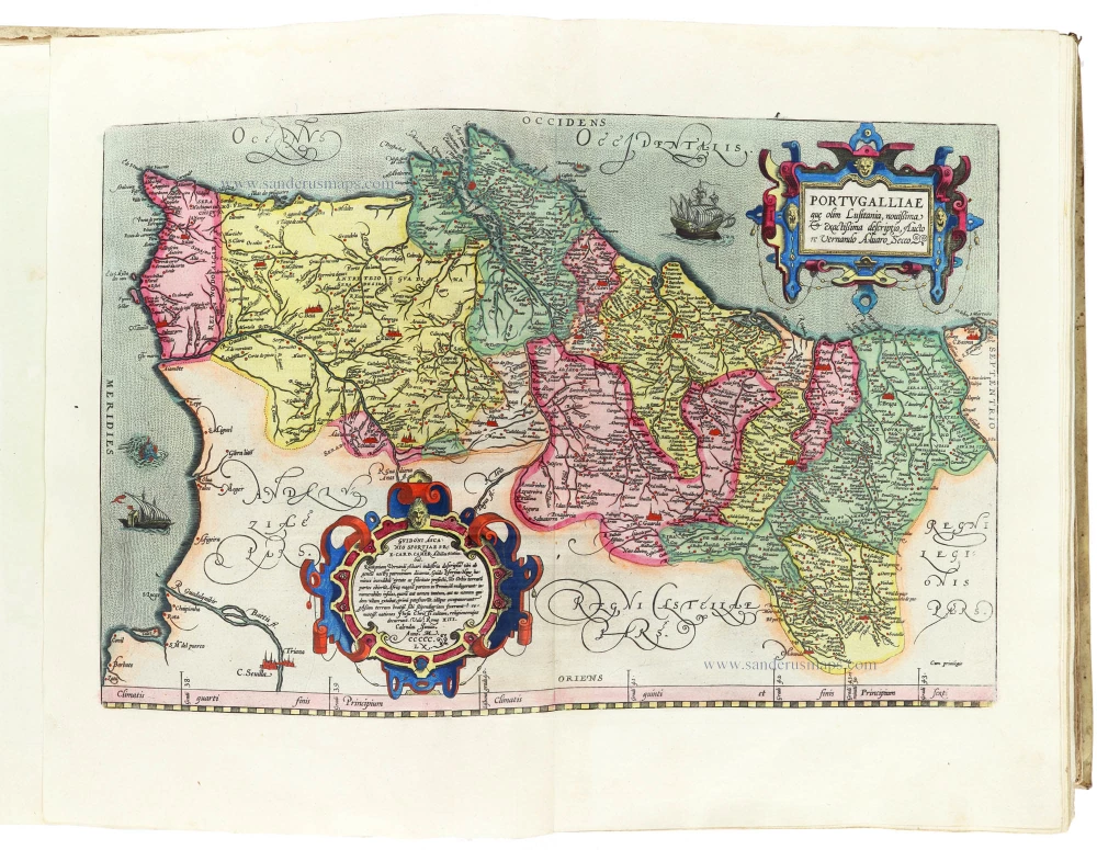
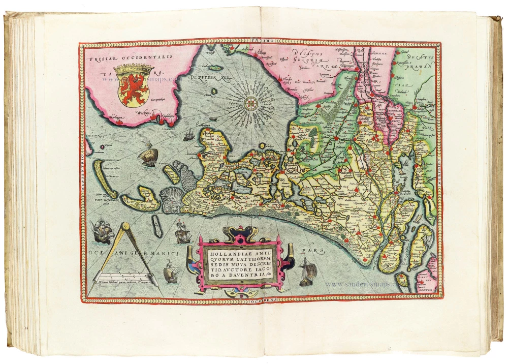
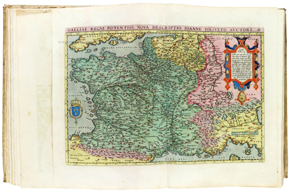
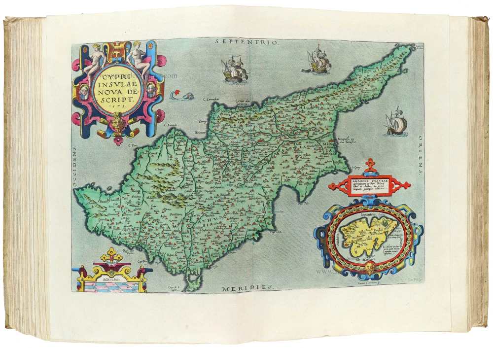
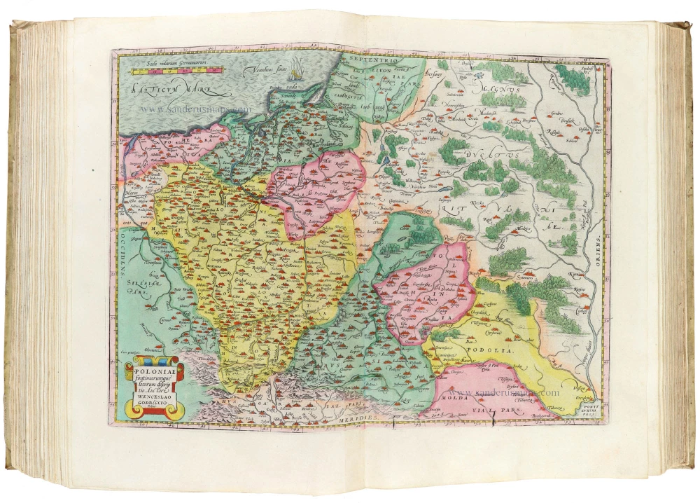
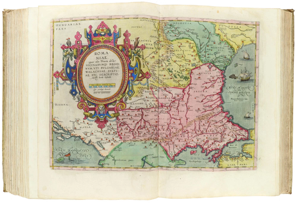
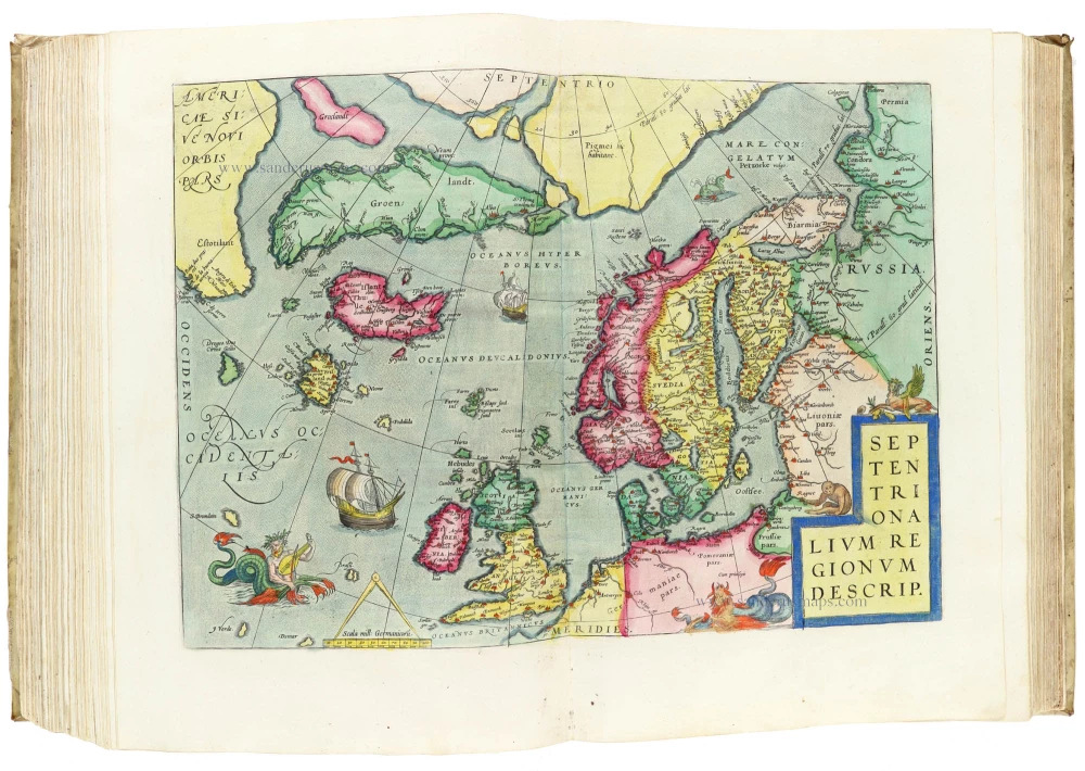
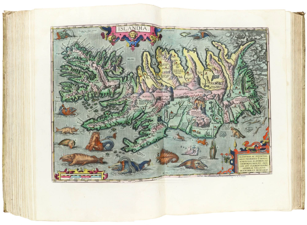
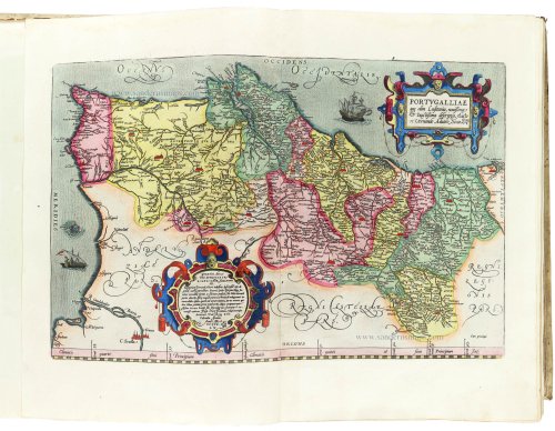
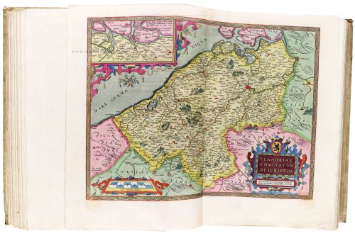
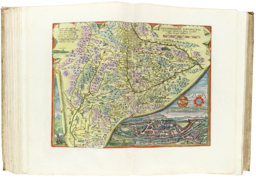
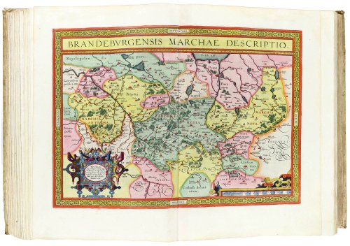
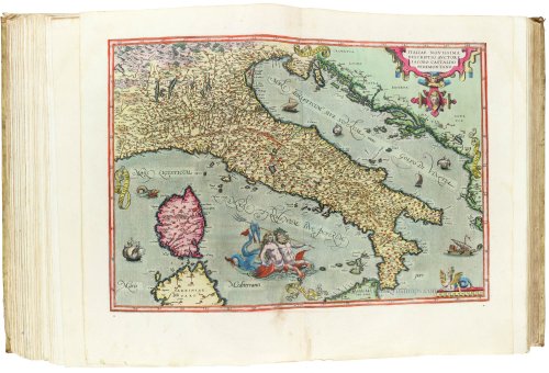
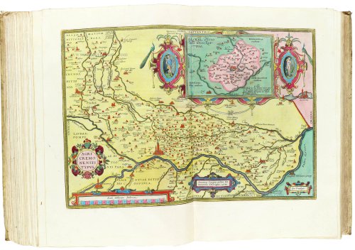
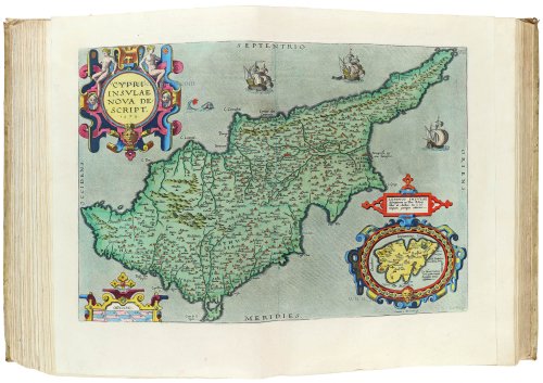
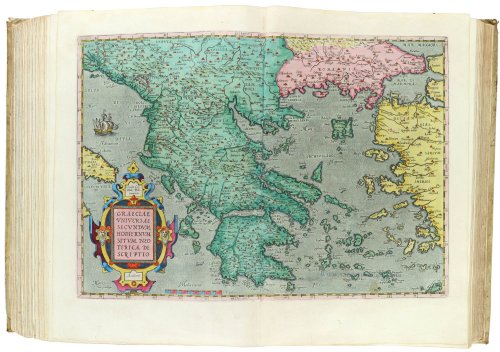
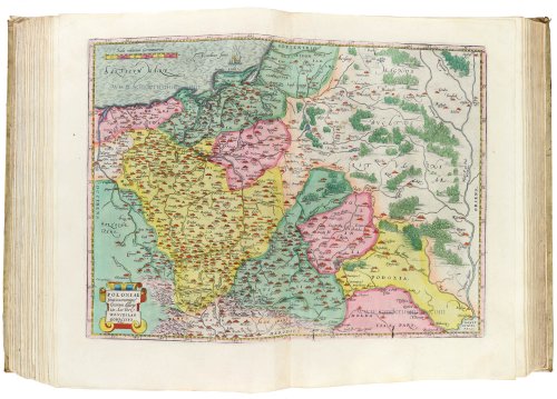
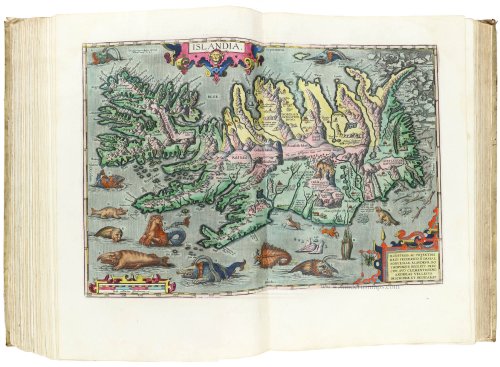
Folio, 46 x 35 cm, Latin text. Engraved allegorical title, engraved portrait and 134 double-page maps, all finely coloured and heightened in gold by a contemporary hand, with a monogram of the colourist (HVS) in gold on the title page. HVS is probably Herman Van Swaenevelt (1600-1655), a Dutch painter.
Contemporary Dutch vellum binding.
Beautiful atlas printed on large, heavy paper in superb luxe colouring.
Origin: from a German noble family.
Ref.: Van der Krogt III.A 31:041
This is the first edition of the Theatrum with a clear division into three parts: (1) the atlas itself, (2) the Parergon, and (3) the Nomenclator. The Parergon had, for the first time, its own title page.
Printing started in July 1590 but lasted longer than expected because of a paper shortage. The Nomenclator was printed between February and May 1591 (the title page was dated 1591). The rest of the Theatrum was printed in the summer of 1591
The first copies were delivered on 6 August 1591. The colophon, however, has the date 1592.
The Plantin Press printed 525 copies of this edition.
Abraham Ortelius (1527-1598)
The maker of the 'first atlas', the Theatrum Orbis Terrarum (1570), was born on 4 April 1527 into an old Antwerp family. He learned Latin and studied Greek and mathematics.
Abraham and his sisters, Anne and Elizabeth, took up map colouring. Ortelius was admitted to the Guild of St. Luke as an "illuminator of maps." In addition to colouring maps, Ortelius was a dealer in antiques, coins, maps, and books, and the book and map trade gradually became his primary occupation.
Business went well because his means allowed him to amass an extensive collection of medals, coins, and antiques, as well as a library of many volumes. In addition, he travelled extensively, visited Italy and France, made contacts with scholars and editors everywhere, and maintained extensive correspondence with them.
In 1564, he published his first map, a large and ambitious world wall map. The inspiration for this map may well have been Gastaldi's large world map. In 1565, he published a map of Egypt and a map of the Holy Land; a large map of Asia followed.
In 1568, the production of individual maps for his atlas Theatrum Orbis Terrarum was already in full swing. He completed the atlas in 1569, and in May 1570, it was available for sale. It was one of the most expensive books ever published.
This first edition contained seventy maps on fifty-three sheets. Franciscus Hogenberg engraved the maps.
Later editions included Additamenta (additions), resulting in Ortelius' historical atlas, the Parergon, which is mainly bound together with the atlas. The Parergon can be considered a truly original work by Ortelius, who drew the maps based on his research.
The importance of the Theatrum Orbis Terrarum for geographical knowledge in the last quarter of the sixteenth century is difficult to overemphasise. Nothing was like it until Mercator's atlas appeared twenty-five years later. Demand for the Theatrum was remarkable. Some 24 editions appeared during Ortelius's lifetime, and another 10 after he died in 1598. Editions were published in Dutch, German, French, Spanish, English, and Italian. The number of map sheets grew from 53 in 1570 to 167 in the last edition in 1612.
In 1577, engraver Philip Galle and poet-translator Pieter Heyns published the first pocket-sized edition of the Theatrum, the Epitome. The work was trendy. Over thirty editions of this Epitome were published in different languages.
Ortelius is also remembered for an early idea resembling continental drift: he suggested that the Americas, Europe, and Africa may once have been joined together before separating over time. His work helped shape the development of modern geography and mapmaking.