
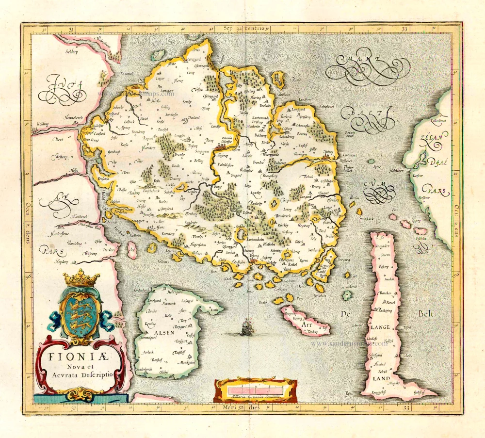
Denmark - Fyn by J. Janssonius, published by Moses Pitt and J. Janssonius-Waesberge. 1680
Moses Pitt (1641-1697)
Moses Pitt, a London based map publisher and bookseller, planned a 12-volume world atlas based on Janssonius’ Atlas Maior. He entered into a partnership with Johann van Waesbergen, one of the heirs of Johannes Janssonius, and Steven Swart. Both publishers had versions with their own imprint. Only four volumes were issued. The undertaking ruined him, and he was imprisoned for two years for debt.
The maps are generally printed from reworked plates of Janssonius. The imprint of Janssonius van Waesbergen and Pitt is added and, to facilitate finding places with the index, the grid of parallels and meridians is added. In all probability, the maps were printed in Amsterdam and shipped to Oxford to be bound with the text.
The Janssonius Family
Joannes Janssonius (Arnhem, 1588-1664), son of the Arnhem publisher Jan Janssen, married Elisabeth Hondius, daughter of Jodocus Hondius, in Amsterdam in 1612. After his marriage, he settled down in this town as a bookseller and publisher of cartographic material. In 1618 he established himself in Amsterdam next door to Blaeu’s book shop. He entered into serious competition with Willem Jansz. Blaeu when copying Blaeu’s Licht der Zeevaert after the expiration of the privilege in 1620. His activities not only concerned the publication of atlases and books, but also of single maps and an extensive book trade with branches in Frankfurt, Danzig, Stockholm, Copenhagen, Berlin, Koningsbergen, Geneva, and Lyon. In 1631 he began publishing atlases together with Henricus Hondius.
In the early 1640s Henricus Hondius left the atlas publishing business completely to Janssonius. Competition with Joan Blaeu, Willem’s son and successor, in atlas production prompted Janssonius to enlarge his Atlas Novus finally into a work of six volumes, into which a sea atlas and an atlas of the Old World were inserted. Other atlases published by Janssonius are Mercator’s Atlas Minor, Hornius’s historical atlas (1652), the townbooks in eight volumes (1657), Cellarius’s Atlas Coelestis and several sea atlases and pilot guides.
After the death of Joannes Janssonius, the shop and publishing firm were continued by the heirs under the direction of Johannes van Waesbergen (c. 1616-1681), son-in-law of Joannes Janssonius. Van Waesbergen added the name of Janssonius to his own.
In 1676, Joannes Janssonius’s heirs sold by auction “all the remaining Atlases in Latin, French, High and Low German, as well as the Stedeboecken in Latin, in 8 volumes, bound and unbound, maps, plates belonging to the Atlas and Stedeboecken.” The copperplates from Janssonius’s atlases were afterwards sold to Schenk and Valck.
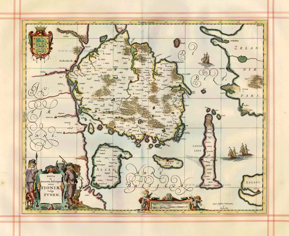
Nova et Accurata descriptio totius Fionae vulgo Funen.
Item Number: 1806 Authenticity Guarantee
Category: Antique maps > Europe > Northern Europe
Denmark - Fyn by J. Janssonius, published by Moses Pitt and J. Janssonius-Waesberge.
Title: Nova et Accurata descriptio totius Fionae vulgo Funen.
Apud Janssonio-Waesbergios, et Mosem Pitt.
Date of the first edition: 1644-58.
Date of this map: 1680.
Copper engraving, printed on paper.
Image size: 405 x 510mm (15.94 x 20.08 inches).
Sheet size: 585 x 665mm (23.03 x 26.18 inches).
Verso: Blank.
Condition: Hand coloured, on large, heavy paper, ruled in red, excellent.
Condition Rating: A+.
From: The English Atlas. Oxford, Moses Pitt, 1680. (Van der Krogt 1, 451)
Moses Pitt (1641-1697)
Moses Pitt, a London based map publisher and bookseller, planned a 12-volume world atlas based on Janssonius’ Atlas Maior. He entered into a partnership with Johann van Waesbergen, one of the heirs of Johannes Janssonius, and Steven Swart. Both publishers had versions with their own imprint. Only four volumes were issued. The undertaking ruined him, and he was imprisoned for two years for debt.
The maps are generally printed from reworked plates of Janssonius. The imprint of Janssonius van Waesbergen and Pitt is added and, to facilitate finding places with the index, the grid of parallels and meridians is added. In all probability, the maps were printed in Amsterdam and shipped to Oxford to be bound with the text.
The Janssonius Family
Joannes Janssonius (Arnhem, 1588-1664), son of the Arnhem publisher Jan Janssen, married Elisabeth Hondius, daughter of Jodocus Hondius, in Amsterdam in 1612. After his marriage, he settled down in this town as a bookseller and publisher of cartographic material. In 1618 he established himself in Amsterdam next door to Blaeu’s book shop. He entered into serious competition with Willem Jansz. Blaeu when copying Blaeu’s Licht der Zeevaert after the expiration of the privilege in 1620. His activities not only concerned the publication of atlases and books, but also of single maps and an extensive book trade with branches in Frankfurt, Danzig, Stockholm, Copenhagen, Berlin, Koningsbergen, Geneva, and Lyon. In 1631 he began publishing atlases together with Henricus Hondius.
In the early 1640s Henricus Hondius left the atlas publishing business completely to Janssonius. Competition with Joan Blaeu, Willem’s son and successor, in atlas production prompted Janssonius to enlarge his Atlas Novus finally into a work of six volumes, into which a sea atlas and an atlas of the Old World were inserted. Other atlases published by Janssonius are Mercator’s Atlas Minor, Hornius’s historical atlas (1652), the townbooks in eight volumes (1657), Cellarius’s Atlas Coelestis and several sea atlases and pilot guides.
After the death of Joannes Janssonius, the shop and publishing firm were continued by the heirs under the direction of Johannes van Waesbergen (c. 1616-1681), son-in-law of Joannes Janssonius. Van Waesbergen added the name of Janssonius to his own.
In 1676, Joannes Janssonius’s heirs sold by auction “all the remaining Atlases in Latin, French, High and Low German, as well as the Stedeboecken in Latin, in 8 volumes, bound and unbound, maps, plates belonging to the Atlas and Stedeboecken.” The copperplates from Janssonius’s atlases were afterwards sold to Schenk and Valck.
Related items
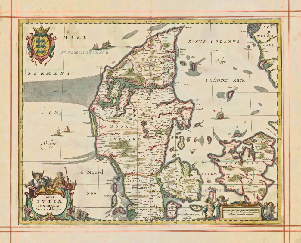
Totius Iutiae Generalis Accurata delineatio. 1680
Denmark - Jylland, by J. Janssonius, published by Moses Pitt and J. Janssonius-Waesberge.
[Item number: 1337]
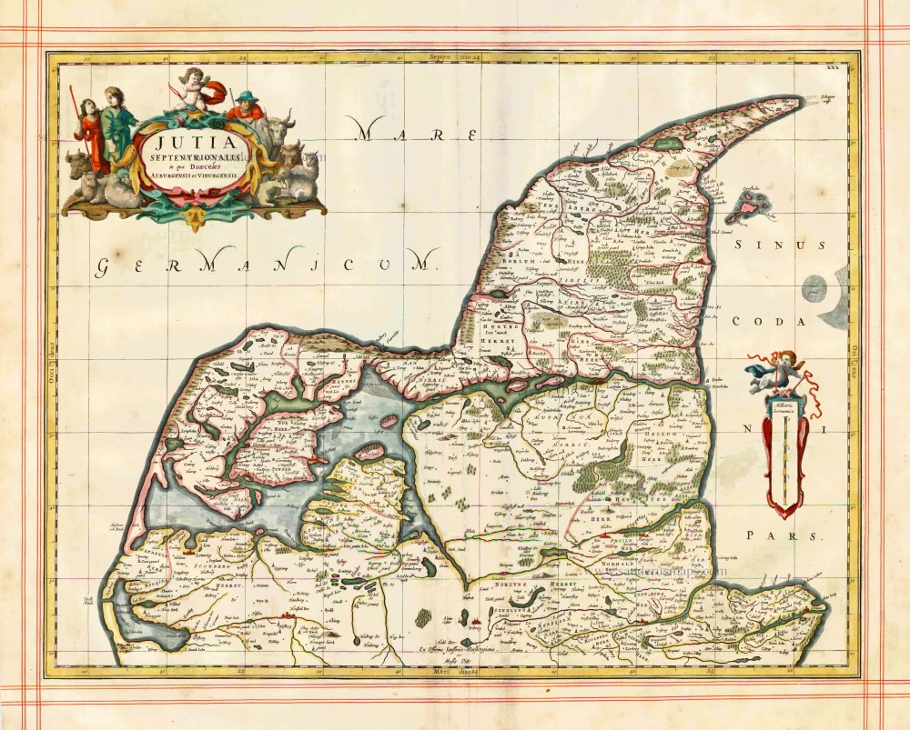
Iutia Septentrionalis, in qua Dioeceses Alburgensis et Viburgensis 1680
Denmark - Jylland (North) by J. Janssonius, published by Moses Pitt and J. Janssonius-Waesberge.
[Item number: 1353]
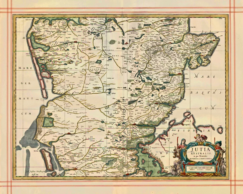
Jutia Australis, in qua Dioecesis Ripensis et Arhusiensis. 1680
Jutia Australis, in qua Dioecesis Ripensis et Arhusiensis. - Janssonius J. - Pitt Moses, 1680.
[Item number: 1373]
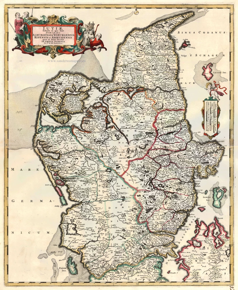
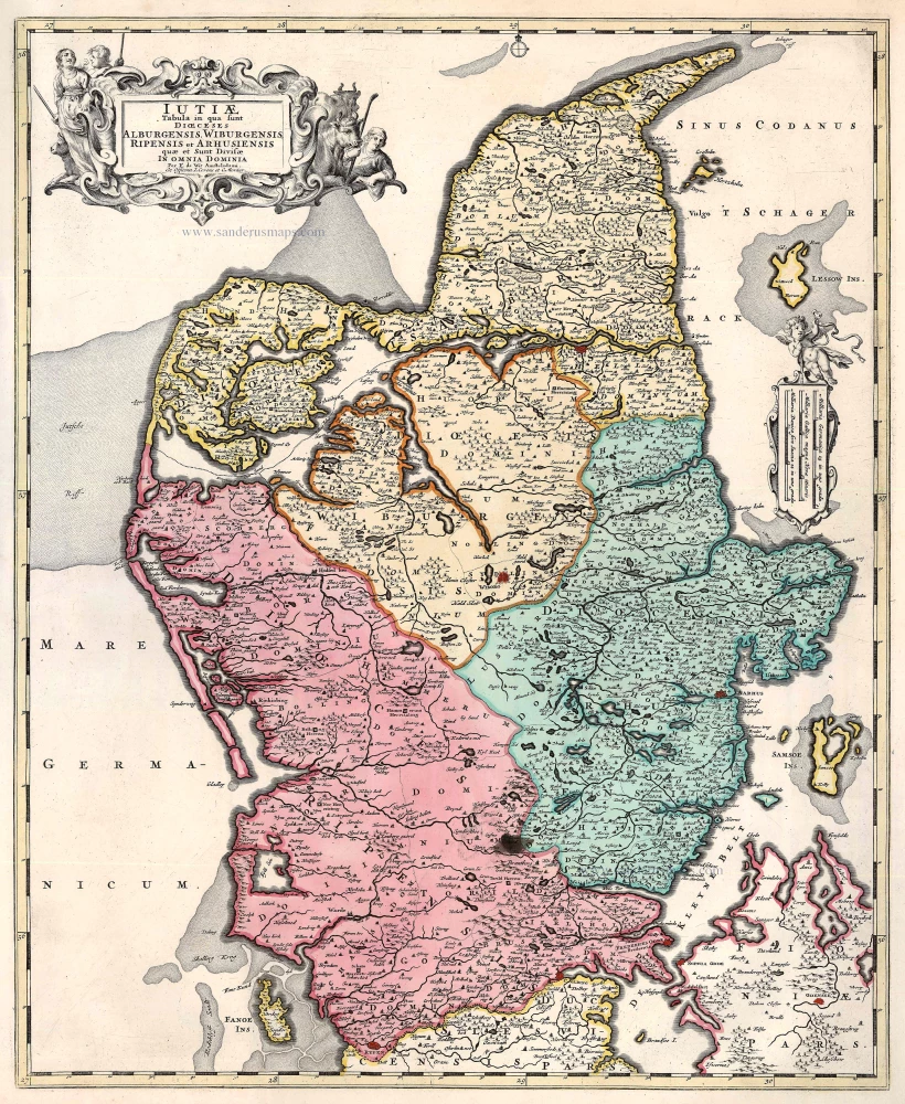
Iutiae Tabula in qua sunt Dioecesis Alburgensis, Wiburgensis, Ripensis et Arhusiensis quae et sunt divisae in Omnia Dominia. c. 1680
Denmark - Jutland, by F. De Wit.
[Item number: 2669]
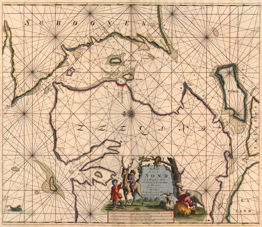
Pascaart om Door de Sond en de Droogen te Seylen Strekkende van Kol tot Meun 1697-1709
Denmark - Sjaelland, by J. Van Keulen Johannes.
[Item number: 4495]
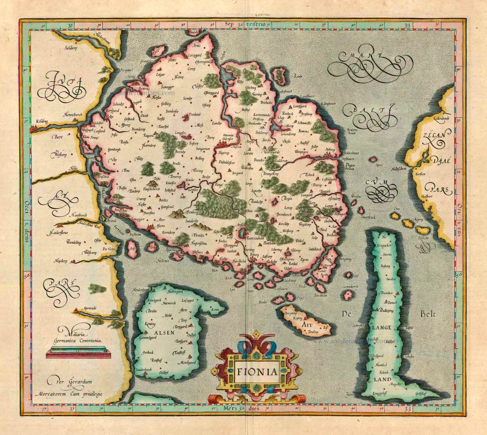
Fionia 1623
Denmark - Fyn, by Gerard Mercator.
[Item number: 12559]
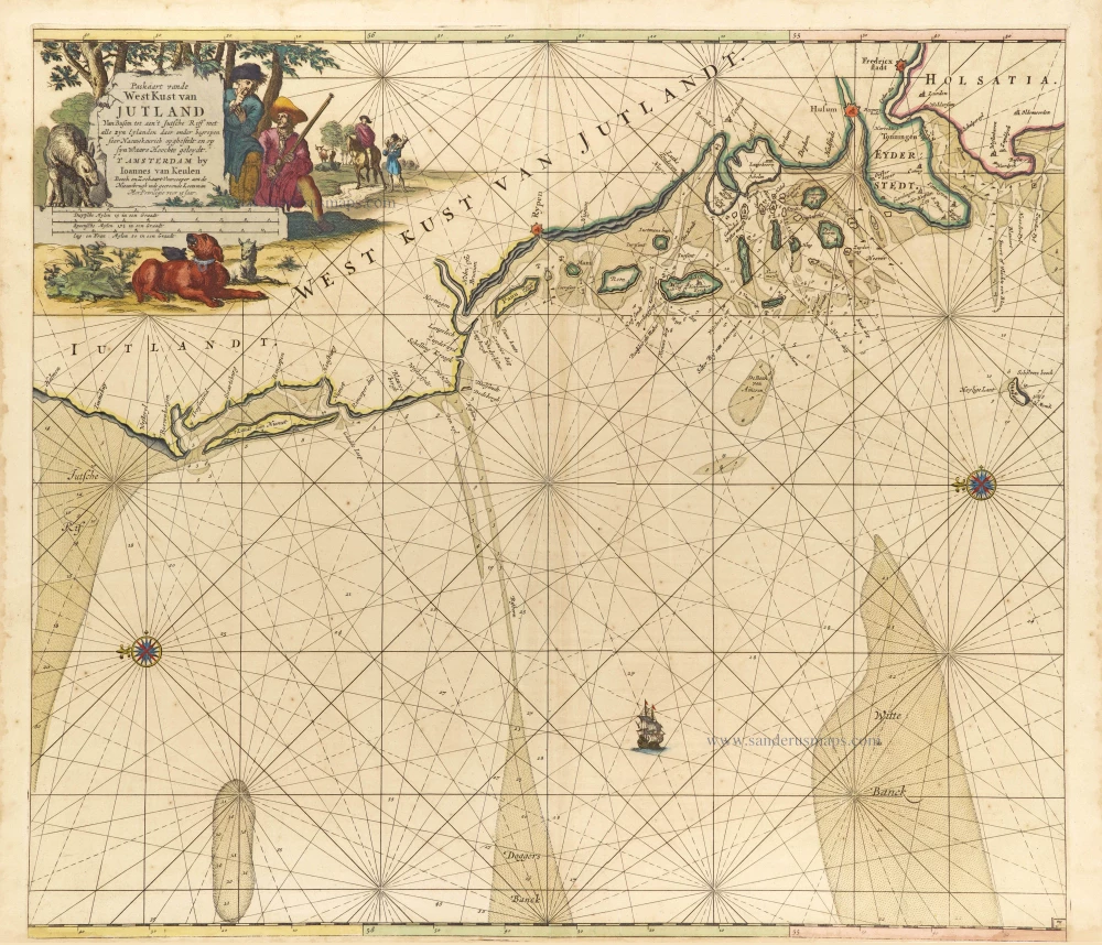
Paskaart vande West Kust van Jutland van Busem tot aen 't Jutsche Riff met Alle syn Eylanden daer onder Begrepen. 1697-1709
Sea chart of Denmark (Westcoast of Jutland), by J. Van Keulen.
[Item number: 13449]
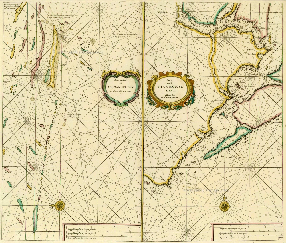
Caarte van 't gat van Abbo, ofte Uttoy. [on sheet with] Caarte van 't Stochomse Liet. 1686
Sea chart of Finland - Sweden, by Doncker H.
[Item number: 14593]
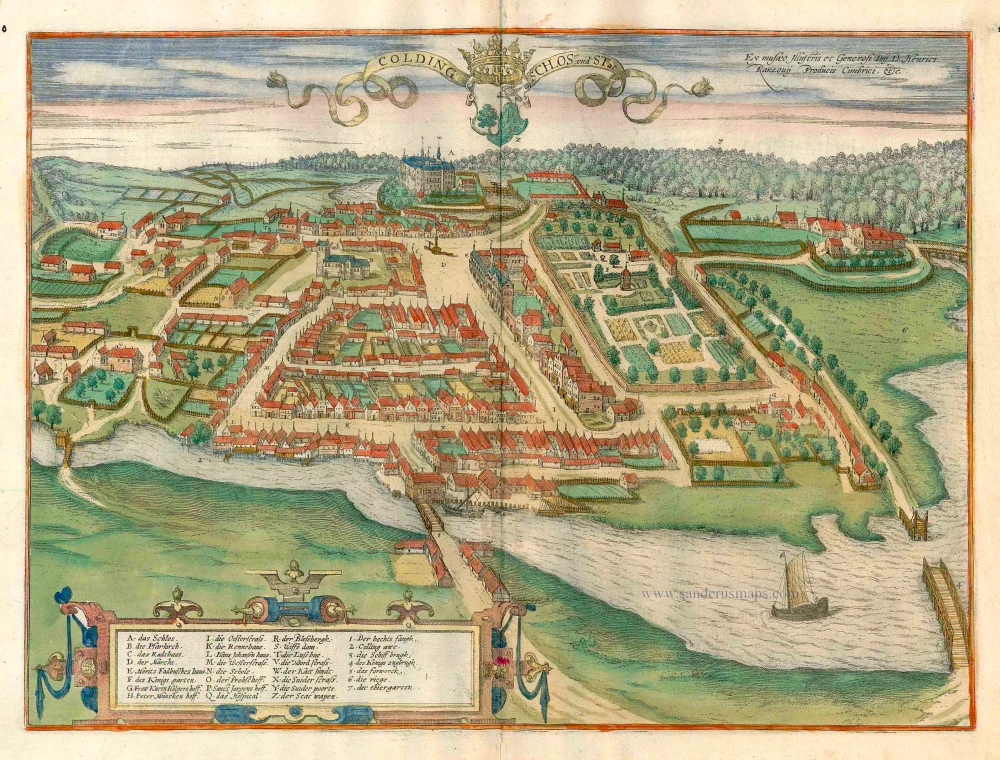
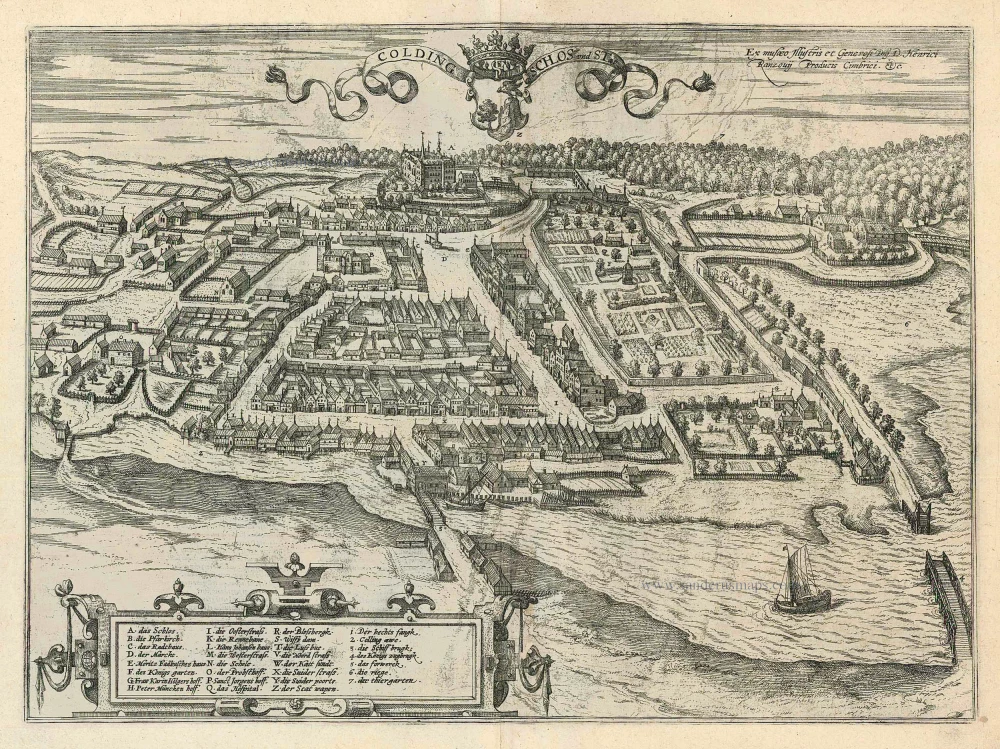
Colding Schloss und Stat c. 1610
Kolding, by Georg Braun and Frans Hogenberg.
[Item number: 16693]

Nouvelle Carte Géographique du Royaume de Dannemarck avec une Table des Villes les plus remarquables. 1714
Denmark, by Zacharias Châtelain.
[Item number: 21341]
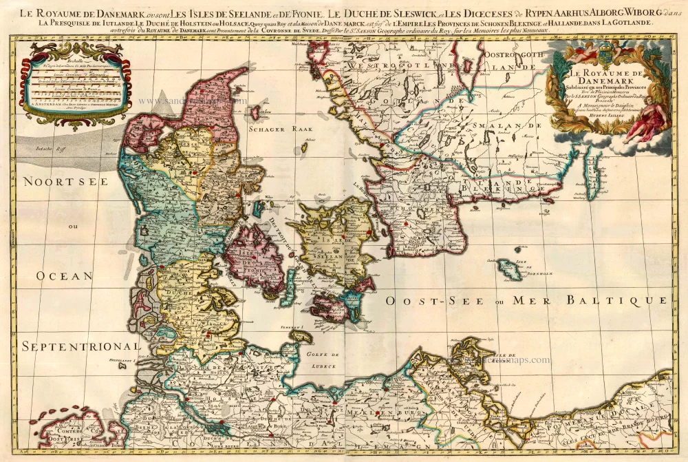
Le Royaume de Danemark Subdivisé en ses Principales Provinces. 1710
Denmark by Sanson - Covens & Mortier.
[Item number: 23736]
Iutiae Tabula in qua sunt Dioecesis Alburgensis, Wiburgensis, Ripensis et Arhusiensis quae et sunt divisae in Omnia Dominia. 1721-41
Denmark - Jutland, by Covens & Mortier.
[Item number: 23738]
Colding Schloss und Stat 1596
Kolding by Braun and Hogenberg
[Item number: 24163]
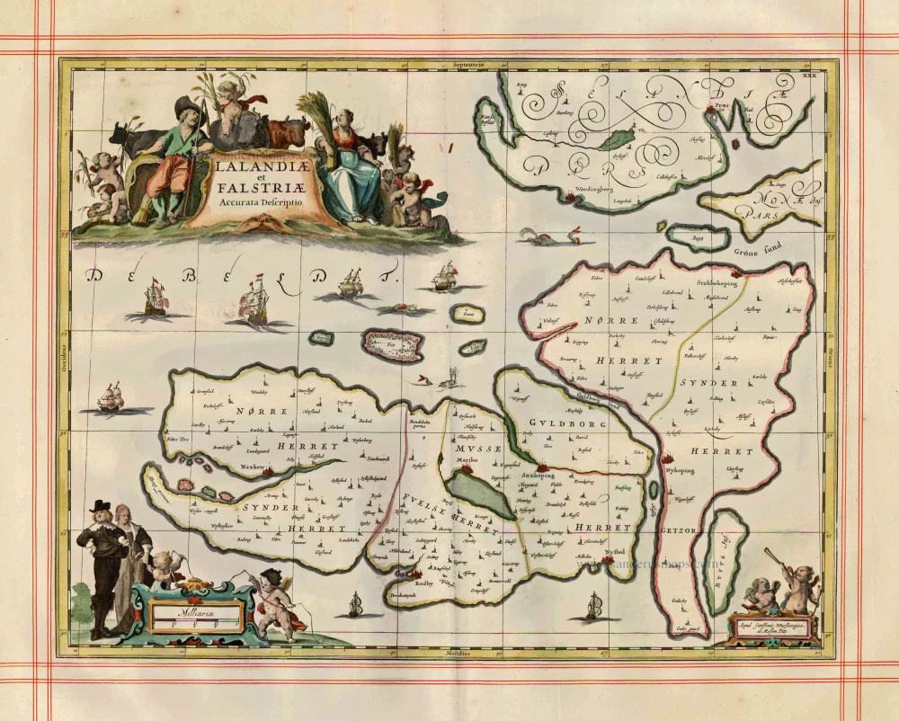
Lalandiae et Falstriae Accurata Descriptio. 1680
Denmark - Laaland and Falster by J. Janssonius, published by Moses Pitt and J. Janssonius-Waesberge.
[Item number: 25066]
Fioniae Nova et Acurata Descriptio. 1641
Denmark - Fyn, by Henricus Hondius.
[Item number: 26285]