
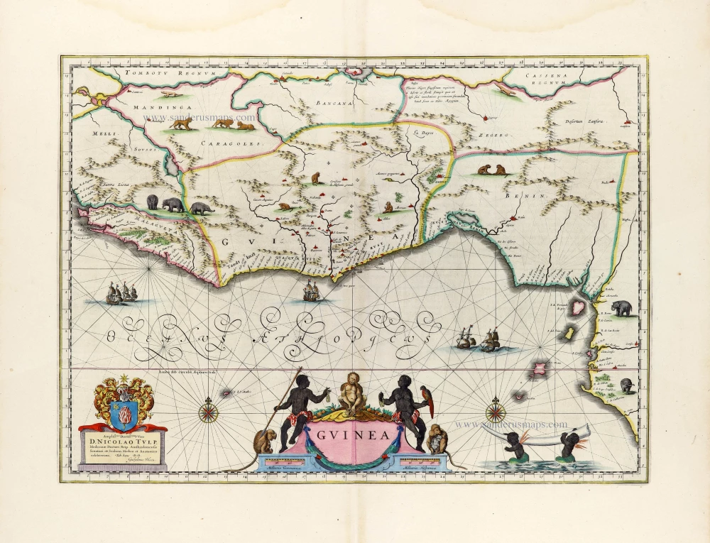
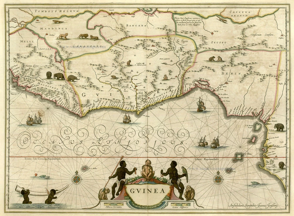
Guinea, by Jodocus Hondius. 1623


The Hondius Family
Jodocus Hondius the Elder (1563-1612)
Joost d’Hondt was born at Wakken (Flanders) in 1563. Two years later, his family settled in Ghent, where young Joost displayed an excellent gift for drawing and calligraphy. Through study and lessons, he developed his talents and became an engraver with a good reputation.
Due to the circumstances of the war, he moved to London in 1584, where he settled down as an engraver, instrument-maker, and map-maker. In 1587, he married Coletta van den Keere, sister of the well-known engraver Pieter van den Keere (Petrus Kaerius); some years earlier, his sister, Jacomina, had married Pieter van den Berghe (Petrus Montanus). Joost, who had Latinized his name to Jodocus Hondius, closely co-operated with his two brothers-in-law.
The political situation in the Northern Netherlands in 1593 was such that Jodocus seemed justified in establishing himself in Amsterdam, where many Antwerp printers, publishers, and engravers had gone. In this new centre of cartography, Jodocus Hondius set up his business “In de Wackere Hondt” (in the vigilant dog), this name being an allusion to his birthplace and name. He engraved many maps and published atlases and many other works, such as his continuation of Gerard Mercator’s Atlas.
He suddenly passed away in February 1612. The publishing firm of Jodocus Hondius was continued by his widow, later on, by his two sons, Jodocus Jr. and Henricus, and by his son-in-law, J. Janssonius.
Jodocus Hondius II (1594-1629) & Henricus Hondius (1597-1651)
After the father’s death, the widow and her seven children continued publishing the atlases under the name of Jodocus Hondius till 1620. The firm was reinforced by the very welcome help of Joannes Janssonius (1588-1664), who married 24-year-old Elisabeth Hondius in 1612. After 1619, Mercator’s Atlas was published under the name of Henricus Hondius.
One of the most dramatic events in the early history of commercial cartography in Amsterdam was the sale of Jodocus Hondius Jr.’s copper plates to Willem Jansz. Blaeu in 1629, the year of his death. At least 34 plates, from which Jodocus II had printed single-sheet maps for his benefit, passed into the hands of his great competitor. Immediately after that, his brother, Henricus, and Joannes Janssonius ordered the engraving of identical plates.
Henricus devoted all his energy to publishing the Atlas for an extended period. He saw its growth up to and including the fourth part in 1646; after that, his name no longer figures on the title pages. After 1638, the title of the Atlas was changed to Atlas Novus; Joannes Janssonius mainly carried it on.
The competition with the Blaeu's dates from 1630. In 1630, Willem Janszoon (=Blaeu) first attacked with his Atlantis Appendix. In 1635, Blaeu completed his Theatrum Orbis Terrarum in two volumes with French, Latin, Dutch, and German texts, prompting Henricus Hondius to speed up the enlargement of his Atlas.
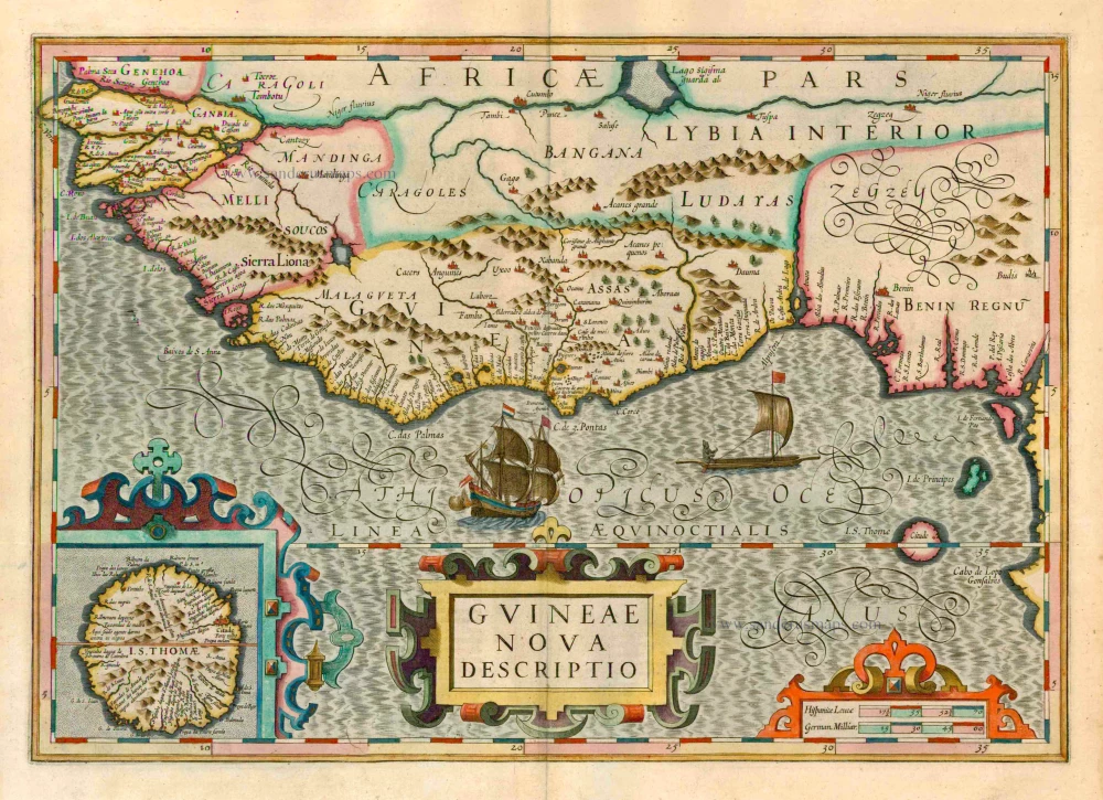
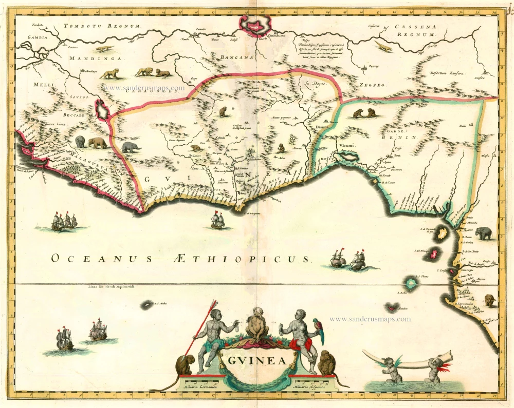
Guineae Nova Descriptio.
Item Number: 21985 Authenticity Guarantee
Category: Antique maps > Africa
Old antique map of Guinea, by Jodocus Hondius.
Title: Guineae Nova Descriptio.
Inset: Isle of St. Thomae
Date of the first edition: 1606.
Date of this map: 1623.
Copper engraving, printed on paper.
Size (not including margins): 345 x 495mm (13.58 x 19.49 inches).
Verso: Latin text.
Condition: Original coloured, excellent.
Condition Rating: A+.
From: Gerardi Mercatoris - Atlas sive Cosmographicae Meditationes de Fabrica Mundi et Fabricati Figura. Denuo auctus Editio Quinta. Henricus Hondius. 1623. (Van der Krogt 1, 105)
The Hondius Family
Jodocus Hondius the Elder (1563-1612)
Joost d’Hondt was born at Wakken (Flanders) in 1563. Two years later, his family settled in Ghent, where young Joost displayed an excellent gift for drawing and calligraphy. Through study and lessons, he developed his talents and became an engraver with a good reputation.
Due to the circumstances of the war, he moved to London in 1584, where he settled down as an engraver, instrument-maker, and map-maker. In 1587, he married Coletta van den Keere, sister of the well-known engraver Pieter van den Keere (Petrus Kaerius); some years earlier, his sister, Jacomina, had married Pieter van den Berghe (Petrus Montanus). Joost, who had Latinized his name to Jodocus Hondius, closely co-operated with his two brothers-in-law.
The political situation in the Northern Netherlands in 1593 was such that Jodocus seemed justified in establishing himself in Amsterdam, where many Antwerp printers, publishers, and engravers had gone. In this new centre of cartography, Jodocus Hondius set up his business “In de Wackere Hondt” (in the vigilant dog), this name being an allusion to his birthplace and name. He engraved many maps and published atlases and many other works, such as his continuation of Gerard Mercator’s Atlas.
He suddenly passed away in February 1612. The publishing firm of Jodocus Hondius was continued by his widow, later on, by his two sons, Jodocus Jr. and Henricus, and by his son-in-law, J. Janssonius.
Jodocus Hondius II (1594-1629) & Henricus Hondius (1597-1651)
After the father’s death, the widow and her seven children continued publishing the atlases under the name of Jodocus Hondius till 1620. The firm was reinforced by the very welcome help of Joannes Janssonius (1588-1664), who married 24-year-old Elisabeth Hondius in 1612. After 1619, Mercator’s Atlas was published under the name of Henricus Hondius.
One of the most dramatic events in the early history of commercial cartography in Amsterdam was the sale of Jodocus Hondius Jr.’s copper plates to Willem Jansz. Blaeu in 1629, the year of his death. At least 34 plates, from which Jodocus II had printed single-sheet maps for his benefit, passed into the hands of his great competitor. Immediately after that, his brother, Henricus, and Joannes Janssonius ordered the engraving of identical plates.
Henricus devoted all his energy to publishing the Atlas for an extended period. He saw its growth up to and including the fourth part in 1646; after that, his name no longer figures on the title pages. After 1638, the title of the Atlas was changed to Atlas Novus; Joannes Janssonius mainly carried it on.
The competition with the Blaeu's dates from 1630. In 1630, Willem Janszoon (=Blaeu) first attacked with his Atlantis Appendix. In 1635, Blaeu completed his Theatrum Orbis Terrarum in two volumes with French, Latin, Dutch, and German texts, prompting Henricus Hondius to speed up the enlargement of his Atlas.
Related items
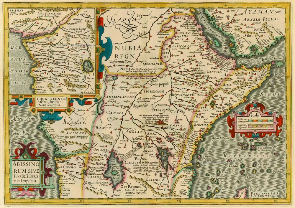
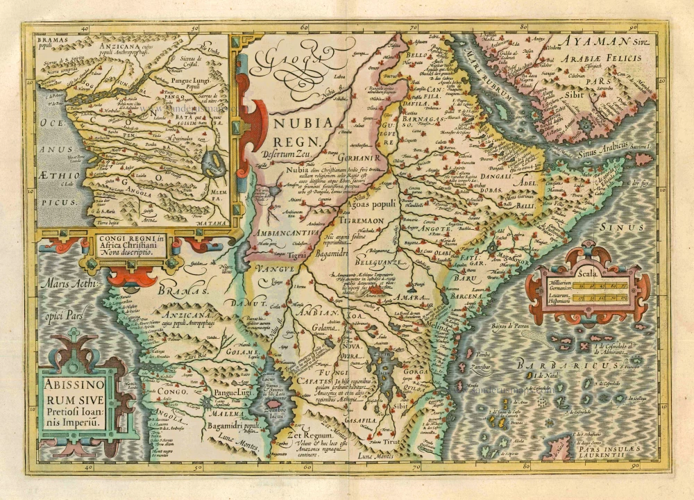
Abissinorum Sive Pretiosi Ioannis Imperiu. 1630
Central Africa by J. Hondius
[Item number: 887]
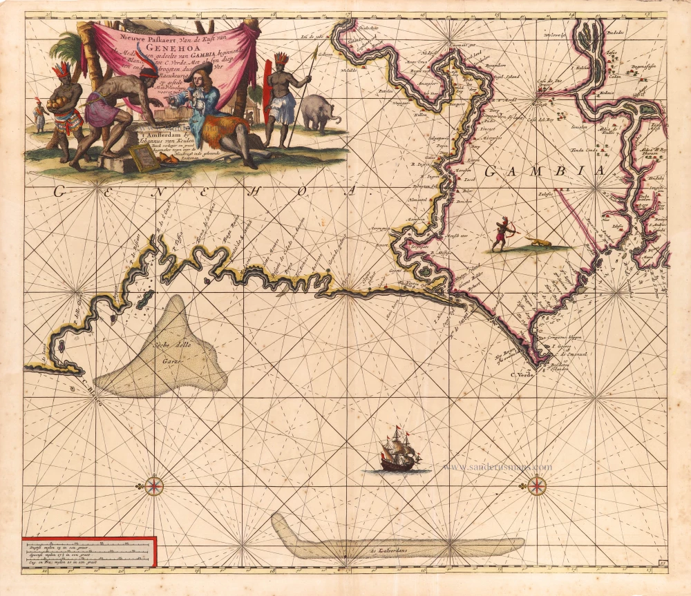
Nieuwe Paskaert, van de Kust van Genehoa als mede een Gedeelte van Gambia, beginnende an C. Blanco tot C. Verde, Met al syn diep ten end droogten, dus Ver Naeukeurig op gestelt. 1697-1709
The coasts of Senegal - Gambia by Johannes Van Keulen.
[Item number: 2016]
Guinea c. 1680
Guinea by F. De Wit.
[Item number: 2646]
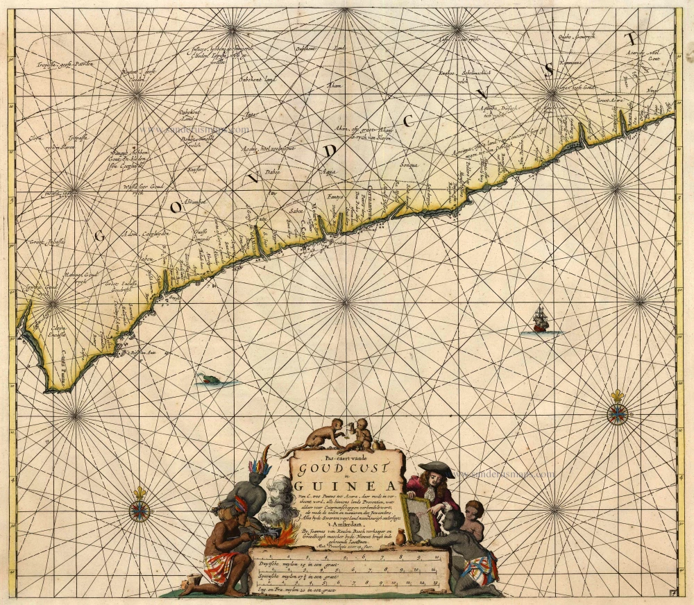
Pas-Caert vande Goud Cust in Guinea van C. Tres Puntas tot Acara ... 1683
Sea chart of Guinea, by Van Keulen Johannes.
[Item number: 4059]
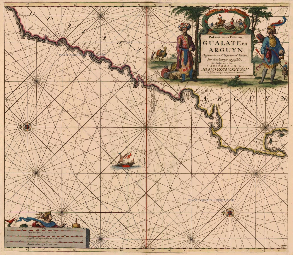
Paskaart van de Kuste van Gualate en Arguyn ... 1681
The coast of the Western Sahara, by J. Van Keulen.
[Item number: 5402]
Abissinorum Sive Pretiosi Ioannis Imperiu 1628.
Central Africa, by Jodocus Hondius.
[Item number: 7749]
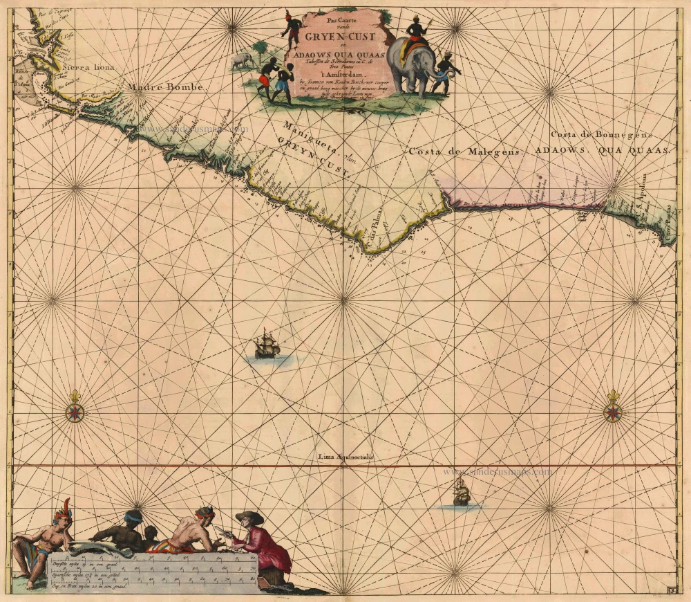
Pas Caarte vande Gryen-Cust en Adaows qua Quaas tuhessen de Serraliones en C. de Tres Puntas. 1683
Grain Coast - West Africa, by Johannes van Keulen.
[Item number: 10776]
Guinea 1664
Guinea by Blaeu J.
[Item number: 12151]
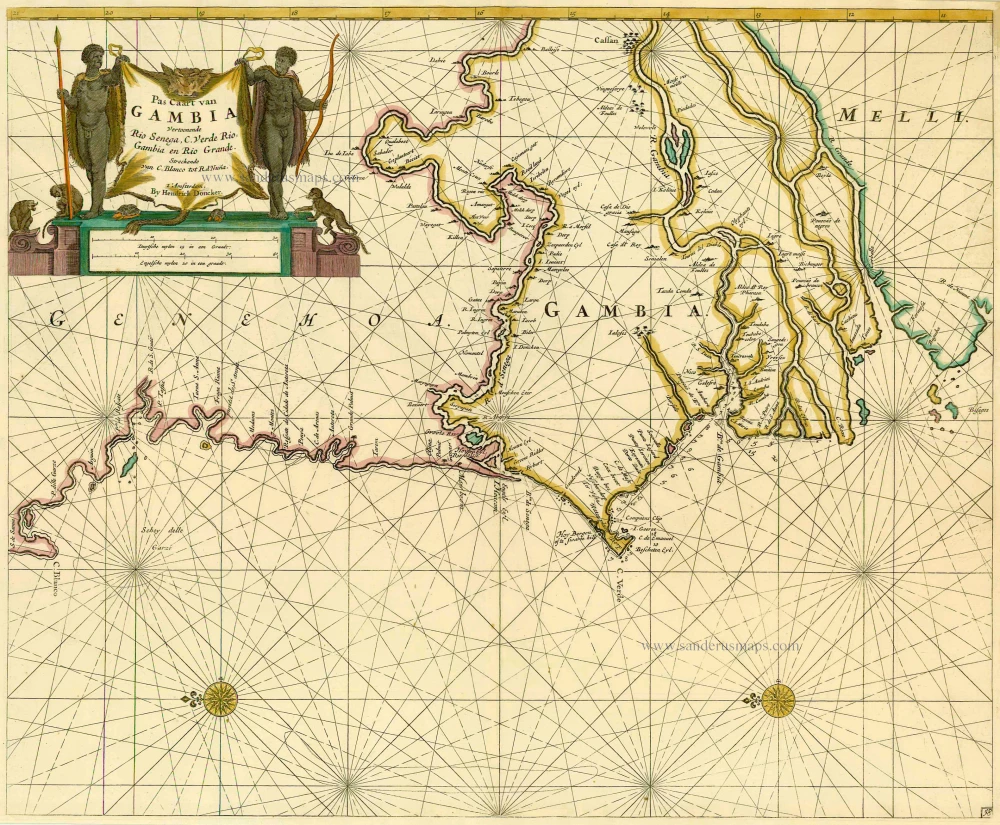
Pas Caart van GAMBIA Vertoonende Rio Senega, C. Verde, Rio Gambia en Rio Grande. Streckende van C. Blanco tot R. d'Nuna. 1686
Sea chart of the coasts of Senegal - Gambia, by Doncker H.
[Item number: 13653]
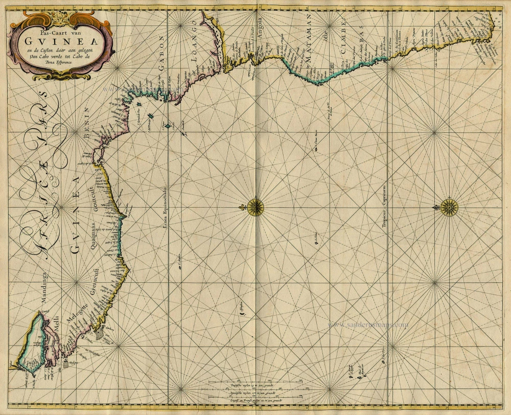
Pas-Caart van Guinea en de Custen daer aen Gelegen van Cabo Verde tot Cabo de Bona Esperanca 1667
Sea chart of Guinea, by Pieter Goos.
[Item number: 19060]
Guinea c. 1658
Guinea, by Janssonius J.
[Item number: 19543]

Pascaerte van Guinea, tusschen C. Verde, tot Cabo de bona Esperanca. 1661
Sea chart of Guinea, by J. Van Loon.
[Item number: 24328]
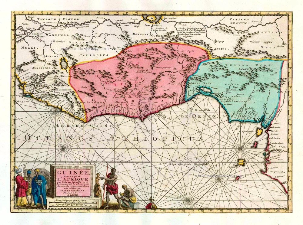
Guinée, Grand Pays de L'Afrique, avec toutes ses Côtes, Havres et Rivieres. 1713
Guinea, by Pieter van der Aa.
[Item number: 26156]
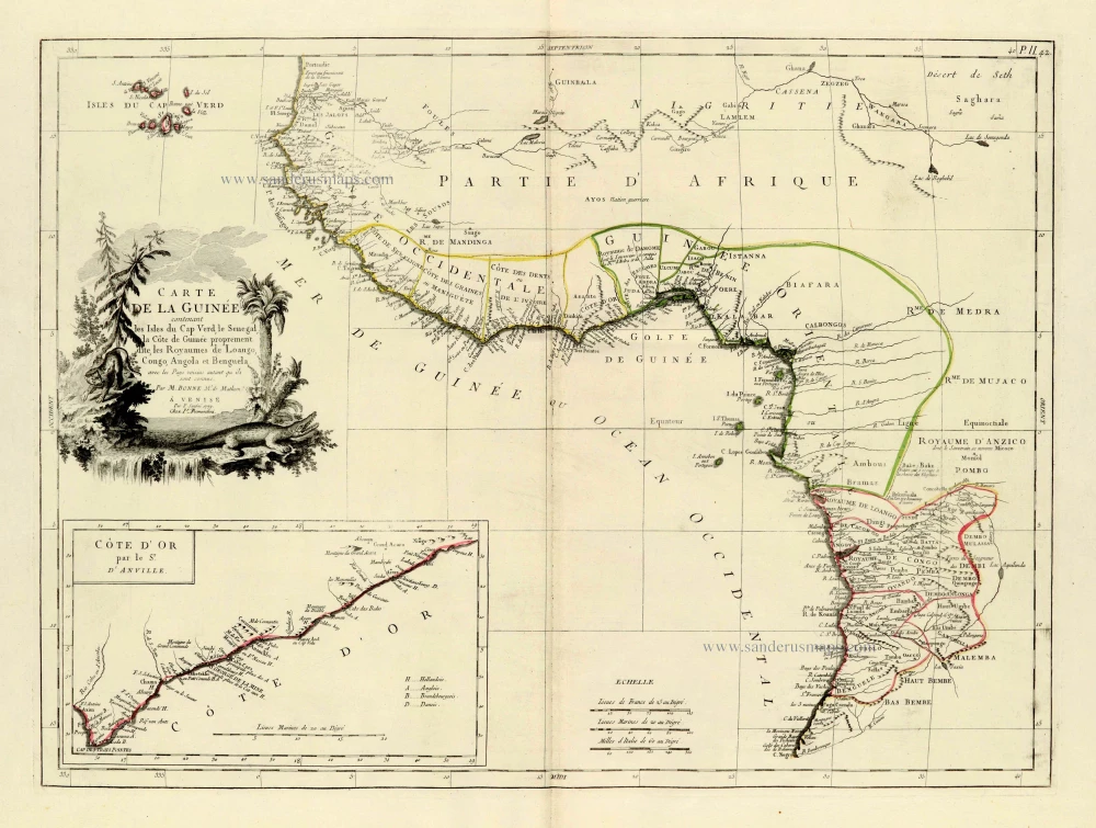
Carte de la Guinée contenant les Isles du Cap Verd, le Senegal, la Côte de Guinée proprement dite, les Royaumes de Loango, Congo, Angola et Benguela, avec les Pays voisins autant qu ils sont connus. 1776-79
West Africa, by Francesco Santini.
[Item number: 28100]
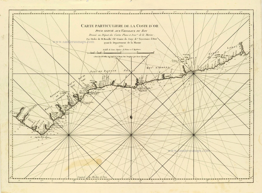
Carte Particulière de la Coste d'Or. 1756-1770
African Gold Coast (Guinea), by J.N. Bellin.
[Item number: 28125]
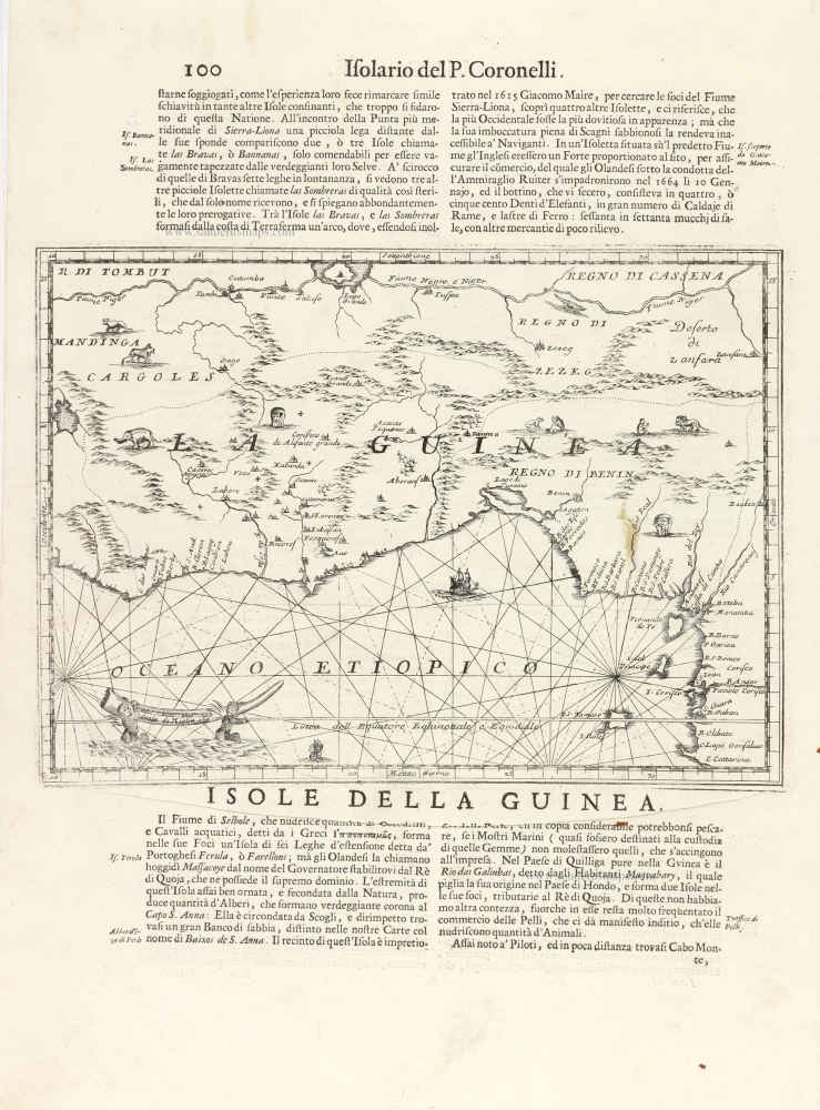
La Guinea. 1696
Guinea, by Vincenzo Coronelli.
[Item number: 29023]
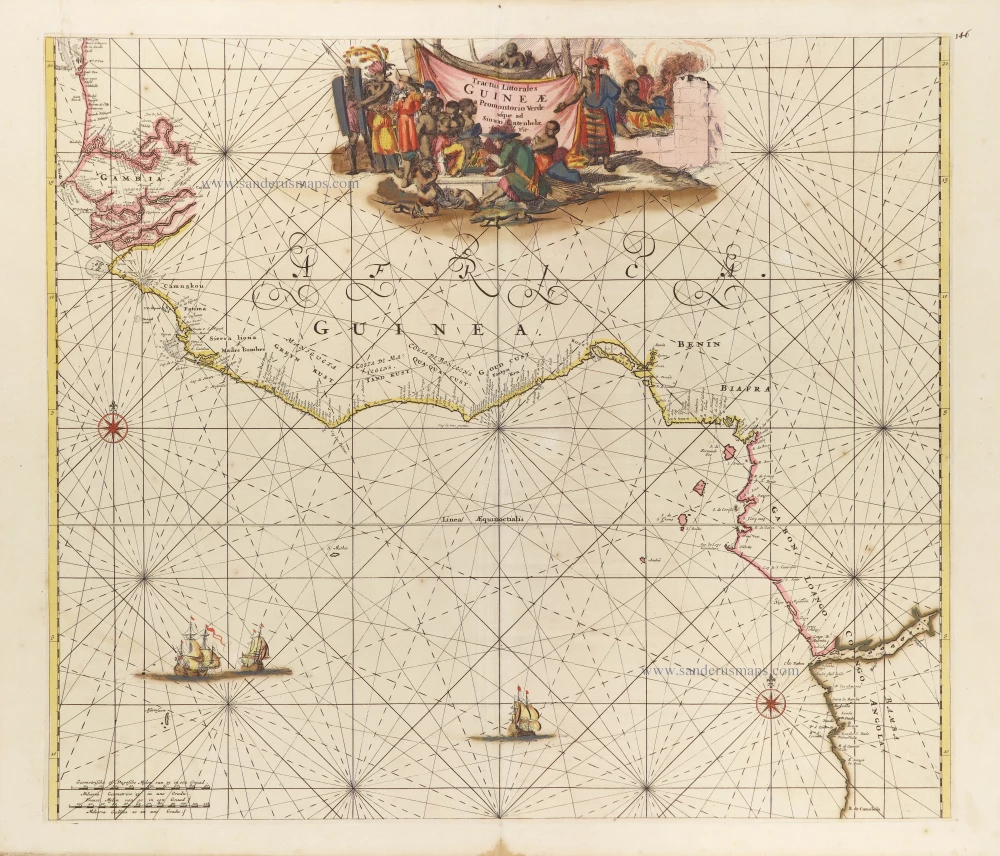
Tractus Littorales Guineae a Promontorio Verde usque ad Sinum Catenbelae. c. 1691-97
Tropical Atlantic Coast of Africa, by Frederick de Wit.
[Item number: 29258]