
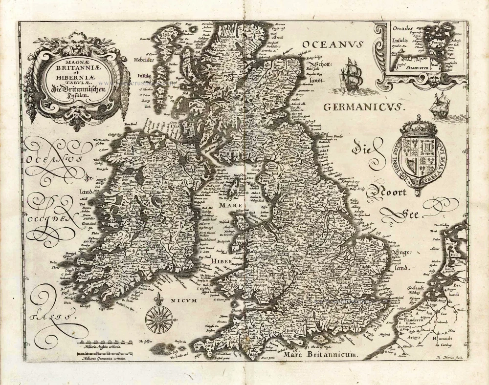
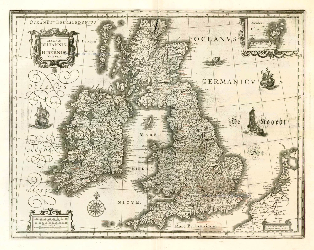
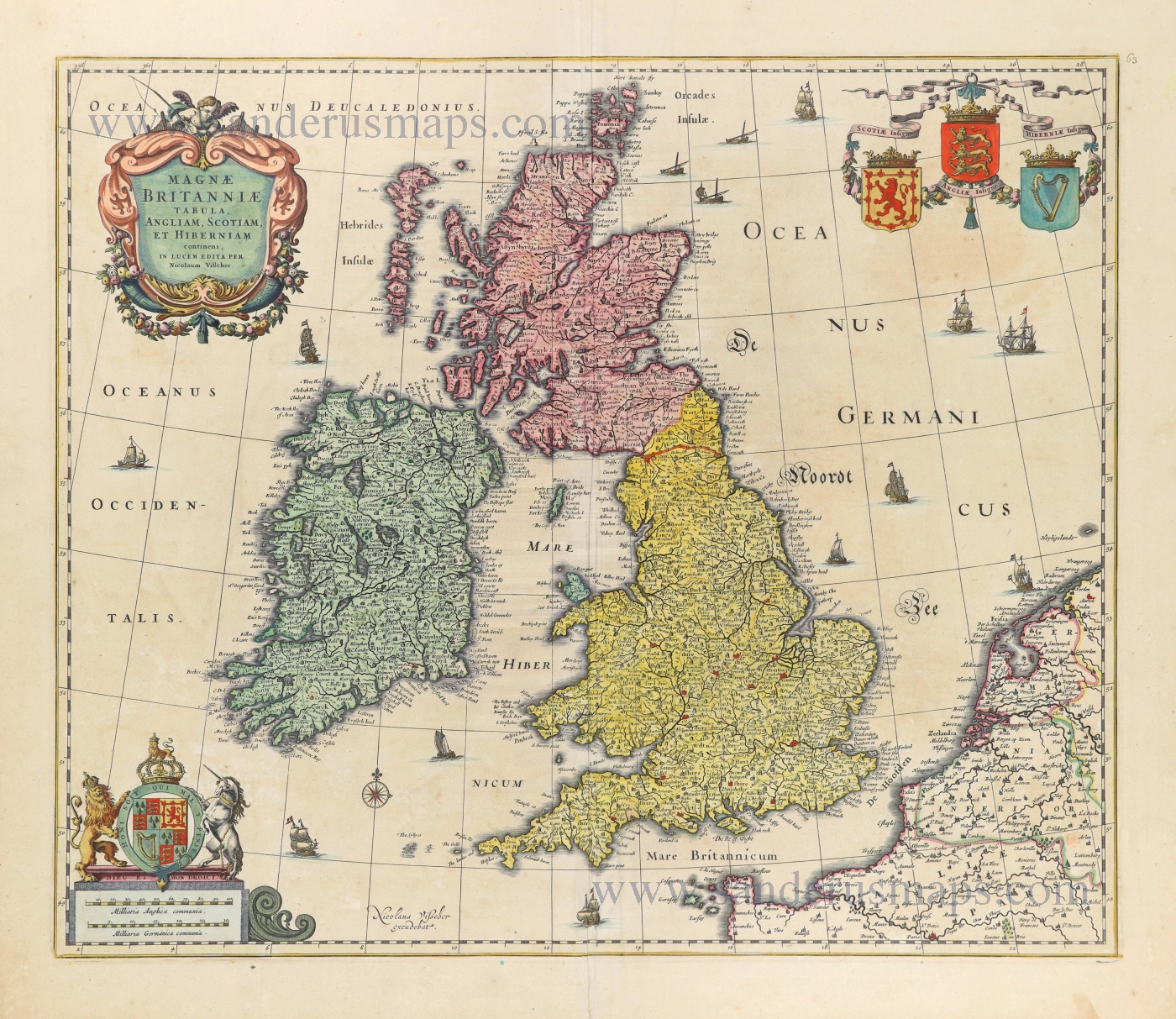
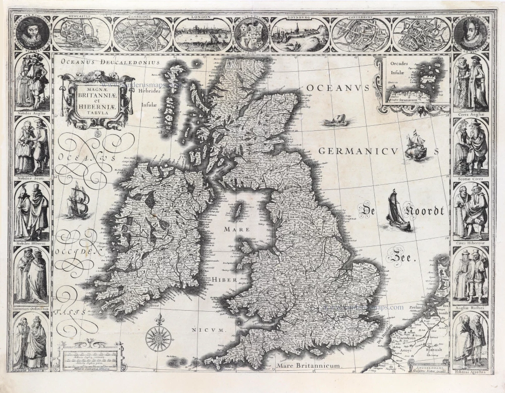
The British Isles, by M. Merian. 1638
Matthäus Merian the Elder (1593-1650)
Matthäus Merian, the leading German illustrator of the 17th century, was born in Basel in 1593. He learned the art of copperplate engraving in Zurich and subsequently worked and studied in Strasbourg, Nancy, Paris, and the Low Countries. In 1618 he went to Frankfurt, wherein in 1618, he married the eldest daughter of J.T. de Bry, publisher and engraver. After de Bry died in 1623, he took over his business. De Bry’s business remained in Merian’s family until 1726, when a fire destroyed it. In 1635 he began the series Theatrum Europaeum. Between 1642 and 1688, he published Martin Zeiller’s Topographia Germaniae, with more than 2,000 plates etched and engraved by himself and his sons Matthäus and Caspar. He also took over and completed the later parts and editions of the Grand Voyages and Petits Voyages, initially started by de Bry in 1590. Matthäus Merian died after in 1650 in Bad Schwalbach near Wiesbaden.
Magnae Britanniae et Hiberniae Tabulae. - Die Britannischen Insulen.
Item Number: 25904 Authenticity Guarantee
Category: Antique maps > Europe > British Isles
Old, antique map of the British Isles by M. Merian.
Date of the first edition: 1638
Date of this map: 1638
Copper engraving, printed on paper.
Size (not including margins): 27 x 36cm (10.5 x 14 inches)
Verso: Blank
Condition: Excellent.
Condition Rating: A+
References: Shirley (BI to 1650), #489 Pl. 135.
From: Gottfried J.L. - Merian M. Newe Archontologia Cosmica, ... Frankfurt, W. Hoffmans, 1638.
Matthäus Merian the Elder (1593-1650)
Matthäus Merian, the leading German illustrator of the 17th century, was born in Basel in 1593. He learned the art of copperplate engraving in Zurich and subsequently worked and studied in Strasbourg, Nancy, Paris, and the Low Countries. In 1618 he went to Frankfurt, wherein in 1618, he married the eldest daughter of J.T. de Bry, publisher and engraver. After de Bry died in 1623, he took over his business. De Bry’s business remained in Merian’s family until 1726, when a fire destroyed it. In 1635 he began the series Theatrum Europaeum. Between 1642 and 1688, he published Martin Zeiller’s Topographia Germaniae, with more than 2,000 plates etched and engraved by himself and his sons Matthäus and Caspar. He also took over and completed the later parts and editions of the Grand Voyages and Petits Voyages, initially started by de Bry in 1590. Matthäus Merian died after in 1650 in Bad Schwalbach near Wiesbaden.
Related items
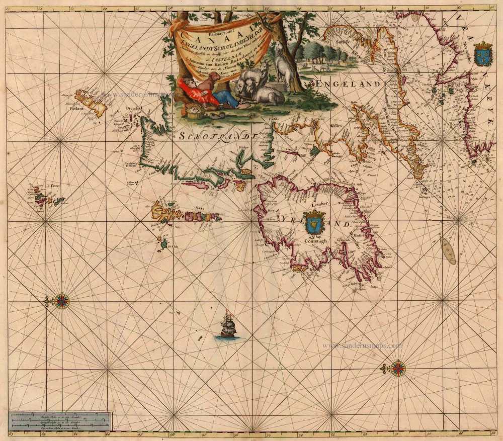
Paskaart van 't Canaal Engelandt Schotlandt en Yrland 1697-1709
British Isles, by Van Keulen Johannes.
[Item number: 5817]
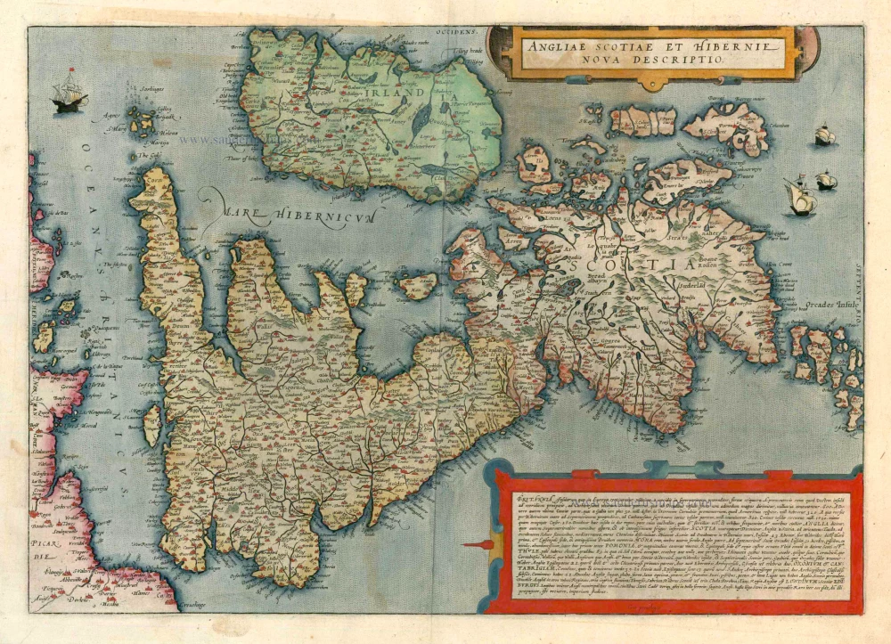
Angliae Scotiae et Hibernie Nova Descriptio 1593
British Isles, by de G. Jode.
[Item number: 11236]
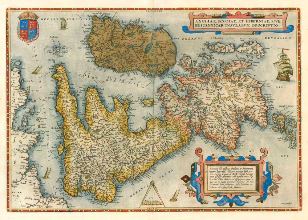
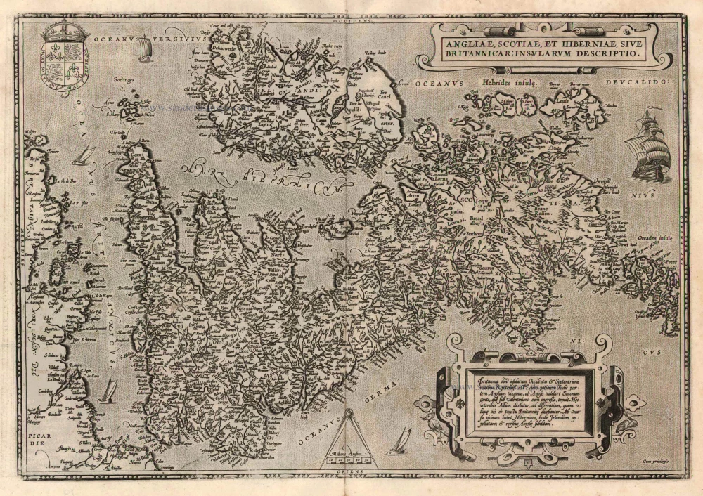
Angliae, Scotiae, et Hiberniae, sive Britannicae Insularum Descriptio. 1579
The British Isles by Abraham Ortelius.
[Item number: 17897]
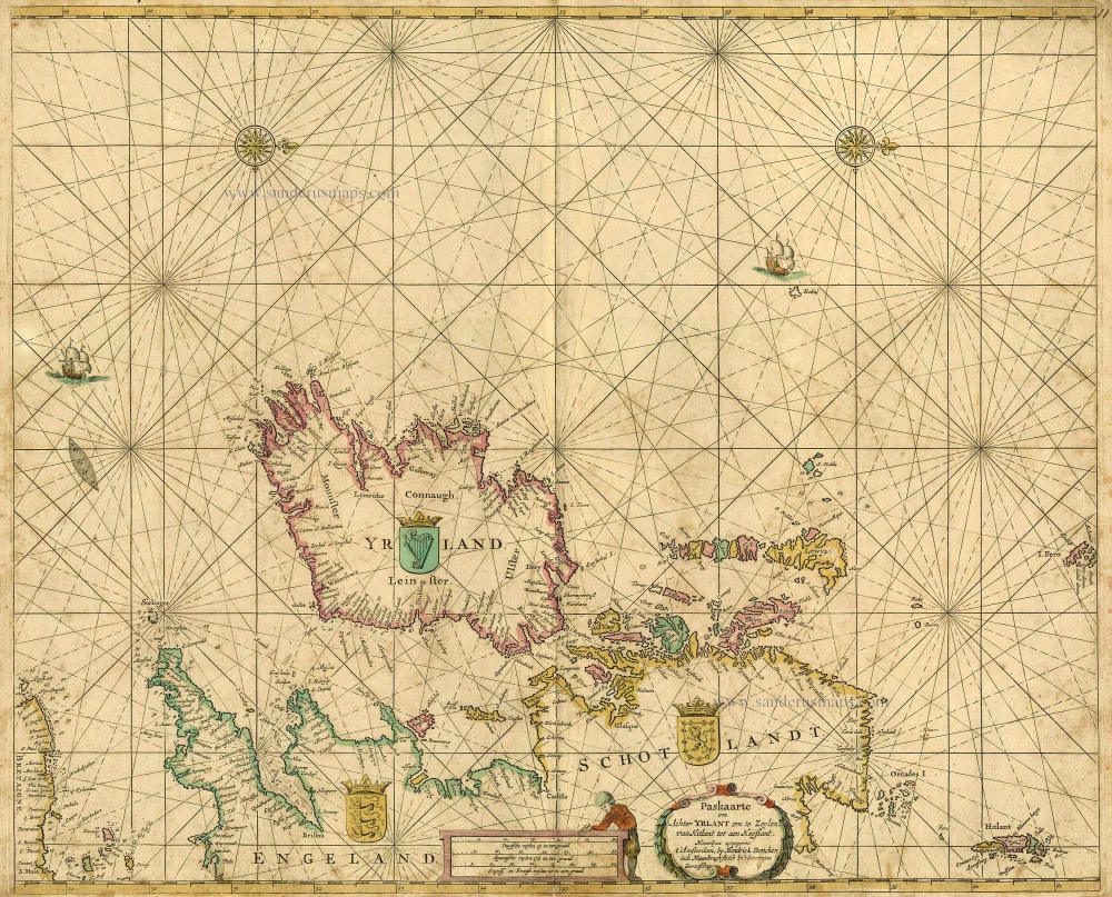
Paskaarte om achter Yrlant om te Zeylen van Hitlant tot aen Heyssant. 1665
British Isles, by Hendrik Doncker.
[Item number: 18567]
Angliae, Scotiae, et Hiberniae, sive Britannicae Insularum Descriptio. 1601
The British Isles, by Ortelius A.
[Item number: 22869]
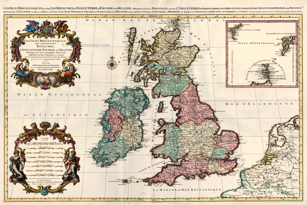
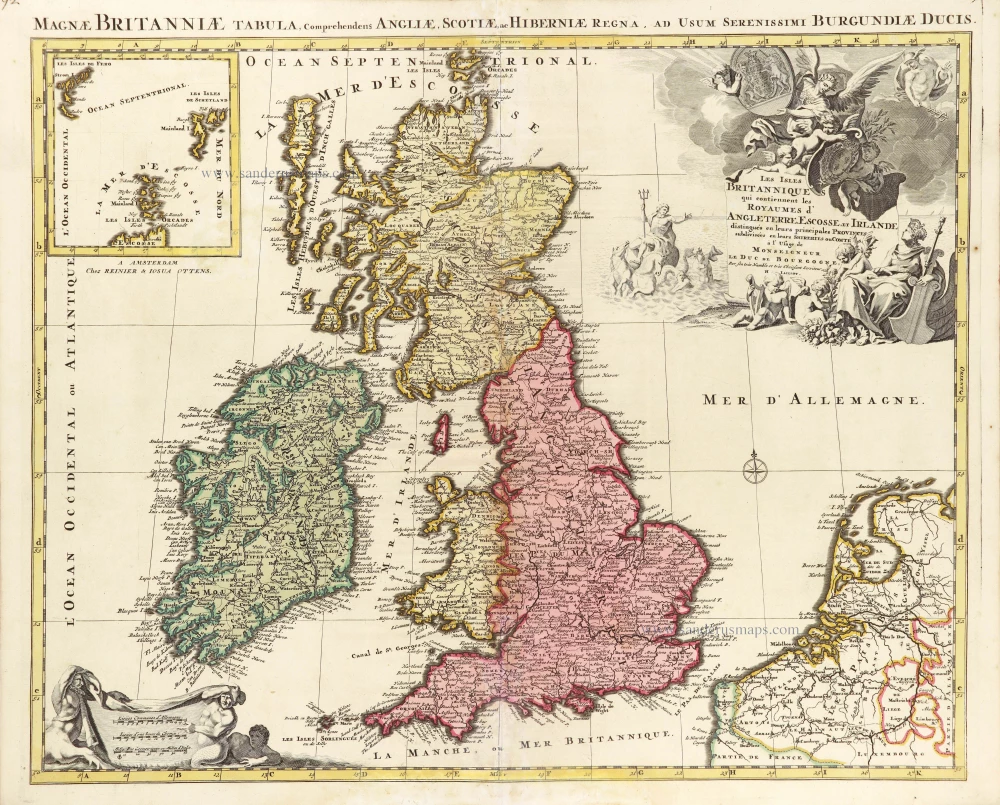
Les Isles Britanniques; qui Contiennent les Royaumes d'Angleterre, Escosse, et Irlande ... 1710
British Isles by Sanson - Covens & Mortier.
[Item number: 23726]
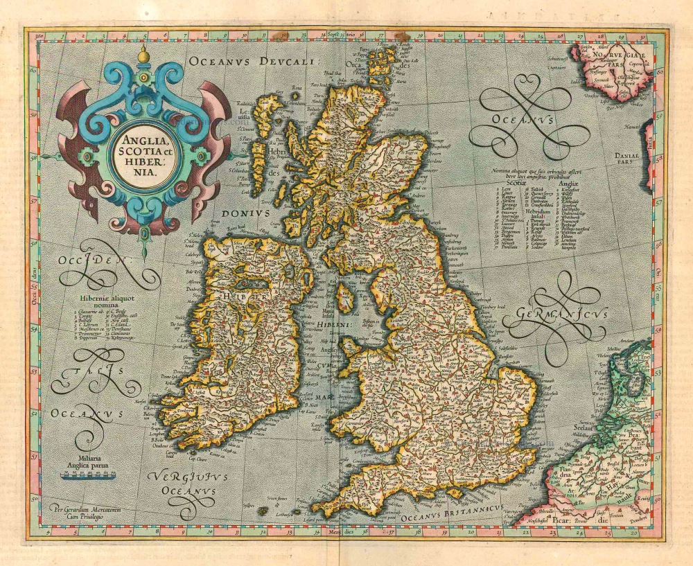
Anglia, Scotia et Hibernia. 1623
British Isles, by Gerard Mercator.
[Item number: 24894]
Magnae Britanniae et Hiberniae Tabula. 1662
British Isles, by W. & J. Blaeu.
[Item number: 25200]
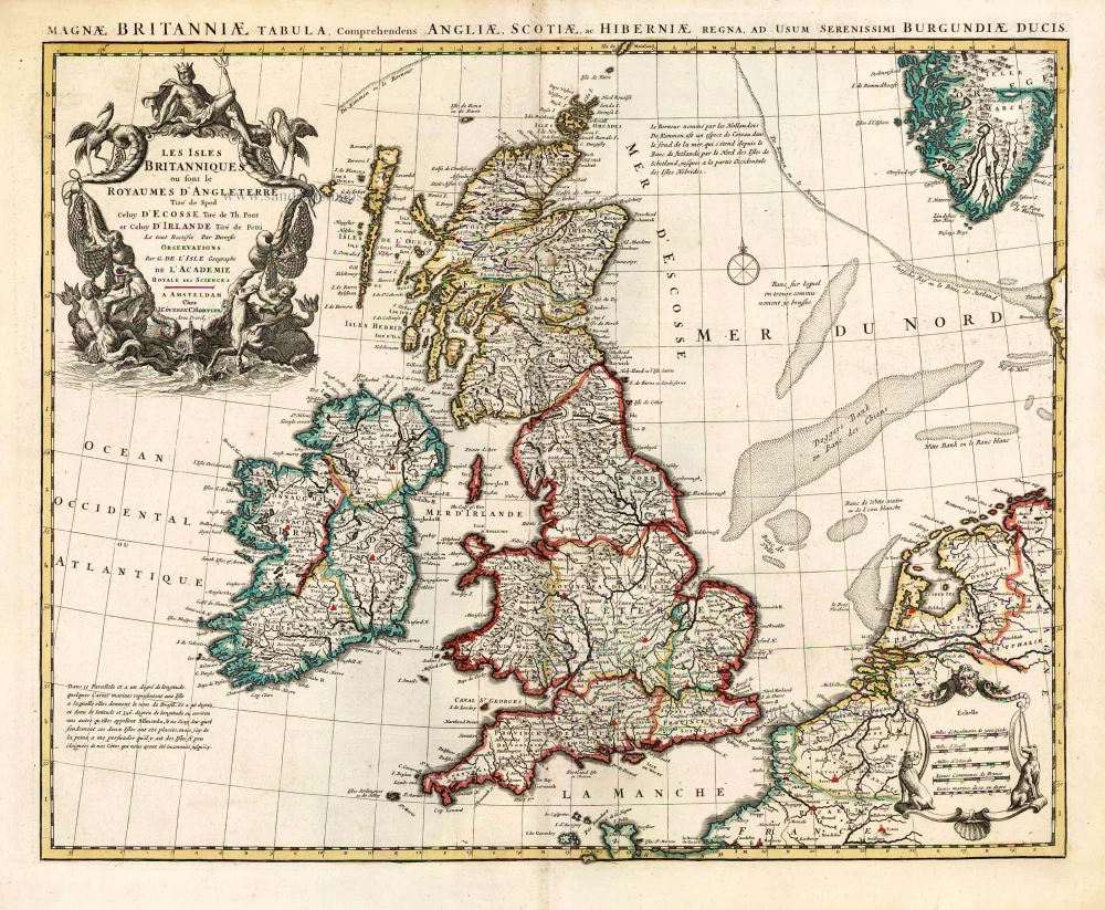
Les Isles Britanniques ou sont le Royaume D'Angleterre Tiré de Sped Celuy D'Ecosse Tiré de Th. Pont et Celuy D'Irlande Riré de Petti. 1730
British Isles by Guillaume Delisle, published by Covens & Mortier.
[Item number: 25680]
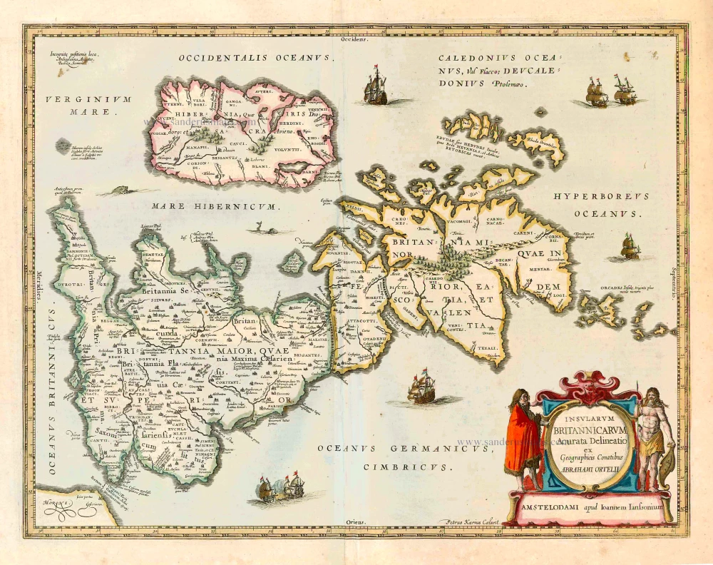
Insularum Britannicarum Acurata Delineatio ex Geographicis Conatibus Abrahami Ortelii. 1641
The British Isles, by Johannes Janssonius.
[Item number: 26483]
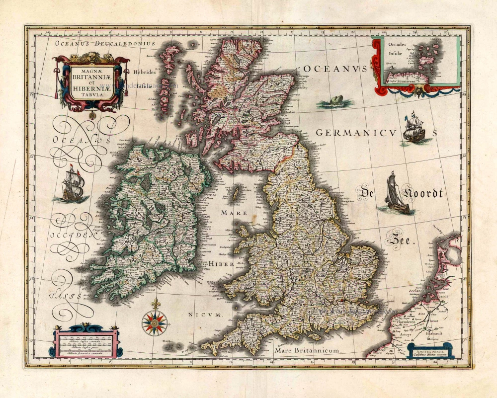
Magnae Britanniae et Hiberniae Tabula. 1645
The British Isles, by Joan and Willem Blaeu
[Item number: 26715]

Les Isles Britanniques Comprenant les Royaumes d'Angleterre, d'Ecosse et d'Iralnade, divisés en grandes provinces, ... 1776-79
British Isles, by Francesco Santini.
[Item number: 26959]

Les Isles Britanniques; qui Contiennent les Royaumes d'Angleterre, Escosse, et Irlande. c. 1705
British Isles, by H. Jaillot
[Item number: 27772]
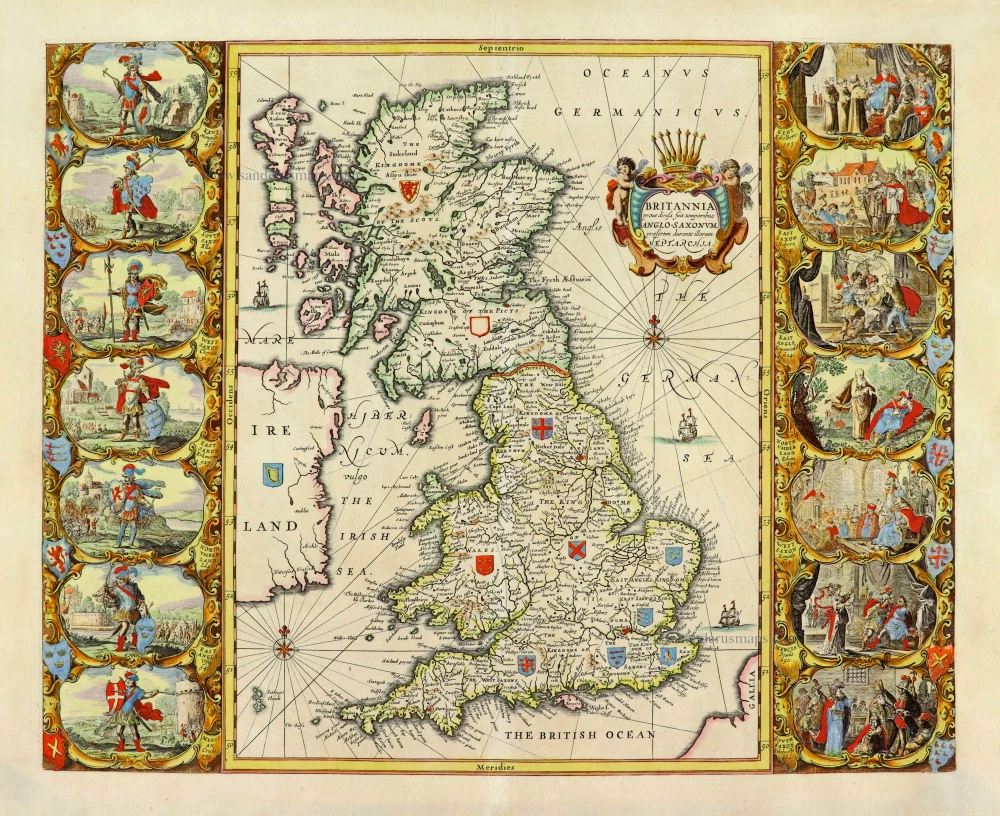
Britannia prout divisa fuit temporibus Anglo-Saxonum, praesertim durante illorum Heptarchia. 1652
Great Brittain by Georg Hornius
[Item number: 28033]
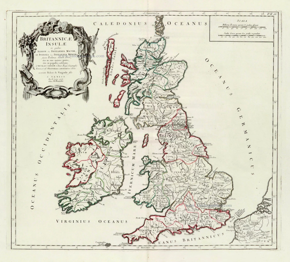
Britannicae Insulae in quibus Albion Seu Britannia Major, et Ivernia Seu Britannia Minor. 1776-79
British Isles, by Paolo Santini, after Nicolas Sanson & Sr. Robert de Vaugondy.
[Item number: 28105]
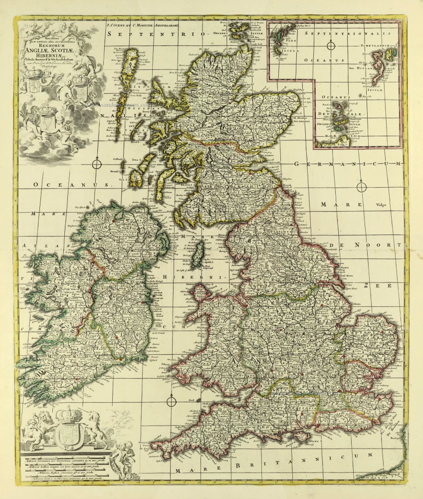
Novissima Prae Caeteris aliis Accuratissima Regnorum Angliae, Scotiae, Hiberniae. c. 1691-96
British Isles by Frederik De Wit.
[Item number: 28239]
Magnae Britanniae Tabula, Angliam, Scotiam, et Hiberniam continens. 1677-80
British Isles by Nicolaes Visscher I.
[Item number: 28586]
Les Isles Britanniques qui contiennent les Royaumes d'Angleterre Escosse, et Irlande. 1730-45
British Isles by Hubert Jaillot, published by Reinier and Josua Ottens.
[Item number: 28747]
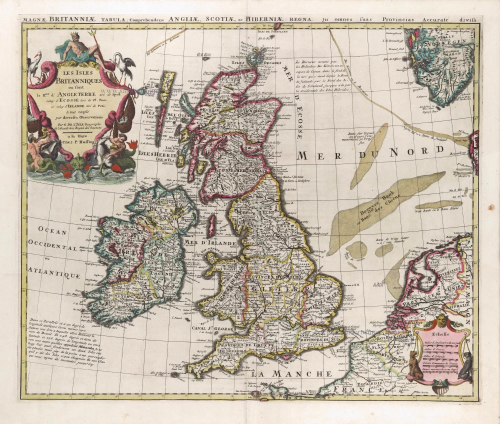
Les Isles Britanniques ou sont le Rme d'Angleterre tiré de Sped celuy d'Ecosse tiré de Th.Pont &c. et celuy d'Irlande tire de Petti, c. 1709
The British Isles by G. Delisle, published by Pierre Husson.
[Item number: 29562]
Magnae Britanniae et Hiberniae Tabula. 1631
British Isles by Blaeu, with three decorative borders
[Item number: 29586]
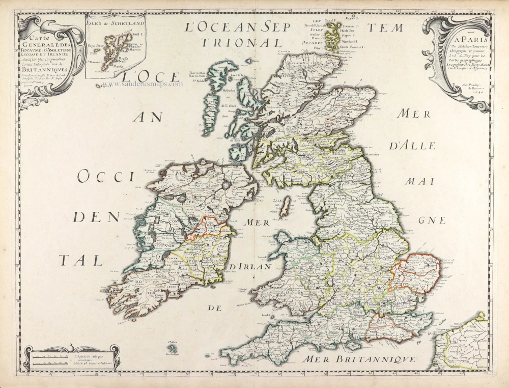
Carte Générale des Royaume d'Angleterre Escosse et Irlande. 1652
British Isles by Nicolas Sanson, published by Melchior Tavernier / Pierre Mariette.
[Item number: 29604]
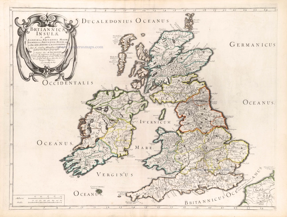
Brtiannicae [sic] Insulae in quibus Albium sive Britannia Maior Iuernia sive Britannia Minor tum et Orcades, Ebudes, Cassiterides. 1652
Ancient British Isles by Nicolas Sanson.
[Item number: 29623]
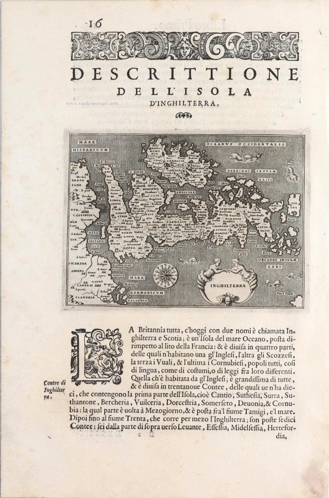
Inghilterra. - [Above map :] Descrittione dell'Isola d'Inghilterra. 1590
British Isles, by Thomaso Porcacchi.
[Item number: 29755]
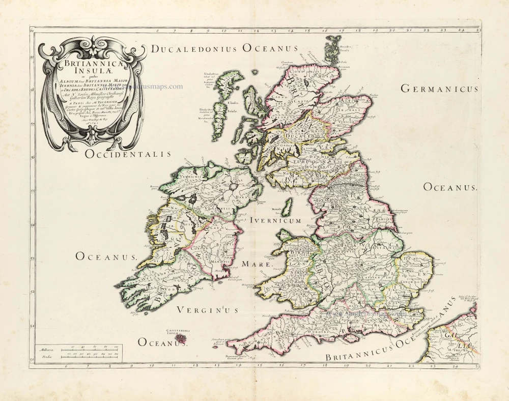
Britannicae Insulae in quibus Albium Sive Britannia Maior Iuernie Sive Bitannia Minor tum et Orcades, Ebudes, Cassiterides. 1659
Ancient British Isles by Melchior Tavernier and Nicolas Sanson.
[Item number: 30014]
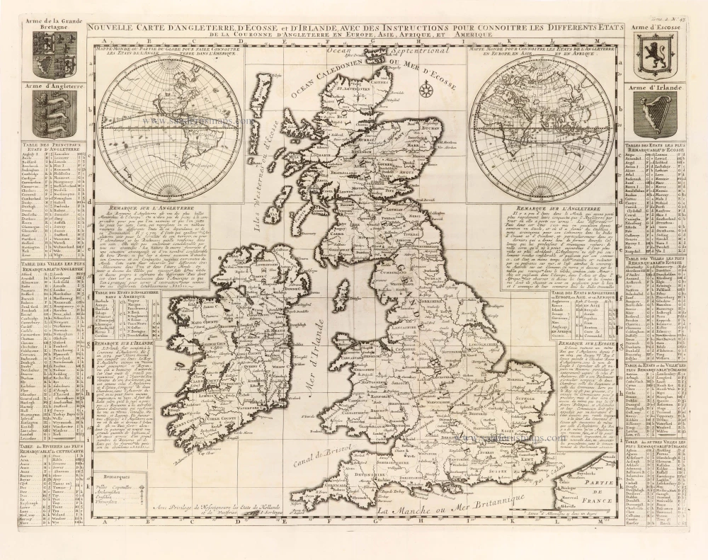
Nouvelle Carte d'Angleterre, d'Ecosse et d'Irlande, avec des Instructions pour connoitre les differents etats de la Couronne d'Angleterre en Europe, Asie, Afrique, et Amérique. 1708
British Isles with a world map in two hemispheres, by Zacharias Châtelain.
[Item number: 30167]

Verschiedene Reisen des Auctoris. 1753-55
British Isles by George Edwards.
[Item number: 30331]