
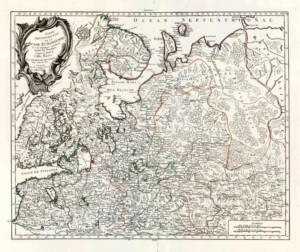
Southern Muscovy, by Pieter van der Aa. 1713

Pieter van der Aa (Leiden, 1659-1733)
Pieter van der Aa was already in 1682 owner of a bookshop and auction house. During his life, he has published an enormous amount of printed material.
After 1700, van der Aa increasingly specialised in books on geography and travel.
He published composite atlases, a series of geographical descriptions of European countries, and some very spectacular works. Between 1706 and 1708 he published the Naauweurige versameling der gedenkwaardigste zee- en land-reysen, in 28 volumes.
Many of Van der Aa’s publications are richly illustrated with maps and plates. He took over many copperplates and prints from other publishers such as Carel Allard and Frederik De Wit. The composite atlases that appeared from his workshop contain a curious mixture of his own material, copies of maps from other publishers, and reprints made from old copper plates, now with his own imprint.
The Galérie agréable du monde, was completed in 1729, and comprised 66 parts, bound in 27 volumes. Van der Aa presented it as a good investment; after publication, the antiquarian value of the work would double, the more so since it was printed in a limited edition of only one hundred copies.
La Moscovie Meridionale Suivant les Nouvelles Observations ...
Item Number: 26040 Authenticity Guarantee
Category: Antique maps > Europe > Eastern Europe
Old, antique map of Russia - Southern Muscovy by P. Van der Aa.
Date of the first edition: 1713
Date of this map: 1713
Copper engraving, printed on paper.
Size (not including margins): 22.5 x 29.5cm (8.7 x 11.5 inches)
Verso: Blank
Condition: Original body colour, trimmed to neatline and mounted on heavy paper at an early time, light waterstain in upper left corner.
Condition Rating: A
References: Van der Krogt A, 44:26; Dutch Maps of Russia and Poland, 12:015; Koeman, Aa7 (20).
From: Nouvel Atlas, très exact et fort commode pour toutes sortes de personnes, Contenant Les Principales cartes géographiques. Leiden, P. Van der Aa, n.d. (1713) (Koeman, Aa7).
Van der Aa maps are rarely found in original colouring.
Pieter van der Aa (Leiden, 1659-1733)
Pieter van der Aa was already in 1682 owner of a bookshop and auction house. During his life, he has published an enormous amount of printed material.
After 1700, van der Aa increasingly specialised in books on geography and travel.
He published composite atlases, a series of geographical descriptions of European countries, and some very spectacular works. Between 1706 and 1708 he published the Naauweurige versameling der gedenkwaardigste zee- en land-reysen, in 28 volumes.
Many of Van der Aa’s publications are richly illustrated with maps and plates. He took over many copperplates and prints from other publishers such as Carel Allard and Frederik De Wit. The composite atlases that appeared from his workshop contain a curious mixture of his own material, copies of maps from other publishers, and reprints made from old copper plates, now with his own imprint.
The Galérie agréable du monde, was completed in 1729, and comprised 66 parts, bound in 27 volumes. Van der Aa presented it as a good investment; after publication, the antiquarian value of the work would double, the more so since it was printed in a limited edition of only one hundred copies.
Related items
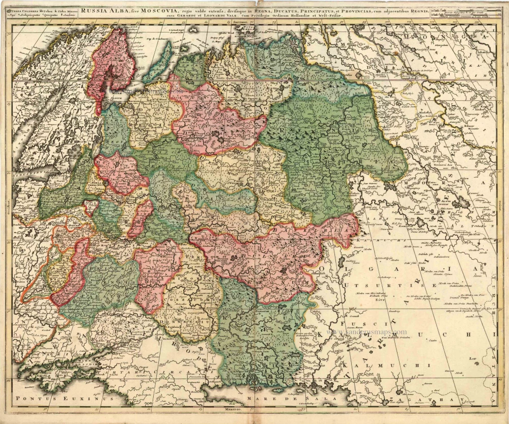
Russia Alba, sive Moscoviae, Regio Valde Extensa, Divisaque in Regna, Ducatus, Principatus, et Provincias, cum Adjacentibus Regnis c. 1702
Russia, by Valk & Schenk.
[Item number: 5099]
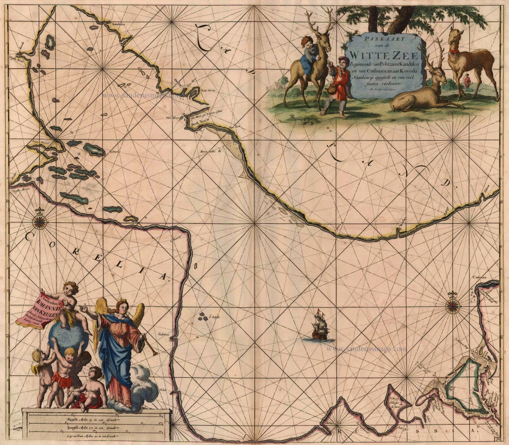
Paskaart van de Witte Zee Beginnende van Pelitza tot Kandalox en van Catsnoes tot aan Kodova. 1697-1709
The White Sea, by Van Keulen Johannes.
[Item number: 5422]
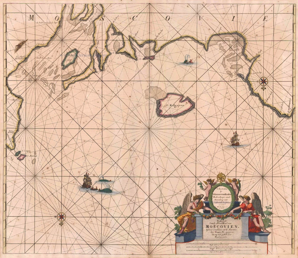
Paskaart vande NoordKust van Moscovien. tussen C. Candenoes ent I. Mauritius. door Teunis Ys opgegeven en int net gestelt door C J Vooght Geometra. 1697-1709
Barents Sea - Russia, by Van Keulen Johannes.
[Item number: 5792]
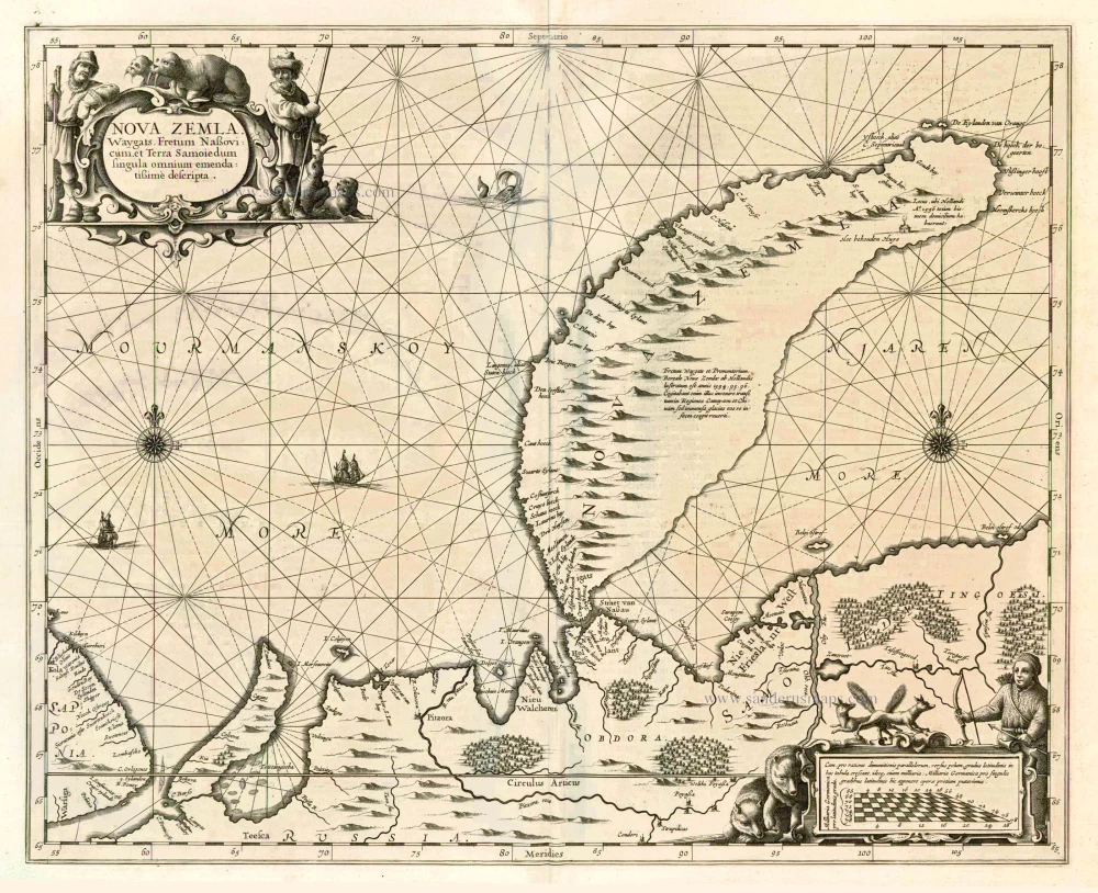
Nova Zemla, Waygats, Fretum Nassovicum, et Terra Samoiedum ... 1650
Chart of Novaya Zemlya, by J. Janssonius
[Item number: 6435]
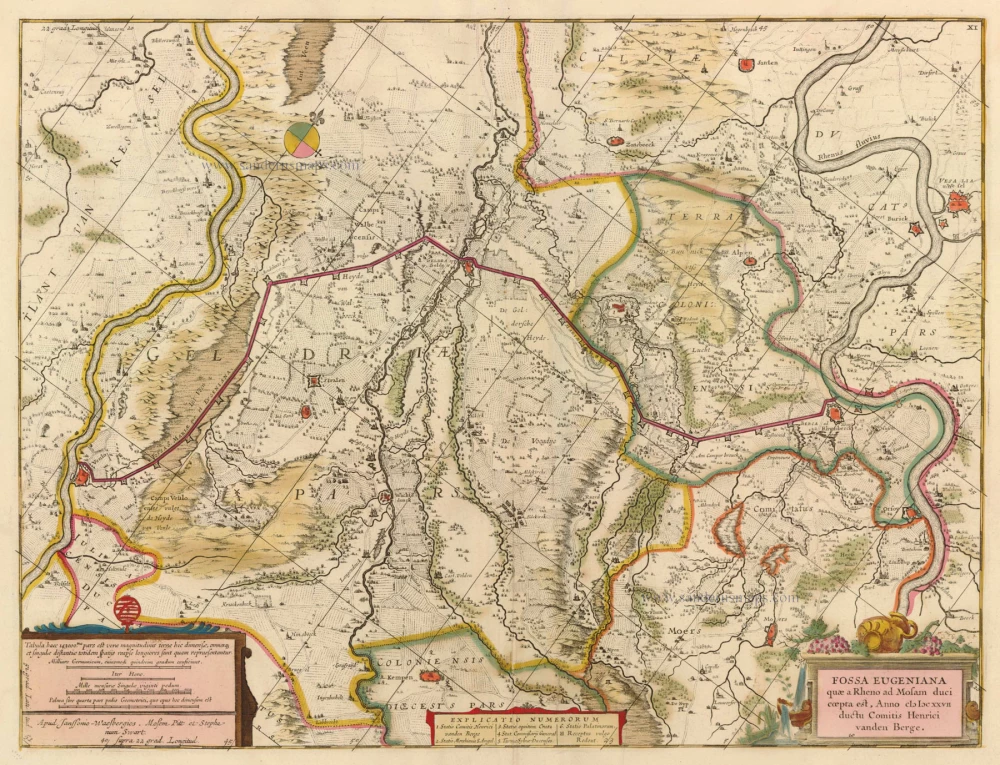
Fossa Eugeniana quae a Rheno ad Mosam duci coepta est, Anno MDCXXVI ... 1680-1683
The Fossa Eugenia by M. Pitt, J. Janssonius van Waesberghe.
[Item number: 6867]

Paskaart van de Rivier de Dwina of Archangel 1697-1709
Sea chart of the Dwina River, by Johannes Van Keulen.
[Item number: 13678]
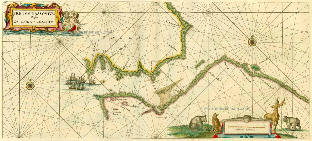
Fretum Nassovium Vulgo De Straet Nassou. 1664-65
Russia - Nassau Strait, by J. Blaeu.
[Item number: 14225]
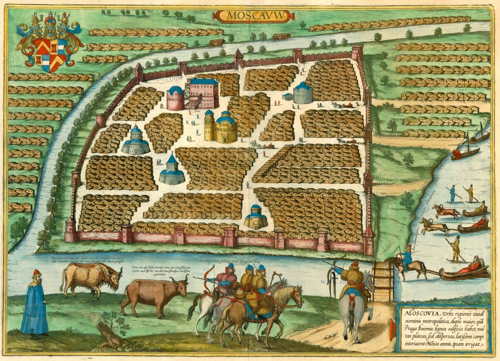
Moscauw - Moscovia, Urbs regionis eiusde nominis metropolitica, duplo maior, ... 1597
Moscow, by Braun and Hogenberg.
[Item number: 24001]
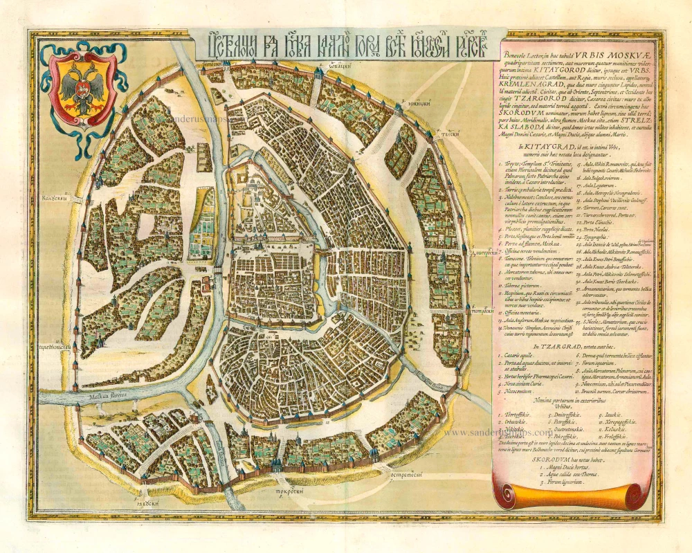
[In Cyrillic characters] Carstvajuscoi Grad Moskva Nacal'noi Gorod useh Moskovskih Gosudarstu ... Urbis Moskvae. 1662
Moskva - Moscow, by Joan Blaeu.
[Item number: 25794]
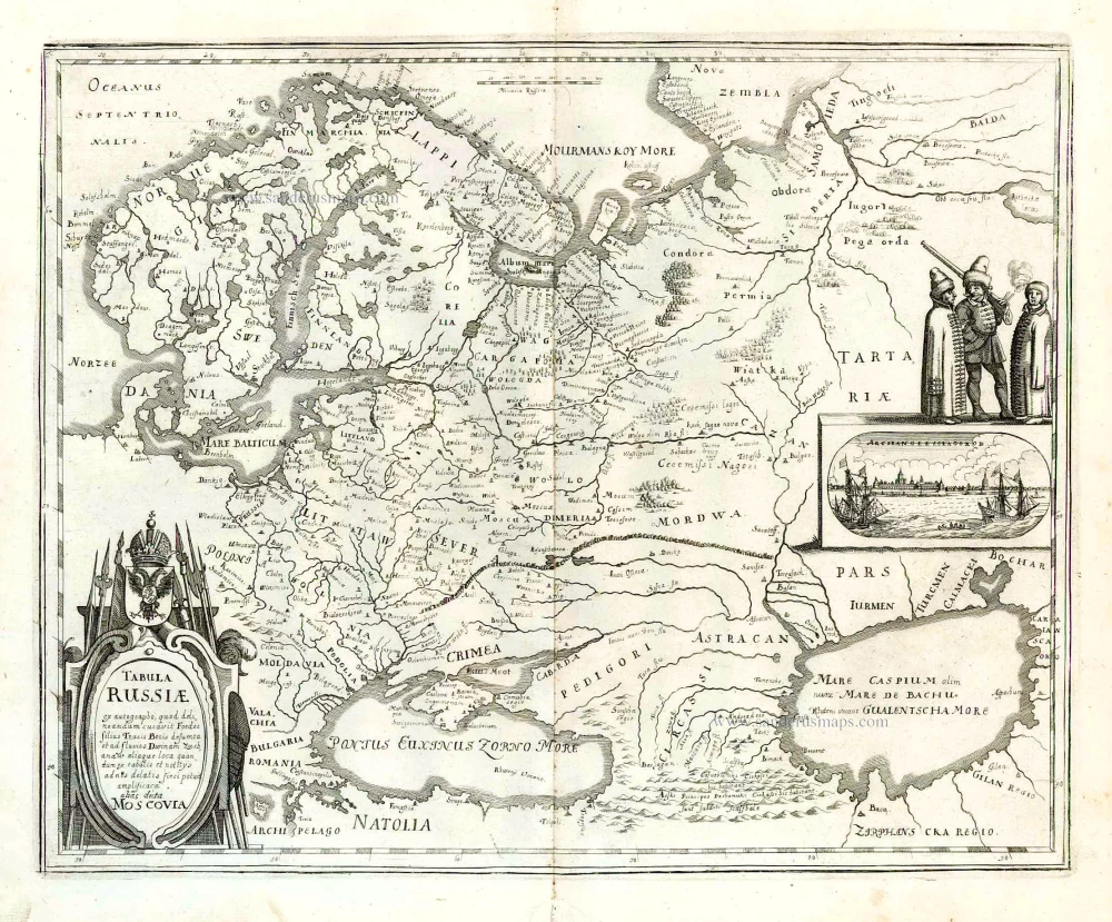
Tabula Russiae ... alias dicta Moscovia. 1638
Russia, by M. Merian.
[Item number: 25918]
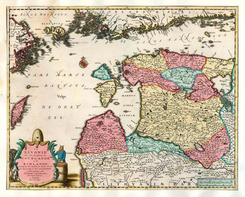
La Livonie Avec les frontieres de Courlande et de Finlande, ... 1713
Livonia by Pieter van der Aa.
[Item number: 26038]
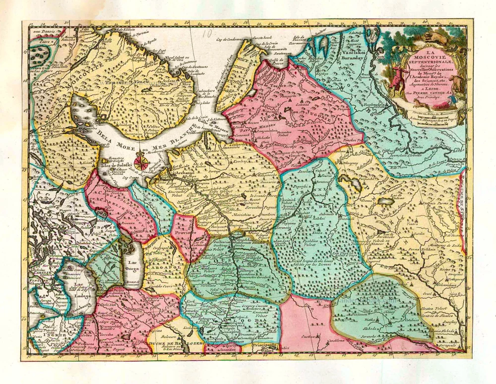
La Moscovie Septentrionale Suivant les Nouvelles Observations ... 1713
Northern Muscovy, by Pieter van der Aa.
[Item number: 26039]
Partie Septentrionale de la Russie Européenne où sont distingées exactement toutes les Provinces, d'après le détail de l'Atlas Russien. 1776-79
Northern European Russia, by Francesco Santini.
[Item number: 26970]

Partie Méridionale de la Russie Européenne où sont distingées exactement toutes les Provinces, d'après le détail de l'Atlas Russien. 1776-79
Southern European Russia, by Francesco Santini.
[Item number: 26971]
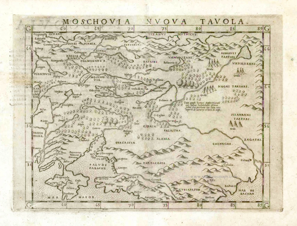
Moschovia Nuova Tavola. 1561
Russia, by Girolamo Ruscelli.
[Item number: 27072]