
Russia, by M. Merian. 1638

Matthäus Merian the Elder (1593-1650)
Matthäus Merian, the leading German illustrator of the 17th century, was born in Basel in 1593. He learned the art of copperplate engraving in Zurich and subsequently worked and studied in Strasbourg, Nancy, Paris, and the Low Countries. In 1618 he went to Frankfurt, wherein in 1618, he married the eldest daughter of J.T. de Bry, publisher and engraver. After de Bry died in 1623, he took over his business. De Bry’s business remained in Merian’s family until 1726, when a fire destroyed it. In 1635 he began the series Theatrum Europaeum. Between 1642 and 1688, he published Martin Zeiller’s Topographia Germaniae, with more than 2,000 plates etched and engraved by himself and his sons Matthäus and Caspar. He also took over and completed the later parts and editions of the Grand Voyages and Petits Voyages, initially started by de Bry in 1590. Matthäus Merian died after in 1650 in Bad Schwalbach near Wiesbaden.
Hessel Gerritsz. (1580/81 – 1632)
Hessel Gerritsz. was one of the seventeenth century's most influential and innovative map makers. He was born in Assum in North Holland and attended Alkmaar school. He must have known Willem Jansz. (= Willem Blaeu) who stayed in Alkmaar for several years. Later, he moved to Amsterdam for his further education.
After the closing of the Scheldt River, Amsterdam’s competitor was cut off so Amsterdam could take over the world trade centre's function. Flourishing Amsterdam offered plenty of work and was an excellent attraction for artisans from the Southern Netherlands. The two dominating publishers in the cartographical field were Cornelis Claesz. and Jodocus Hondius, both from the Southern Netherlands. Hessel Gerritsz. was trained in the graphic trade by David Vingboons, a painter and artist from the Southern Netherlands.
After his apprenticeship with David Vingboons, Hessel Gerritsz. continued his schooling in the publishing house of Willem Jansz. (Blaeu). There, he could perfect his etching style, was given the mathematical skills that would be useful to him later, and learned the trade of mapmaking. With the engraver Josua van den Ende, he was responsible for engraving the superb wall map of the Seventeen Provinces (1608). Van den Ende engraved the map image while Hessel Gerritsz. took care of the decorative borders and the decorations on the main map.
During his activities for Willem Jansz. Hessel Gerritsz. not only perfected his etching and engraving style but also received the geographical and mathematical education that would stand him in good stead in later years. He could not wish for a better cartographical school. Blaeu’s workshop was a repository where geographical information from all parts of the world came together.
Hessel Gerritsz. married in 1607 to Geertje Gijsbertdr. One of his children, Gerrit, born in 1609, was to follow in his father’s footsteps. Shortly after his marriage, he established himself as an independent engraver, mapmaker and printer.
Hessel Gerritsz. regularly worked with Claes Jansz. Visscher, as well. They cooperated for a long time.
His artistic talent comes to the fore in his map of the Leo Belgicus, depicting the Seventeen Provinces in the shape of a lion. This was seen as a symbol of the courage and persistence of the Dutch provinces in their resistance against Spanish tyranny.
In 1612-13, Hessel Gerritsz. was intensively busy with publications about Russia. In 1612, he published the influential booklet Beschryvinghe vander Samoyeden Landt. The two chapters about Siberia were provided by Isaac Massa, who had lived in Moscow for nine years. With the aid of original Russian material, Gerrritsz. produced a series of three maps in folio format: a map of Russia and Moscow and the Kremlin town plans. He also made an essential new wall map of Lithuania and engraved it on four plates for Willem Blaeu. In the meantime, he also made a wall map and a folio map of Spain.
Next to these works undertaken on his initiative, Hessel Gerritsz. also accepted engraving and publishing tasks for third parties.
In 1617, Hessel Gerritsz. published a large wall map of Italy in six sheets. He gave his wall map an extra cachet by extending the map image with town views and costumed figures. The map was copied shortly after publication by Willem Blaeu. To protect himself against such plagiarism in the future, he requested a patent from the States-General. In January 1618, they granted him a general license in which, amongst other things, it was forbidden in any way to reproduce, copy or distribute his maps, both written or printed.
Hessel Gerritsz. was so highly regarded in 1617 that he received such an extraordinary privilege. He was appointed as a geography instructor for the Councillors of the Admiralty at Amsterdam and as a mapmaker for the Chamber Amsterdam of the VOC. With both appointments, his old employer, Willem Blaeu, was passed over. In his function as VOC's mapmaker, he improved and expanded the charts for navigation to and from the Indies. The chart maker, of course, did not draw the charts needed for the VOC ships himself. He manufactured specific prototypes, the so-called leggers (master charts), which served as models for copying work by his assistants in his house.
At the beginning of September 1632, Hessel Gerritsz. died at the age of 52. He must be considered one of the most comprehensive map makers of his time. “He was multi-disciplined in his working method, integrating graphical technique and artistic expression in his scientific approach. Because of his mathematical talent, he could solve nautical problems and make proposals about them. His exceptional network – the interviews with pilots from diverse companies and his correspondence with persons at home and abroad – supplied him with a huge amount of geographical and nautical information that he used most efficiently. His good contacts with the families of the great merchants, ship owners, and the influential regents' representatives opened doors for him. He was, without doubt, the most informed person in geographical matters in Amsterdam of his time.” (Schilder)
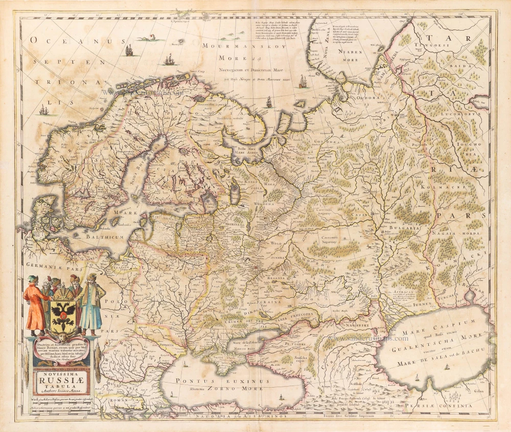
Tabula Russiae ... alias dicta Moscovia.
Item Number: 25918 Authenticity Guarantee
Category: Antique maps > Europe > Eastern Europe
Old, antique map of Russia by M. Merian.
Based on Blaeu's map (Cartographer: Hessel Gerritsz).
With inset view of Archangel.
The map extends to the west to include all of Scandinavia.
Date of the first edition: 1638
Date of this map: 1638
Copper engraving, printed on paper.
Size (not including margins): 28 x 35cm (10.9 x 13.7 inches)
Verso: Blank
Condition: Excellent.
Condition Rating: A+
From: Gottfried J.L. - Merian M. Newe Archontologia Cosmica, ... Frankfurt, W. Hoffmans, 1638.
Matthäus Merian the Elder (1593-1650)
Matthäus Merian, the leading German illustrator of the 17th century, was born in Basel in 1593. He learned the art of copperplate engraving in Zurich and subsequently worked and studied in Strasbourg, Nancy, Paris, and the Low Countries. In 1618 he went to Frankfurt, wherein in 1618, he married the eldest daughter of J.T. de Bry, publisher and engraver. After de Bry died in 1623, he took over his business. De Bry’s business remained in Merian’s family until 1726, when a fire destroyed it. In 1635 he began the series Theatrum Europaeum. Between 1642 and 1688, he published Martin Zeiller’s Topographia Germaniae, with more than 2,000 plates etched and engraved by himself and his sons Matthäus and Caspar. He also took over and completed the later parts and editions of the Grand Voyages and Petits Voyages, initially started by de Bry in 1590. Matthäus Merian died after in 1650 in Bad Schwalbach near Wiesbaden.
Hessel Gerritsz. (1580/81 – 1632)
Hessel Gerritsz. was one of the seventeenth century's most influential and innovative map makers. He was born in Assum in North Holland and attended Alkmaar school. He must have known Willem Jansz. (= Willem Blaeu) who stayed in Alkmaar for several years. Later, he moved to Amsterdam for his further education.
After the closing of the Scheldt River, Amsterdam’s competitor was cut off so Amsterdam could take over the world trade centre's function. Flourishing Amsterdam offered plenty of work and was an excellent attraction for artisans from the Southern Netherlands. The two dominating publishers in the cartographical field were Cornelis Claesz. and Jodocus Hondius, both from the Southern Netherlands. Hessel Gerritsz. was trained in the graphic trade by David Vingboons, a painter and artist from the Southern Netherlands.
After his apprenticeship with David Vingboons, Hessel Gerritsz. continued his schooling in the publishing house of Willem Jansz. (Blaeu). There, he could perfect his etching style, was given the mathematical skills that would be useful to him later, and learned the trade of mapmaking. With the engraver Josua van den Ende, he was responsible for engraving the superb wall map of the Seventeen Provinces (1608). Van den Ende engraved the map image while Hessel Gerritsz. took care of the decorative borders and the decorations on the main map.
During his activities for Willem Jansz. Hessel Gerritsz. not only perfected his etching and engraving style but also received the geographical and mathematical education that would stand him in good stead in later years. He could not wish for a better cartographical school. Blaeu’s workshop was a repository where geographical information from all parts of the world came together.
Hessel Gerritsz. married in 1607 to Geertje Gijsbertdr. One of his children, Gerrit, born in 1609, was to follow in his father’s footsteps. Shortly after his marriage, he established himself as an independent engraver, mapmaker and printer.
Hessel Gerritsz. regularly worked with Claes Jansz. Visscher, as well. They cooperated for a long time.
His artistic talent comes to the fore in his map of the Leo Belgicus, depicting the Seventeen Provinces in the shape of a lion. This was seen as a symbol of the courage and persistence of the Dutch provinces in their resistance against Spanish tyranny.
In 1612-13, Hessel Gerritsz. was intensively busy with publications about Russia. In 1612, he published the influential booklet Beschryvinghe vander Samoyeden Landt. The two chapters about Siberia were provided by Isaac Massa, who had lived in Moscow for nine years. With the aid of original Russian material, Gerrritsz. produced a series of three maps in folio format: a map of Russia and Moscow and the Kremlin town plans. He also made an essential new wall map of Lithuania and engraved it on four plates for Willem Blaeu. In the meantime, he also made a wall map and a folio map of Spain.
Next to these works undertaken on his initiative, Hessel Gerritsz. also accepted engraving and publishing tasks for third parties.
In 1617, Hessel Gerritsz. published a large wall map of Italy in six sheets. He gave his wall map an extra cachet by extending the map image with town views and costumed figures. The map was copied shortly after publication by Willem Blaeu. To protect himself against such plagiarism in the future, he requested a patent from the States-General. In January 1618, they granted him a general license in which, amongst other things, it was forbidden in any way to reproduce, copy or distribute his maps, both written or printed.
Hessel Gerritsz. was so highly regarded in 1617 that he received such an extraordinary privilege. He was appointed as a geography instructor for the Councillors of the Admiralty at Amsterdam and as a mapmaker for the Chamber Amsterdam of the VOC. With both appointments, his old employer, Willem Blaeu, was passed over. In his function as VOC's mapmaker, he improved and expanded the charts for navigation to and from the Indies. The chart maker, of course, did not draw the charts needed for the VOC ships himself. He manufactured specific prototypes, the so-called leggers (master charts), which served as models for copying work by his assistants in his house.
At the beginning of September 1632, Hessel Gerritsz. died at the age of 52. He must be considered one of the most comprehensive map makers of his time. “He was multi-disciplined in his working method, integrating graphical technique and artistic expression in his scientific approach. Because of his mathematical talent, he could solve nautical problems and make proposals about them. His exceptional network – the interviews with pilots from diverse companies and his correspondence with persons at home and abroad – supplied him with a huge amount of geographical and nautical information that he used most efficiently. His good contacts with the families of the great merchants, ship owners, and the influential regents' representatives opened doors for him. He was, without doubt, the most informed person in geographical matters in Amsterdam of his time.” (Schilder)
Related items

Russia Alba, sive Moscoviae, Regio Valde Extensa, Divisaque in Regna, Ducatus, Principatus, et Provincias, cum Adjacentibus Regnis c. 1702
Russia, by Valk & Schenk.
[Item number: 5099]
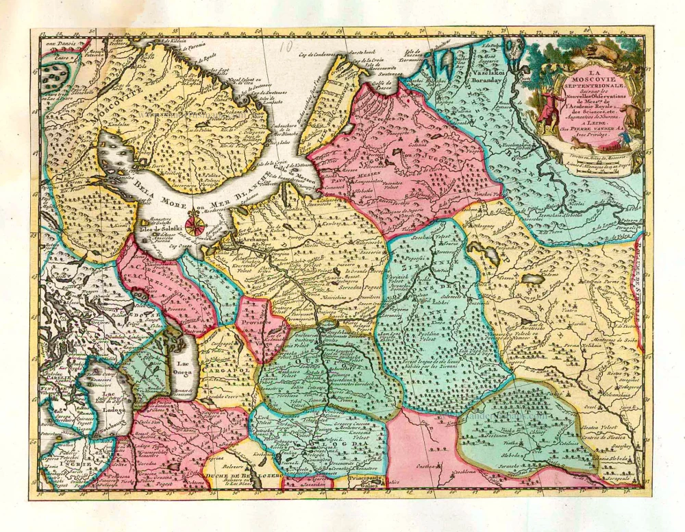
La Moscovie Septentrionale Suivant les Nouvelles Observations ... 1713
Northern Muscovy, by Pieter van der Aa.
[Item number: 26039]

La Moscovie Meridionale Suivant les Nouvelles Observations ... 1713
Southern Muscovy, by Pieter van der Aa.
[Item number: 26040]
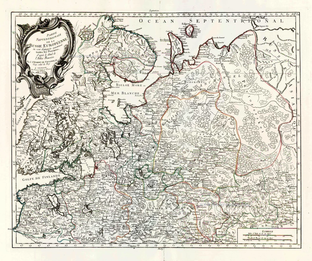
Partie Septentrionale de la Russie Européenne où sont distingées exactement toutes les Provinces, d'après le détail de l'Atlas Russien. 1776-79
Northern European Russia, by Francesco Santini.
[Item number: 26970]

Partie Méridionale de la Russie Européenne où sont distingées exactement toutes les Provinces, d'après le détail de l'Atlas Russien. 1776-79
Southern European Russia, by Francesco Santini.
[Item number: 26971]

Moschovia Nuova Tavola. 1561
Russia, by Girolamo Ruscelli.
[Item number: 27072]
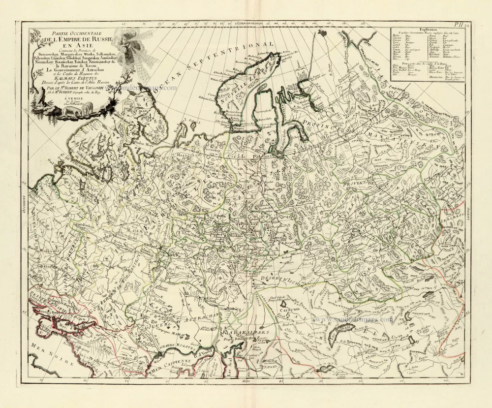
Partie Occidentale de l'Empire de Russie en Asie. 1776-79
Russia (East), by Paolo Santini.
[Item number: 28093]

Imperii Russici Sive Moscoviae. after 1721
Russia by Frederik de Wit, published by Covens & Mortier.
[Item number: 28333]
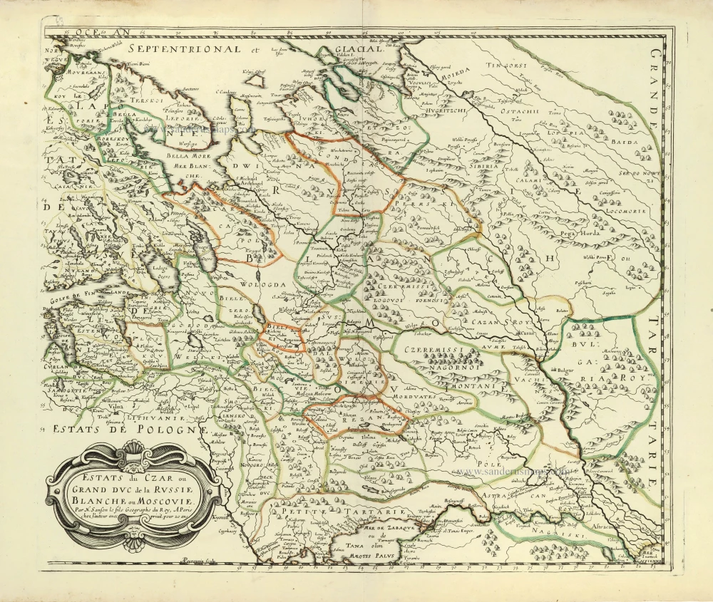
Estats du Czar ou Grand Duc de la Russie Blanche ou Moscovie. 1658
Russia by Nicolas Sanson.
[Item number: 28499]
Novissima Russiae Tabula. 1639
Russia, by Henricus Hondius.
[Item number: 28811]

Nouvelle Carte de Moscovie où sont representés diferents Etats de sa Maiesté Czarienne en Europe et en Asie 1714
Russia, by Zacharias Châtelain.
[Item number: 29400]

Carte Générale des Etats du Czar Empereur de Moscovie, ou l'on voit ce que ce Prince possède en Europe et les Etats qu'il possède en Asie 1714
Russia, by Zacharias Châtelain.
[Item number: 29401]
La Russie Blanche ou Moscovie. c. 1709
Russia by Hubert Jaillot, published by Pierre Mortier.
[Item number: 29615]

Sarmatia Utraque Europaea et Asiatica. 1659
European Russia and Ukraine by Nicolas Sanson.
[Item number: 29717]

Carte Nouvelle de Moscovie Represente la partie Septentrionale. [In set with:] Partie Meridionale de Moscovie. 1792
Russia by G. Delisle, published by J.B. Elwe.
[Item number: 30173]

Moscoviae pars Australis. 1653
Southern Russia by Johannes Janssonius.
[Item number: 30342]
La Russie Blanche ou Moscovie Divisee Suivant l'Estendue des Royaumes, Duchés, Principautes, Provinces et Peuples qui sont Presentement sous la Domination du Czar de la Russe Cognu sous le Nom de Grand Duc de Moscovie. 1692
Russia by N. Sanson, so-called published by Hubert Jaillot. (Pirated edition by Pierre Mortier).
[Item number: 31176]

La Russia Europea divisa ne' suoi Governi, e Provincie. 1779-1785
Russia (European), by Antonio Zatta.
[Item number: 32136]

Generalis totius Imperii Moscovitici Novissima Tabula Magnam Orbis terrarum pertem à Polo Articousq ad mare Iaponicum, et Chinae Septentrionalis confinia exhibens cum via Czaricae nuper legationis ex urbe Moscua per universam Tartariam ad magnu[m] Chinae Imperatorem. c. 1720
Russia, by J.B. Homann.
[Item number: 32194]

Tabula Russiae ex autographo, quod delineandum curavit Foedor filius Tzaris Boris desumta; . . . 1643
Russia by Willem & Joan Blaeu.
[Item number: 32266]
Russia Bianca o Moscovia 1687
Russia, by Giacomo Cantelli da Vignola, published by Giovanni de Rossi.
[Item number: 32918]