
Russia (European), by Antonio Zatta. 1779-1785

Antonio Zatta (ca. 1722-1804)
Antonio Zatta was an influential Italian cartographer and publisher based in Venice during the 18th century. As one of the last great mapmakers of the Italian Enlightenment, Zatta played a crucial role in preserving and advancing the art of cartography at a time when Venice's status as a centre for mapmaking was in decline.
Little is known about his early life, but Zatta established himself as a prolific publisher and printer, producing a wide range of works including atlases, city plans, and historical maps. His most celebrated achievement is the Atlante Novissimo, published between 1775 and 1785. This monumental four-volume atlas is considered one of the finest Italian cartographic productions of its time. It combined contemporary geographical knowledge with elegant artistry, featuring detailed hand-coloured maps, elaborate title cartouches, and decorative embellishments characteristic of the late Baroque style.
Zatta’s work is notable for incorporating the latest geographical discoveries alongside classical and historical information, reflecting the Enlightenment's emphasis on reason, exploration, and empirical knowledge. He published maps covering all parts of the known world, including detailed representations of Europe, the Americas, and Asia, often updating older cartographic models with new data from explorers and diplomats.
Among his notable contributions is one of the earliest printed maps depicting the newly independent United States after the American Revolutionary War. Zatta's 1778 map, "Gli Stati Uniti della America Settentrionale," adapted English and French sources, marking a significant moment in the cartographic recognition of the United States.
Antonio Zatta's legacy endures through the beauty and precision of his maps, which continue to be prized by collectors and historians alike for their artistic merit and historical value. His works offer a window into the geographical understanding and visual culture of the 18th century, securing his place among the notable figures of cartographic history.
La Russia Europea divisa ne' suoi Governi, e Provincie.
Item Number: 32136 Authenticity Guarantee
Category: Antique maps > Europe > Eastern Europe
Russia (European), by Antonio Zatta.
Title: La Russia Europea divisa ne' suoi Governi, e Provincie.
Tratta dall' Atlante Polacco del Sig.r Rizzi Zanoni.
Venezia 1781 | Presso Antonio Zatta.
Con Privilegio dell' Eccmo Senato.
G. Zuliani inc. G Pitteri scr.
Engraver: Giuliano Zuliani & Giovanni Pitteri.
Date of the first edition: 1779-1785.
Date of this map: 1779-1785.
Date on map: 1781.
Copper engraving, printed on paper.
Image size: 410 x 315mm (16¼ x 12½ inches).
Sheet size: 500 x 390mm (19¾ x 15¼ inches).
Verso: Blank.
Condition: Original coloured, excellent.
Condition Rating: A+.
From: Atlante novissimo, illustrato ed accresciuto sulle osservazioni, e scoperte fatte dai più celebri e più recenti geografi, che ora per la prima volta si produce. Venice, Antonio Zatta, 1779-1785.
Antonio Zatta (ca. 1722-1804)
Antonio Zatta was an influential Italian cartographer and publisher based in Venice during the 18th century. As one of the last great mapmakers of the Italian Enlightenment, Zatta played a crucial role in preserving and advancing the art of cartography at a time when Venice's status as a centre for mapmaking was in decline.
Little is known about his early life, but Zatta established himself as a prolific publisher and printer, producing a wide range of works including atlases, city plans, and historical maps. His most celebrated achievement is the Atlante Novissimo, published between 1775 and 1785. This monumental four-volume atlas is considered one of the finest Italian cartographic productions of its time. It combined contemporary geographical knowledge with elegant artistry, featuring detailed hand-coloured maps, elaborate title cartouches, and decorative embellishments characteristic of the late Baroque style.
Zatta’s work is notable for incorporating the latest geographical discoveries alongside classical and historical information, reflecting the Enlightenment's emphasis on reason, exploration, and empirical knowledge. He published maps covering all parts of the known world, including detailed representations of Europe, the Americas, and Asia, often updating older cartographic models with new data from explorers and diplomats.
Among his notable contributions is one of the earliest printed maps depicting the newly independent United States after the American Revolutionary War. Zatta's 1778 map, "Gli Stati Uniti della America Settentrionale," adapted English and French sources, marking a significant moment in the cartographic recognition of the United States.
Antonio Zatta's legacy endures through the beauty and precision of his maps, which continue to be prized by collectors and historians alike for their artistic merit and historical value. His works offer a window into the geographical understanding and visual culture of the 18th century, securing his place among the notable figures of cartographic history.
Related items

Russia Alba, sive Moscoviae, Regio Valde Extensa, Divisaque in Regna, Ducatus, Principatus, et Provincias, cum Adjacentibus Regnis c. 1702
Russia, by Valk & Schenk.
[Item number: 5099]

Paskaart vande NoordKust van Moscovien. tussen C. Candenoes ent I. Mauritius. door Teunis Ys opgegeven en int net gestelt door C J Vooght Geometra. 1697-1709
Barents Sea - Russia, by Van Keulen Johannes.
[Item number: 5792]

Fretum Nassovium Vulgo De Straet Nassou. 1664-65
Russia - Nassau Strait, by J. Blaeu.
[Item number: 14225]

Tabula Russiae ... alias dicta Moscovia. 1638
Russia, by M. Merian.
[Item number: 25918]
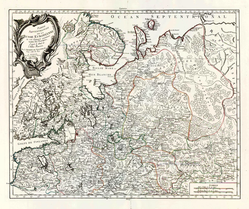
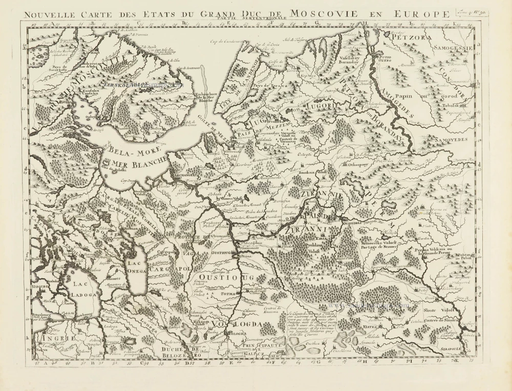
Partie Septentrionale de la Russie Européenne où sont distingées exactement toutes les Provinces, d'après le détail de l'Atlas Russien. 1776-79
Northern European Russia, by Francesco Santini.
[Item number: 26970]

Partie Méridionale de la Russie Européenne où sont distingées exactement toutes les Provinces, d'après le détail de l'Atlas Russien. 1776-79
Southern European Russia, by Francesco Santini.
[Item number: 26971]

Moschovia Nuova Tavola. 1561
Russia, by Girolamo Ruscelli.
[Item number: 27072]

Birds-eye view of the Island, Harbours and Fortifications of Cronstadt. With a distant view of the mouths of the Neva, the City of St. Petersburg and the head of the Gulf of Finland. 1854
Kronstadt (Russia), by H. Whittock.
[Item number: 27449]

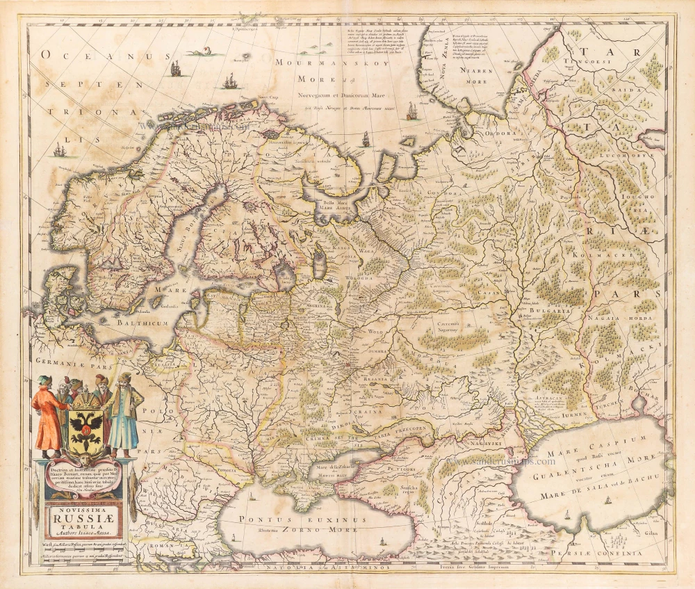
Russiae, Vulgo Moscovia Pars Australis. Auctore Isaaco Massa. 1643
Southern Russia, by Joan Blaeu.
[Item number: 27663]
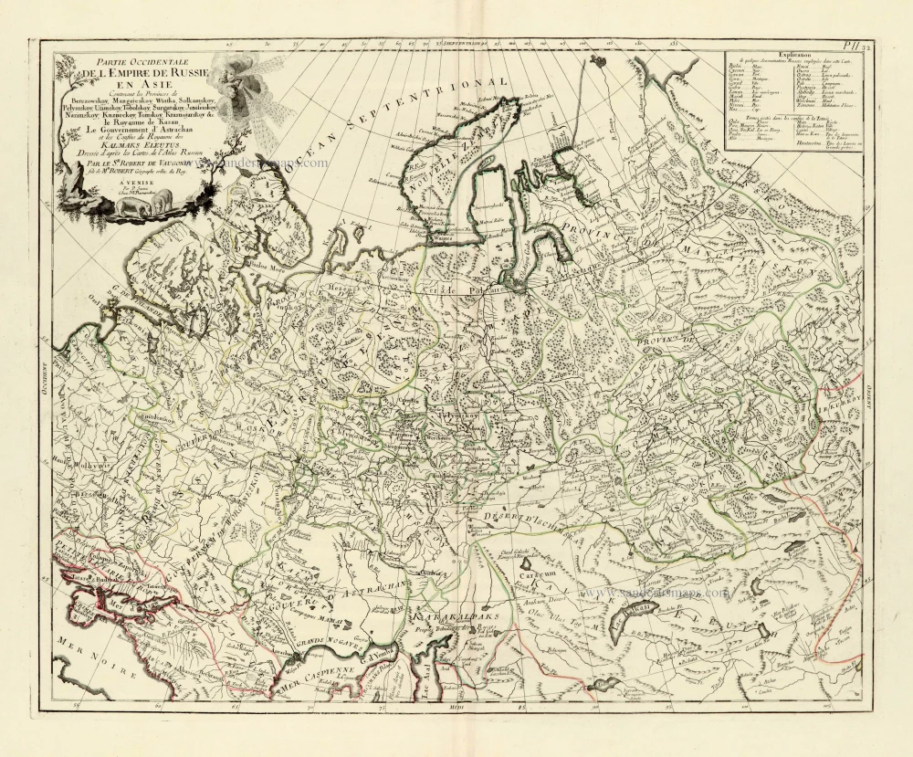
Partie Occidentale de l'Empire de Russie en Asie. 1776-79
Russia (East), by Paolo Santini.
[Item number: 28093]

Imperii Russici Sive Moscoviae. after 1721
Russia by Frederik de Wit, published by Covens & Mortier.
[Item number: 28333]
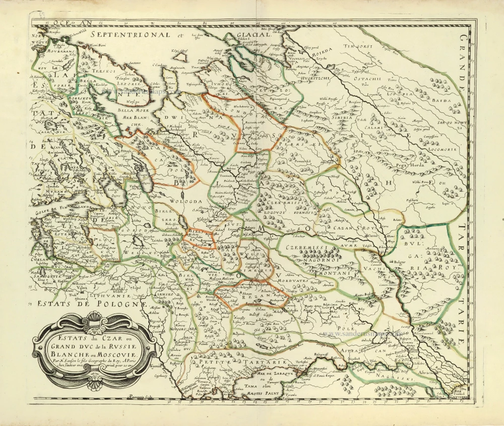
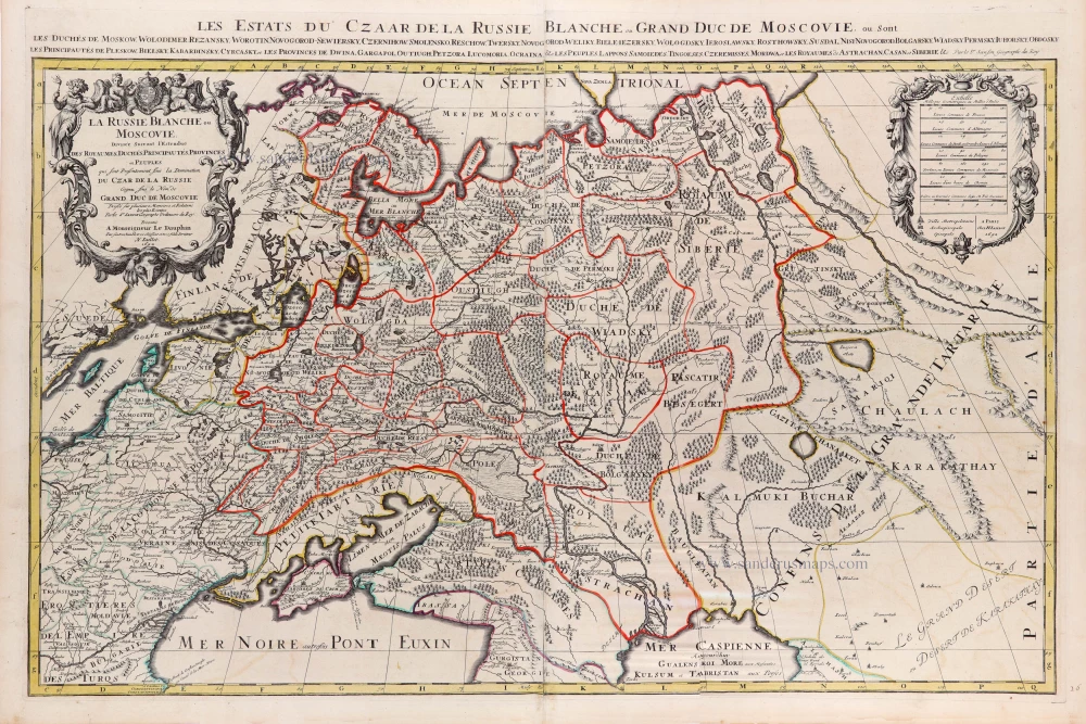
Estats du Czar ou Grand Duc de la Russie Blanche ou Moscovie. 1658
Russia by Nicolas Sanson.
[Item number: 28499]
Tabula Russiae. c. 1678
Russia by Claes Jansz Visscher.
[Item number: 28516]

With rare old colour
Secunda Asiae Tabula. 1513
Russia and Caucasus by Martin Waldseemüller.
[Item number: 28794]
Novissima Russiae Tabula. 1639
Russia, by Henricus Hondius.
[Item number: 28811]
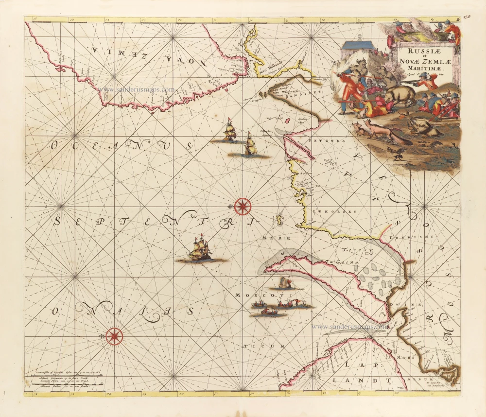
Russiae et Novae Zemlae Maritimae. c. 1680
Northern Coast of Russia, by Frederick de Wit.
[Item number: 29178]

Nouvelle Carte de Moscovie où sont representés diferents Etats de sa Maiesté Czarienne en Europe et en Asie 1714
Russia, by Zacharias Châtelain.
[Item number: 29400]

Carte Générale des Etats du Czar Empereur de Moscovie, ou l'on voit ce que ce Prince possède en Europe et les Etats qu'il possède en Asie 1714
Russia, by Zacharias Châtelain.
[Item number: 29401]

Nouvelle Carte des Etats du Grand Duc de Moscovie en Europe. Partie Meridionale. 1714
Southern European Russia, by Zacharias Châtelain.
[Item number: 29403]
Nouvelle Carte des Etats du Grand Duc de Moscovie en Europe. Partie Meridionale. 1714
Northern European Russia, by Zacharias Châtelain.
[Item number: 29404]
La Russie Blanche ou Moscovie. c. 1709
Russia by Hubert Jaillot, published by Pierre Mortier.
[Item number: 29615]

Carte Nouvelle de Moscovie Represente la partie Septentrionale. [In set with:] Partie Meridionale de Moscovie. 1792
Russia by G. Delisle, published by J.B. Elwe.
[Item number: 30173]

Moscoviae pars Australis. 1653
Southern Russia by Johannes Janssonius.
[Item number: 30342]
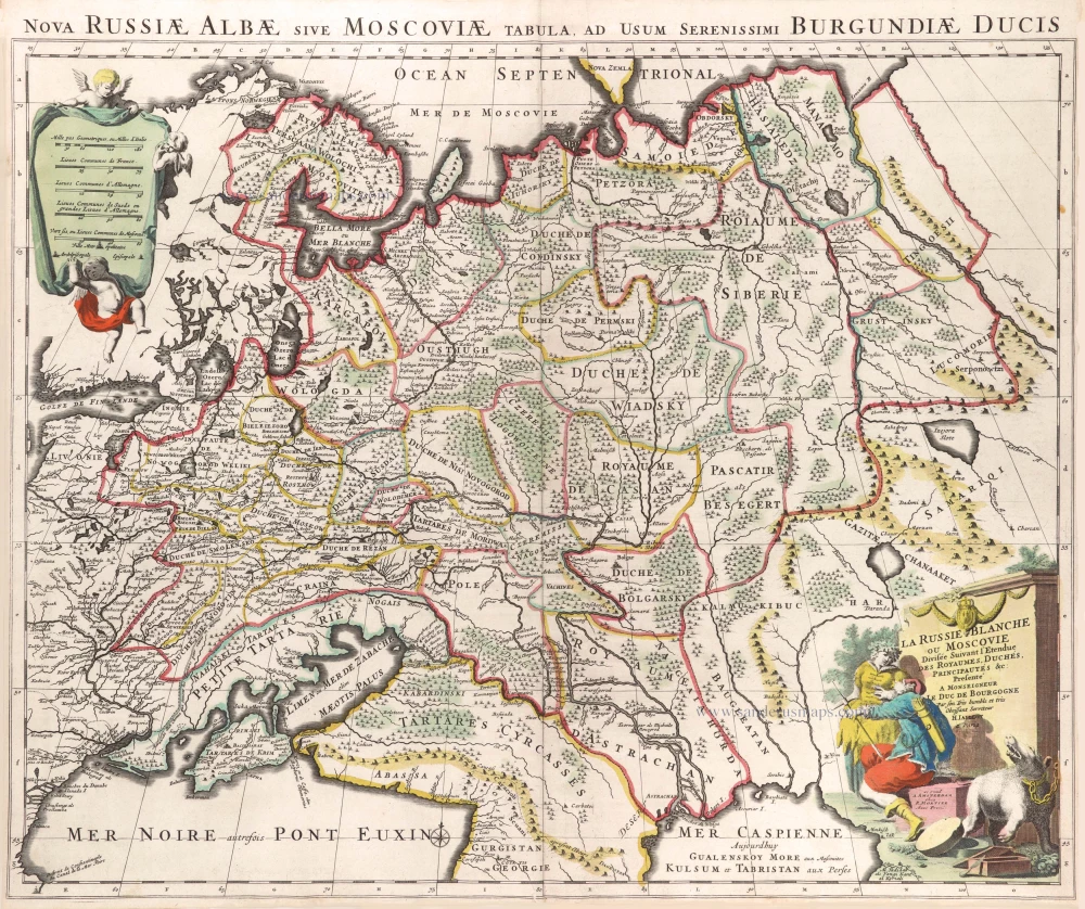
La Russie Blanche ou Moscovie Divisee Suivant l'Estendue des Royaumes, Duchés, Principautes, Provinces et Peuples qui sont Presentement sous la Domination du Czar de la Russe Cognu sous le Nom de Grand Duc de Moscovie. 1692
Russia by N. Sanson, so-called published by Hubert Jaillot. (Pirated edition by Pierre Mortier).
[Item number: 31176]
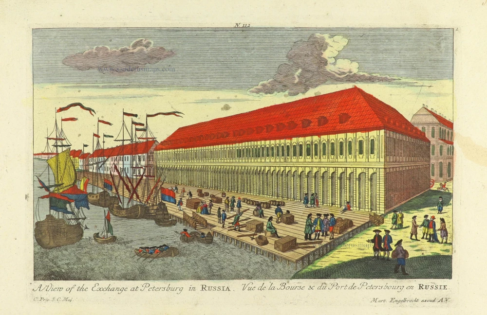
A view of the Exchange at Petersburg in Russia. - Vue de la Bourse & du Port de Petersbourg en Russie. c. 1750
Exchange at Petersburg in Russia, by Martin Engelbrecht.
[Item number: 31984]

The Buiheigs of the Imperial Colleges in St. Petersburg on the Leftside and the Warehouses for Merchants on ye right. - Vue des Colleges Imperiaux et du Magazin des Marchandises de l'Orient a Peterbourg. c. 1750
The Imperial Colleges and warehouses at St. Petersburg in Russia, by Martin Engelbrecht.
[Item number: 31987]

Generalis totius Imperii Moscovitici Novissima Tabula Magnam Orbis terrarum pertem à Polo Articousq ad mare Iaponicum, et Chinae Septentrionalis confinia exhibens cum via Czaricae nuper legationis ex urbe Moscua per universam Tartariam ad magnu[m] Chinae Imperatorem. c. 1720
Russia, by J.B. Homann.
[Item number: 32194]

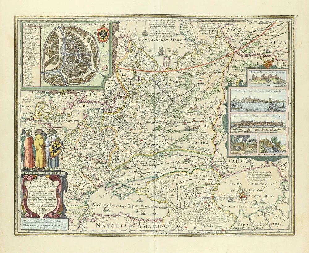
Tabula Russiae ex autographo, quod delineandum curavit Foedor filius Tzaris Boris desumta; . . . 1643
Russia by Willem & Joan Blaeu.
[Item number: 32266]
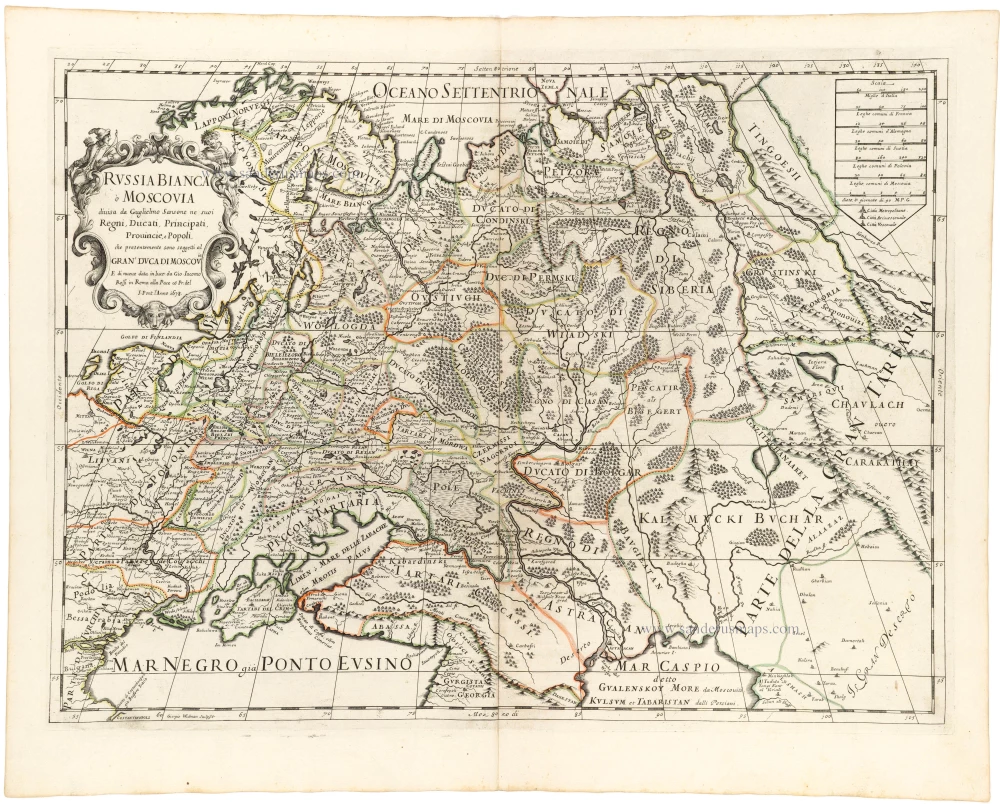
Russia Bianca o Moscovia 1687
Russia, by Giacomo Cantelli da Vignola, published by Giovanni de Rossi.
[Item number: 32918]